

 Brazil
 Argentina
 Bolivia
 Chile
 Colombia
 Ecuador
 Guyana
 French Guiana
 Falkland Islands (Malvinas)
 Paraguay
 Peru
 Suriname
 Uruguay
 Venezuela
 Germany
 Austria
 Belgium
 Croatia
 Denmark
 Spain
 Finland
 France
 Greece
 the Netherlands
 Hungary
 Ireland
 Iceland
 Italy
 Luxembourg
 Norway
 Poland
 Portugal
 the United Kingdom
 the Czech Republic
 Sweden
 Switzerland
 Turkey
 Mexico
 the Dominican Republic
 South Africa
 Fiji
State · Sudoeste (Grand Canyon e Las Vegas)
Utah
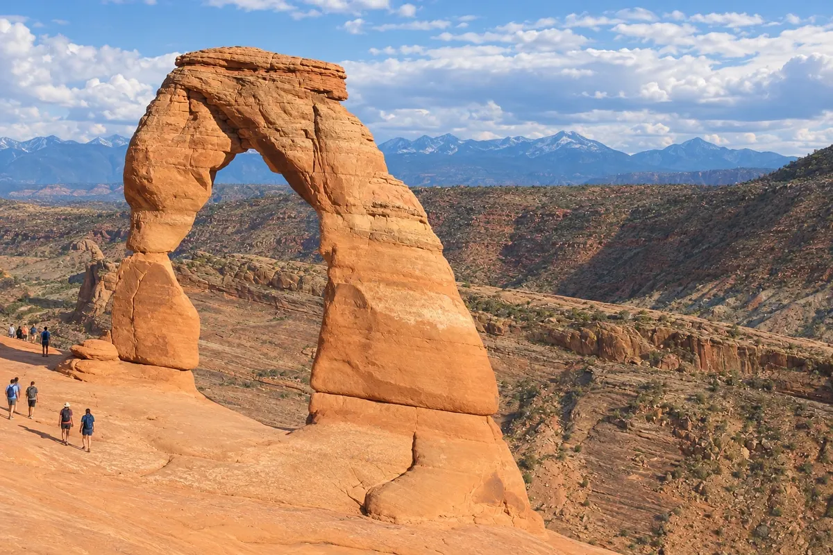
Utah has five red-rock national parks, including Zion, Bryce Canyon and Arches, plus Salt Lake City and the Park City ski resorts.
In the photo: Delicate Arch, Arches National Park
Illustrative images. The pictures in this guide are illustrations based on the real place, not photographs, and may differ from it.

The state
Get to know Utah
Utah lies in the western United States, between the Rocky Mountains and the Great Basin. The capital and largest city is Salt Lake City, founded in 1847 by Mormon pioneers near the Great Salt Lake. The southern part of the state is a plateau of canyons and sandstone arches, with five national parks: Zion, Bryce Canyon, Capitol Reef, Arches and Canyonlands.
Springdale sits at the entrance to Zion National Park, where the trails The Narrows, following the Virgin River bed, and Angels Landing climb between sheer cliffs hundreds of meters high. Bryce Canyon City stands beside the amphitheater of stone pinnacles (hoodoos) at Bryce Canyon, and Kanab, near the Arizona border, serves as a base for the two parks.
Moab, in the east, is the base for Arches National Park, with more than 2,000 stone arches including Delicate Arch, and for Canyonlands and the Dead Horse Point overlook. In the southeast, Oljato–Monument Valley lies by the rock formations of Monument Valley, in the Navajo Nation.
In the north, Salt Lake City has Temple Square, headquarters of The Church of Jesus Christ of Latter-day Saints, and the Great Salt Lake. About 50 km away, Park City brings together the Park City and Deer Valley ski areas, which hosted events at the 2002 Winter Olympic Games.
When to go
For the southern parks, April–May and September–October are usually the best times. In summer, temperatures in Zion and Moab often exceed 35 °C, and The Narrows can close due to river floods. At about 2,400 m elevation, Bryce Canyon gets snow in winter. The ski season in Park City generally runs from December through April.
Getting there
Salt Lake City (SLC) is the state's main airport. Connections from Brazil are usually via another U.S. city. Confirm before you buy. For Zion and Bryce many travelers arrive via Las Vegas: Springdale is about 260 km, or two and a half hours by car. St. George (SGU) has a regional airport near Zion, and Moab is about 380 km from Salt Lake City.
Your questions
Frequently asked questions about Utah
Do you need a reservation to enter Arches?
For part of the year the park has required a timed entry reservation in addition to a ticket, and rules change each season: check before you go. Arriving before the controlled period is another option.
How does the Zion shuttle work?
For most of the year the main canyon road closes to private vehicles and access is by the park shuttle, which departs from the visitor center near Springdale. Outside the shuttle season the road usually opens to cars.
How many days for Utah’s parks?
An itinerary including Zion, Bryce Canyon, Arches and Canyonlands requires five to seven days, using Springdale and Moab as bases. Capitol Reef lies on the route between Bryce and Moab.
Can you ski in Park City from Salt Lake City?
Yes. Park City is about a 45-minute drive from Salt Lake City airport, with buses and shuttles. The Park City and Deer Valley resorts are adjacent to the town.
What is the Great Salt Lake?
It is the largest salt lake in the Western Hemisphere, northwest of Salt Lake City. The water is so salty the body floats; Antelope Island, connected by road, has bison and trails.