

 Brazil
 Argentina
 Bolivia
 Chile
 Colombia
 Ecuador
 Guyana
 French Guiana
 Falkland Islands (Malvinas)
 Paraguay
 Peru
 Suriname
 Uruguay
 Venezuela
 Germany
 Austria
 Belgium
 Croatia
 Denmark
 Spain
 Finland
 France
 Greece
 the Netherlands
 Hungary
 Ireland
 Iceland
 Italy
 Luxembourg
 Norway
 Poland
 Portugal
 the United Kingdom
 the Czech Republic
 Sweden
 Switzerland
 Turkey
 Mexico
 the Dominican Republic
 South Africa
 Fiji
State · Washington e o Meio-Atlântico
Pensilvânia
In Pennsylvania the Declaration of Independence and the Constitution were signed: Philadelphia and the Liberty Bell, Bethlehem and the Amish farms of Lancaster.
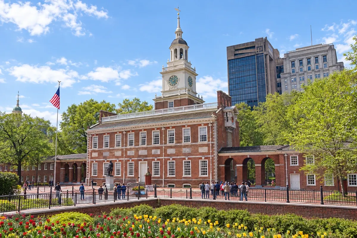
In the photo: Independence Hall, Philadelphia
Illustrative images. The pictures in this guide are illustrations based on the real place, not photographs, and may differ from it.

The state
Get to know Pensilvânia
Pennsylvania is in the northeastern United States, between New York, New Jersey, Maryland and Lake Erie. The capital is Harrisburg; the largest city is Philadelphia, in the east, about 150 km from New York and 225 km from Washington.
In Philadelphia, Independence Hall, a UNESCO World Heritage site, is the building where the Declaration of Independence was adopted in 1776 and the Constitution in 1787; opposite it, in a pavilion, is the Liberty Bell. The Philadelphia Museum of Art has the staircase made famous by the film Rocky, and the Reading Terminal Market is the city's best-known covered market.
Bethlehem, about 90 km to the north, was founded by Moravians in the 18th century, and its historic center is part of the UNESCO heritage of the Moravian Church Settlements. In December the town is decorated for Christmas, with a market and lights.
In the southern part of the state, Lancaster County has Amish communities who live without cars and travel by buggy, and Gettysburg preserves the battlefield of the 1863 Civil War. In the west, Pittsburgh sits where three rivers meet, and nearby is Fallingwater, Frank Lloyd Wright’s house over a waterfall. On the table, Philadelphia cheesesteak and soft pretzels.
When to go
Spring (April to June) and autumn (September to November) are usually the nicest seasons, with colorful leaves in October. Summer tends to be hot and humid. Winter is cold, with snow on some days, and December features Bethlehem’s Christmas festivities.
Getting there
Philadelphia International Airport (PHL) is about 15 km from downtown, with train service to the city. Connections from Brazil are usually via another U.S. city. Confirm before booking. Amtrak trains link Philadelphia to New York in about an hour and a half and to Washington in about two hours. Bethlehem is served by Lehigh Valley Airport (ABE) and by buses from New York and Philadelphia.
Your questions
Frequently asked questions about Pensilvânia
Can you see Philadelphia on a day trip from New York?
Yes: the train takes about an hour and a half, and the historic center, with Independence Hall and the Liberty Bell, can be explored on foot. With only one day there's little time for museums; with an overnight stay you can fit in the Museum of Art and the Reading Terminal Market.
How to visit Independence Hall?
Visits are guided and there is no admission fee, but a timed ticket is required, either reserved in advance or picked up at the visitor center depending on the season. The Liberty Bell is in a pavilion opposite the building, with its own line.
Where to see Amish communities?
In Lancaster County, about an hour and a half by car from Philadelphia, in towns such as Intercourse, Bird-in-Hand and Strasburg. Farms and buggies are part of family life: residents ask not to be photographed up close.
How many days for Philadelphia?
Two days are enough for the historic center, the Museum of Art and the neighborhoods of Old City and Society Hill. A third day allows a visit to Bethlehem or the Lancaster farms.