

 Brazil
 Argentina
 Bolivia
 Chile
 Colombia
 Ecuador
 Guyana
 French Guiana
 Falkland Islands (Malvinas)
 Paraguay
 Peru
 Suriname
 Uruguay
 Venezuela
 Germany
 Austria
 Belgium
 Croatia
 Denmark
 Spain
 Finland
 France
 Greece
 the Netherlands
 Hungary
 Ireland
 Iceland
 Italy
 Luxembourg
 Norway
 Poland
 Portugal
 the United Kingdom
 the Czech Republic
 Sweden
 Switzerland
 Turkey
 Mexico
 the Dominican Republic
 South Africa
 Fiji
State · Noroeste do Pacífico (Seattle)
Oregon
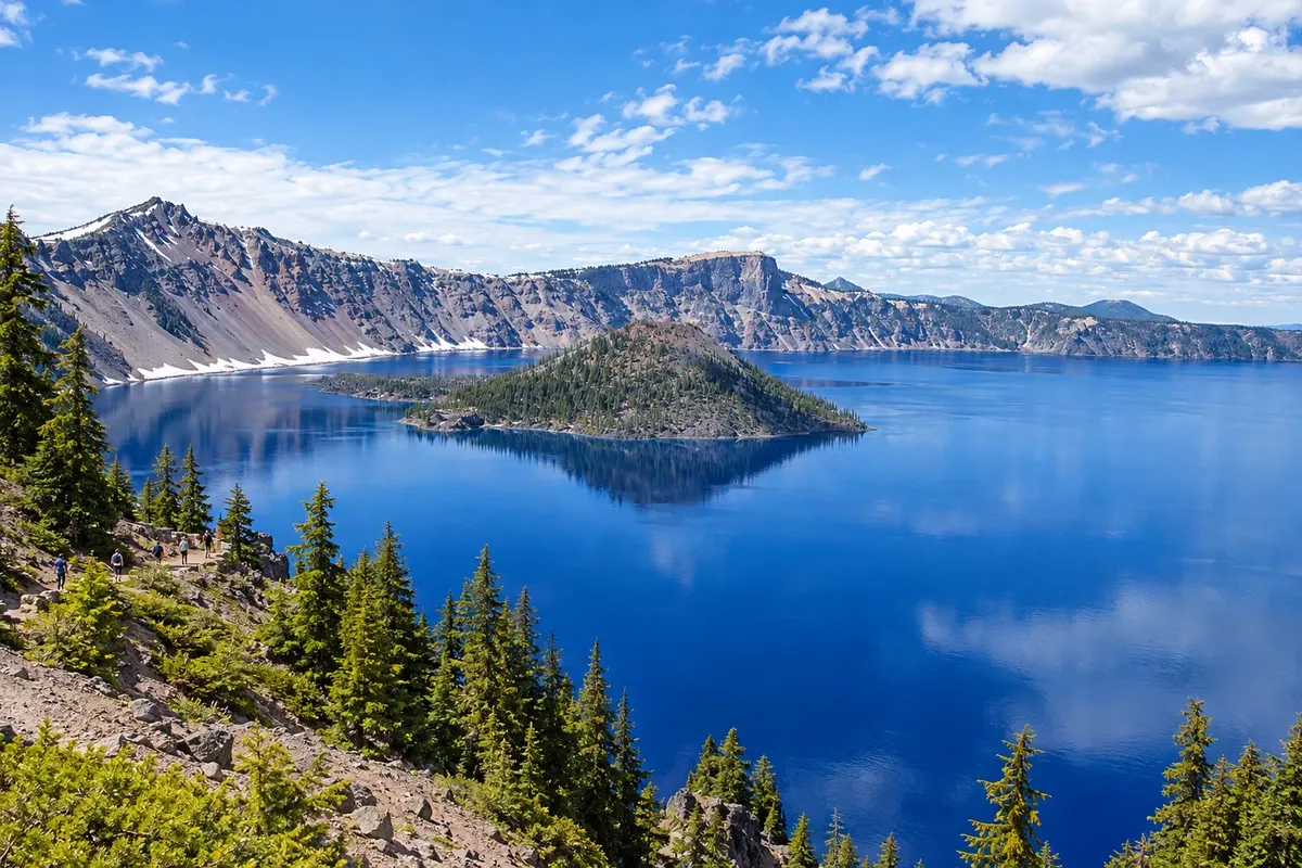
Oregon, in the Pacific Northwest: Crater Lake, Multnomah Falls in the Columbia River Gorge, the Cannon Beach coastline, the wineries of the Willamette Valley and the city of Portland.
In the photo: Crater Lake
Illustrative images. The pictures in this guide are illustrations based on the real place, not photographs, and may differ from it.

The state
Get to know Oregon
Oregon lies on the Pacific coast, between California and the State of Washington. The Cascade Range divides the state: to the west are the coast, wet forests and the Willamette Valley; to the east, dry plateaus, deserts and canyons. The state has no sales tax and was the end point of the Oregon Trail, used by 19th-century pioneers.
Portland, the largest city, has the Japanese Garden and the rose garden in Washington Park, neighborhoods full of cafés and breweries, food carts and a network of trams and bike lanes. To the east, the Columbia River Gorge gathers waterfalls along a historic road, including Multnomah, a 189-meter fall, and Mount Hood, a snow-capped volcano, is about 1h30 from the city.
South of the Cascades, Crater Lake National Park has the deepest lake in the United States, 594 meters, inside the caldera of a collapsed volcano, with dark blue water; the Rim Drive circles the rim. In the center of the state, Bend is a base for trails, skiing and climbing at Smith Rock, and the Painted Hills show striped hills of red and yellow.
All of Oregon's coastline is public by law. At Cannon Beach, Haystack Rock rises from the shore; Astoria sits at the mouth of the Columbia, Newport has an aquarium, and the Oregon Dunes form miles of coastal dunes. In the Willamette Valley, south of Portland, wineries produce pinot noir. On the table: salmon, Dungeness crab, hazelnuts and berries.
When to go
From July to September days are usually dry and sunny — good for the coast, trails and Crater Lake, whose rim road typically fully opens only in July and closes with the first snows, until November 1. From October to May it rains heavily in the western part of the state, and snow covers the Cascades — ski season on Mount Hood. Oregon is 5 hours behind Brasília (4 hours during daylight saving); one county in the east follows Mountain Time.
Getting there
Portland International Airport (PDX) has domestic flights and some international service. From Brazil, trips usually involve a connection; check before booking. Portland is about a 3-hour drive from Seattle, and the Amtrak Cascades train links the two cities. Cannon Beach is about 1h30 from Portland, and Crater Lake about 4h30. A car is needed for the coast and the parks.
Your questions
Frequently asked questions about Oregon
When to visit Crater Lake?
From July to September, when the rim road is usually fully open and trails are free of snow. In winter, the south entrance and the Rim Village overlook remain open, with deep snow, while the rim road is closed. Park entry requires a fee; check the park website.
What to do in Portland?
Visit the Japanese Garden and the rose garden in Washington Park, stroll through the Pearl District and Alberta neighborhoods, eat at the food carts and take a day trip to the Columbia River Gorge to Multnomah Falls, about 45 minutes away.
What is Oregon's coast like?
A coastline of cliffs, wide beaches, lighthouses and sea stacks, with cold water year-round and frequent summer fog. Highway US 101 runs the length of the shore; Cannon Beach, Newport and Bandon are the most visited stops.
Can you combine Oregon with Seattle or California?
Yes. Portland is about 3 hours from Seattle, and the coast along US 101 continues down to California, where the Redwood sequoias are near the border. Many road-trip itineraries go from Seattle to San Francisco via Oregon.