

 Brazil
 Argentina
 Bolivia
 Chile
 Colombia
 Ecuador
 Guyana
 French Guiana
 Falkland Islands (Malvinas)
 Paraguay
 Peru
 Suriname
 Uruguay
 Venezuela
 Germany
 Austria
 Belgium
 Croatia
 Denmark
 Spain
 Finland
 France
 Greece
 the Netherlands
 Hungary
 Ireland
 Iceland
 Italy
 Luxembourg
 Norway
 Poland
 Portugal
 the United Kingdom
 the Czech Republic
 Sweden
 Switzerland
 Turkey
 Mexico
 the Dominican Republic
 South Africa
 Fiji
State · Grandes Planícies (Monte Rushmore)
Dakota do Norte
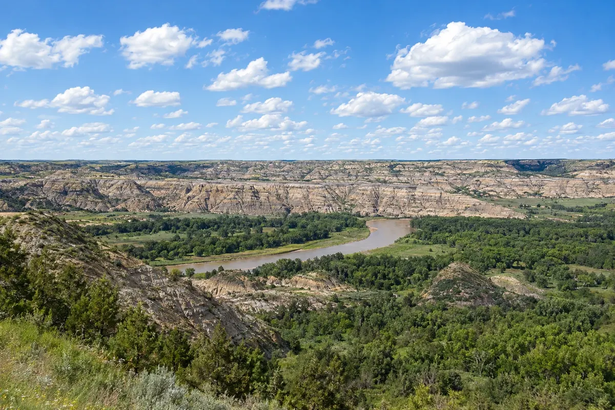
North Dakota, in the Great Plains: the badlands of Theodore Roosevelt National Park, the frontier town of Medora, the Lewis and Clark route, and the International Peace Garden on the border with Canada.
In the photo: Theodore Roosevelt National Park
Illustrative images. The pictures in this guide are illustrations based on the real place, not photographs, and may differ from it.

The state
Get to know Dakota do Norte
North Dakota sits on the high Great Plains at the Canadian border and is one of the least-visited states in the country. Most of it is wheat, sunflower fields and pastures as far as the eye can see; the Missouri River crosses the state, and in the west the plains break into badlands—lands of ravines and striped hills.
The badlands form Theodore Roosevelt National Park, named for the president who had ranches in the region in the 1880s. The scenic road in the south unit passes through bison, wild horse territory and prairie dog colonies. At the entrance is Medora, a frontier village with an outdoor musical in summer.
Bismarck, the capital, has a tower-shaped capitol—the tallest building in the state—and is near Fort Abraham Lincoln, associated with General Custer. To the north, the Knife River Indian Villages preserve traces of the Hidatsa and Mandan villages, and near Washburn the Fort Mandan was reconstructed, where explorers Lewis and Clark wintered in 1804.
Fargo, the largest city, lies in the east on the Minnesota border. To the north, the International Peace Garden straddles the Canada border, with flower beds in summer. On the table, the heritage of Norwegian and German immigrants appears in dishes such as knoephla, a dumpling soup, and lefse, a thin potato flatbread.
When to go
From June to September days are usually long and pleasant, with highs around 27 °C; it’s the season for the Medora musical and park outings. Winter is long and severe, with lows often below -15 °C and blizzards, and some park services close. Most of the state is 3 hours behind Brasília (2 hours during daylight saving); the southwest, where Medora and the park are, is 4 hours behind (3 in summer).
Getting there
Fargo (FAR) and Bismarck (BIS) airports have domestic flights, often connecting through Minneapolis or Denver. From Brazil, expect more than one connection or a driving leg; confirm before buying. Medora is about a 2-hour drive from Bismarck via I-94, and Fargo is about 3 hours from Bismarck. Outside cities there is no public transport for visitors.
Your questions
Frequently asked questions about Dakota do Norte
What to see in Theodore Roosevelt National Park?
The Little Missouri badlands, with ravines and striped hills, and Great Plains wildlife: bison, wild horses, deer and prairie dogs. The south unit, next to Medora, is the most visited; the north unit is just over an hour’s drive. Visitors pay an entrance fee; check the park website.
When is the Medora musical?
The Medora Musical is an outdoor country-music and comedy show presented in an amphitheater on the badlands slope. The season usually runs from June to early September; check the schedule before you go.
Does North Dakota pair well with South Dakota on a trip?
Yes. From Medora to Rapid City, the gateway to Mount Rushmore, it’s about a 4-hour drive, and many Great Plains itineraries combine the two states.
Is it very cold in North Dakota’s winter?
Yes. From December to February temperatures are often well below zero, with strong winds and blizzards. Travelers in that season need snow clothing and a vehicle equipped for winter, and should check road conditions before setting out.