

 Brazil
 Argentina
 Bolivia
 Chile
 Colombia
 Ecuador
 Guyana
 French Guiana
 Falkland Islands (Malvinas)
 Paraguay
 Peru
 Suriname
 Uruguay
 Venezuela
 Germany
 Austria
 Belgium
 Croatia
 Denmark
 Spain
 Finland
 France
 Greece
 the Netherlands
 Hungary
 Ireland
 Iceland
 Italy
 Luxembourg
 Norway
 Poland
 Portugal
 the United Kingdom
 the Czech Republic
 Sweden
 Switzerland
 Turkey
 Mexico
 the Dominican Republic
 South Africa
 Fiji
State · Grandes Lagos e Meio-Oeste (Chicago)
Michigan
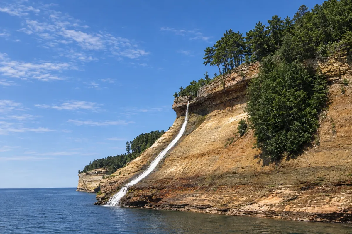
Michigan, among four of the Great Lakes: the car-free Mackinac Island, the Sleeping Bear Dunes, the colorful cliffs of Pictured Rocks and the automobile museums in Detroit.
In the photo: Pictured Rocks
Illustrative images. The pictures in this guide are illustrations based on the real place, not photographs, and may differ from it.

The state
Get to know Michigan
Michigan is made up of two peninsulas surrounded by four of the five Great Lakes (Superior, Michigan, Huron and Erie), which give the state more than 5,000 km of freshwater shoreline, with beaches, dunes and lighthouses. The Lower Peninsula, glove-shaped, concentrates the cities; the Upper Peninsula, to the north, is forested, with waterfalls and small towns.
Detroit, the motor city, has the Motown Museum, in the studio where the label's hits were recorded, and the Detroit Institute of Arts, with Diego Rivera’s murals about industry. In Dearborn, the Henry Ford Museum and Greenfield Village bring together cars, planes and historic houses, and the Ford Rouge truck plant accepts visits.
In the north, Mackinac Island has banned cars since the late 19th century: you get around on foot, by bike or by carriage, among Victorian houses, a fort and fudge shops, the island’s chocolate candy. The Mackinac Bridge, about 8 km long, links the two peninsulas. On Lake Michigan, the Sleeping Bear Dunes rise more than 100 meters above the water, and Traverse City is known for cherries.
In the Upper Peninsula, Pictured Rocks, on the shore of Lake Superior, has sandstone cliffs stained by minerals, waterfalls and beaches, seen by boat or kayak, and Tahquamenon Falls lie in the middle of the forest. On the plate, the pasty, a meat pie brought by Cornish miners, lake fish and cherry pie.
When to go
From June to September is the season for the lakes, beaches and Mackinac Island, with highs near 27 °C; most island services and boats operate from May to October. fall foliage runs from late September to mid-October, starting first in the Upper Peninsula. Winter is long and snowy, the season for skiing and snowmobiling in the north. Michigan is 2 hours behind Brasília (1 hour during daylight saving time); four counties in the western Upper Peninsula follow Central Time, 3 hours behind.
Getting there
Detroit Airport (DTW) is the main airport, with domestic and international flights; Grand Rapids (GRR) and Traverse City (TVC) serve the west and the north. From Brazil, travel usually requires a connection; check before booking. From Detroit to Mackinaw City, where boats depart for the island, it's about a 4-hour drive; from Chicago, Grand Rapids is about 3 hours away.
Your questions
Frequently asked questions about Michigan
How to get to Mackinac Island?
By boat, departing from Mackinaw City or St. Ignace, on a crossing of about 20 minutes. Boats run more frequently from May to October. Cars stay in the pier parking lot because the island does not allow vehicles.
How many days to book for Mackinac Island?
One day allows you to circle the island by bike, about 13 km along the lakeshore, and visit Fort Mackinac. Staying overnight on the island lets you see it after the day boats have gone.
How to see Pictured Rocks?
The most common way is the boat tour that departs from Munising and passes close to the cliffs, from May to October. Guided kayaking and trails along the tops of the cliffs are other options. Tours depend on the weather on Lake Superior.
What to see in Detroit?
The Motown Museum, the Detroit Institute of Arts with Diego Rivera’s murals, and in Dearborn, the Henry Ford Museum and Greenfield Village, which warrant a full day. The Detroit riverfront has a promenade from which you can see Windsor, in Canada.