

 Brazil
 Argentina
 Bolivia
 Chile
 Colombia
 Ecuador
 Guyana
 French Guiana
 Falkland Islands (Malvinas)
 Paraguay
 Peru
 Suriname
 Uruguay
 Venezuela
 Germany
 Austria
 Belgium
 Croatia
 Denmark
 Spain
 Finland
 France
 Greece
 the Netherlands
 Hungary
 Ireland
 Iceland
 Italy
 Luxembourg
 Norway
 Poland
 Portugal
 the United Kingdom
 the Czech Republic
 Sweden
 Switzerland
 Turkey
 Mexico
 the Dominican Republic
 South Africa
 Fiji
State · Grandes Lagos e Meio-Oeste (Chicago)
Indiana
Indiana, in the Midwest: the Indianapolis 500 race, the dunes on Lake Michigan, the Amish communities in the north, and Columbus’s modern architecture.
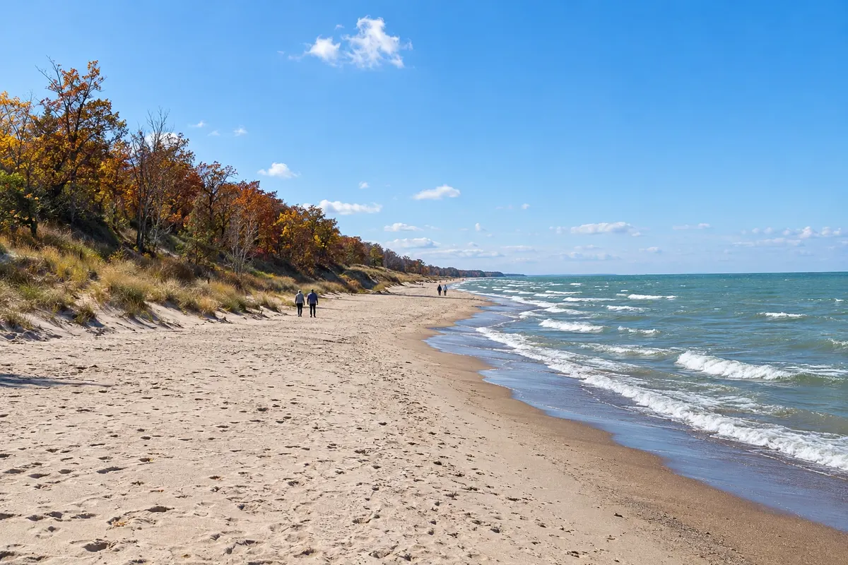
In the photo: Indiana Dunes
Illustrative images. The pictures in this guide are illustrations based on the real place, not photographs, and may differ from it.

The state
Get to know Indiana
Indiana is in the U.S. Midwest, between Illinois and Ohio, with a tip on Lake Michigan to the north and the border with Kentucky along the Ohio River to the south. It is a state of agricultural plains, small towns and straight roads, known for auto racing and basketball.
Indianapolis, the capital, revolves around the Indianapolis Motor Speedway, the 500 Miles racetrack held in May, with a museum and circuit tours the rest of the year. The city also has the Children’s Museum of Indianapolis, one of the largest children’s museums in the world, the Soldiers and Sailors Monument downtown, and a canal with a promenade.
In the north, Indiana Dunes National Park protects dunes, beaches and forests on the shore of Lake Michigan, about 1 hour from Chicago. Further east, Shipshewana, Middlebury and Nappanee are home to Amish communities, with buggies on the roads, farms and craft and homemade-food fairs.
In the south, the terrain becomes rolling and wooded. Madison, on the Ohio River, has a 19th-century historic downtown, and Columbus is known for modern architecture, with churches, schools and public buildings by architects such as Eero Saarinen and I. M. Pei. On the table, the breaded pork tenderloin sandwich and the sugar cream pie, a cream-and-sugar pie that is the state’s official pie.
When to go
From May to October days are usually pleasant; May is the month of the 500 Miles, with the city crowded and accommodation in high demand. Summer, from June to August, is the season for Lake Michigan beaches, with highs around 29 °C (84 °F). Winter is cold, with snow. Most of Indiana is 2 hours behind Brasília (1 hour during daylight saving); the northwest, near Chicago, and the far southwest follow Central Time, 3 hours behind (2 in summer).
Getting there
Indianapolis Airport (IND) has domestic flights; the northern part of the state is closer to Chicago, whose O'Hare Airport (ORD) handles international flights. From Brazil, travel usually involves a connection in another U.S. city; confirm before booking. From Chicago, the dunes are about 1 hour by car or via the South Shore Line train, and Indianapolis is about 3 hours by car.
Your questions
Frequently asked questions about Indiana
When are the Indianapolis 500 races?
The race is held on the Sunday of the Memorial Day weekend, at the end of May, after a month of practice, qualifying and city events. Tickets and accommodation often sell out early: buy in advance.
Can you visit the racetrack outside the race?
Yes. The Indianapolis Motor Speedway Museum displays winning cars and offers guided tours, some with a bus lap of the circuit and a stop at the brick strip of the start/finish line. Check days and tour options before you go.
What to do in Indiana Dunes National Park?
Swimming and beach time on Lake Michigan in summer, hikes across the dunes—such as the 3 Dune Challenge loop in the neighboring state park—and birdwatching in spring and fall. The national park and the state park sit side by side.
Where can you see Amish communities in Indiana?
In the northern part of the state, in Shipshewana, Middlebury and Nappanee, about 2.5 hours from Chicago. There are fairs, farm tours and homestyle restaurants. Amish people generally dislike being photographed: ask permission or photograph only the scenery.