

 Brazil
 Argentina
 Bolivia
 Chile
 Colombia
 Ecuador
 Guyana
 French Guiana
 Falkland Islands (Malvinas)
 Paraguay
 Peru
 Suriname
 Uruguay
 Venezuela
 Germany
 Austria
 Belgium
 Croatia
 Denmark
 Spain
 Finland
 France
 Greece
 the Netherlands
 Hungary
 Ireland
 Iceland
 Italy
 Luxembourg
 Norway
 Poland
 Portugal
 the United Kingdom
 the Czech Republic
 Sweden
 Switzerland
 Turkey
 Mexico
 the Dominican Republic
 South Africa
 Fiji
State · Montanhas Rochosas
Idaho
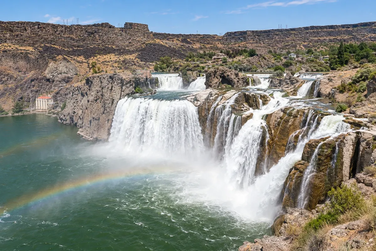
Idaho, in the Rocky Mountains: the Shoshone Falls, the lava fields of Craters of the Moon, the Sawtooth Mountains, the Sun Valley ski resort and Lake Coeur d'Alene.
In the photo: Shoshone Falls
Illustrative images. The pictures in this guide are illustrations based on the real place, not photographs, and may differ from it.

The state
Get to know Idaho
Idaho is in the northwest of the United States, between Oregon and the Rocky Mountains, and stretches from the southern lava desert to lakes and forests on the Canadian border. It is land of whitewater rivers, hot springs, roadless mountains and the potato, the state's best-known product. A narrow strip of Yellowstone Park lies within Idaho, on the border with Wyoming and Montana.
In the south, the Snake River cuts a canyon into the plain. Near Twin Falls, Shoshone Falls drops 65 meters—higher than Niagara—and Craters of the Moon is a national monument of lava fields, ash cones and lava-tube caves. On the border with Oregon, the same river carved Hells Canyon, considered the deepest river canyon in North America.
In the central region, Sun Valley, beside Ketchum, is one of the country's oldest ski resorts, where Ernest Hemingway spent his final years; in summer the area offers hiking and fishing. To the north, the Sawtooth Mountains form a wall of peaks above alpine lakes, with the village of Stanley at their base.
Boise, the capital, has a lively downtown, a park trail along the Boise River and one of the largest Basque communities in the United States, with a museum and the Basque quarter. In the north, Coeur d'Alene sits on the shore of a blue lake with boat excursions, and Lake Pend Oreille, near Sandpoint, is one of the deepest in the country.
When to go
From June to September mountain roads are usually open and the days are dry and sunny; it is the season for hiking, rafting and lakes. Shoshone Falls typically have more water from April to June with the snowmelt. The ski season in Sun Valley runs from December to April. Southern Idaho, including Boise, is 4 hours behind Brasília (3 during daylight saving); northern Idaho, including Coeur d'Alene, is 5 hours behind (4 in summer).
Getting there
Boise Airport (BOI) is the main airport, with domestic flights; Spokane (GEG), in Washington state, serves Coeur d'Alene, about 45 minutes away, and Hailey (SUN) serves Sun Valley. From Brazil, expect a connection in another U.S. city such as Seattle, Denver or Salt Lake City; check before you buy. Distances are large: from Boise to Twin Falls is about a 2-hour drive, and to Stanley about 3 hours.
Your questions
Frequently asked questions about Idaho
When is the best time to see Shoshone Falls with the most water?
In spring, from April to June, when the snowmelt increases the Snake River’s flow. In late summer and autumn some water is diverted for irrigation and the falls are usually much smaller.
What is Craters of the Moon?
A national monument in southern Idaho with lava fields, volcanic ash cones and caves formed by lava tubes. It has a scenic drive and short trails; to enter the caves you need a permit obtained at the visitor center. Bring water and sturdy footwear, because the lava is sharp.
Can Idaho be included in a trip to Yellowstone?
Yes. The park’s west entrance, at West Yellowstone, is about 2 hours from Idaho Falls, which has an airport with domestic flights, and the route passes through Harriman State Park, with rivers and prairie.
What is skiing like in Sun Valley?
Sun Valley has two mountains: Bald Mountain, with long, steep runs, and Dollar Mountain, for beginners. The season runs from December to April, and access is via Hailey Airport or by car from Boise, about 2.5 hours.