

 Brazil
 Argentina
 Bolivia
 Chile
 Colombia
 Ecuador
 Guyana
 French Guiana
 Falkland Islands (Malvinas)
 Paraguay
 Peru
 Suriname
 Uruguay
 Venezuela
 Germany
 Austria
 Belgium
 Croatia
 Denmark
 Spain
 Finland
 France
 Greece
 the Netherlands
 Hungary
 Ireland
 Iceland
 Italy
 Luxembourg
 Norway
 Poland
 Portugal
 the United Kingdom
 the Czech Republic
 Sweden
 Switzerland
 Turkey
 Mexico
 the Dominican Republic
 South Africa
 Fiji
State · Luisiana e o Delta do Mississippi
Arkansas
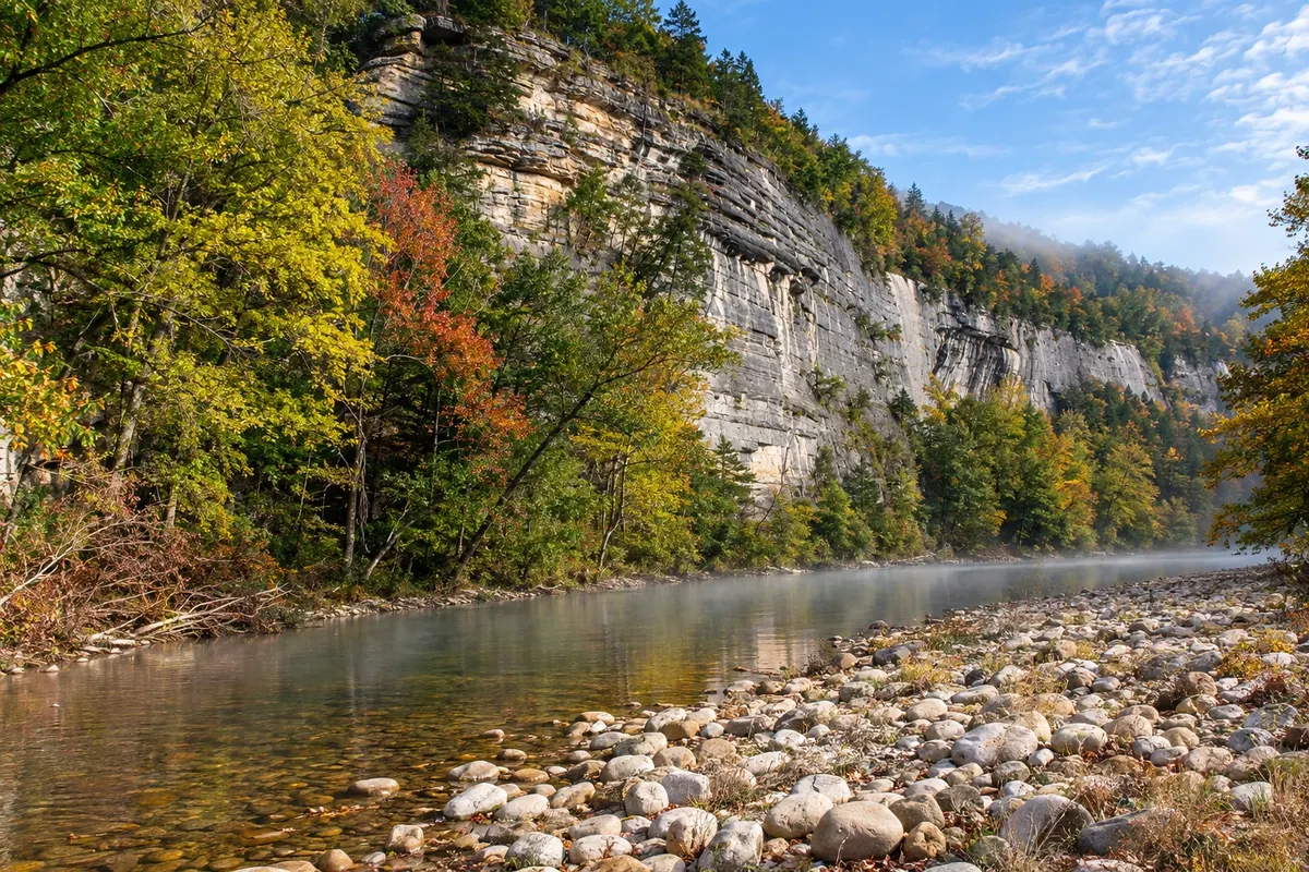
Arkansas, in the Ozark Mountains: the Hot Springs thermal bathhouses, the Crystal Bridges museum in Bentonville, the Buffalo River and the park where visitors search for diamonds.
In the photo: Buffalo National River
Illustrative images. The pictures in this guide are illustrations based on the real place, not photographs, and may differ from it.

The state
Get to know Arkansas
Arkansas sits in the south-central United States, between the Mississippi River to the east and the Great Plains to the west. The north is dominated by the Ozark Mountains, with forests, caves and clear-water rivers; the south and east are flat, with rice fields and cotton on the Mississippi floodplain. The state markets itself as The Natural State because of its landscapes.
Hot Springs has a national park in the middle of town: Bathhouse Row brings together early-20th-century bathhouses, two of which still operate with spring water that emerges at about 60 °C. The Grand Promenade, a brick walkway behind the bathhouses, passes springs where locals fill bottles.
In the northwest, Bentonville is home to Crystal Bridges, a museum of American art set in a valley with trails and sculptures, and Eureka Springs is a Victorian town with hilly streets. The Buffalo River, the country’s first national river, is popular for canoeing among limestone bluffs. Near Murfreesboro, the Crater of Diamonds is a state park where visitors hunt for diamonds and keep whatever they find.
Little Rock, the capital, sits on the banks of the Arkansas River, with a riverfront promenade and Little Rock Central High School, a landmark of the end of school segregation in 1957 and a national historic site. On the table: fried catfish, barbecue and fruit pies. For those traveling the blues Delta, Arkansas lies en route between Memphis and the Ozarks.
When to go
Spring (April and May) and fall (mid-October to early November, when the Ozark forests change color) usually bring mild days. The Buffalo River typically has more water for canoeing from March through June. Summers tend to be hot and humid, above 30 °C, and winters are short, with frosts and occasional mountain snow. Arkansas is three hours behind Brasília (two hours during daylight saving time).
Getting there
The main airports are Little Rock (LIT) and Northwest Arkansas (XNA), near Bentonville, both with domestic flights. From Brazil, trips usually connect through Dallas, Atlanta, Houston or Chicago; check before booking. Little Rock is about a 2-hour drive from Memphis, and Hot Springs about 1 hour from Little Rock. In the Ozarks, getting around is best done by car.
Your questions
Frequently asked questions about Arkansas
Is it true you can search for diamonds in Arkansas?
Yes. At the Crater of Diamonds State Park, near Murfreesboro, visitors search for stones in a plowed field and keep whatever they find. Most finds are small. There is an entrance fee, and the park rents tools; check the rules before you go.
Can you bathe in the Hot Springs thermal waters?
Yes. Two bathhouses on Bathhouse Row operate with spring water, and there are public springs to fill bottles. Baths are charged separately; check the current price schedule.
When is the best time to canoe on the Buffalo River?
The most popular season runs from March to June, when the river usually has enough water along its length. In summer, the upper stretches can run shallow, and trips concentrate on the lower Buffalo.
How many days should I set aside for Arkansas?
Three to four days allow you to combine Little Rock and Hot Springs with the northwest (Bentonville and Eureka Springs). To include the Buffalo River, add one or two more days.