

 Brazil
 Argentina
 Bolivia
 Chile
 Colombia
 Ecuador
 Guyana
 French Guiana
 Falkland Islands (Malvinas)
 Paraguay
 Peru
 Suriname
 Uruguay
 Venezuela
 Germany
 Austria
 Belgium
 Croatia
 Denmark
 Spain
 Finland
 France
 Greece
 the Netherlands
 Hungary
 Ireland
 Iceland
 Italy
 Luxembourg
 Norway
 Poland
 Portugal
 the United Kingdom
 the Czech Republic
 Sweden
 Switzerland
 Turkey
 Mexico
 the Dominican Republic
 Fiji
Viewpoint · Wilderness, Cabo Ocidental
Map of Africa Viewpoint
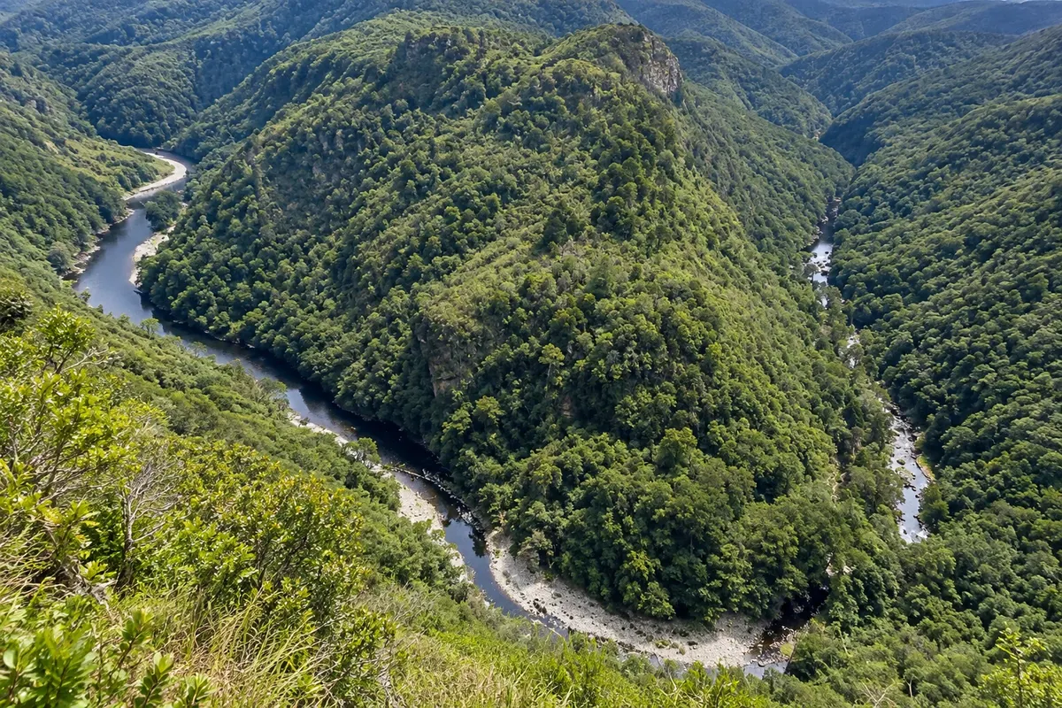
Viewpoint on the high ridge above Wilderness from where the Kaaimans River, between forested slopes, outlines the African continent.
Illustrative images. The pictures in this guide are illustrations based on the real place, not photographs, and may differ from it.

Discover
About Map of Africa Viewpoint
The Map of Africa viewpoint sits on the ridge above Wilderness, about 15 km from George. Below, the Kaaimans River runs through a deep forested valley, and a bend in the river, seen from a specific vantage point, resembles the outline of the African continent.
Besides the 'map', the viewpoint offers views of the Outeniqua mountains, the Kaaimans valley and, on the other side of the road, Wilderness village and the long beach stretching to the horizon.
The lawn in front is a launch site for paragliding and hang-gliding, and on windy days the sky fills with colorful sails. There are benches and picnic space.
The final stretch of road is gravel but well maintained. Volunteers look after the site, and a voluntary contribution is requested.
Before you go
Practical information
Cidade Turismo reviews its information regularly, but something may have changed. Check with the place before planning your trip.
How much time to set aside
30 minutes to 1 hour.
Best time
Late afternoon, with the sun low over the sea, and on clear days. In fog the river disappears.
How to get there
Via Hoogte Road off George Road in Wilderness, up the ridge to the viewpoint sign; about a 15-minute drive from the village.
Tip
Cross the lawn to view the beach on the other side of the road.
Get your questions answered
Frequently asked questions about Map of Africa Viewpoint
Where is the Map of Africa viewpoint?
On the ridge above Wilderness, about 15 km from George.
Why is it called Map of Africa?
Because a bend in the Kaaimans River, seen from there, outlines a shape similar to the continent.
Can you paraglide at the Map of Africa?
The lawn is a paragliding launch site, with tandem flights offered by local operators.