

 Brazil
 Argentina
 Bolivia
 Chile
 Colombia
 Ecuador
 Guyana
 French Guiana
 Falkland Islands (Malvinas)
 Paraguay
 Peru
 Suriname
 Uruguay
 Venezuela
 Germany
 Austria
 Belgium
 Croatia
 Denmark
 Spain
 Finland
 France
 Greece
 the Netherlands
 Hungary
 Ireland
 Iceland
 Italy
 Luxembourg
 Norway
 Poland
 Portugal
 the United Kingdom
 the Czech Republic
 Sweden
 Switzerland
 Turkey
 Mexico
 the Dominican Republic
 Fiji
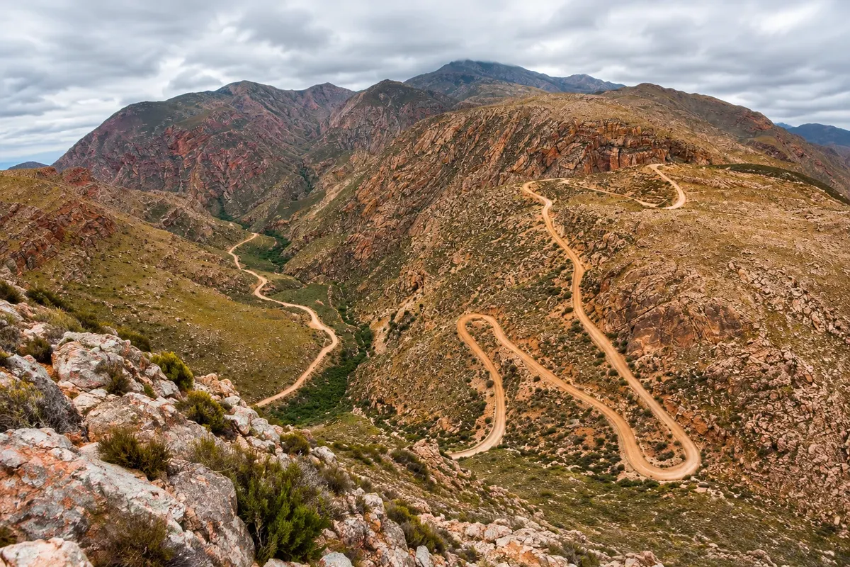
Historic road · Oudtshoorn, Cabo Ocidental
Swartberg Pass
1888 dirt road over the Swartberg range, between Oudtshoorn and Prince Albert, with zigzag bends and dry stone walls.
Illustrative images. The pictures in this guide are illustrations based on the real place, not photographs, and may differ from it.

Discover
About Swartberg Pass
The Swartberg Pass was the last and best-known work of road engineer Thomas Bain. Built with convict labour and opened on 10 January 1888, it crosses the Swartberg range between the Little Karoo to the south and the Great Karoo to the north. It is about 24 km of dirt road, with the highest point, called Die Top, at about 1,583 metres.
The ascent features zigzag bends supported by dry stone walls, without mortar, which still stand more than a century later. From the top you can see both Karoos. The descent to the north enters a gorge of folded, reddish rocks, one of the clearest examples of folded mountains in the world.
The Swartberg range is part of the Cape Floral Region, a World Heritage Site, and the fynbos along the road has proteas and other flowers in spring. The pass is a national monument.
At the end of the descent lies the village of Prince Albert, and the return to Oudtshoorn is commonly made via the Meiringspoort, a paved gorge road with a waterfall.
Before you go
Practical information
Cidade Turismo reviews its information regularly, but something may have changed. Check with the place before planning your trip.
How much time to set aside
From 2 hours to half a day, round trip.
Best time
On a dry, clear day. The road can close after heavy rain or snow in winter; check conditions before driving up.
How to get there
The start is on the R328 road, after the Cango Caves, about 40 km from Oudtshoorn. A regular car can pass in dry conditions, with care.
Tip
Fill up beforehand and drive slowly: the road is narrow and unprotected in some sections. Return via the Meiringspoort.
Get your questions answered
Frequently asked questions about Swartberg Pass
Is the Swartberg Pass paved?
No, it is all gravel/dirt, with narrow sections and no side protection.
Who built the Swartberg Pass?
Engineer Thomas Bain, using prison labour. It was opened in 1888.
What is the altitude of the Swartberg Pass?
The highest point, Die Top, is at about 1,583 metres.
Does the Swartberg Pass close?
It can close after heavy rain or snow. Check before you drive up.