

 Antarktika
 Argentina
 Bolivija
 Čile
 Kolumbija
 Ekvator
 Gvajana
 Francoska Gvajana
 Falklandski otoki (Malvini)
 Paragvaj
 Peru
 Surinam
 Urugvaj
 Venezuela
 Nemčija
 Avstrija
 Belgija
 Hrvaška
 Danska
 Slovaška
 Slovenija
 Španija
 Finska
 Francija
 Grčija
 Nizozemska
 Madžarska
 Irska
 Islandija
 Italija
 Luksemburg
 Norveška
 Poljska
 Portugalska
 Združeno kraljestvo
 Češka
 Švedska
 Švica
 Turčija
 Bermudi
 Kanada
 Združene države Amerike
 Grenlandija
 Mehika
 Sveta Peter in Mihael
 Dominikanska republika
 Japonska
 Južnoafriška republika
 Egipt
 Avstralija
 Fidži
 Nova Zelandija
 Papua Nova Gvineja
Pot · BA
Green Line
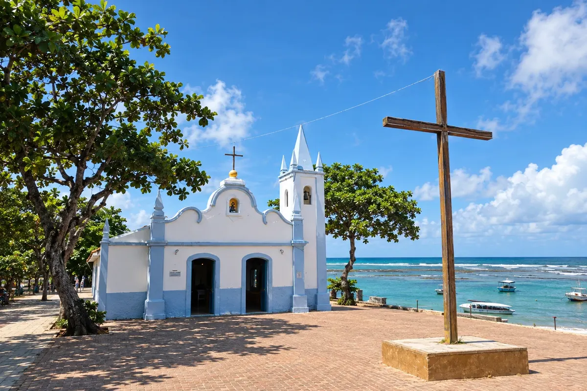
From Praia do Forte to the municipality of Jandaíra, the Green Line connects villages, beaches and estuaries of the Northern Coast of Bahia, with local access points to reach Mangue Seco.
Na fotografiji: Church of Saint Francis of Assisi, in Praia do Forte, Mata de São João.
Illustrative images. The pictures in this guide are illustrations based on the real place, not photographs, and may differ from it.


Pot
Green Line – predstavitev
The Green Line is the section of BA-099 that continues the Estrada do Coco from Praia do Forte. This route follows the coast through five municipalities, between Mata de São João and Jandaíra. Beach turnoffs leave the main roadway and provide access to fishing communities, restingas, dunes and estuaries. Mangue Seco ends the trip as a village of Jandaíra; arriving there depends on a local access point, separate from the highway.
Zemljevid
Število mest na poti: 5
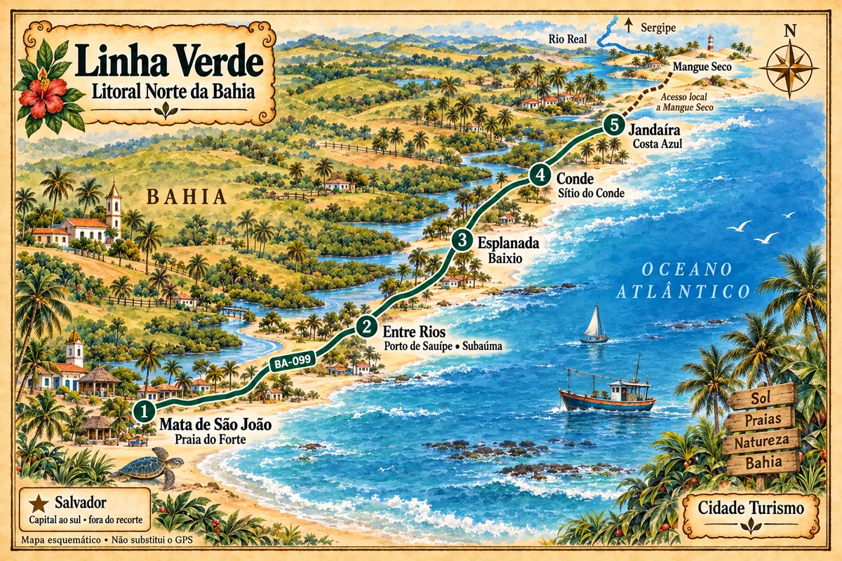
Zemljevid: @svg-maps/brazil, CC BY 4.0
Potek poti
Od mesta do mesta
Razdalje in časi so okvirni. Preverite jih pred odhodom.
-
 1 · BA
Mata de São João
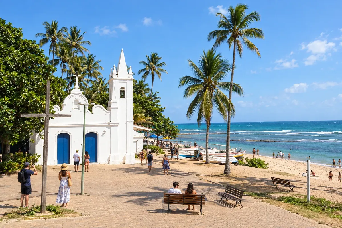
Mata de São João brings together in Praia do Forte the sea turtle conservation efforts of Projeto Tamar and the heritage of Castelo Garcia D’Ávila. In Imbassaí, the river runs alongside the beach before reaching the sea. The municipality’s coastline marks the start of this Green Line route.
→ Entre Rios From Praia do Forte, head north on BA-099 along the Green Line segment. Turnoffs to Porto de Sauípe, Massarandupió and Subaúma lead to the coastal villages of Entre Rios; the municipal seat lies off this axis.
-
 2 · BA
Entre Rios
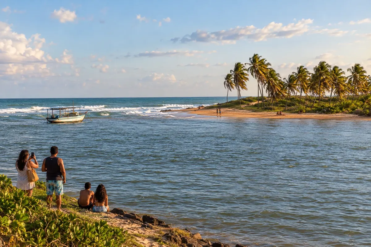
Entre Rios’ coastline is distributed among Porto de Sauípe, Massarandupió and Subaúma. The meeting of the Rio Sauípe with the sea and piaçava straw handicrafts are features of Porto de Sauípe; in Subaúma, the reefs appear according to the tide. The Green Line provides access to these villages, which are separate from the municipal seat.
→ Esplanada Return to BA-099 after visiting the Entre Rios coast and proceed to the access to Baixio via BA-400. The main connection is paved; visiting Esplanada’s lagoons involves local routes and specific access conditions.
-
 3 · BA
Esplanada
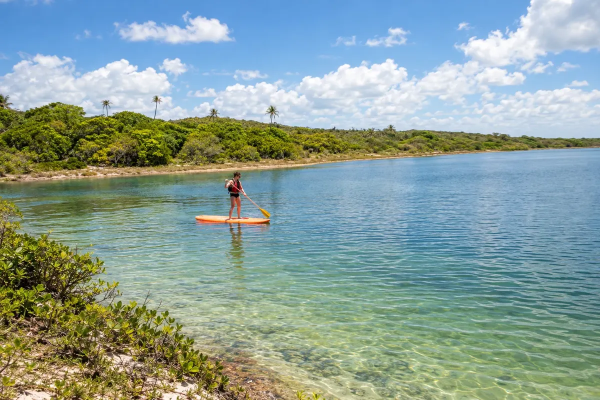
Esplanada reaches the sea at the district of Baixio, where the beach and Lagoa Azul concentrate coastal visits. The mouth of the Rio Inhambupe adds another water-meeting landscape. On this route, entry to the municipality is via the coast — a turnoff from BA-099 to Baixio — rather than through the inland municipal seat.
→ Conde Leave Baixio via BA-400 and continue north on BA-099. Conde’s access network includes BA-233; coastal turnoffs lead to Barra do Itariri, Sítio do Conde, Poças and Siribinha.
-
 4 · BA
Conde
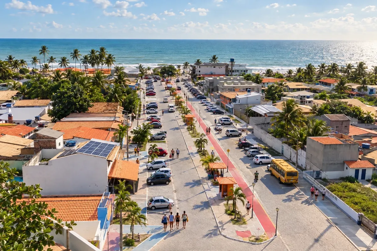
Conde comprises four coastal localities with distinct beach names: Barra do Itariri, Sítio do Conde, Poças and Siribinha. In the latter, the estuary of the Rio Itapicuru is part of the scenery; Poças retains a fishing-linked community. Turnoffs from the Green Line lead to different points along this coastline.
→ Jandaíra BA-099 continues from Conde into the territory of Jandaíra. Costa Azul is reached via BA-782; the paving announced for 2026 is not treated as completed. Mangue Seco requires local access by water via Pontal (Sergipe) or by a 4x4 vehicle via Coqueiro.
-
 5 · BA
Jandaíra
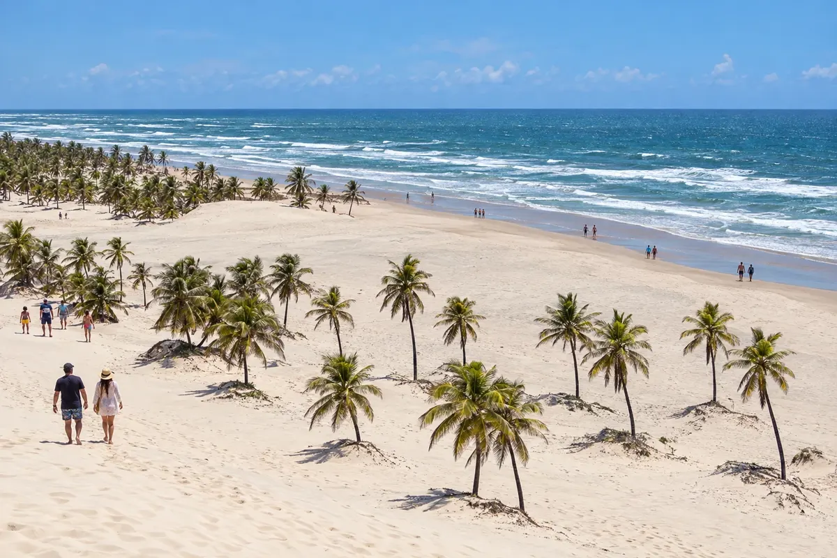
Jandaíra is home to Mangue Seco, a fishing village associated with Jorge Amado’s novel Tieta do Agreste, set among dunes and the estuary of the Rio Real. The beaches of Costa Azul and Coqueiro also belong to the municipality. The final stage requires a local access to the village: BA-099 does not end inside Mangue Seco.
Koliko dni
Allow four to six days to spread visits among the villages and prepare the final access to Mangue Seco.
Najboljši čas za obisk
Check the coastal forecast and plan outings according to the tide. Rainy days can change the condition of local sand and dirt access routes.
The seasons shown are the most usual ones; nature doesn't always follow the calendar.
Kako prepotovati pot
Use BA-099 as the main axis and take turnoffs to the coastal villages. The main stretch is a highway; for Mangue Seco, arrange either a water crossing or an appropriate vehicle access, depending on local conditions and rules.
Komu je pot namenjena
For travelers who wish to drive the Northern Coast of Bahia and visit coastal localities beyond the busiest beaches.
Odgovori na vaša vprašanja
Pogosta vprašanja – Green Line
Does the Green Line start in Salvador?
On this route, the name Green Line refers to the section of BA-099 starting at Praia do Forte in the municipality of Mata de São João. Salvador is mentioned as an arrival reference; the Estrada do Coco lies before the selected segment.
Do I need to change accommodations during the trip?
Staying in a single base requires returning via the highway after outings. For a staged trip, spread nights among coastal localities and plan the final transfer according to the access chosen for Mangue Seco. Check where your accommodation sits in relation to the beach and BA-099.
Is it possible to reach Mangue Seco by car via BA-099?
The highway does not enter the village. The final stretch must be arranged separately, with a water crossing from Pontal, in Sergipe, or an authorized 4x4 vehicle access from Coqueiro. Confirm local conditions before traveling.
Is a car necessary to explore the Green Line?
A car or hired transport makes it easier to combine BA-099 with turnoffs to beaches and villages. Without your own vehicle, confirm services available for each access and plan your return; the final crossing to Mangue Seco requires separate transport.
How to plan beach visits?
Check the weather forecast, the tide and the most recent bathing water quality bulletin. dune, restinga and mangrove environments are subject to conservation rules; use the designated access routes and follow local guidance.
Več kot vodnik


