

 Antarktika
 Argentina
 Bolivija
 Čile
 Kolumbija
 Ekvator
 Gvajana
 Francoska Gvajana
 Falklandski otoki (Malvini)
 Paragvaj
 Peru
 Surinam
 Urugvaj
 Venezuela
 Nemčija
 Avstrija
 Belgija
 Hrvaška
 Danska
 Slovaška
 Slovenija
 Španija
 Finska
 Francija
 Grčija
 Nizozemska
 Madžarska
 Irska
 Islandija
 Italija
 Luksemburg
 Norveška
 Poljska
 Portugalska
 Združeno kraljestvo
 Češka
 Švedska
 Švica
 Turčija
 Bermudi
 Kanada
 Združene države Amerike
 Grenlandija
 Mehika
 Sveta Peter in Mihael
 Dominikanska republika
 Japonska
 Južnoafriška republika
 Egipt
 Avstralija
 Fidži
 Nova Zelandija
 Papua Nova Gvineja
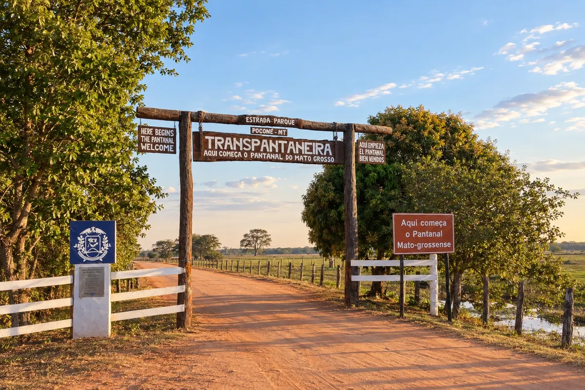
Pot · MT
Transpantaneira
From Poconé to Porto Jofre through the Pantanal, with Cuiabá as the arrival point for the trip.
Na fotografiji: Transpantaneira gateway, in Poconé
Illustrative images. The pictures in this guide are illustrations based on the real place, not photographs, and may differ from it.


Pot
a Transpantaneira – predstavitev
The Transpantaneira Road-Park runs from Poconé to Porto Jofre, a locality of the same municipality. It is not a road crossing to Corumbá. In this itinerary, Cuiabá is listed as the arrival and trip organization point; access to the capital is shown separately from the road route.
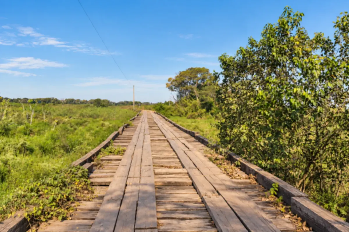
After arriving in Poconé, the trip continues along the MT-060 through Pantanal landscapes and over bridges. Wildlife viewing and stops are part of the outing. Arrange the route with local support and confirm access conditions for your dates.
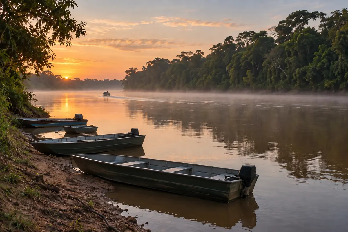
Porto Jofre marks the end of the road and provides the base to arrange boat trips in the Rio Cuiabá region. The locality appears on the map as part of Poconé, not as a separate municipality. Travel to the Parque Nacional do Pantanal Matogrossense is a separate river stage, subject to visitation rules.
On the map, the dashed connection between Cuiabá and Poconé represents the access. The solid line to Porto Jofre represents the Transpantaneira schematically. The guide’s three stops are Cuiabá, Poconé, and Porto Jofre. The final stop is a locality of Poconé, presented as an attraction, not another municipality.
Zemljevid
Število mest na poti: 3
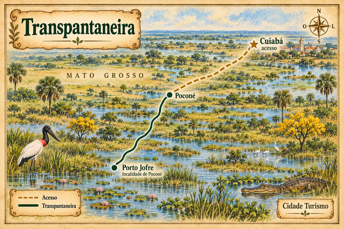
Zemljevid: @svg-maps/brazil, CC BY 4.0
Potek poti
Od mesta do mesta
Razdalje in časi so okvirni. Preverite jih pred odhodom.
-
 1 · MT
Cuiabá
Capital and arrival point for the trip. The connection to Poconé is the access to the itinerary, preceding the Transpantaneira.
→ Poconé From Cuiabá, access to Poconé uses the BR-070 axis and the MT-060. This connection precedes the Transpantaneira: the continuation to Porto Jofre takes place within Poconé, as a separate leg of the trip.
-
 2 · MT
Poconé
Municipality of the Transpantaneira, with the route to Porto Jofre. The road’s final locality belongs to Poconé and is not another city.
→ Porto Jofre From Poconé to Porto Jofre, take the Transpantaneira (MT-060), a dirt road with bridges through Pantanal landscapes. Confirm access conditions with local support; the route ends at the Rio Cuiabá.
-
 3 · MT
Porto Jofre
Porto Jofre marks the end of the Transpantaneira, on the banks of the Rio Cuiabá. The locality belongs to Poconé and is a base for boat trips in the Pantanal region.
Koliko dni
We suggest four days, including arrival, travel along the road, and chosen excursions with local support. Extend your stay if you want to spend more time on wildlife watching or river trips. The duration is an editorial suggestion.
Najboljši čas za obisk
Pantanal conditions vary with the water cycle. Confirm with your operator the status of the road, bridges, and excursions for your dates. Do not treat a seasonal indication as a guarantee of access or wildlife sightings.
The seasons shown are the most usual ones; nature doesn't always follow the calendar.
Kako prepotovati pot
Arrange arrival via Cuiabá and the road access to Poconé. For the Transpantaneira, arrange vehicle and accompaniment with a local operator according to road conditions. In Porto Jofre, river excursions are contracted separately. Confirm the rules for the areas you will visit.
Komu je pot namenjena
For those seeking Pantanal landscapes, bird and wildlife observation, and boat trips. The trip requires planning for transfers and willingness to travel on dirt roads; coordinate activities according to your group’s needs.
Odgovori na vaša vprašanja
Pogosta vprašanja – Transpantaneira
Is Porto Jofre another municipality?
Porto Jofre is a locality of Poconé, where the Transpantaneira ends. In the guide it is the third stop on the route, linked to the attraction of Poconé.
Why does Cuiabá appear on this route?
The capital serves as the arrival and trip organization point. Access to Poconé is shown separately from the Transpantaneira.
Does the road reach Corumbá?
No. The described route ends in Porto Jofre. Do not plan a road continuation to Corumbá via the Transpantaneira.
Can I visit the national park directly by road?
Access to the Parque Nacional do Pantanal Matogrossense from Porto Jofre is by river. Organize that visit separately and confirm the rules and logistics.
Is there a guarantee of seeing animals?
No. Wildlife viewing depends on natural conditions and the excursion. Coordinate activities with local support, keep your distance, and follow the guide’s instructions.
Does the map show every bridge and access?
No. It separates access via Cuiabá from the route between Poconé and Porto Jofre and shows approximate positions. Use local guidance to navigate.
Več kot vodnik


