TO · 5 mesta
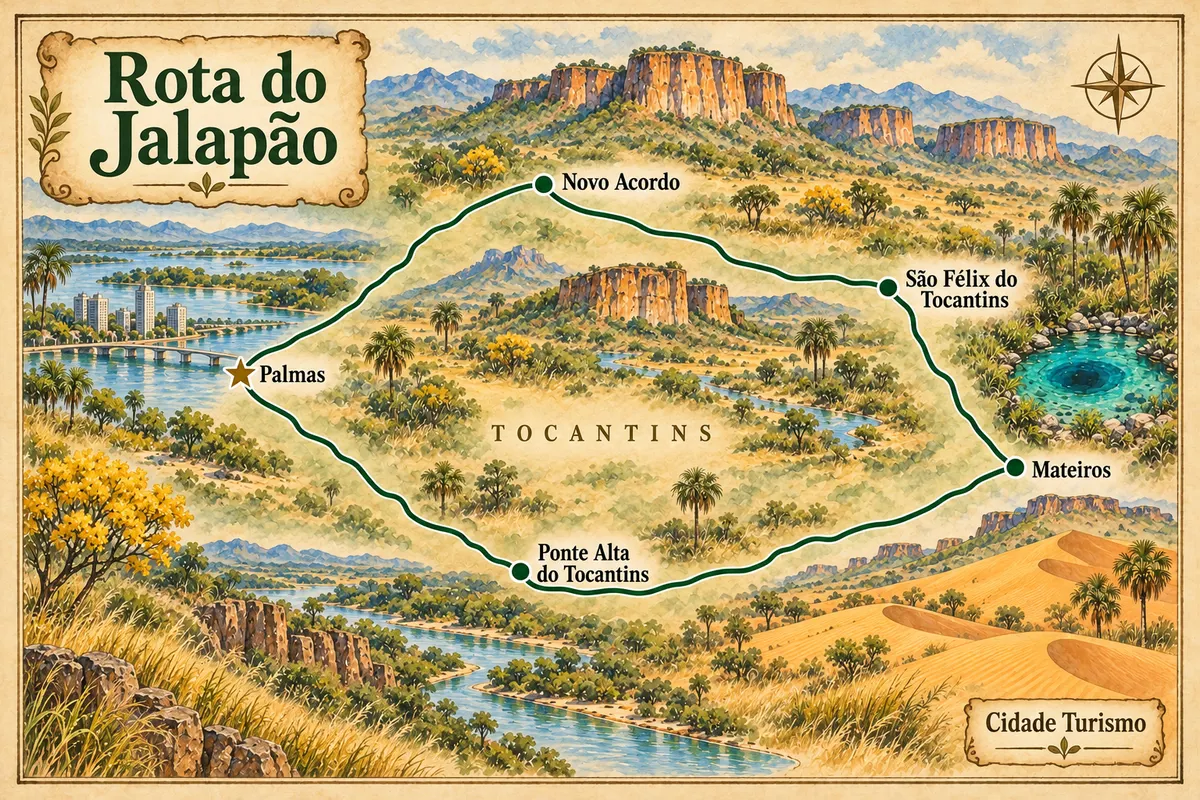
Jalapão Route
A circuit starting from Palmas through dunes, fervedouros, rivers and Jalapão communities.

 Išči
Brazilija
 Antarktika
 Argentina
 Bolivija
 Čile
 Kolumbija
 Ekvator
 Gvajana
 Francoska Gvajana
 Falklandski otoki (Malvini)
 Paragvaj
 Peru
 Surinam
 Urugvaj
 Venezuela
 Nemčija
 Avstrija
 Belgija
 Hrvaška
 Danska
 Slovaška
 Slovenija
 Španija
 Finska
 Francija
 Grčija
 Nizozemska
 Madžarska
 Irska
 Islandija
 Italija
 Luksemburg
 Norveška
 Poljska
 Portugalska
 Združeno kraljestvo
 Češka
 Švedska
 Švica
 Turčija
 Bermudi
 Kanada
 Združene države Amerike
 Grenlandija
 Mehika
 Sveta Peter in Mihael
 Dominikanska republika
 JaponskaTurčija
 Južnoafriška republika
 Egipt
 Avstralija
 Fidži
 Nova Zelandija
 Papua Nova Gvineja
Poti
Znane poti, ki povezujejo mesta in destinacije, z zemljevidi, odseki in napotki pred odhodom.
Illustrative images. The pictures in this guide are illustrations based on the real place, not photographs, and may differ from it.
Turistična pot ima svoje ime, ki ga uporabljajo zvezna država, regija ali popotniki. Primeri so Estrada Real, Rota das Falésias in Caminho dos Cânions do Sul. Mesta in destinacije poveže v zaporedje, pri tem pa je tudi pot sama del doživetja. Za vsako pot najdete zemljevid, odseke med mesti, priporočeno število dni, najboljši čas za obisk in napotke pred odhodom.
Trenutni obseg vodnika: 40 poti. Kraji ob poteh: 328 mesta. Območja: 21 zvezne države.
Ni poti za iskalni niz “”.
A circuit starting from Palmas through dunes, fervedouros, rivers and Jalapão communities.
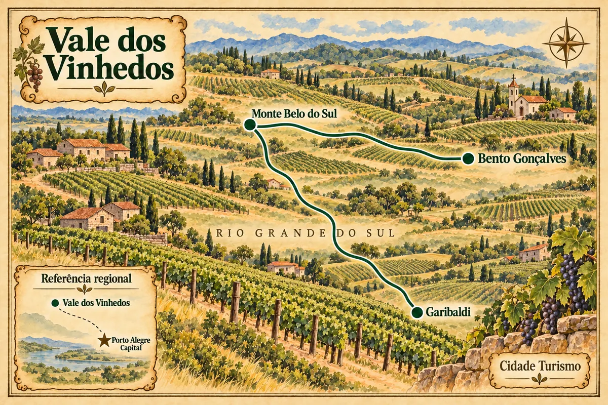
Wineries, rural landscape and Italian heritage between Bento Gonçalves, Monte Belo do Sul and Garibaldi.
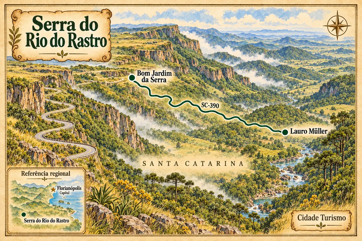
From the base in Lauro Müller to the plateau in Bom Jardim da Serra, along the curves of SC-390.
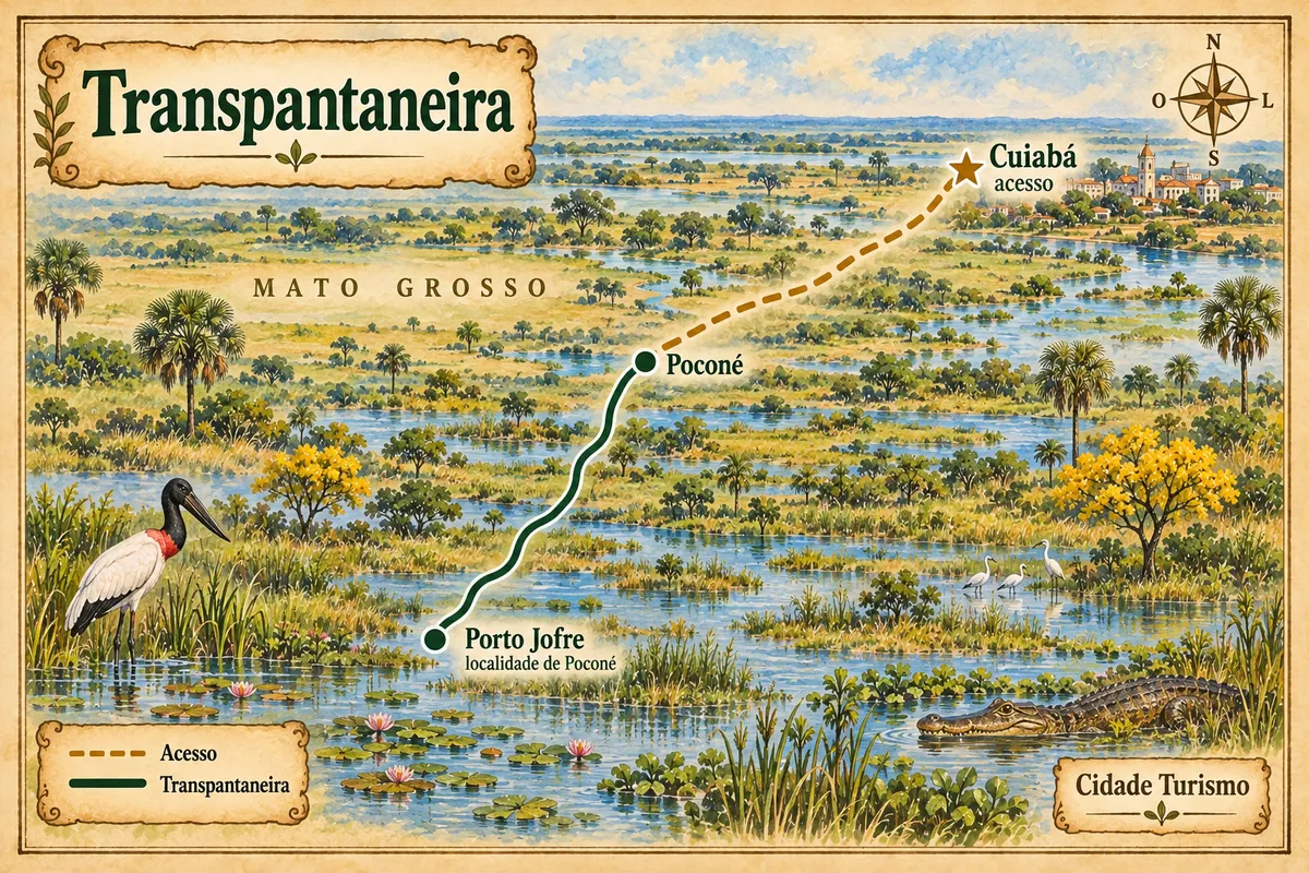
From Poconé to Porto Jofre through the Pantanal, with Cuiabá as the arrival point for the trip.
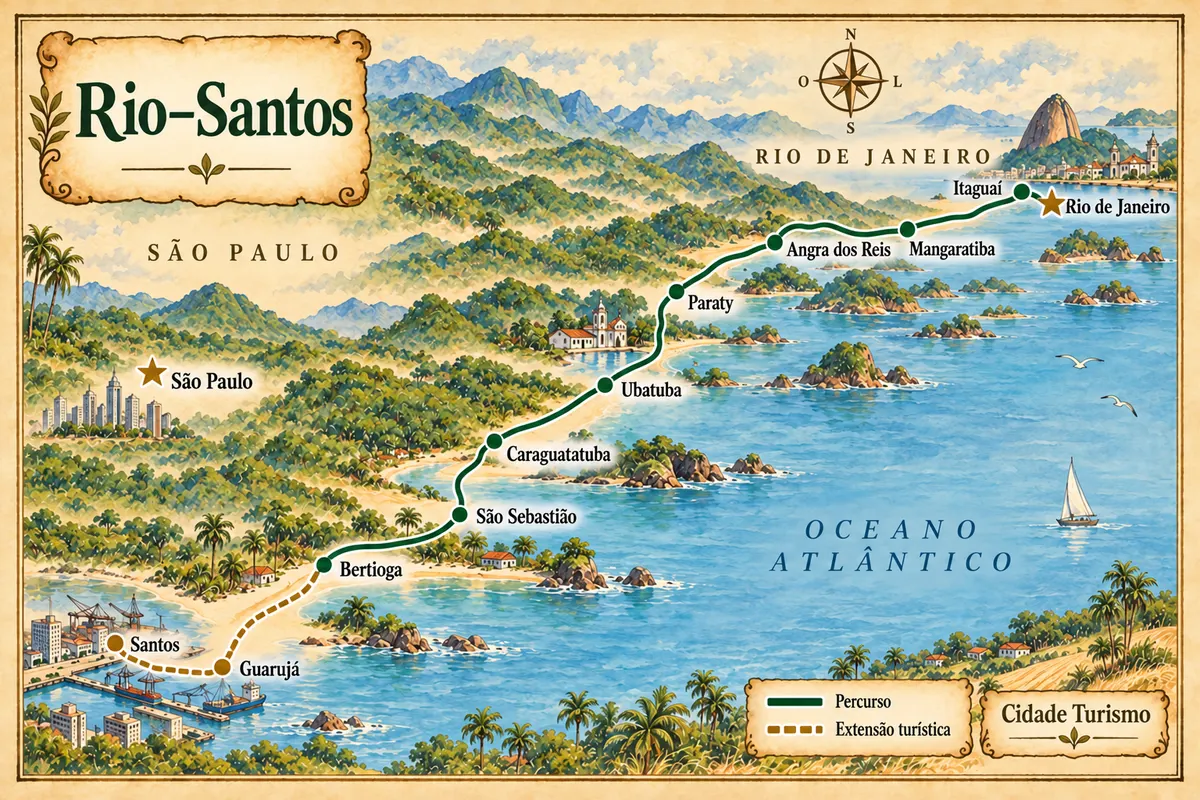
From the Costa Verde to the São Paulo coast, with beaches, heritage and an extension via Guarujá to Santos.
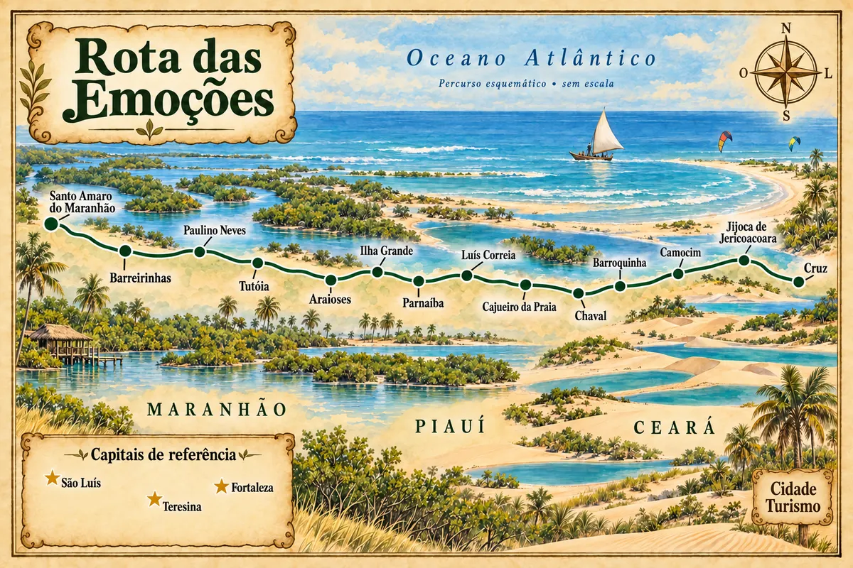
From the coast of Jericoacoara to the Parnaíba Delta and the Lençóis Maranhenses, through fourteen municipalities.
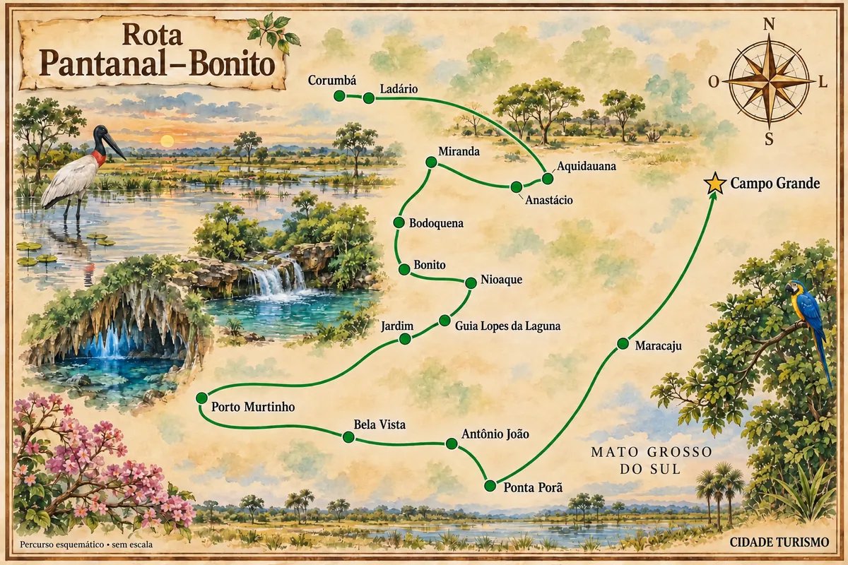
A trip through the landscapes of the Pantanal, the Bonito region and the cities in the south of Mato Grosso do Sul.
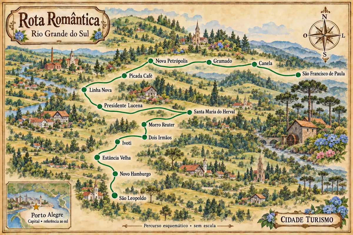
From the Vale dos Sinos to the Serra Gaúcha, a trip through fourteen municipalities, landscapes and heritage.
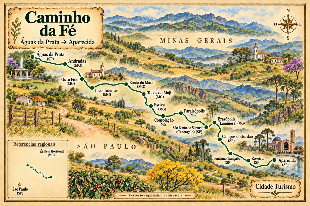
From Águas da Prata to Aparecida, a pilgrimage branch through towns and landscapes of the Mantiqueira.
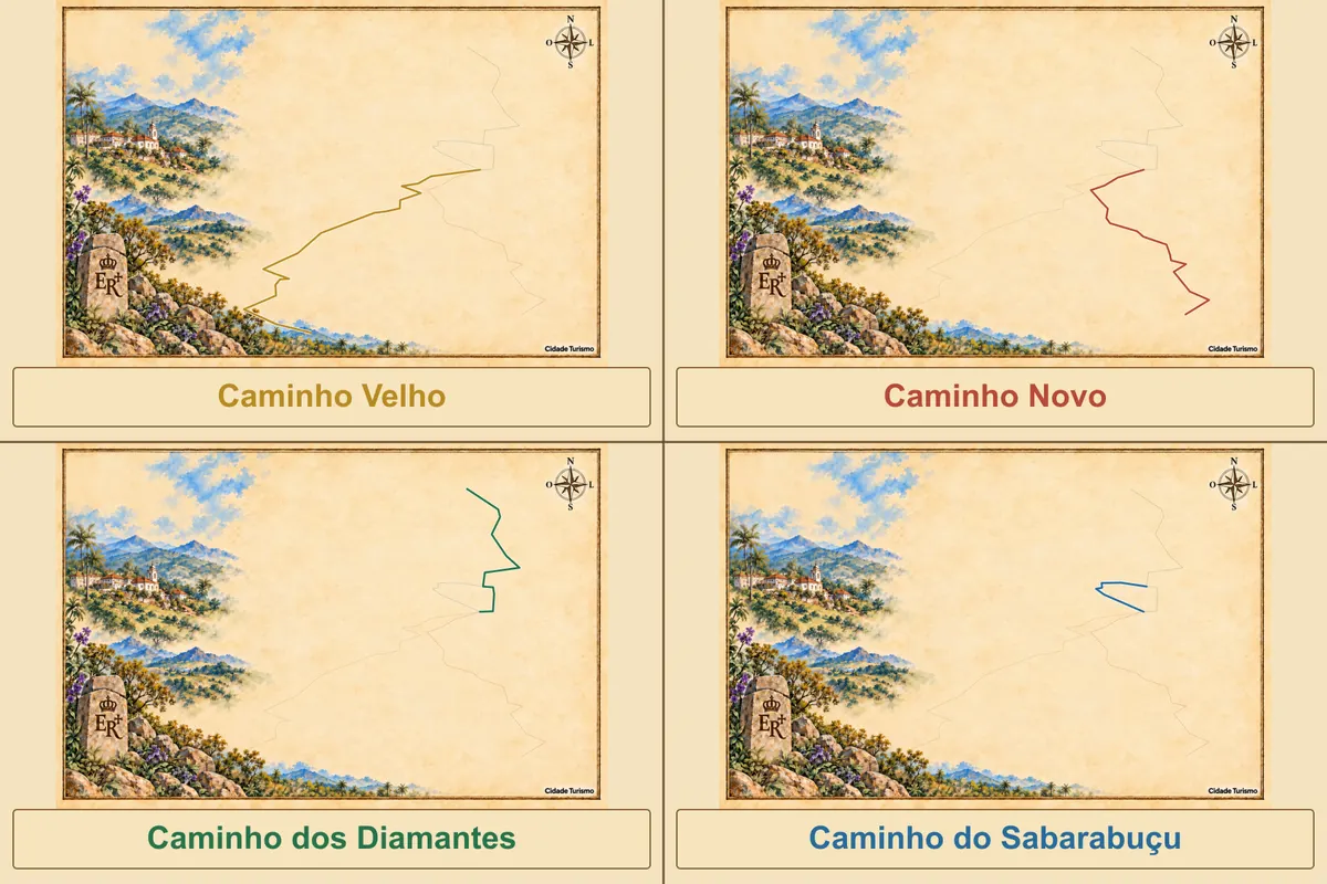
Four Estrada Real routes linking historic towns, mountain ranges and the coast: Velho, Novo, Diamantes and Sabarabuçu. Choose a route and explore its stops.
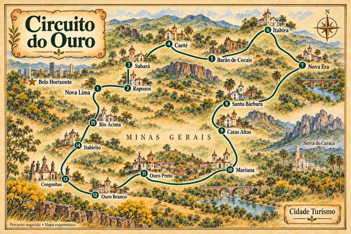
Fifteen municipalities of Minas Gerais in a route through gold heritage, mountain ranges, railway memory and Minas cuisine.
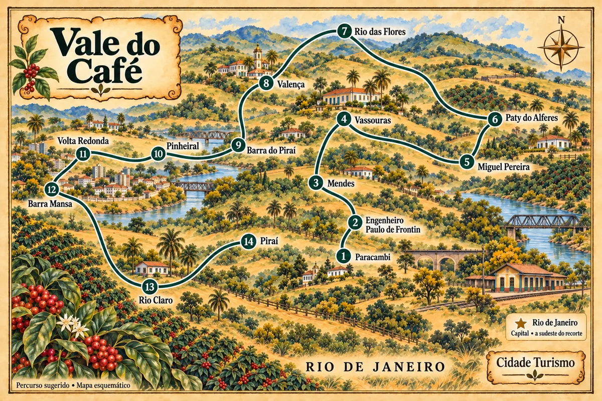
A route through 14 municipalities in the state of Rio de Janeiro, among historic farms, museums, memories of the railways and the heritage of the towns of the Médio Paraíba.
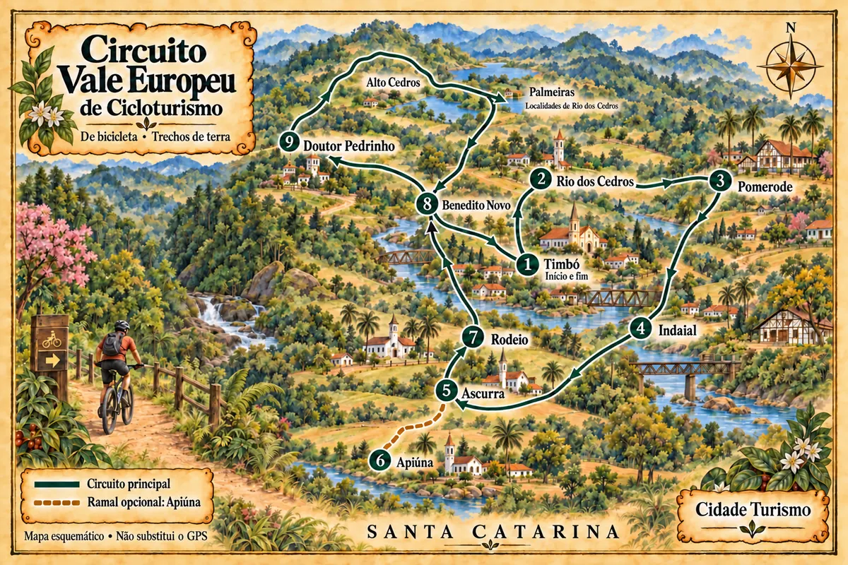
A bicycle circuit through nine municipalities of Santa Catarina, with dirt roads, immigration heritage and stages in the Lakes Region.
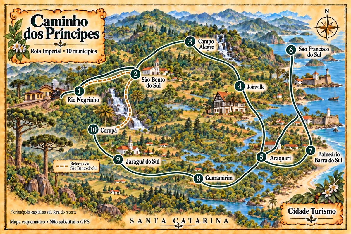
Ten cities in northern Santa Catarina on a driving circuit through railway memory, museums, mountains and maritime heritage.
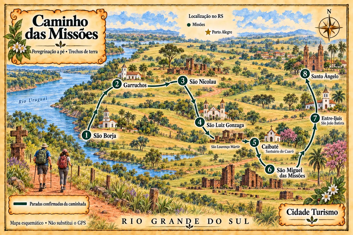
Pilgrimage on foot between São Borja and Santo Ângelo, across fields and dirt roads, with stops at Jesuit–Guarani heritage sites.
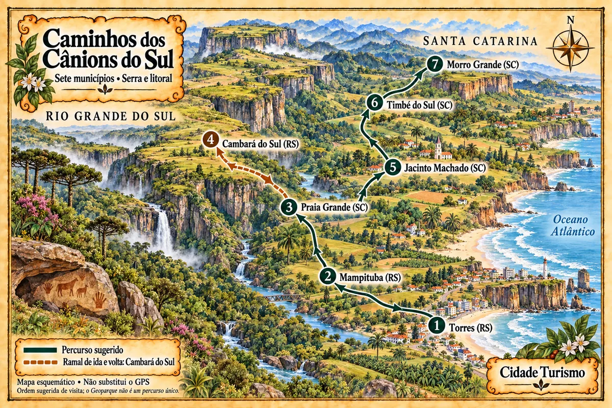
Seven municipalities between the coast and the Serra Geral, with canyons, waterfalls, paleotocas and rural roads within the Geopark territory.
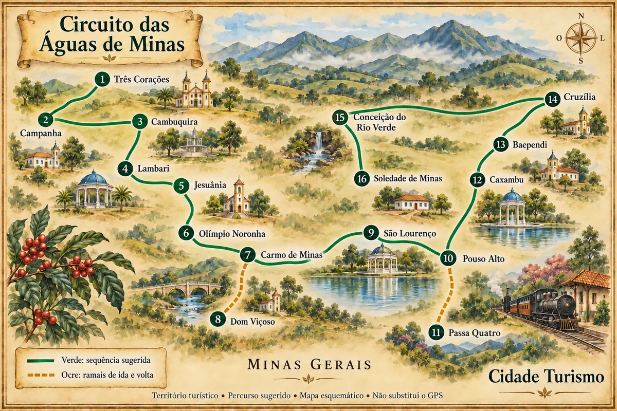
Mineral water resorts, museums, pilgrimages and coffee across 16 municipalities in South Minas, with a suggested sequence by car.
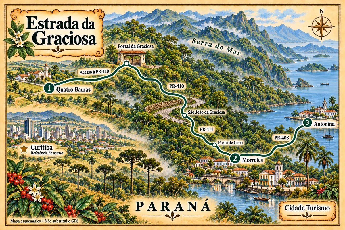
Quatro Barras, Morretes and Antonina on a trip through the Serra do Mar, with historic paving, rivers and coastal heritage.
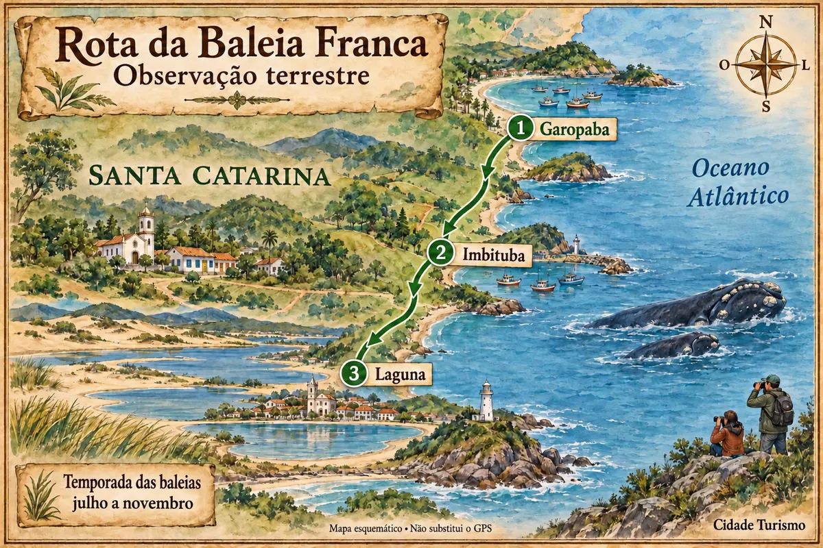
Garopaba, Imbituba and Laguna on a coastal trip, with land-based whale watching during the season.
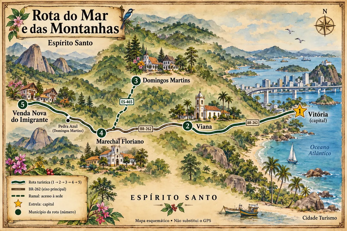
From Vitória’s bay to the immigration settlements and the landscapes of Pedra Azul, a road itinerary through five municipalities of Espírito Santo.
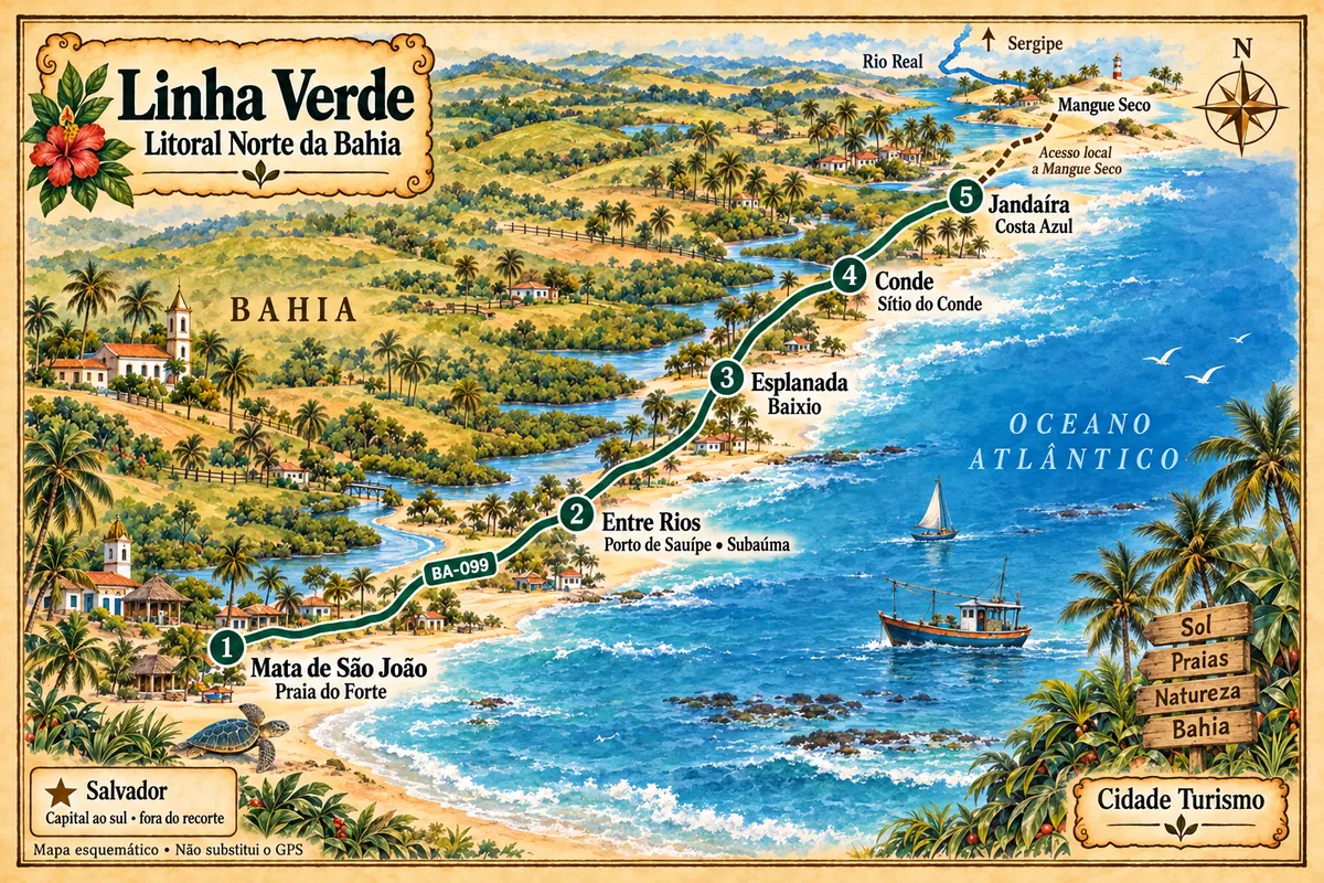
From Praia do Forte to the municipality of Jandaíra, the Green Line connects villages, beaches and estuaries of the Northern Coast of Bahia, with local access points to reach Mangue Seco.
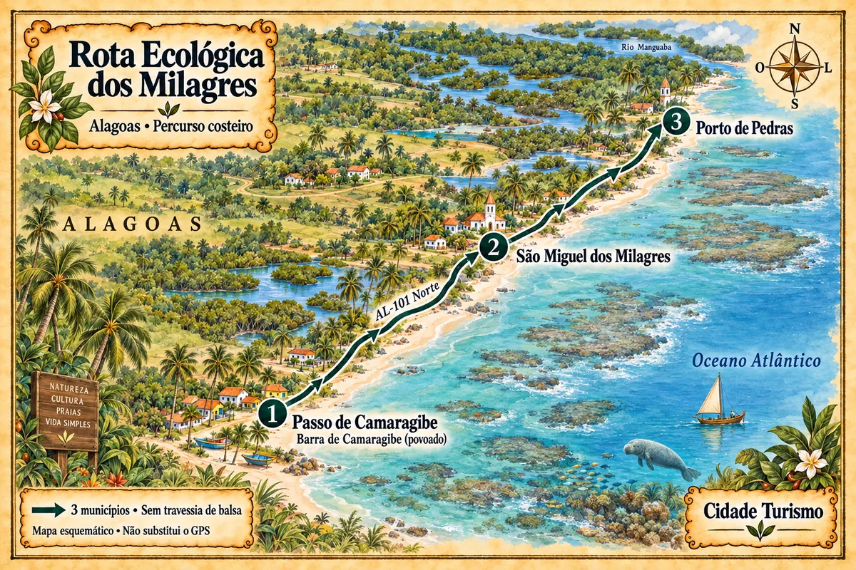
Barra de Camaragibe, Milagres beaches and mangroves of Porto de Pedras on a coastal route through three municipalities of Alagoas.
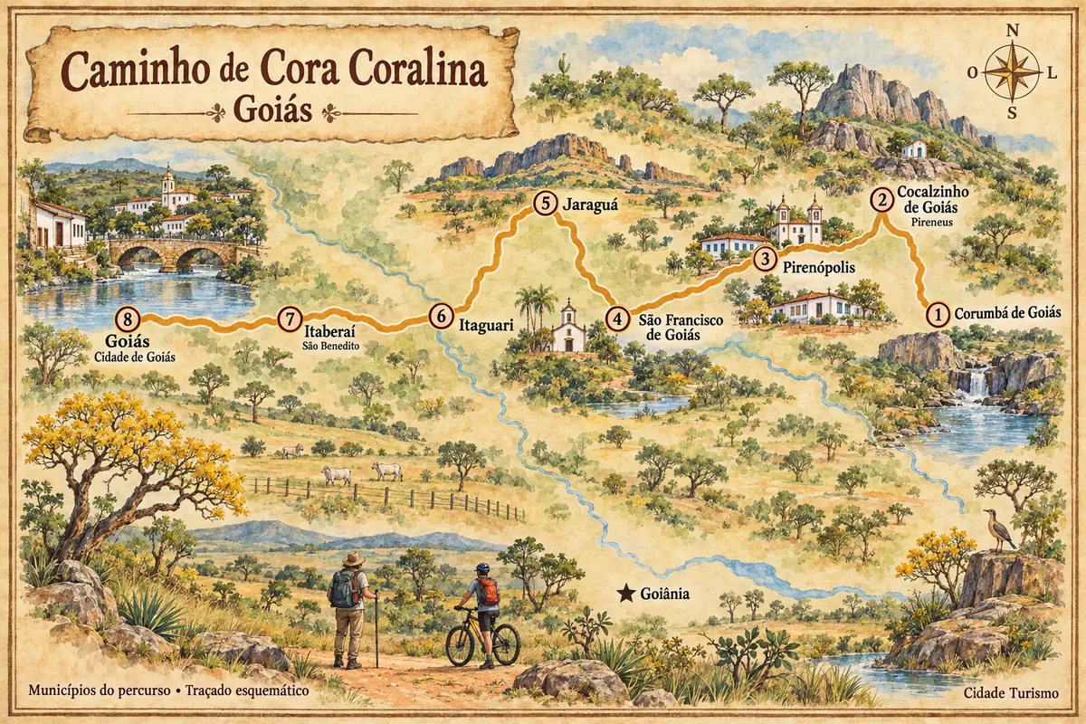
A trek on foot or by bicycle through the Cerrado, between historic towns, hills and small towns in Goiás.
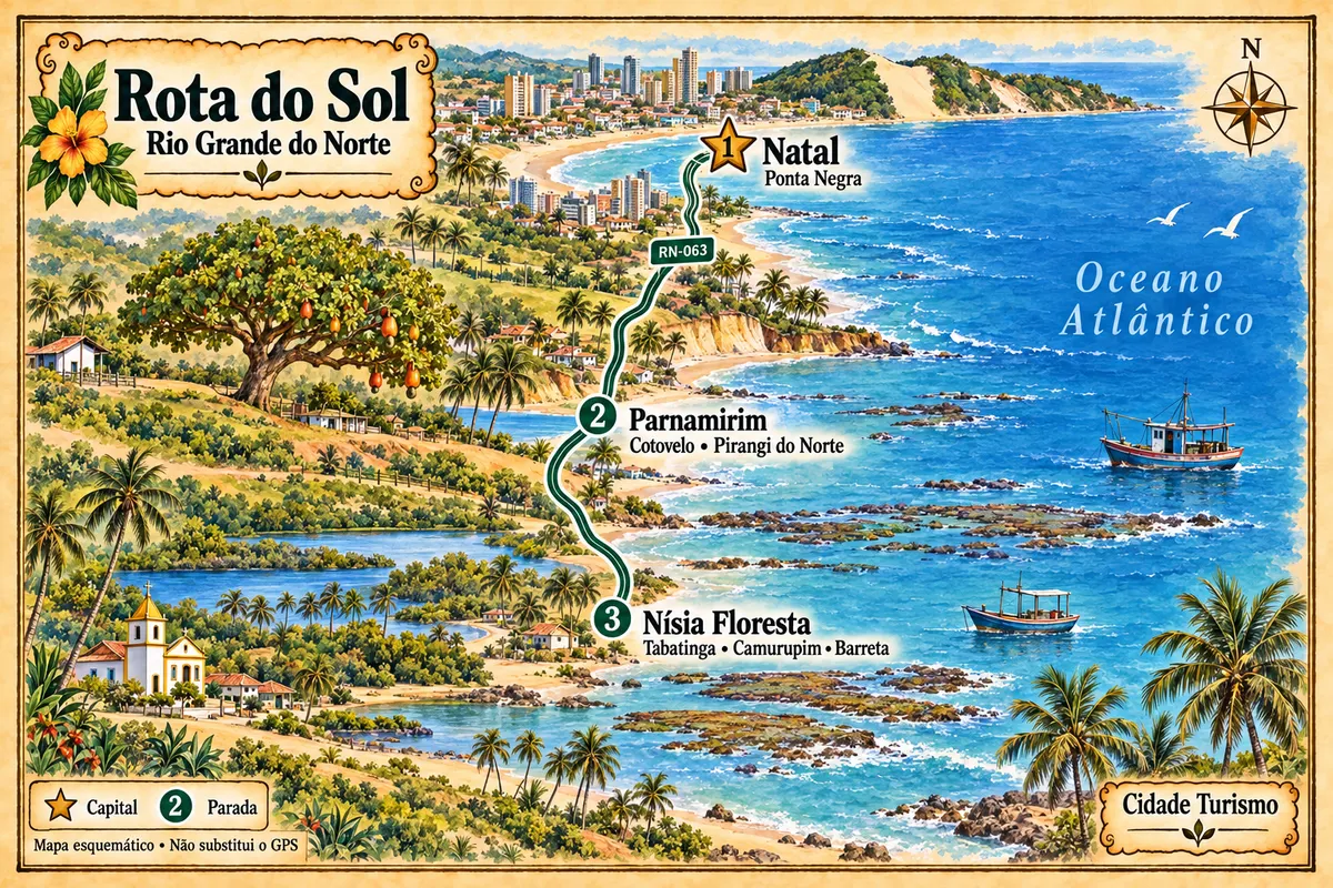
From Natal to Nísia Floresta, RN-063 links beaches, cliffs and lagoons on the southern coast of Rio Grande do Norte, with a stop at the Cajueiro de Pirangi in Parnamirim.
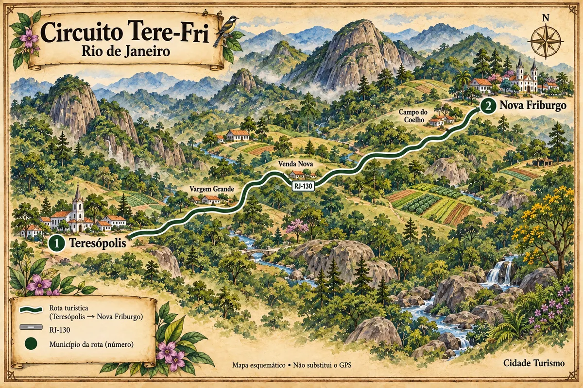
Teresópolis and Nova Friburgo connected by the RJ-130, passing through agricultural valleys, Atlantic Forest and mountains of the Mountain Region.
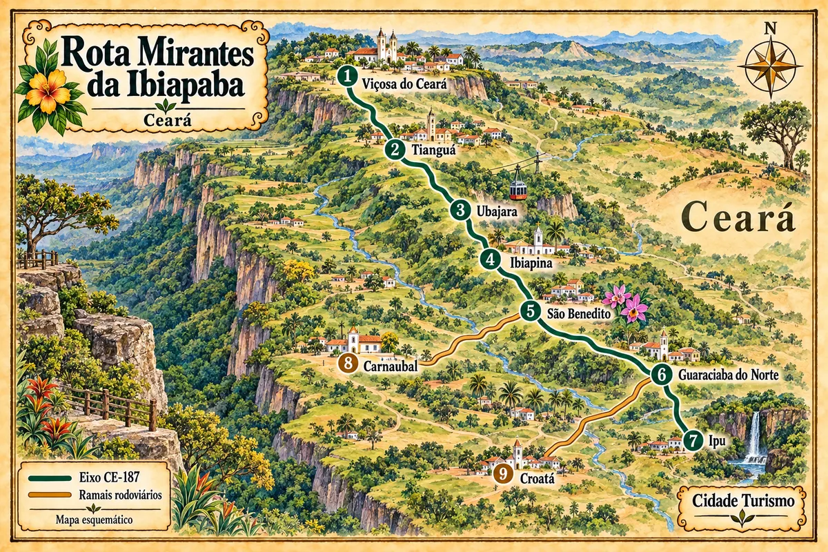
Nine municipalities of the Ceará highlands linked by the CE-187 axis and its branches, between the heritage of Viçosa, the Ubajara National Park, the religious tourism of São Benedito and the landscape of the Bica do Ipu.
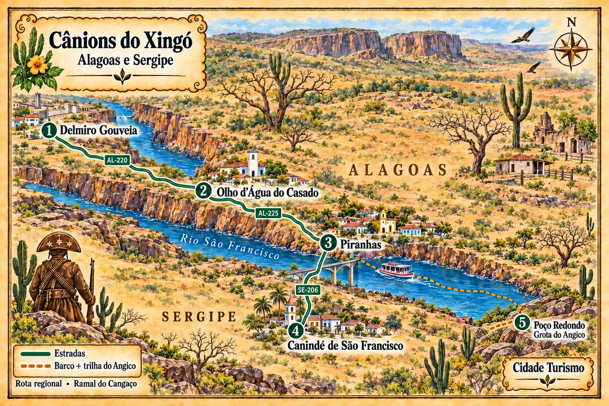
Between the banks of Alagoas and Sergipe, the São Francisco links the landscape of the Xingó reservoir, the history of Piranhas, and the boat-and-hike route to the Grota do Angico.
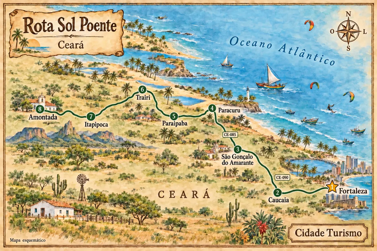
From Fortaleza to Amontada, the western coast of Ceará combines dunes, fishing villages and estuaries, with access to Cumbuco, Taíba, Lagoinha and Flecheiras.
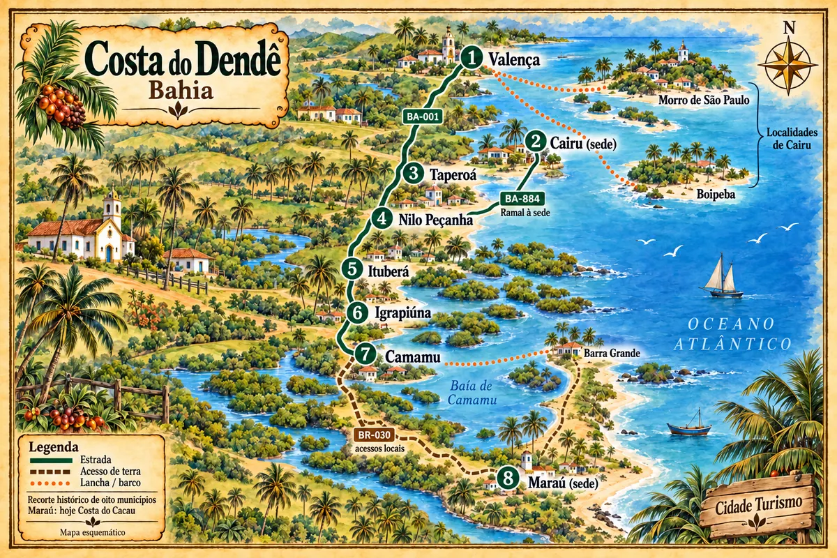
From the Una River to the Maraú Peninsula, the route combines towns of the Lower South, beaches, heritage and crossings along the historic Dendê Coast.
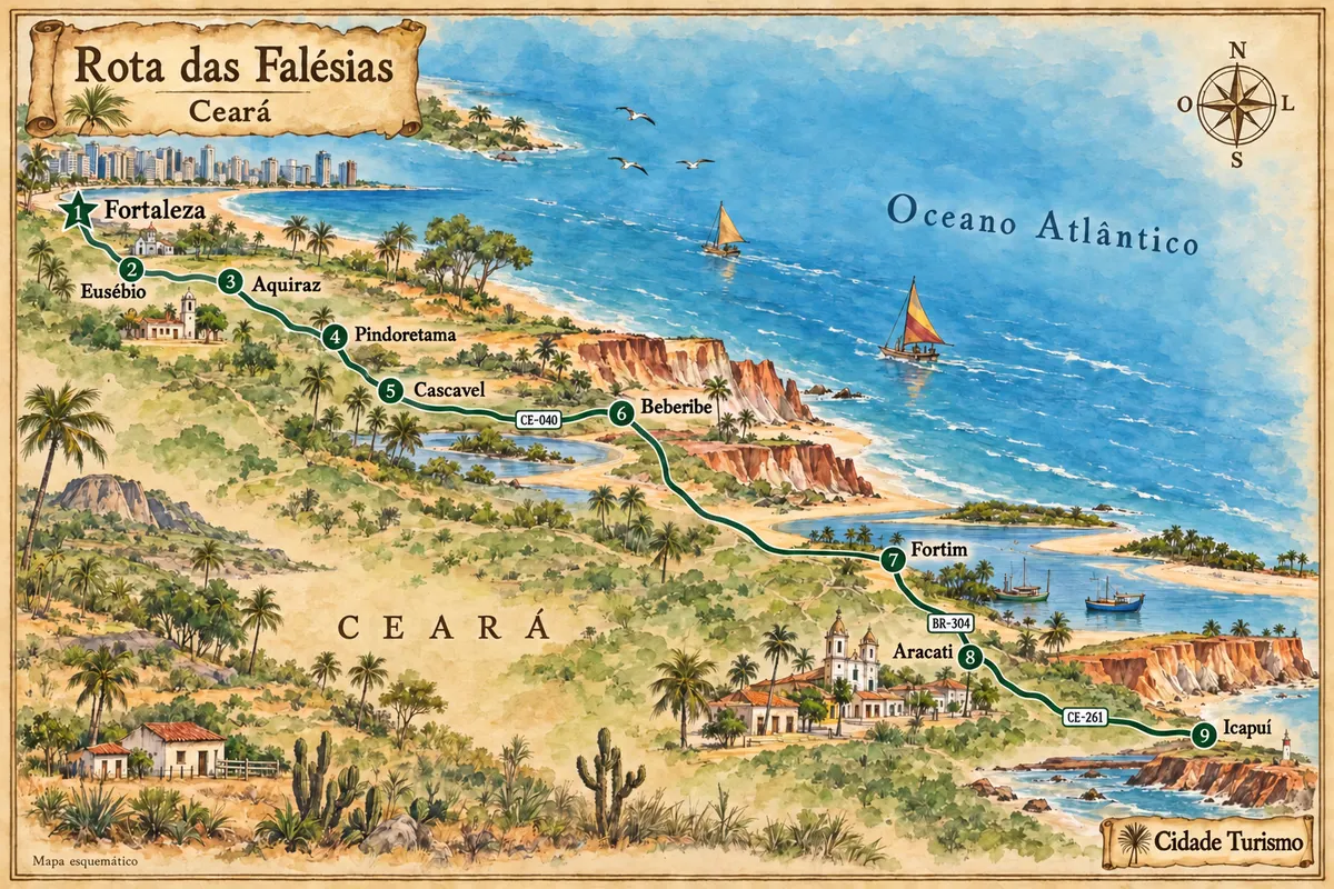
Between Fortaleza and Icapuí, the eastern coast of Ceará features cliffs, estuaries and fishing communities, with stops in the heritage sites of Aquiraz and Aracati.
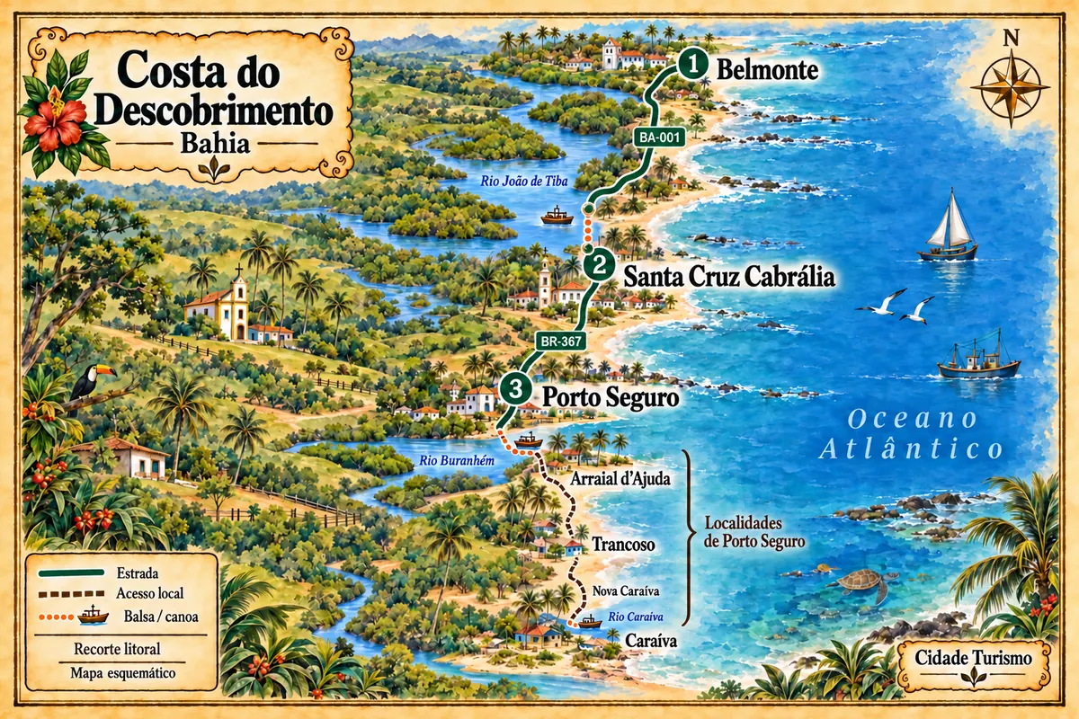
Between Belmonte, Santa Cruz Cabrália and Porto Seguro, the coastline brings together estuaries, historical heritage and communities linked to Pataxó culture.
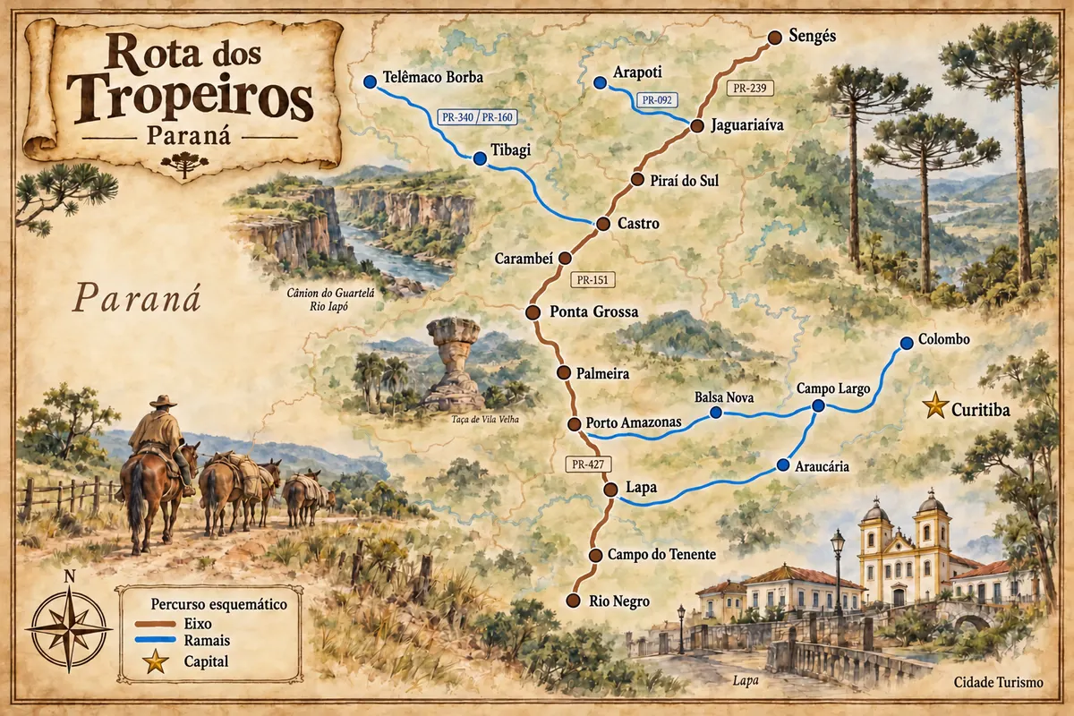
Historic routes, museums and landscapes between southern Paraná, the Curitiba Metropolitan Region and the Campos Gerais.
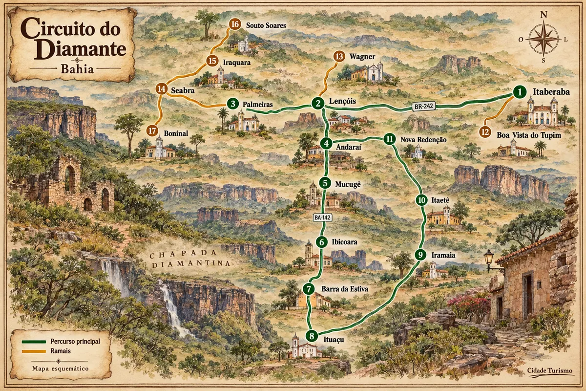
Mining-era houses, mountain ranges and rural roads among the municipalities of Chapada Diamantina.
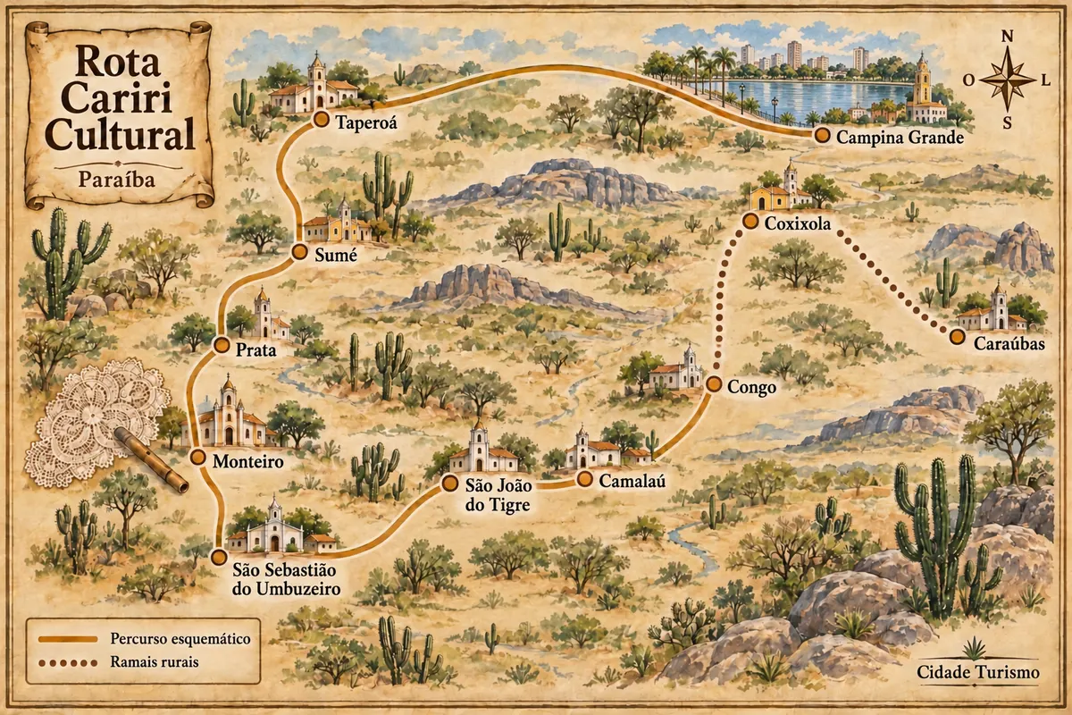
Between the sierras of the Cariri and the towns of Ariano, Zé Marcolino and Zabé da Loca.
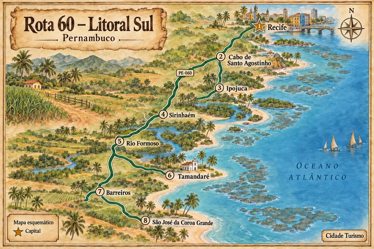
Beaches, reefs and estuaries between Recife and the far south of Pernambuco’s coast.
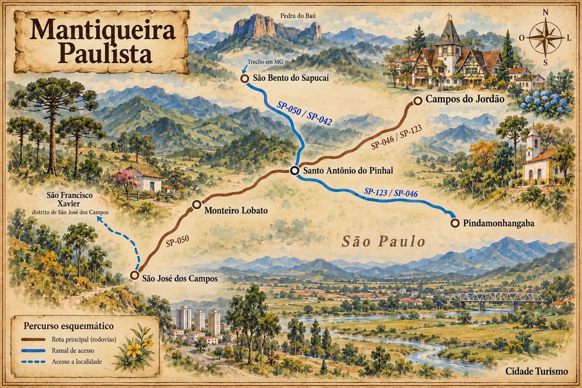
Mantiqueira roads between the Vale do Paraíba, mountain towns and the São Francisco Xavier district.
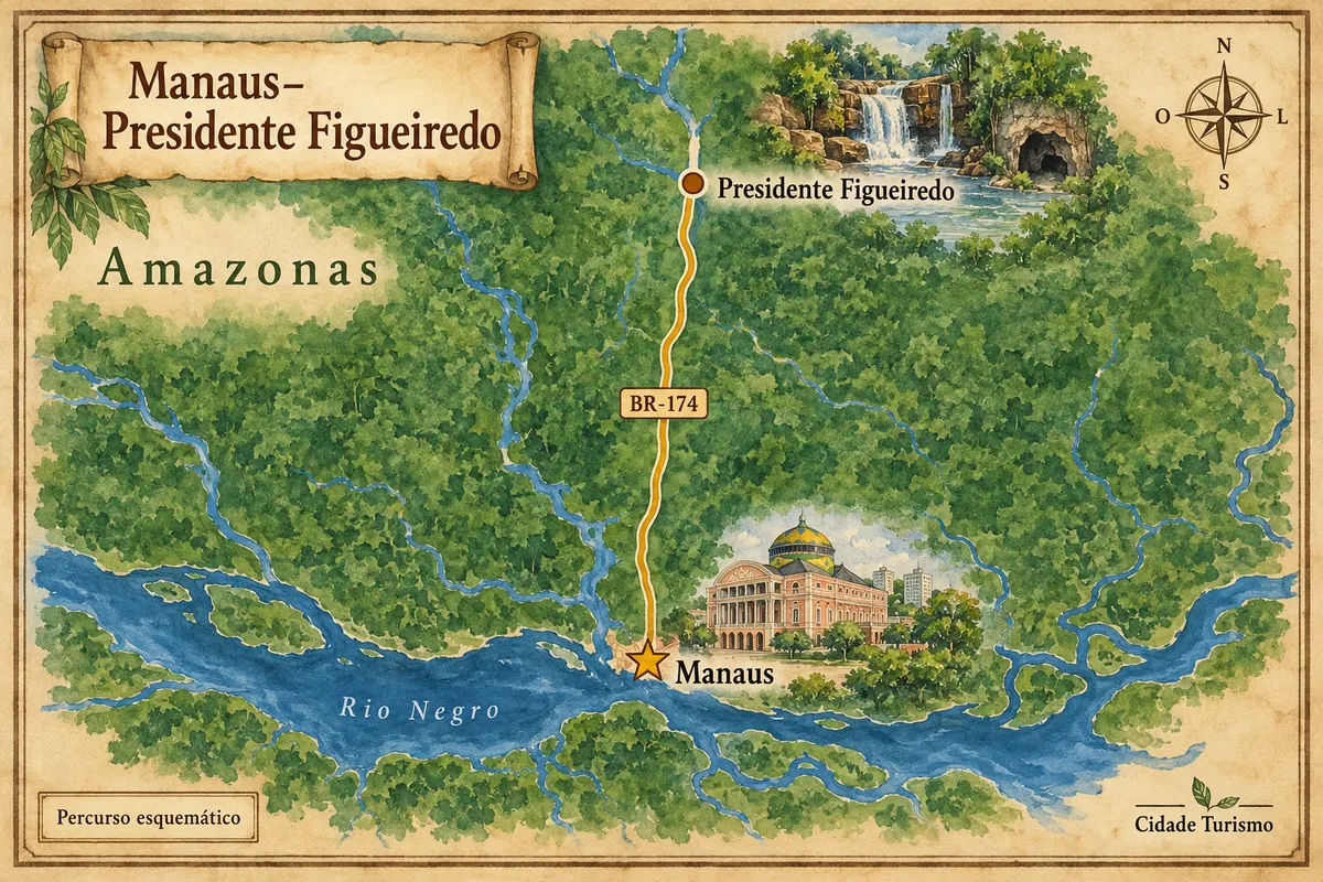
From Teatro Amazonas to the waterfalls and caves of Presidente Figueiredo, via BR-174.
Zemljevid
Z dvema prstoma povečajte zemljevid.
Zemljevid: @svg-maps/brazil, CC BY 4.0
Več kot vodnik