Brazil
 Chile
Chile Colombia
 Peru
Peru Uruguay
 Germany
 Belgium
 Spain
Spain France
 Greece
 the Netherlands
 Ireland
 Italy
Italy Portugal
 the United Kingdom
 Switzerland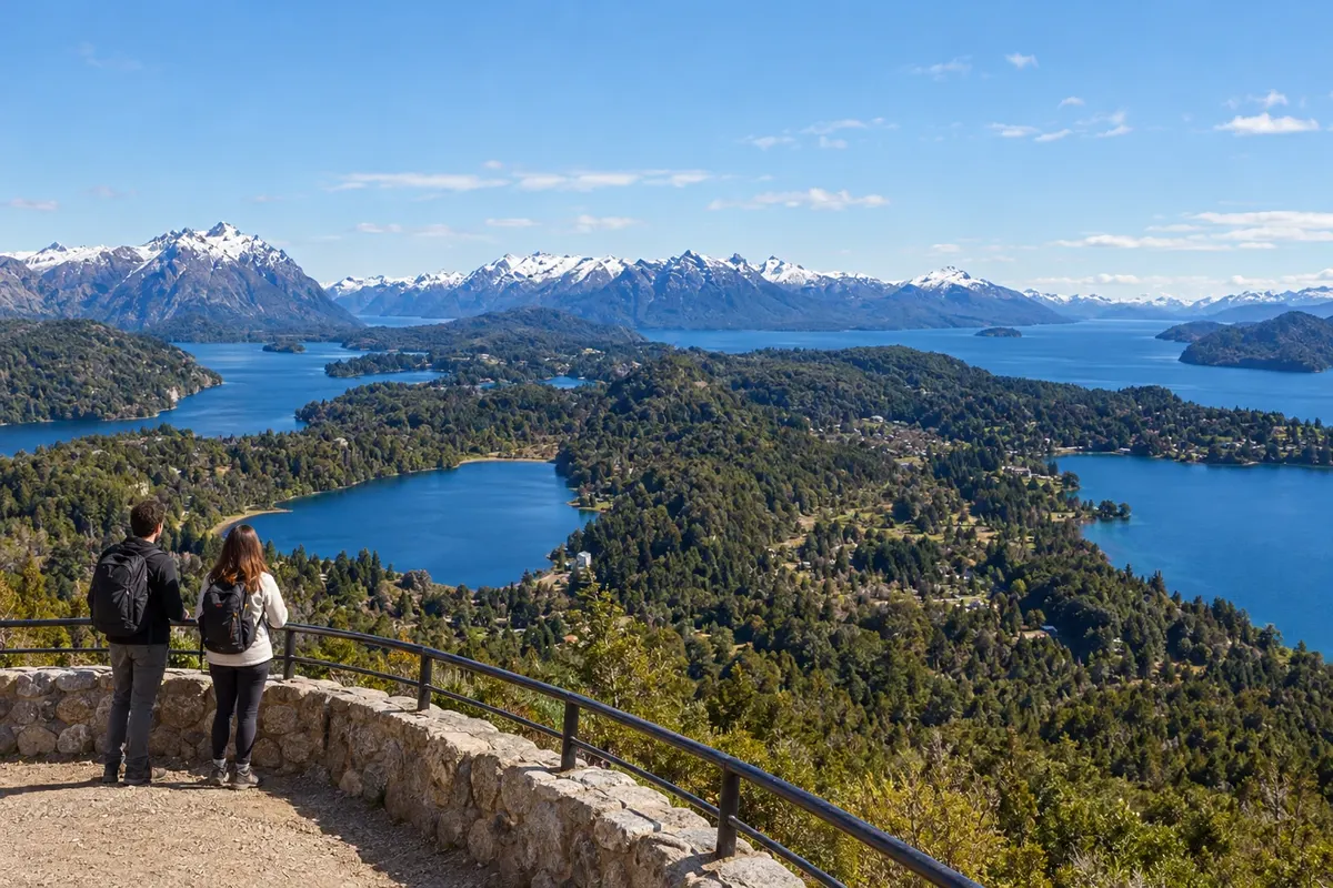
2 cities
Province · Patagônia
Lakes, forests and volcanoes mark Neuquén, where Villa La Angostura and San Martín de los Andes are linked by the Camino de los Siete Lagos.
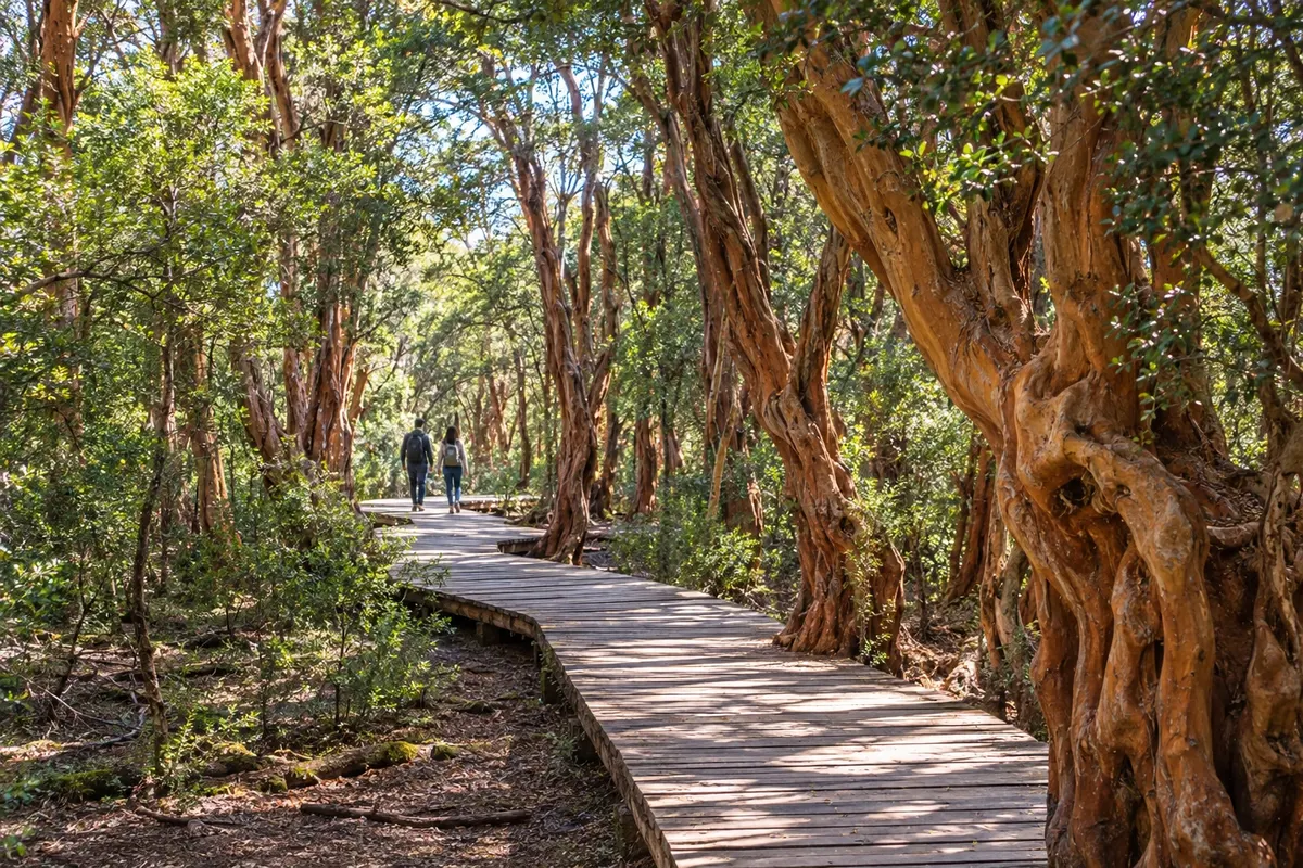
In the photo: Bosque de Arrayanes, Quetrihué peninsula, Villa La Angostura, Neuquén
Illustrative images. The pictures in this guide are illustrations based on the real place, not photographs, and may differ from it.

The province
Neuquén brings together different landscapes within Patagonia. In the southwest are the Andean lakes and forests; in the north there are volcanoes, mountains and thermal phenomena. To the east, the steppe reaches the valleys of the Limay and Neuquén rivers, close to the provincial capital and cultivated areas.
Villa La Angostura and San Martín de los Andes are two bases for exploring the lake region. The first lies by Nahuel Huapi and the Quetrihué peninsula, where the Bosque de Arrayanes is located. The second fronts Lake Lácar and serves as a base for lakeside beaches, trails and Cerro Chapelco.
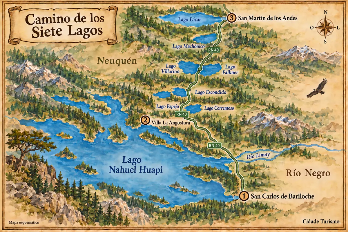
RN 40 links these bases via the Camino de los Siete Lagos. The national parks Nahuel Huapi, Los Arrayanes and Lanín protect part of the region’s forests and waters. Further north, the Lanín volcano stands out around the Huechulafquen and Tromen lakes; araucarias characterize other sectors of the Neuquén mountain range.
The Mapuche presence appears in history, in place names and in the relationship with the pehuén, whose pine nut (pinhón) is a regional food. Trout, lamb and preparations with piñones share the table with wines from San Patricio del Chañar. Summer festivals, such as the Fiesta de la Confluencia in the provincial capital, add music to a trip whose bases can be quite far apart.
Destinations
Cities
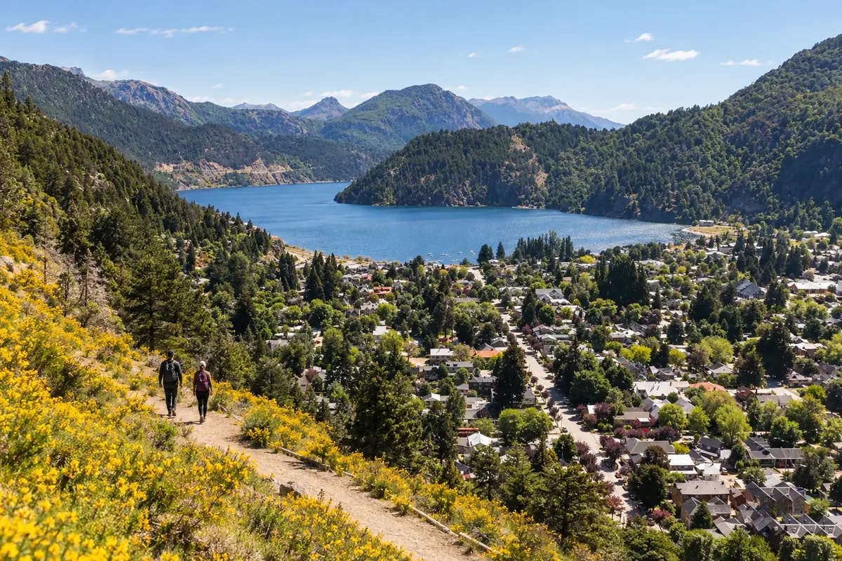
San Martín de los Andes sits on the eastern tip of Lago Lácar. The costanera is near the town center, while the Bandurrias and Arrayán viewpoints show the town from different sides of the valley. Quila Quina adds a walk along the lake's south shore. The town marks the northern end of the Rota dos Sete Lagos.

Villa La Angostura lies on the northern shore of Nahuel Huapi, in the province of Neuquén. Bahía Mansa marks the port area and the Quetrihué peninsula leads to the Bosque de Arrayanes. Río Correntoso and Lago Espejo round out the nearby visits. It is a base for starting the Ruta 40 section toward San Martín de los Andes.
Routes
From December to March the lake region usually offers long days for hiking and lakeside beaches, with cold water and cool nights. July to September is the period when snow is most common at the Chapelco and Cerro Bayo centers, depending on the season. The Andean forests receive more rain and snow than the eastern steppe; the dry north has strong temperature variation between day and night. The Fiesta de la Confluencia is usually held in February, in the city of Neuquén.
Presidente Perón International Airport is located in the city of Neuquén, far from the southern bases. For San Martín de los Andes, Aviador Carlos Campos Airport, known as Chapelco, is closer; Villa La Angostura can also be reached via Bariloche airport, in Río Negro. Departing from Brazil, plan a connection—for example in Buenos Aires—and compare the remaining overland section. RN 40 links the lake towns; RN 22 and RN 237 form accesses from the east of the province.
Your questions
Allow five or six days to split your stay between the two towns and tour the lakes without reducing everything to a drive-through. Add days if the focus is skiing or doing long hikes.
Chapelco serves San Martín de los Andes more directly; Bariloche is an alternative for Villa La Angostura. The capital Neuquén’s airport can serve other provincial itineraries but requires a longer overland transfer to reach those bases.
It’s an appropriate choice when the idea is to stop at viewpoints and lake access points. The direct drive along RN 40 is different from an excursion that includes hikes and time on the shores; set aside the day to make the most of those stops.
There are boat trips to the forest sector, near the tip of the Quetrihué peninsula. The trail from the isthmus is about 12 km each way; to combine hiking and boat, arrange the ticket and the return before you set out.