Brazil
 Chile
Chile Colombia
 Peru
Peru Uruguay
 Germany
 Belgium
 Spain
Spain France
 Greece
 the Netherlands
 Ireland
 Italy
Italy Portugal
 the United Kingdom
 Switzerland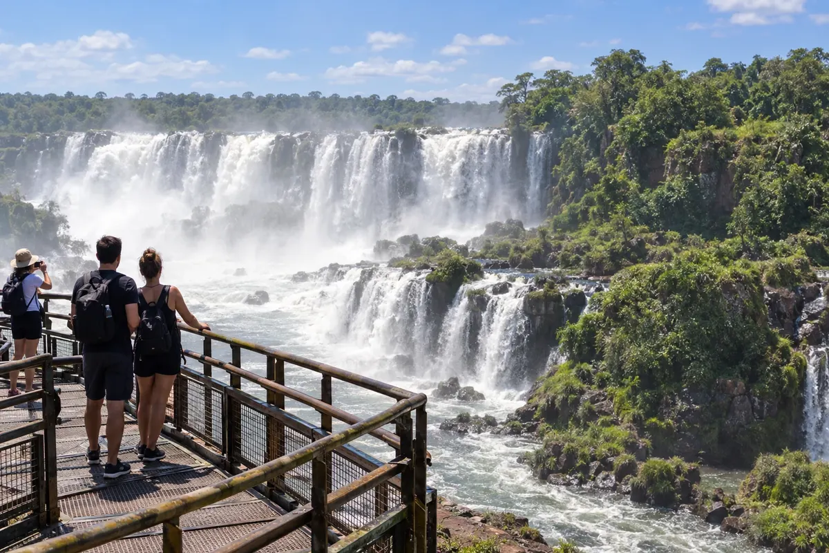
4 cities
Province · Litoral
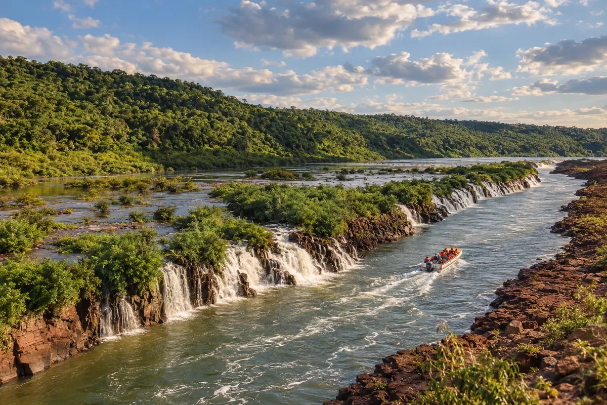
Misiones brings together the jungle of the waterfalls, the Paraná and Uruguay rivers, and the Jesuit-Guarani complexes amid towns and yerba mate plantations.
In the photo: Saltos del Moconá, río Uruguay, Misiones
Illustrative images. The pictures in this guide are illustrations based on the real place, not photographs, and may differ from it.

The province
Misiones forms a strip in northeastern Argentina between Brasil, Paraguai and Corrientes. The reddish soil and the Paraná rainforest shape the landscape, cut by rivers and waterfalls. Posadas, the provincial capital, sits on the banks of the Paraná; to the north, Puerto Iguazú sits at the meeting of borders.
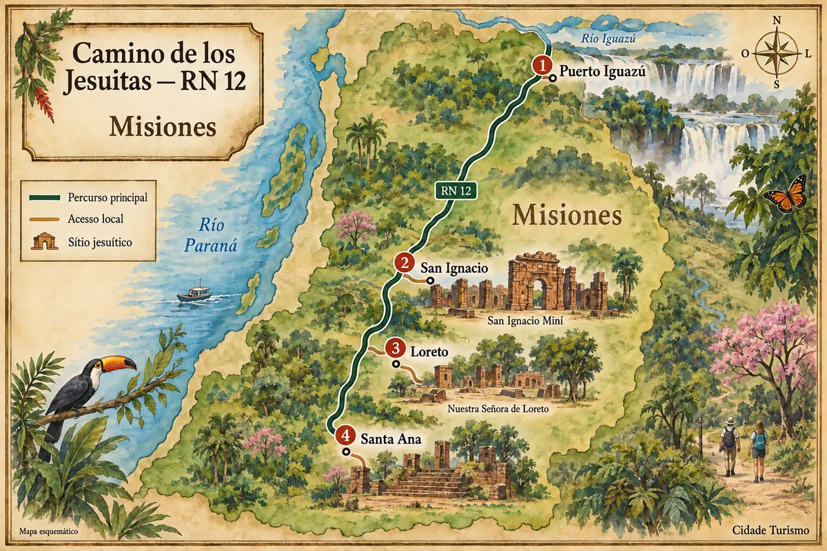
From Puerto Iguazú to the towns of San Ignacio, Loreto and Santa Ana, the trip combines waterfalls and Jesuit-Guarani heritage. Puerto Iguazú is the base for the Argentine side of the falls, with walkway circuits and the Garganta del Diablo. The journey south along RN 12 leads to the Jesuit-Guarani complexes, which preserve walls, squares and traces of daily life from the former reductions.
San Ignacio Miní, Loreto and Santa Ana let you discover different parts of that history, which involves Guarani communities and the work of the Jesuits. In Santa Ana, the Parque Temático de la Cruz provides an outlook over the region. Further east, the Saltos del Moconá run longitudinally along the río Uruguay; their appearance depends on the water level.
Yerba mate links rural production to the habit of sharing mate. In the kitchen, chipá, reviro, sopa paraguaya and river fish show Guarani influences and those of the communities that formed the province. The Fiesta Nacional del Inmigrante, in Oberá, brings together traditions and cuisine from different origins. Including the missions requires dedicated days beyond visits to the waterfalls.
Destinations
Cities
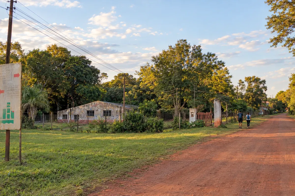
Loreto is in the department of Candelaria, along RN12. The modern town grew near the old Jesuit-Guaraní reduction. Remains of the temple and a Via Procesional through the vegetation give substance to the historical visit, starting from the small center around Plaza San Martín.
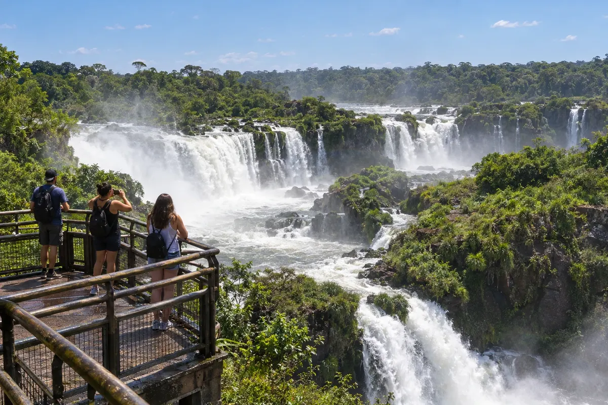
Puerto Iguazú is the Argentine base for the waterfalls, close to the confluence of the Iguazú and Paraná rivers. In the national park, Circuito Superior and Circuito Inferior offer distinct views of the falls. The Hito Tres Fronteras and La Aripuca complete an itinerary off the walkways. The center gathers services for those arriving by road from Brazil or via the Argentine airport.
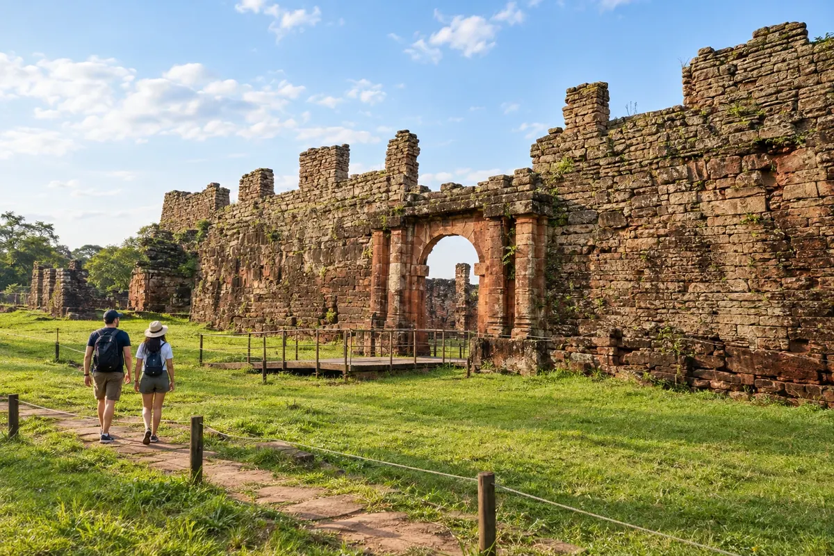
San Ignacio lies along the corridor of Ruta Nacional 12, between the Misiones forest and the Paraná River. San Ignacio Miní displays the layout and buildings of a Jesuit-Guarani mission. Casa de Horacio Quiroga brings the route closer to literature; Parque Provincial Teyú Cuaré and Parroquia San Ignacio de Loyola add nature and local life.
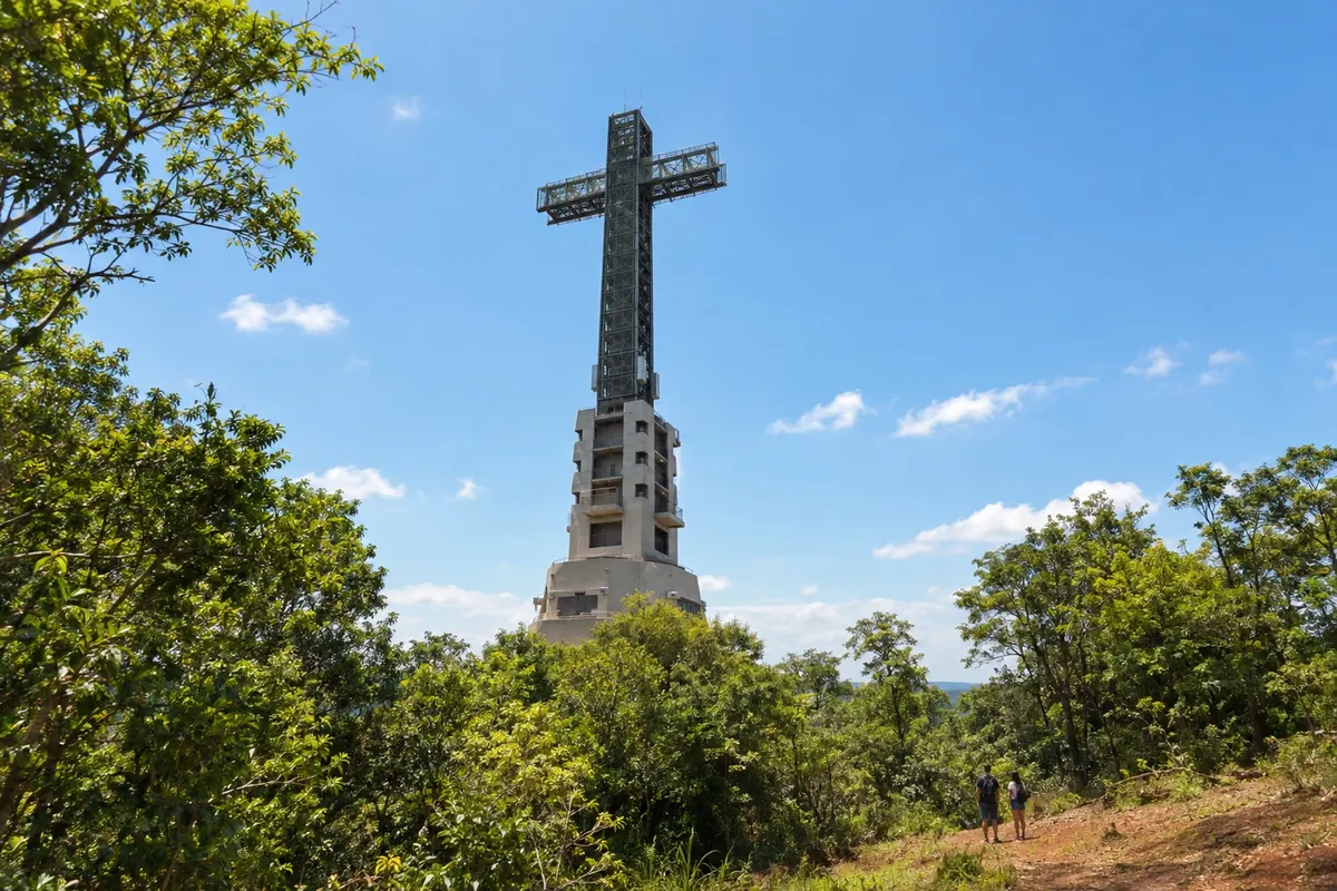
Santa Ana is located in southern Misiones, along the RN12 corridor. On the outskirts of town, the Jesuit-Guaraní complex preserves remains of the temple, a semicircular stairway and structures for cultivation and water management. Paths through the vegetation connect the spaces of the former reduction.
Routes
April to September usually brings milder temperatures for walking in parks and historic complexes. From October to March, heat and humidity are more present; rain can occur in any month and river flows vary. June to August can have cool mornings despite the subtropical climate. September usually hosts the Fiesta Nacional del Inmigrante in Oberá. The Saltos del Moconá depend on the level of the río Uruguay, with no fixed month that guarantees their appearance.
From Brasil, arrive via the Aeroporto Internacional de Foz do Iguaçu/Cataratas and continue by land to Puerto Iguazú. Check requirements before traveling and arrange the transfer between the two countries. The Aeroporto Internacional Cataratas del Iguazú serves Puerto Iguazú, and the Aeroporto Internacional Libertador General José de San Martín is in Posadas, closer to the south of the missions. RN 12 connects Puerto Iguazú, San Ignacio and Posadas, with local accesses to Loreto and Santa Ana. RN 14 crosses the eastern part of the province, and RP 2 follows the Alto Uruguay.
Your questions
Allow five to seven days to see the waterfalls and travel the historic axis to the south. Using Puerto Iguazú and another base near the complexes avoids many long back-and-forth trips along RN 12.
You can combine arrival on the Brazilian side with a land transfer to the Argentine city. Check requirements before traveling and arrange round-trip transport; the border crossing adds time to the journey.
They are different complexes linked to Jesuit-Guarani history. San Ignacio Miní preserves structures with a stronger visual presence; Loreto and Santa Ana have other remains and routes. Visiting more than one lets you perceive those differences.
Moconá is in another region of Misiones, on the río Uruguay, far from Puerto Iguazú. Allow dedicated time for the transfer and check navigation conditions; the river level affects the shape and visibility of the falls.