
 Brazil
 Argentina
 Bolivia
 Chile
Chile Colombia
 Ecuador
 Guyana
 French Guiana
 Falkland Islands (Malvinas)
 Paraguay
 Peru
Peru Suriname
 Uruguay
 Venezuela
 Germany
 Belgium
 Denmark
 Spain
Spain France
 Greece
 the Netherlands
 Ireland
 Italy
Italy Luxembourg
 Norway
 Portugal
 the United Kingdom
 Switzerland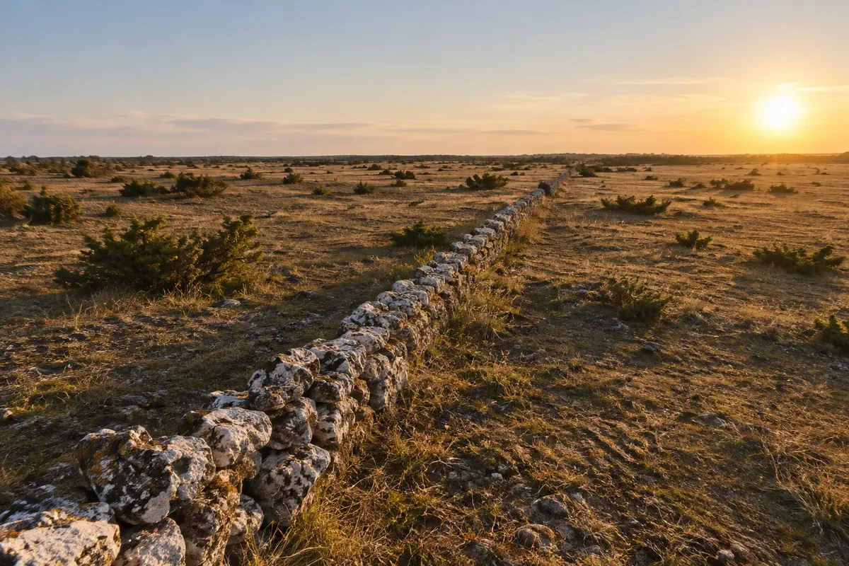
Park · Borgholm, Kalmar
Stora Alvaret
The large limestone plain of southern Öland, almost treeless, with pastures, stone walls, orchids and birds — the heart of southern Öland's agricultural landscape, a UNESCO World Heritage site.
Illustrative images. The pictures in this guide are illustrations based on the real place, not photographs, and may differ from it.

Discover
About Stora Alvaret
The Stora Alvaret is a limestone plain about 40 km long in the south of Öland, where the soil layer is so thin that almost no trees grow. The landscape resembles a steppe: exposed rock, short grass, shrubs, pools that form with rain and stone walls that divide the pastures. For thousands of years people have taken cattle, sheep and horses to graze there, which has kept the landscape open.
This coexistence between people and nature, with villages lined along the edge of the Alvaret, cultivated fields and communal pastures, led UNESCO to designate the agricultural landscape of southern Öland as a World Heritage Site in 2000. Along the roads that cross the plain you find villages of low houses, windmills and stone churches.
In spring, from May to early June, the Alvaret usually blooms, with several species of orchids and rare flowers that grow almost only there. It is also a place for birds: sandpipers, larks and birds of prey, and at the southern tip of the island the Långe Jan lighthouse is a bird‑watching point for migrants.
There is no park infrastructure: the Alvaret is experienced via the marked roads and trails, by car or by bicycle.
Before you go
Practical information
Cidade Turismo reviews its information regularly, but something may have changed. Check with the place before planning your trip.
How much time to set aside
From half a day to a full day, by car, with stops.
Best time
From May to early June, when orchids and rare flowers usually appear. In summer it's dry and hot with little shade. In spring and autumn there are migratory birds at the southern tip.
How to get there
The Alvaret covers the south of Öland, starting about 15 km south of the bridge. From Borgholm it's roughly 50 km to the middle of the plain. The road linking Resmo to Gårdby crosses the Alvaret. A car or bicycle is the practical way to go.
Tip
Bring water, a hat and sunscreen: there is no shade. Follow the marked trails and respect the stone walls and the livestock, which belong to the farms. Combine it with Eketorp and the Långe Jan lighthouse.
Get your questions answered
Frequently asked questions about Stora Alvaret
What is the Alvaret?
A limestone plain with very thin soil, almost treeless, used for thousands of years as pasture. It covers much of southern Öland.
What did UNESCO designate in southern Öland?
The agricultural landscape: the villages, the fields, the pastures and the Alvaret, which reflect thousands of years of human occupation.
When does the Alvaret bloom?
From May to early June, when orchids and other rare flowers usually appear.