

 Brazil
 Argentina
 Bolivia
 Chile
Chile Colombia
 Ecuador
 Guyana
 French Guiana
 Falkland Islands (Malvinas)
 Paraguay
 Peru
Peru Suriname
 Uruguay
 Germany
 Belgium
 Denmark
 Spain
Spain France
 Greece
 the Netherlands
 Ireland
 Italy
Italy Luxembourg
 Norway
 Portugal
 the United Kingdom
 Sweden
 Switzerland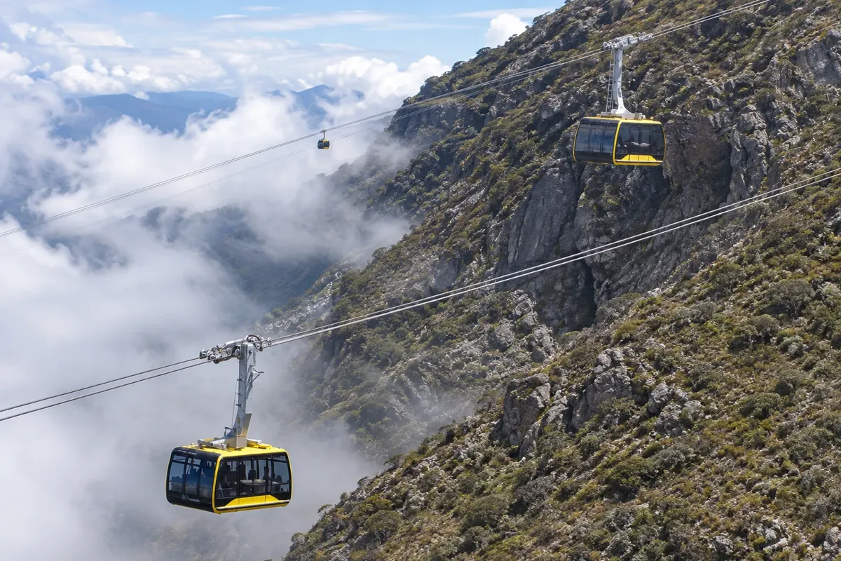
Cable car · Mérida, Mérida
Mukumbarí Sistema Teleférico de Mérida
The cable car that departs from downtown Mérida, at about 1,600 meters, and climbs in five stations to Pico Espejo at 4,765 meters, beside Pico Bolívar. The trip crosses the cloud forest and the páramo up to the rocks and ice at the summit.
Illustrative images. The pictures in this guide are illustrations based on the real place, not photographs, and may differ from it.

Discover
About Mukumbarí Sistema Teleférico de Mérida
Mukumbarí is the teleférico of Mérida, which links the city center to the high reaches of the Sierra Nevada. The line is about 12.5 km long and has five stations: Barinitas, in the city, at around 1,600 meters; La Montaña, at about 2,400 meters; La Aguada, at about 3,450 meters; Loma Redonda, at about 4,050 meters; and Pico Espejo, at 4,765 meters. It is one of the highest and longest cable cars in the world. The current system replaced the old 1950s teleférico, and the name comes from an indigenous word of the region.
The journey shows the mountain's zones. Departing from Barinitas station, na praça Las Heroínas, the cabins rise over the humid, green cloud forest and reach the páramo, the high-altitude vegetation with frailejones, plants with fuzzy, silvery leaves. Above Loma Redonda, the landscape turns to rock, glacial lagoons and, on the highest slopes, remnants of ice.
At Pico Espejo, at 4,765 meters, the view opens to Pico Bolívar, about 4,978 meters, the highest point in Venezuela, and to the Humboldt and Bonpland peaks. Up there the temperature is usually near 0 °C, with wind, and clouds rise quickly from the valleys from late morning onward.
Loma Redonda station is the starting point for the hike to Los Nevados, a mountain village reached in a few hours of descent on foot or by mule. The intermediate stations have viewpoints and snack bars, and visitors can stop at them on the descent.
Before you go
Practical information
Cidade Turismo reviews its information regularly, but something may have changed. Check with the place before planning your trip.
How much time to set aside
About 4 to 6 hours to go up to Pico Espejo and descend with stops at the intermediate stations.
Best time
Very early, on the first ascent of the day, when the sky is usually clear at the top. From December to April, the dry season, there are more clear days. Operations and schedules change, with maintenance stops; check before you go.
How to get there
Barinitas station is na praça Las Heroínas, in downtown Mérida, a few minutes' walk from the pousadas in the center and about 1 km from Plaza Bolívar.
Tip
Bring a coat, hat, gloves and sunglasses: at Pico Espejo the temperature is usually near 0 °C and the sun is strong. Take the first trip of the day up and leave stops at the intermediate stations for the descent.
Get your questions answered
Frequently asked questions about Mukumbarí Sistema Teleférico de Mérida
How high does the Mukumbarí go?
Up to Pico Espejo, at 4,765 meters. The lower station in the city is at about 1,600 meters.
What are the cable car stations?
Barinitas, in the city; La Montaña; La Aguada; Loma Redonda; and Pico Espejo at the top.
Is it cold at the top?
Yes. At Pico Espejo the temperature is usually near 0 °C, with wind. Bring a coat, hat and gloves.
Can you see Pico Bolívar?
From Pico Espejo, yes, when the sky is clear. Pico Bolívar, at about 4,978 meters, is Venezuela’s highest point. Mornings tend to be clearer.
Does the cable car operate every day?
Days and hours vary, with occasional closures for maintenance. Check before you go.