

 Brazil
 Argentina
 Bolivia
 Chile
 Colombia
 Ecuador
 Guyana
 French Guiana
 Falkland Islands (Malvinas)
 Paraguay
 Suriname
 Uruguay
 Venezuela
 Germany
 Belgium
 Denmark
 Spain
 France
 Greece
 the Netherlands
 Ireland
 Italy
 Luxembourg
 Norway
 Portugal
 the United Kingdom
 Sweden
 Switzerland
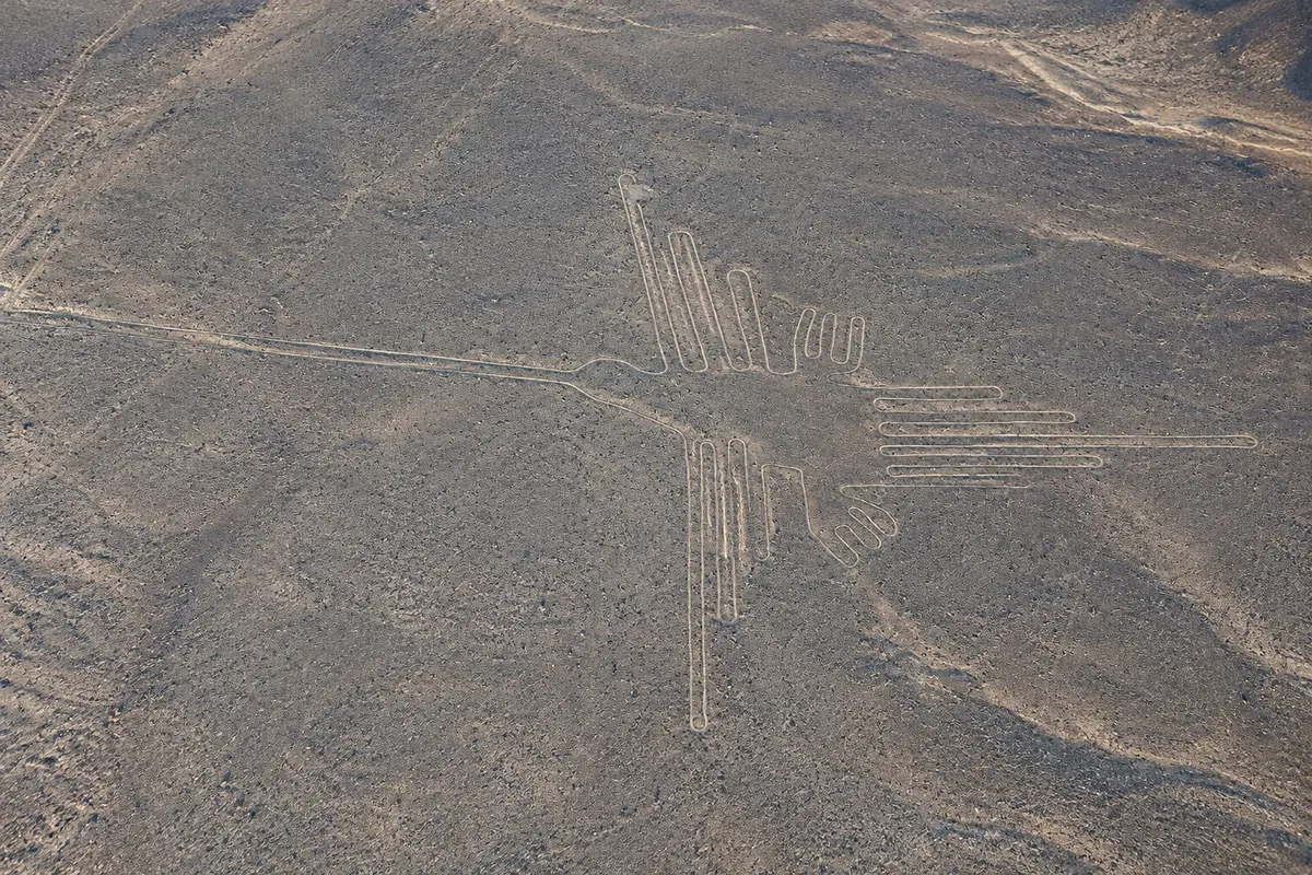
Archaeological site · Nazca, Ica
Líneas y Geoglifos de Nasca
Hundreds of figures and lines engraved in the desert floor by the Nazca culture around 2,000 years ago, such as the hummingbird, the monkey and the whale, visible from the overflight or the Panamericana viewpoint. World Heritage Site since 1994.
Illustrative images. The pictures in this guide are illustrations based on the real place, not photographs, and may differ from it.

Discover
About Líneas y Geoglifos de Nasca
The Nazca Lines are geoglyphs traced on the pampas between Nazca and Palpa, in an area of roughly 450 km² of desert. They were made mainly by the Nazca culture, between about 200 BC and 600 AD, by removing the dark stones on the surface to reveal the lighter soil beneath. Because it hardly ever rains and the wind is weak at ground level, the lines have been preserved for centuries. The ensemble, together with the Palpa lines, is a UNESCO World Heritage Site since 1994.
There are hundreds of figures: straight lines several kilometers long, triangles, trapezoids and about 70 drawings of animals and plants, such as the hummingbird, the monkey, the spider, the condor, the whale, the hands and the tree, some over 100 meters. New figures continue to be identified by archaeologists. The meaning is still debated: some link them to astronomical calendars, others to rituals connected with water and fertility, or to ceremonial pathways.
The German María Reiche, who studied and protected the lines for more than 40 years, supported the astronomical hypothesis. The house where she lived, near the road, is now a museum.
The most complete way to see the figures is by overflight in a small plane from the Nazca aerodrome. There is also a metal viewpoint on the Panamericana Sur, about 25 km north of town, from which the hands and the tree can be seen. It is forbidden to enter the pampas on foot so as not to damage the lines.
Before you go
Practical information
Cidade Turismo reviews its information regularly, but something may have changed. Check with the place before planning your trip.
How much time to set aside
About 30 minutes of overflight, with 2 to 3 hours of waiting and check-in; 20 to 30 minutes at the viewpoint.
Best time
In the morning, when the wind is usually weaker and the flight more stable. Flights can be postponed on foggy or very windy days. It is possible year-round, since it hardly ever rains.
How to get there
The María Reiche Neuman aerodrome is about 5 km from Nazca center; overflight companies usually pick up at hotels. The viewpoint is at km 420 of the Panamericana Sur, about 25 km north, reachable by taxi or along the route from Ica.
Tip
Eat lightly before the flight and choose an early time. Bring your passport or an ID with photo: it is requested at boarding. Before flying, see the model of the Lines at the Museo Regional de Ica or a map of the figures to recognize them from the air.
Get your questions answered
Frequently asked questions about Líneas y Geoglifos de Nasca
Who made the Linhas de Nazca?
Mainly the Nazca culture, between about 200 BC and 600 AD. Some older lines in the Palpa region are attributed to the Paracas culture.
How did the lines survive for so long?
The region receives almost no rain, and wind close to the ground is weak. The stones removed from the surface left shallow grooves that were not erased.
Can you walk on the lines?
No. On-foot entry into the pampas is prohibited to protect the figures. The visit is done from the plane or from the viewing platforms.
Which figures are seen on the flight?
Generally, the whale, the trapezoids, the astronaut, the monkey, the dog, the condor, the spider, the hummingbird, the parrot, the hands and the tree, depending on the company's route.