

 Brazil
 Argentina
 Bolivia
 Chile
 Colombia
 Ecuador
 Guyana
 French Guiana
 Falkland Islands (Malvinas)
 Paraguay
 Peru
 Suriname
 Uruguay
 Venezuela
 Germany
 Belgium
 Denmark
 Spain
 France
 Greece
 the Netherlands
 Italy
 Luxembourg
 Norway
 Portugal
 the United Kingdom
 Sweden
 Switzerland
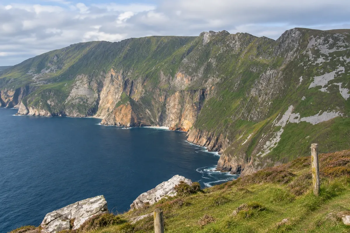
Viewpoint · Donegal, Donegal
Slieve League
Cliffs on the Teelin peninsula that drop about 600 metres to the Atlantic, among the highest in Europe, seen from the Bunglass lookout, with high-level trails and a visitor centre.
Illustrative images. The pictures in this guide are illustrations based on the real place, not photographs, and may differ from it.

Discover
About Slieve League
Slieve League, Irish Sliabh Liag, is a seaward mountain in southwest Donegal, near the village of Teelin, about 50 km from the town of Donegal. The Atlantic-facing side is a series of cliffs that fall from the summit, about 600 metres, down to the sea. They are nearly three times the height of the Cliffs of Moher and are among the highest in Europe.
The best-known viewpoint is the Bunglass lookout, Amharc Mór in Irish, at the end of a narrow road climbing from Teelin. From there you can see the cliff face head-on, with layers of rock in rust, green, grey and ochre tones, the coves below and, on clear days, Donegal Bay and the mountains of Sligo. On the slope are the remains of an early 19th-century watchtower and an old pilgrimage chapel.
From the lookout a trail climbs along the cliff edge up to the summit, passing One Man's Pass, a narrow ridge with the sea on one side and the valley on the other. The full route is long and exposed and intended for experienced walkers; many visitors only tackle the first sections from the lookout to view the cliffs from another angle.
At the entrance to Teelin there is a visitor centre with a café, information and a shuttle bus to the upper car park for part of the year. Those who prefer to walk follow the road from the lower car park. Boats run from Teelin harbour to view the cliffs from the sea in season, weather permitting.
Before you go
Practical information
Cidade Turismo reviews its information regularly, but something may have changed. Check with the place before planning your trip.
How much time to set aside
1 to 2 hours at the lookout and on the first sections of the trail; 4 to 5 hours for the full trail to the summit.
Best time
On clear days, in the morning or late afternoon. With low cloud, the top and part of the cliffs disappear. Avoid the high trail in strong wind or rain.
How to get there
It's near Teelin, about 50 km west of the town of Donegal, along the coastal road via Killybegs and Carrick. From the visitor centre at the entrance to Teelin you can take a shuttle bus, walk or drive to the Bunglass viewpoint, depending on the season.
Tip
Stop at the lower car park and walk the final stretch of road up to the viewpoint: the view of the cliffs gradually opens up. Bring warm clothing and do not go close to the edge, which is unprotected.
Get your questions answered
Frequently asked questions about Slieve League
Is Slieve League higher than the Cliffs of Moher?
Yes. The Slieve League cliffs reach about 600 metres, almost three times the height of the Cliffs of Moher.
Can you drive to the viewpoint?
It depends on the season: at times of year there are shuttle buses from the visitor centre, and car access may be limited to the lower car park. Check with the visitor centre.
Is the trail to the top difficult?
It's long and exposed, featuring the One Man's Pass, a narrow ridge. It's for experienced hikers and when the weather is good. The first sections from the viewpoint are easier.
Are there boat trips?
Yes, in season, from Teelin harbour, depending on sea conditions.