
 Brazil
 Argentina
 Bolivia
 Chile
Chile Colombia
 Ecuador
 Guyana
 French Guiana
 Falkland Islands (Malvinas)
 Paraguay
 Peru
Peru Suriname
 Uruguay
 Venezuela
 Germany
 Belgium
 Denmark
 Spain
Spain France
 Greece
 the Netherlands
 Ireland
 Italy
Italy Luxembourg
 Portugal
 the United Kingdom
 Sweden
 Switzerland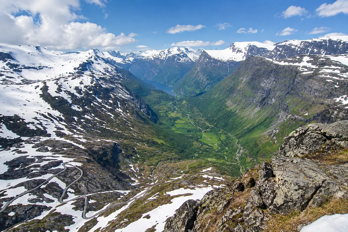
Viewpoint · Geiranger, Møre e Romsdal
Dalsnibba
The viewpoint at the top of Mount Dalsnibba, at 1,476 metres above Geiranger: the Geiranger Skywalk platform displays the fjord below, the lakes, the glaciers and the winding road.
Illustrative images. The pictures in this guide are illustrations based on the real place, not photographs, and may differ from it.

Discover
About Dalsnibba
Dalsnibba is the peak at 1,476 metres altitude located south of Geiranger, atop the road coming from Stryn and Lom. A private toll road, the Nibbevegen, climbs from Djupvatnet lake in hairpin bends up the mountain to the summit, where the Geiranger Skywalk observation platform is located.
From the top, the view drops down to the Geirangerfjord, about 1,400 metres below, across the valley, the village and the mountain lakes. Surrounding peaks retain snow well into summer and there are glaciers. The platform has glass edges and railings, and there is a café and shop at the summit.
The route to Dalsnibba is part of the experience: road 63 climbs from Geiranger in bends, passes the Flydalsjuvet viewpoint and Djupvatnet lake, which often remains frozen until June, and reaches the base of the Nibbevegen.
The top road usually opens in late May or June depending on snow, and closes in October. Even in summer, the summit can have snow, fog and very cold winds.
Before you go
Practical information
Cidade Turismo reviews its information regularly, but something may have changed. Check with the place before planning your trip.
How much time to set aside
About 1 hour at the top; 2 to 3 hours including the ascent from Geiranger.
Best time
On a clear day, from June to September, when the road is usually open. In early summer, the snow walls along the roadside are part of the experience. Check road opening and visibility before you go up; fog can obscure the view.
How to get there
From Geiranger, follow road 63 south for about 17 km to Djupvatnet lake and turn onto the toll road Nibbevegen, with another 5 km to the top. In summer, tour buses climb from Geiranger.
Tip
Bring a jacket, hat and gloves even in July: it's cold and windy at the top. Stop at Flydalsjuvet on the way up or down, it's on the route.
Official website
Get your questions answered
Frequently asked questions about Dalsnibba
How to get to Dalsnibba?
By car via road 63 and the Nibbevegen toll road, or by tour bus from Geiranger in summer.
When is the Dalsnibba road open?
It usually opens between late May and June and closes in October, depending on the snow. Check before you go.
Is it cold at the top?
Yes. At 1,476 metres, temperatures are usually much lower than at the fjord, with wind and sometimes snow even in summer.
Are Dalsnibba and Flydalsjuvet on the same route?
Yes. Flydalsjuvet is on road 63, about 4 km from the village, on the way to Dalsnibba.