
 Brazil
 Argentina
 Bolivia
 Chile
Chile Colombia
 Ecuador
 Guyana
 French Guiana
 Falkland Islands (Malvinas)
 Paraguay
 Peru
Peru Suriname
 Uruguay
 Venezuela
 Germany
 Belgium
 Denmark
 Spain
Spain France
 Greece
 the Netherlands
 Ireland
 Italy
Italy Luxembourg
 Portugal
 the United Kingdom
 Sweden
 Switzerland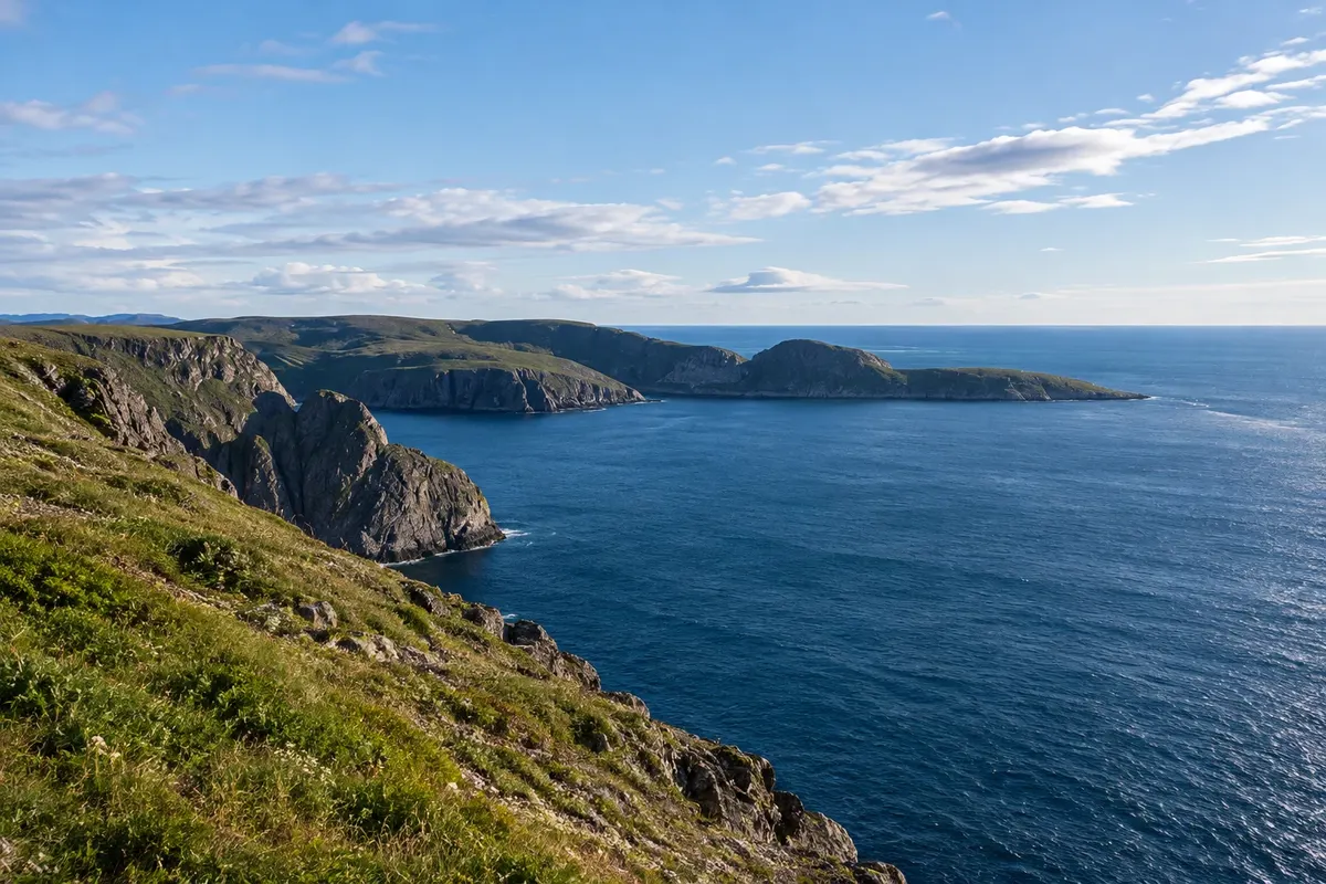
Trail and cape · Honningsvåg, Finnmark
Knivskjellodden
The rock point west of the North Cape that juts a little further north, at 71°11', reached by a trail of about 18 km round trip across the Magerøya tundra down to sea level.
Illustrative images. The pictures in this guide are illustrations based on the real place, not photographs, and may differ from it.

Discover
About Knivskjellodden
Knivskjellodden is a low rock point on the north coast of Magerøya, west of the North Cape. It lies at about 71 degrees 11 minutes latitude, roughly 1.5 km further north than the famous cliff, and is the northernmost point of the island. Unlike the cape, it has no road, visitor centre or high cliff: it is a tongue of rock that projects into the sea.
The trail starts at a car park by the E69, about 6 km from the North Cape, and is roughly 9 km each way, taking 4 to 6 hours round trip. The route is marked with stone cairns and stakes and descends across Magerøya’s tundra among lakes, streams, moss and rocks down to the sea. There are no trees and the wind is usually steady.
At the end, by the water, there is a stone marker with the latitude and a logbook where hikers leave their names. On the other side of the bay you can see the North Cape cliff. On the return the trail climbs again about 300 metres back up to the road.
The trail is usually done from June to September when there is no snow. With the midnight sun, up to the end of July, many people also walk at night.
Before you go
Practical information
Cidade Turismo reviews its information regularly, but something may have changed. Check with the place before planning your trip.
How much time to set aside
About 4 to 6 hours round trip.
Best time
From June to September, when the trail is usually free of snow. In fog the markers can be hard to see; check the forecast and set out in stable weather.
How to get there
The trailhead is at a car park by the E69, about 6 km before the North Cape and 28 km from Honningsvåg. There is no bus to the site; go by car or taxi.
Tip
Wear waterproof boots: the tundra has wet sections. Bring layered clothing, a hat, gloves, water and snacks. Sign the logbook at the end of the trail.
Get your questions answered
Frequently asked questions about Knivskjellodden
Is Knivskjellodden further north than Cabo Norte?
Yes, about 1.5 km further north. It is the northernmost point of the island of Magerøya.
How long does the hike take?
About 4 to 6 hours round trip, roughly 18 km.
When to do the hike?
It is usually done from June to September, when there is no snow.
Is there any infrastructure along the route?
No. There is only the parking on the E69 and the marker with the logbook at the end.