

 Brazil
 Argentina
 Bolivia
 Chile
Chile Colombia
 Ecuador
 Guyana
 French Guiana
 Falkland Islands (Malvinas)
 Paraguay
 Suriname
 Uruguay
 Venezuela
 Germany
 Belgium
 Spain
Spain France
 Greece
 the Netherlands
 Ireland
 Italy
Italy Luxembourg
 Portugal
 the United Kingdom
 Switzerland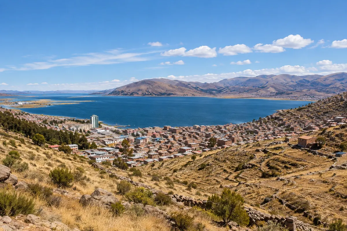
Lake · Puno, Puno
Lago Titicaca
The sacred lake of the Andes, at about 3,810 m, with over 8,000 km² divided between Peru and Bolivia. Boats from Puno go to the islands and to the Reserva Nacional del Titicaca, with its totora reed beds.
Illustrative images. The pictures in this guide are illustrations based on the real place, not photographs, and may differ from it.

Discover
About Lago Titicaca
Lake Titicaca sits at the center of the Altiplano, at about 3,810 meters of altitude, with more than 8,000 km² of surface divided between Peru to the west and Bolivia to the east. In several places the lake exceeds 200 meters in depth. For Andean peoples it is sacred: tradition says that Manco Cápac and Mama Ocllo emerged from its waters, sent by the Sun to found Cusco and the Inca Empire.
On the Peruvian side, Puno lies at the head of a large bay, the Bay of Puno, protected by the peninsulas of Capachica and Chucuito. Much of the bay is part of the Reserva Nacional del Titicaca, created in 1978 to protect the totora reed beds, the reed that grows in shallow water and is used by the Uros to build islands, houses and boats. The reedbeds are home to waterbirds such as the Titicaca grebe, which exists only there, as well as ducks and herons.
Puno's port is the departure point for boats to the floating Uros islands, about 30 minutes away, and to the stone islands of Taquile and Amantaní, further out. From the waterfront and the city's viewpoints you can see the entire bay and, on clear days, the snow‑capped peaks of the Cordillera Real in Bolivia.
The lake water is cold year‑round, and the sun, reflected off the water, is strong at altitude. Bring a hat, sunglasses, sunscreen and warm clothing for boat trips.
Before you go
Practical information
Cidade Turismo reviews its information regularly, but something may have changed. Check with the place before planning your trip.
How much time to set aside
Half a day for the Uros; one to two days for Taquile and Amantaní.
Best time
In the dry season, typically from May to September, with clear skies and a calmer lake. Tours depart in the morning when the wind is usually lighter. From December to March it often rains in the afternoon.
How to get there
Puno's port is about 1 km from the Plaza de Armas, a 15‑minute walk or a few minutes by taxi or mototaxi. Boats depart with agencies or with the port's associations of boatmen.
Tip
Leave early for boat tours when the lake is usually calmer. To see the bay from above, go up to the Kuntur Wasi or Cerrito de Huajsapata viewpoints in the late afternoon.
Get your questions answered
Frequently asked questions about Lago Titicaca
Is Titicaca in Peru or Bolivia?
In both. The lake is divided between Peru to the west and Bolivia to the east. On the Peruvian side the gateway is Puno; on the Bolivian side, Copacabana.
Can you swim in Titicaca?
The water is cold year-round, and most visitors do not swim. Some beaches on Taquile and on the Capachica peninsula attract bathers on sunny days.
Why is the lake sacred?
For Andean peoples, Manco Cápac and Mama Ocllo emerged from the waters of Titicaca; according to tradition they were the founders of the Inca Empire.