

 Brazil
 Argentina
 Bolivia
 Chile
Chile Colombia
 Guyana
 French Guiana
 Falkland Islands (Malvinas)
 Paraguay
 Peru
Peru Suriname
 Uruguay
 Venezuela
 Germany
 Belgium
 Spain
Spain France
 Greece
 the Netherlands
 Ireland
 Italy
Italy Luxembourg
 Portugal
 the United Kingdom
 Switzerland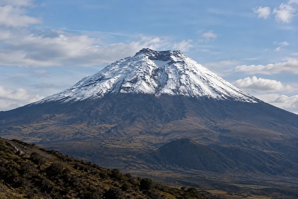
Park · Latacunga, Cotopaxi
Parque Nacional Cotopaxi
The park of the Cotopaxi volcano, at 5,897 meters, with its snow-covered cone, the páramo, the Limpiopungo lagoon and wild horses. You can drive up to about 4,600 meters.
Illustrative images. The pictures in this guide are illustrations based on the real place, not photographs, and may differ from it.

Discover
About Parque Nacional Cotopaxi
Cotopaxi National Park is about 35 km north of Latacunga and was created in 1975 around the Cotopaxi volcano, one of the highest active volcanoes in the world at 5,897 meters with an almost perfect cone covered in snow and ice. The park encompasses the páramo, the high-mountain grasses and shrubs, between roughly 3,400 and 5,900 meters.
The main entrance leads, via an unpaved road, to the Limpiopungo lagoon at about 3,800 meters, with a flat trail around it and reflections of the volcano when the sky is clear. The area is home to wild horses, deer, Andean foxes, hawks and, with luck, the condor. Nearby are Rumiñahui and other mountains.
The road continues to a parking area at about 4,600 meters, from which a steep trail of volcanic sand climbs to the José Rivas refuge on the slope. The ascent is short in distance but strenuous because of the altitude. The summit is only for climbers with a guide and equipment.
The volcano has active phases, and sectors and trails can close: check before going whether the park and trails are open. The weather changes quickly, with wind, cold and clouds in the afternoon.
Before you go
Practical information
Cidade Turismo reviews its information regularly, but something may have changed. Check with the place before planning your trip.
How much time to set aside
Half a day for Limpiopungo and the high parking; a full day for the ascent to the refuge.
Best time
Early in the morning, when the volcano is often cloud-free. From June to September the sky tends to be clearer. Check before going whether the park and trails are open.
How to get there
The main entrance is about 35 km from Latacunga, leaving the Pan-American Highway near Lasso; the drive to the lagoon takes about an hour. Go with a tour, driver or car; there is no public transport inside the park.
Tip
Bring a jacket, gloves, a hat, sunscreen and water: it is cold at the top and the sun is strong. Do not ascend to the refuge in the first days of your trip; save it for when you are acclimatized to the altitude.
Get your questions answered
Frequently asked questions about Parque Nacional Cotopaxi
How far can you drive on Cotopaxi?
To a parking area at about 4,600 meters; from there a steep trail climbs to the José Rivas refuge, if it's open.
Do you need a guide in the park?
For entering with a private car, the rules change over time; for high trails and for the summit, yes. Confirm the rules before you go.
Is Cotopaxi active?
Yes, the volcano has phases of activity. Check before going whether the park and the trails are open.