

 Brazil
 Argentina
 Bolivia
 Chile
Chile Colombia
 Guyana
 French Guiana
 Falkland Islands (Malvinas)
 Paraguay
 Peru
Peru Suriname
 Uruguay
 Venezuela
 Germany
 Belgium
 Spain
Spain France
 Greece
 the Netherlands
 Ireland
 Italy
Italy Luxembourg
 Portugal
 the United Kingdom
 Switzerland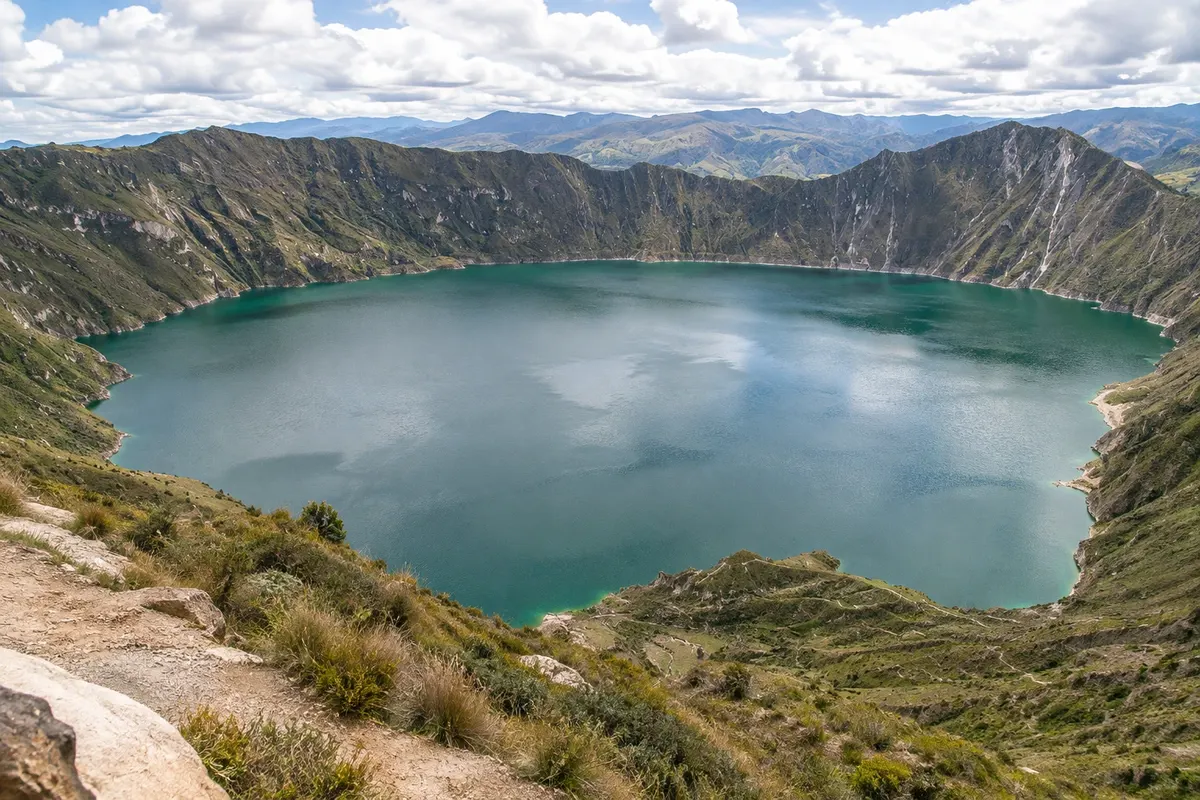
Lagoon · Latacunga, Cotopaxi
Laguna Quilotoa
Volcanic crater about 3 km across with an emerald-green lake at the bottom, at about 3,900 meters in the western range. Trail down to the water and walk along the rim.
Illustrative images. The pictures in this guide are illustrations based on the real place, not photographs, and may differ from it.

Discover
About Laguna Quilotoa
Laguna Quilotoa occupies the caldera of a volcano that had a major eruption about 800 years ago, in the western Andes range, about 90 km from Latacunga by road. The crater is roughly 3 km in diameter, and the lake at the bottom has emerald-green water that changes shade with the light and minerals. The rim sits at about 3,900 meters altitude.
On the rim is the village of Quilotoa, of the local Kichwa community, with guesthouses, restaurants and craft shops, including the Tigua paintings—scenes of Andean life painted on sheepskin. A glass viewpoint projects over the crater.
A sandy trail descends to the lake’s edge in about 45 minutes; the return, a steep climb, takes one to two hours, and there are mules for those who prefer to ride up. Down there there are kayaks. The full rim walk, five to six hours, is demanding, with ascents and descents. Quilotoa is also a starting or ending point of the Quilotoa Loop, a multi-day trek between villages.
The wind is strong and the cold increases in the afternoon.
Before you go
Practical information
Cidade Turismo reviews its information regularly, but something may have changed. Check with the place before planning your trip.
How much time to set aside
2 to 3 hours with the descent to the lagoon; 5 to 6 hours for the rim return.
Best time
In the morning, with more sun on the water and less wind. From June to September it usually rains less.
How to get there
It's about 90 km from Latacunga; the road via Pujilí and Zumbahua takes between two and two-and-a-half hours. There are buses from the Latacunga terminal to Zumbahua and Quilotoa, as well as tours and pickup trucks.
Tip
Descend to the lagoon only if you have the stamina for the climb back, or arrange a mule for the return. Bring a jacket, hat and sunscreen; the sun burns even in the cold.
Get your questions answered
Frequently asked questions about Laguna Quilotoa
How long does it take to descend and climb at Quilotoa?
About 45 minutes to descend and one to two hours to climb, on a steep sandy trail.
Can you go up by mule?
Yes, there are mules for the return from the lagoon up to the rim.
What is the Quilotoa Loop?
A multi-day hike between Kichwa villages in the highlands, such as Sigchos, Chugchilán and Isinliví, that passes by the crater.