

 Brazil
 Argentina
 Bolivia
 Chile
Chile Ecuador
 Guyana
 French Guiana
 Falkland Islands (Malvinas)
 Paraguay
 Peru
Peru Suriname
 Uruguay
 Venezuela
 Germany
 Belgium
 Spain
Spain France
 Greece
 the Netherlands
 Ireland
 Italy
Italy Luxembourg
 Portugal
 the United Kingdom
 Switzerland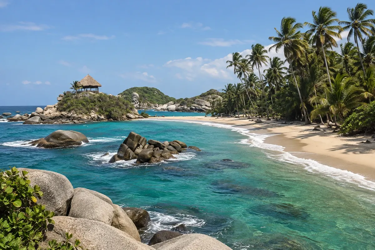
Park · Santa Marta, Magdalena
Parque Nacional Natural Tayrona
Protected coastline east of Santa Marta, with golden-sand beaches between rounded rocks and tropical forest that reaches the sea. Sacred territory of the indigenous peoples of the Sierra Nevada.
Illustrative images. The pictures in this guide are illustrations based on the real place, not photographs, and may differ from it.

Discover
About Parque Nacional Natural Tayrona
The Parque Nacional Natural Tayrona was created in 1964 and protects about 150 km² of land and a strip of sea east of Santa Marta, where the Sierra Nevada meets the Caribbean. The coastline is cut into bays and coves, with golden-sand beaches, large rounded rocks, coconut palms and dry and humid tropical forest, home to monkeys, birds and lizards. The name comes from the tairona, a people who lived in the region before the Spanish arrived.
The park is sacred territory for the kogui, arhuaco, wiwa and kankuamo peoples, descendants of the tairona, who live in the Sierra Nevada. For that reason, and for the rest of nature, it often closes several times a year, in periods in February, June and from October to November: check before you go.
The most common visit starts at the El Zaíno entrance, from where an internal transport takes you to Cañaveral. From there the trails go through forest and sand: in about an hour you reach Arrecifes, a long beach where swimming is not allowed; continuing along the coast, La Piscina, protected by a rock barrier, and Cabo San Juan del Guía, with two coves and a viewpoint over the rocks, about two hours from Cañaveral. There are cabins, hammocks and camping in some spots, as well as simple restaurants.
You can also reach some beaches by other entrances and by boat from Taganga, according to park rules. The trails are of dirt, roots and rocks, with heat and humidity; in rainy seasons, mud. For some areas, such as Parque Tayrona, yellow fever vaccination is usually recommended or required; confirm before traveling.
Before you go
Practical information
Cidade Turismo reviews its information regularly, but something may have changed. Check with the place before planning your trip.
How much time to set aside
A full day to reach Cabo San Juan and return; one or two nights to explore the beaches at a relaxed pace.
Best time
From December to April it usually rains less, but it's the busiest season. Enter at opening, early in the morning, to walk before the heat. The park closes during some periods of the year and has a daily visitor limit; check before you go.
How to get there
The El Zaíno entrance is about 35 km east of Santa Marta, on the road to Riohacha. Buses leave from the market in the center and drop passengers at the gate in about an hour; by taxi or car it's also about an hour. Boats from Taganga take you to some beaches, according to park rules.
Tip
Bring identification, cash, water, sunscreen, insect repellent and trail shoes. Disposable plastic bottles and packaging are often restricted; check at the entrance. Respect the bathing warnings: the beaches suitable for swimming are La Piscina and Cabo San Juan.
Official website
Get your questions answered
Frequently asked questions about Parque Nacional Natural Tayrona
Which Tayrona beaches are suitable for swimming?
La Piscina and Cabo San Juan del Guía, on the trail from Cañaveral, are the most used for swimming. Swimming is not allowed at Arrecifes; follow the park's warnings.
Can you sleep inside Tayrona?
Yes — in cabins, hammocks and camping areas at some spots, such as Arrecifes and Cabo San Juan. Book in advance.
Why does Tayrona close at certain times of the year?
To allow ecosystems to rest and by agreement with the indigenous peoples of the Sierra Nevada, who carry out territorial cleansing ceremonies. Dates are announced by Parques Nacionales; check before going.
How long is the walk to Cabo San Juan?
About two hours from Cañaveral, along a trail of dirt, roots and sand, passing Arrecifes and La Piscina.