

 Brazil
 Chile
Chile Colombia
 Peru
Peru Uruguay
 Germany
 Belgium
 Spain
Spain France
 Greece
 the Netherlands
 Ireland
 Italy
Italy Portugal
 the United Kingdom
 Switzerland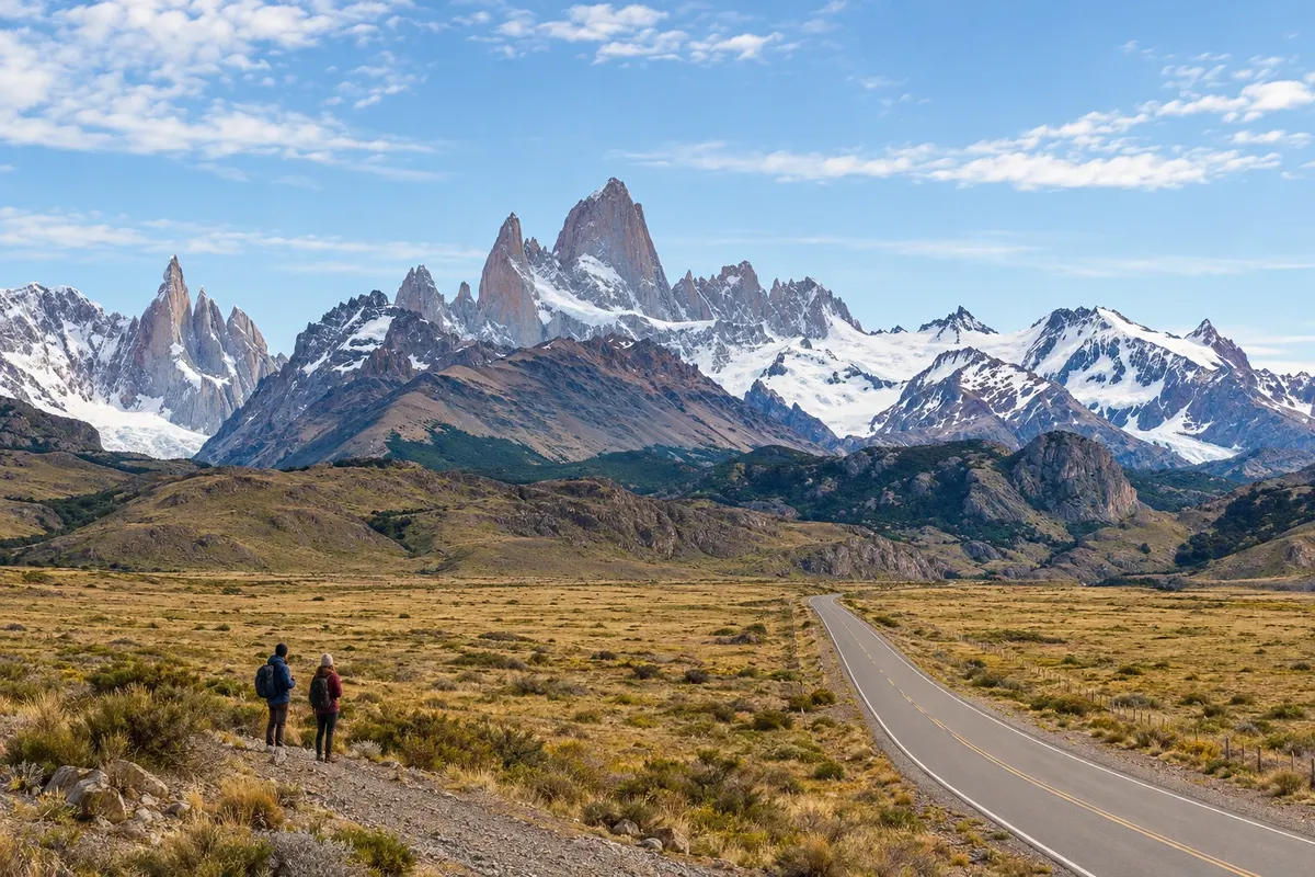
Route · Santa Cruz
From El Calafate to El Chaltén
Between Lago Argentino and Lago Viedma, RN 40 links the steppe to the access roads to El Calafate and El Chaltén.
In the photo: Fitz Roy seen from the access road to El Chaltén
Illustrative images. The pictures in this guide are illustrations based on the real place, not photographs, and may differ from it.

The route
What the From El Calafate to El Chaltén is
El Calafate is on the southern shore of Lago Argentino and is the air gateway for this route. The road exit reaches RN 40, which continues north across the steppe. Excursions to Perito Moreno and other areas of the park require their own time in addition to travel between the towns.
The route passes through the area of the río La Leona, which links Lago Viedma and Lago Argentino. La Leona is a spot in the steppe alongside the river. When leaving RN 40 to the west, the access road to El Chaltén follows the northern shore of Lago Viedma and approaches the mountain range.
El Chaltén sits beside the río de las Vueltas and in the northern sector of Los Glaciares. The Fitz Roy area is known for hikes that start in the village or at nearby access points. Lago del Desierto lies north of El Chaltén, at the end of a gravel road that follows the río de las Vueltas. Visiting requires a round trip through that valley. Allow nights in both towns to separate road travel, viewpoints and walks; mountain views depend on the day's conditions.
The map
2 cities along the way
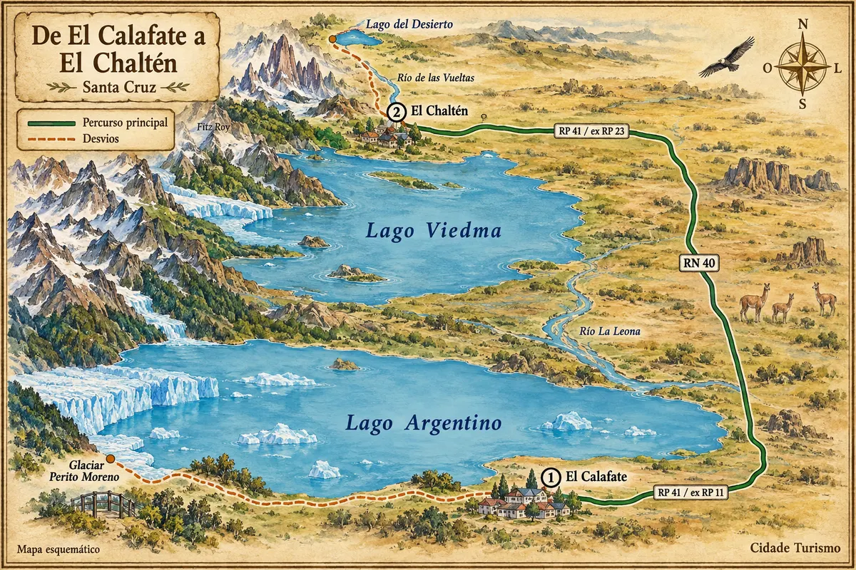
Fuente: Instituto Geográfico Nacional de la República Argentina (IGN), contornos de 2019. Adaptação do Cidade Turismo.
The journey
City by city
Distances and times are approximate: check before you set off.
-
 1 · Santa Cruz
El Calafate
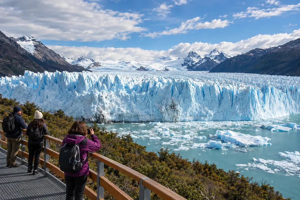
On the shore of Lago Argentino, El Calafate has an airport, accommodation and transport services. The Perito Moreno walkways and boat excursions require separate departures; Laguna Nimez and Glaciarium can occupy time close to the urban base.
→ El Chaltén about 220 km Head east on RP 11, go north on RN 40, passing La Leona, and turn west onto RP 23, on the northern shore of Lago Viedma. The connection is paved. Perito Moreno and Lago del Desierto have separate accesses, with round trips via Calafate and Chaltén.
-
 2 · Santa Cruz
El Chaltén
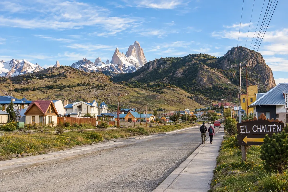
El Chaltén is beside the río de las Vueltas, in the northern area of Los Glaciares. Trails to Laguna de los Tres and Laguna Torre require a full day each, while the Mirador de los Cóndores allows a shorter outing. Staying in the village helps choose hikes according to the weather.
How many days
Allow five to seven days for the two towns, separating road travel, hikes and detours to Perito Moreno and Lago del Desierto.
Best time to go
From October to April there is usually more tourist availability. From December to February there are more daylight hours; wind and weather changes remain present. Between May and September cold, ice and snow can affect the road and hikes.
The seasons shown are the most usual ones; nature doesn't always follow the calendar.
How to travel it
Car or transfer allow choosing road stops; regular buses connect the two towns. Fuel up and take water and food before departure, as there are no continuous services along the steppe. Check access conditions and arrange trail transport separately.
Who it's for
Travelers who want to combine glaciers, steppe landscapes and mountain hikes, with nights in two Patagonian bases. Panoramic tours and long trails require different choices of time and effort.
Your questions
Frequently asked questions about the From El Calafate to El Chaltén
Is the connection between the towns fully paved?
The access roads and the RN 40 segment are paved. Turnoffs to attractions and the continuation beyond El Chaltén are other routes, each with their own conditions.
What features appear on the route between the two bases?
The stretch crosses the steppe and the area of río La Leona. Lago Argentino accompanies the exit from Calafate, while the approach to Chaltén follows the northern shore of Lago Viedma.
Is it necessary to rent a car?
There are buses and transfers between the towns. A car allows choosing stops, but it is not necessary to link the two bases.
Is it possible to do the road trip and a long trail in the same day?
Allow separate days for longer routes. Travel between the towns and stops along the way take up part of the day.
Which period usually favors the itinerary?
From October to April there is usually more tourist availability. From December to February there are more daylight hours, but wind and weather changes continue to be part of the planning.