Gora
Pico da Lapinha
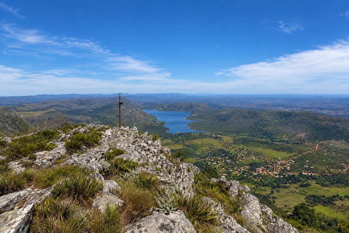
Peak of about 1,686 meters just above the village, the second highest in Serra do Cipó, with a summit cross. The trail climbs the slope and shows the lagoon, the village and the range.

 Išči
Brazilija
 Antarktika
 Argentina
 Bolivija
 Čile
 Kolumbija
 Ekvator
 Gvajana
 Francoska Gvajana
 Falklandski otoki (Malvini)
 Paragvaj
 Peru
 Surinam
 Urugvaj
 Venezuela
 Nemčija
 Avstrija
 Belgija
 Hrvaška
 Danska
 Slovaška
 Slovenija
 Španija
 Finska
 Francija
 Grčija
 Nizozemska
 Madžarska
 Irska
 Islandija
 Italija
 Luksemburg
 Norveška
 Poljska
 Portugalska
 Združeno kraljestvo
 Češka
 Švedska
 Švica
 Turčija
 Bermudi
 Kanada
 Združene države Amerike
 Grenlandija
 Mehika
 Sveta Peter in Mihael
 Dominikanska republika
 JaponskaTurčija
 Južnoafriška republika
 Egipt
 Avstralija
 Fidži
 Nova Zelandija
 Papua Nova Gvineja
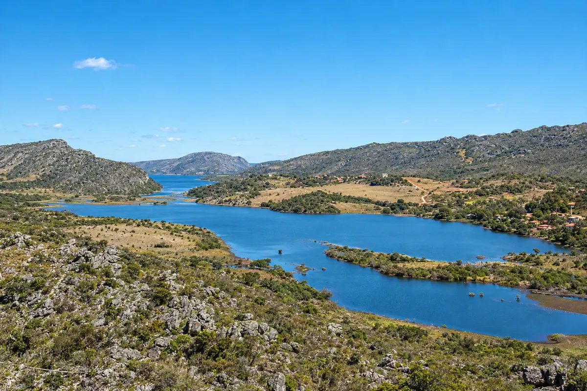
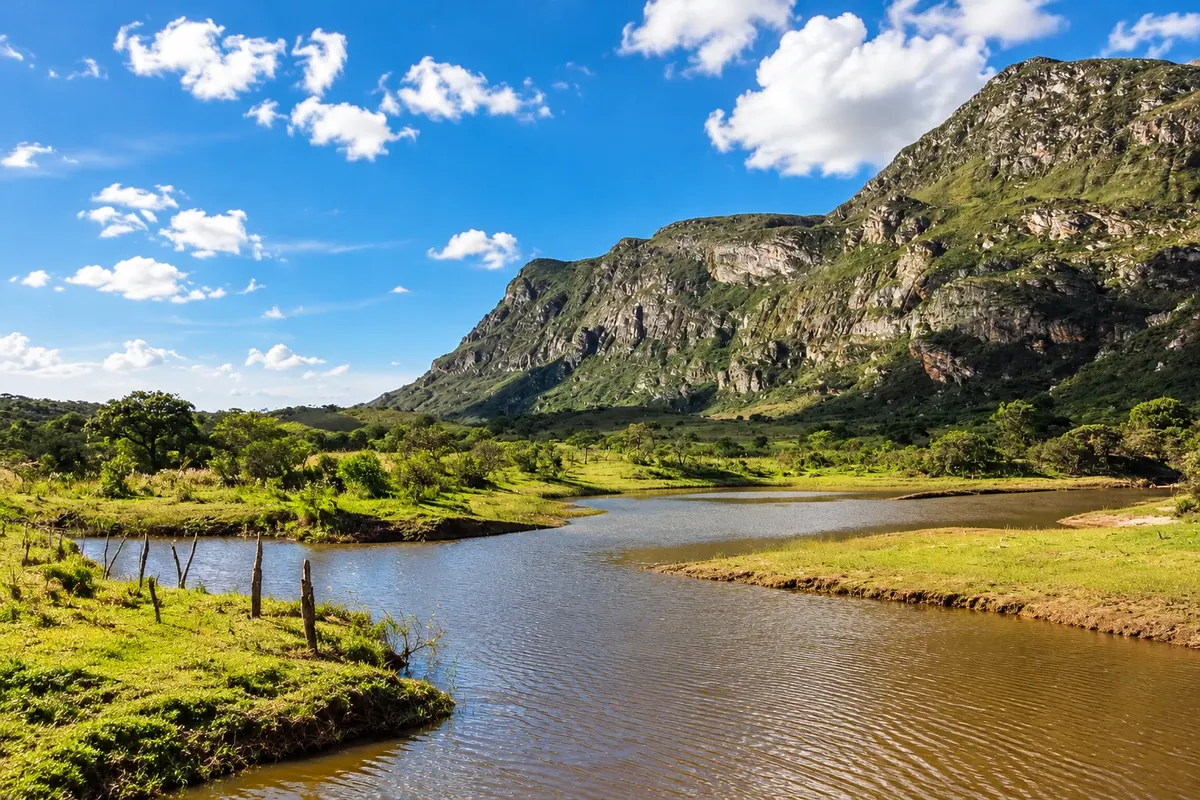
Na fotografiji: Reservoir and landscape of Lapinha da Serra, in Santana do Riacho
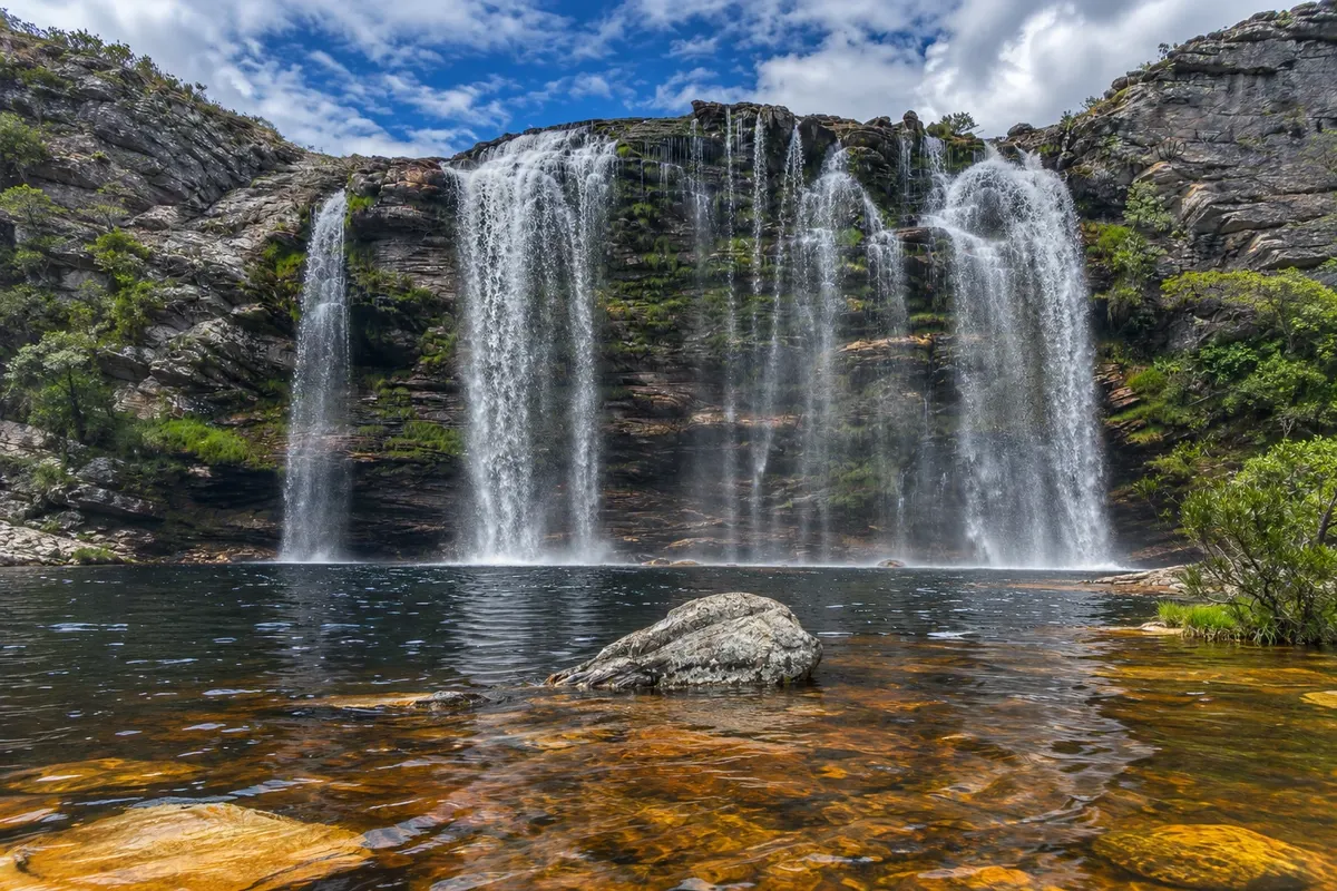
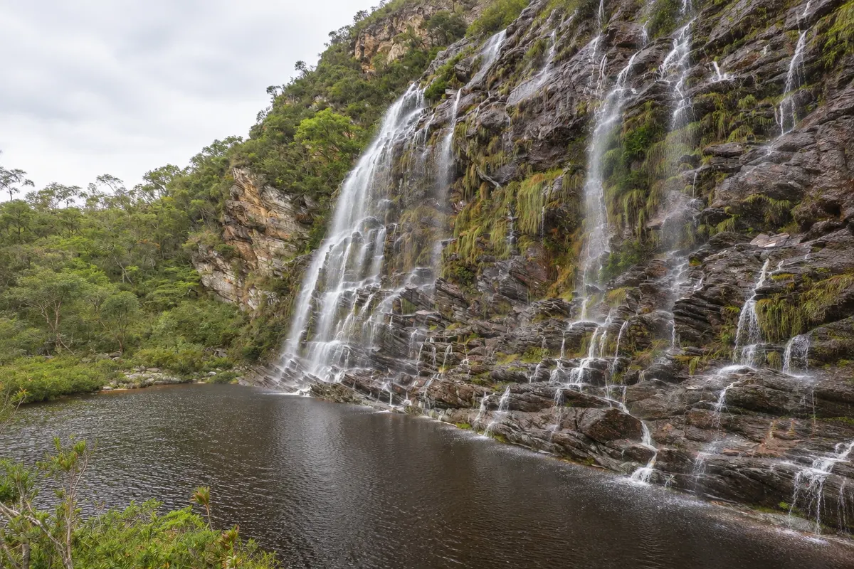
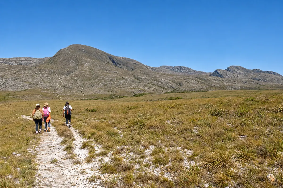
Illustrative images. The pictures in this guide are illustrations based on the real place, not photographs, and may differ from it.
Mesto
Lapinha da Serra is a village of about 300 inhabitants in the municipality of Santana do Riacho, at the end of a dirt road, at the foot of Pico da Lapinha and Pico do Breu, the two highest points of Serra do Cipó. The village surrounds Lagoa da Lapinha, a reservoir from the 1950s, on the other side of which there are rock paintings. From here the foot crossing to Cachoeira do Tabuleiro departs, and there are waterfalls a few hours' walk away.
Lapinha da Serra – število nastanitev: 4.
kako do tja · koliko dni · načrt poti · vprašanja
Doživite kraj
Peak of about 1,686 meters just above the village, the second highest in Serra do Cipó, with a summit cross. The trail climbs the slope and shows the lagoon, the village and the range.
A reservoir built in the 1950s that surrounds the village at the foot of the range. It allows swimming, kayaking and paddleboarding, and on the other side of the water there is a site with rock paintings.
High drop over a rock face, with a large deep pool, north of the village of Lapinha da Serra, inside the Brumas do Espinhaço private natural reserve. You reach it by road and by a long trail, with controlled entry.
A high rock wall where water flows down in several streams into a large pool, southeast of the village of Lapinha da Serra. The trail is long but easy, across fields and farm gates.
A two- or three-day on-foot crossing of the Serra do Espinhaço, from the village of Lapinha da Serra to Cachoeira do Tabuleiro, in Conceição do Mato Dentro. It’s about 35 to 40 km across campos rupestres, usually done with a local guide.
Raziščite Lapinha-Tabuleiro Crossing
Pred odhodom
Lapinha da Serra – MG Destinacija Serra do Cipó približno 143 km stran (izhodišče: Belo Horizonte)
Razdalje so približne. Pred potovanjem preverite lete in vozne rede avtobusov, vlakov ali ladij.
From Belo Horizonte, follow MG-010 to Serra do Cipó, climb the range and take the access road to Santana do Riacho. From the municipal seat it's about 15 km of dirt road to the village; in total about 143 km. Confins Airport is a little over 110 km away. Public transport goes to Santana do Riacho; from there you need to arrange local transport.
Two days allow you to climb Pico da Lapinha in one day and hike to a waterfall or cross the lagoon on the other. With three days you can include Pico do Breu. Those doing the crossing to Tabuleiro need two to three days just for it.
From April to September it rains little, trails are firm and the sky usually clears more on the peaks; nights are cold. From November to March the waterfalls usually have more water, but the dirt road can become difficult with rains. In prolonged drought the lagoon level often falls.
The seasons shown are the most usual ones; nature doesn't always follow the calendar.
Practically, yes. Public transport reaches only Santana do Riacho, and the road to the village is dirt. In the village everything is done on foot, and the trails start from the streets. There is no fuel station: refuel before climbing the range. Cell signal is weak or nonexistent in a large part of the village.
Predlog poti
Pot povezuje znamenitosti na tej strani. Za oglede boste imeli dovolj časa.
Leave the village early via the trail to Pico da Lapinha, which climbs the slope right behind the houses. It's about 5 km of ascent to the summit cross.
Descend slowly along the same trail, loose rock in several sections, and have lunch at one of the village restaurants.
Walk to the shore of Lagoa da Lapinha to see the range reflected in the water at the end of the day.
Dine in the village, which has few restaurants and grocery shops. Bring warm clothing: after the sun sets behind the range, the temperature falls quickly.
Dan 1
Climb Pico da Lapinha early in the morning, when the sun hasn't yet heated the exposed slope.
After lunch, relax at the lagoon shore or paddle by kayak or stand-up paddleboard, rented in the village.
Dan 2
Follow the trail that skirts the lagoon to Cachoeira do Lajeado, about 7 km of walking without major climbs.
Back in the village, arrange with a local resident the boat crossing to the archaeological site on the other side of the lagoon.
Check before you go. Opening hours and days change, and places may close for renovations, holidays or events. This itinerary is a suggestion from Cidade Turismo, not a commitment: plan yours by checking directly with each place you intend to visit.
Pred odhodom
Lapinha da Serra is a village in the municipality of Santana do Riacho, in Minas Gerais, in the Serra do Cipó region. The municipal seat is about 15 km away via dirt road. Do not confuse it with Gruta da Lapinha, which is in Lagoa Santa.
About 143 km, via MG-010 to Serra do Cipó and then via Santana do Riacho, with about the final 15 km on dirt road. The drive takes around two and a half hours.
Cell signal is weak or nonexistent in much of the village, and many accommodations offer Wi‑Fi. There is no gas station or bank branch: refuel beforehand and bring some cash.
It is a hike of about 30 to 40 km, depending on the route, between Lapinha da Serra and Cachoeira do Tabuleiro in Conceição do Mato Dentro, done in two or three days, with overnight stays in local houses or camping. There is no cell signal along the route, and those unfamiliar with the trail should go with a guide.
Več kot vodnik