

 Antarktika
 Argentina
 Bolivija
 Čile
 Kolumbija
 Ekvator
 Gvajana
 Francoska Gvajana
 Falklandski otoki (Malvini)
 Paragvaj
 Peru
 Surinam
 Urugvaj
 Venezuela
 Nemčija
 Avstrija
 Belgija
 Hrvaška
 Danska
 Slovaška
 Slovenija
 Španija
 Finska
 Francija
 Grčija
 Nizozemska
 Madžarska
 Irska
 Islandija
 Italija
 Luksemburg
 Norveška
 Poljska
 Portugalska
 Združeno kraljestvo
 Češka
 Švedska
 Švica
 Turčija
 Bermudi
 Kanada
 Združene države Amerike
 Grenlandija
 Mehika
 Sveta Peter in Mihael
 Dominikanska republika
 Japonska
 Južnoafriška republika
 Egipt
 Avstralija
 Fidži
 Nova Zelandija
 Papua Nova Gvineja
Bahia · Brazilija
Souto Soares
Destinacija: Chapada Diamantina.
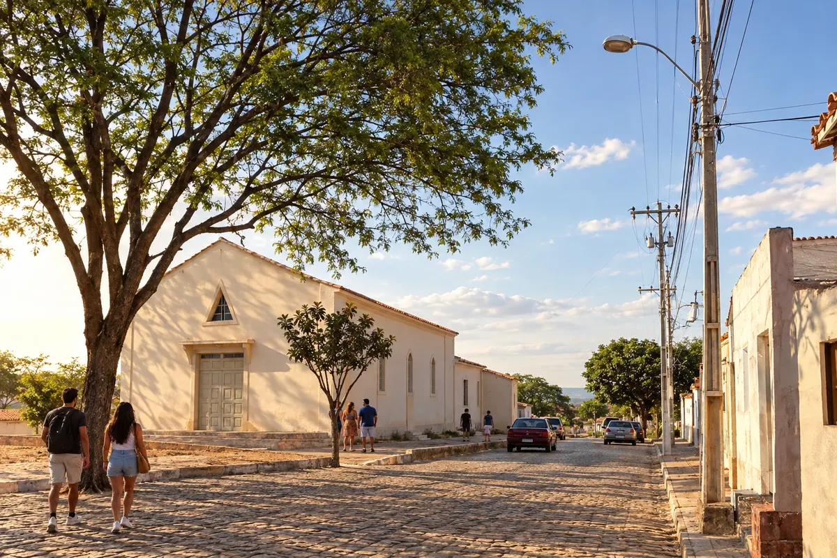
Na fotografiji: A street in the urban center of Souto Soares.
Illustrative images. The pictures in this guide are illustrations based on the real place, not photographs, and may differ from it.


Mesto
Kaj lahko pričakujete – Souto Soares.
Souto Soares arose from the former settlement of Licuri, separated from Seabra, and is connected to the rural roads of the northern Chapada. Communities and agricultural activities make up the municipality's landscape. In the Circuito do Diamante, the municipal seat extends the Iraquara branch along the BA-122 corridor.
Kje prenočiti
Souto Soares – število nastanitev: 3.
Kje jesti
Souto Soares – število lokalov: 3.
Vaše potovanje
kako do tja · vprašanja
Brazilske poti
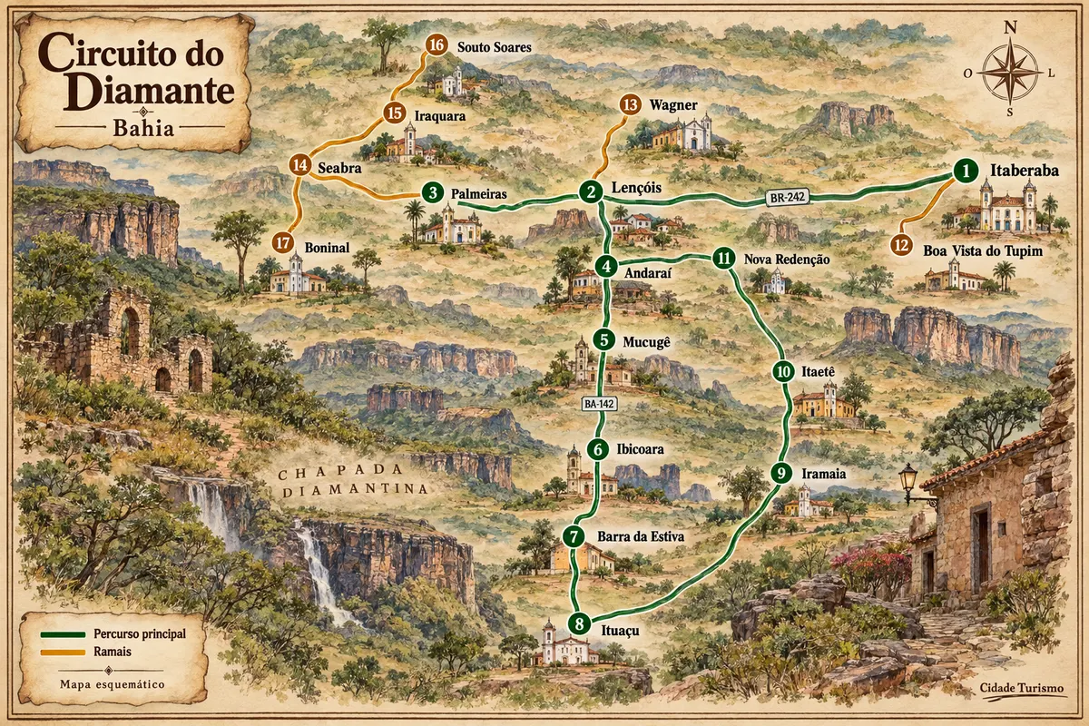
Souto Soares – del poti z imenom Diamond Circuit
Mining-era houses, mountain ranges and rural roads among the municipalities of Chapada Diamantina.
Pred odhodom
Vaše potovanje – Souto Soares
Souto Soares – BA Destinacija Chapada Diamantina
Kako do tja
The approach from Iraquara uses the BA-122 corridor and Souto Soares's local access roads. Return to the axis of the chosen bases to continue through the center of the Chapada.
Kdaj se odpraviti
The period from May to September usually has less rain in Souto Soares. From November to April precipitation increases in the municipality's climate records. To enter rural localities, confirm access with the person hosting the activity.
The seasons shown are the most usual ones; nature doesn't always follow the calendar.
Pred odhodom
Pogosta vprašanja
Why does Souto Soares appear on the northern branch?
Its position north of Iraquara extends the regional BA-122 corridor, rather than forming a stage of the southern axis of the Serra do Sincorá.
Can I visit the caves from this stop?
The caves mentioned in the circuit are located in municipalities such as Iraquara. They have their own approaches and reception, in addition to the road connection between municipal seats.
Is it necessary to go onto rural roads?
Passing through the municipal seat can use the regional axis. Localities off that route must be chosen and arranged separately.
Več kot vodnik


