

Cave and religious heritage
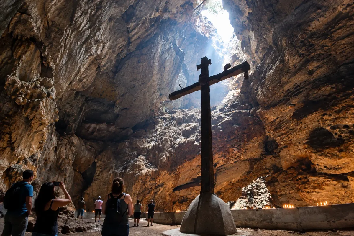
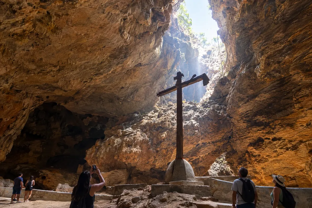
Gruta da Mangabeira
Gruta de Ituaçu that brings together limestone formations and a tradition of pilgrimage on the southern edge of the Chapada.

 Išči
Brazilija
 Antarktika
 Argentina
 Bolivija
 Čile
 Kolumbija
 Ekvator
 Gvajana
 Francoska Gvajana
 Falklandski otoki (Malvini)
 Paragvaj
 Peru
 Surinam
 Urugvaj
 Venezuela
 Nemčija
 Avstrija
 Belgija
 Hrvaška
 Danska
 Slovaška
 Slovenija
 Španija
 Finska
 Francija
 Grčija
 Nizozemska
 Madžarska
 Irska
 Islandija
 Italija
 Luksemburg
 Norveška
 Poljska
 Portugalska
 Združeno kraljestvo
 Češka
 Švedska
 Švica
 Turčija
 Bermudi
 Kanada
 Združene države Amerike
 Grenlandija
 Mehika
 Sveta Peter in Mihael
 Dominikanska republika
 JaponskaTurčija
 Južnoafriška republika
 Egipt
 Avstralija
 Fidži
 Nova Zelandija
 Papua Nova Gvineja
Bahia · Brazilija
Destinacija: Chapada Diamantina.
Na fotografiji: Rocks and a space of devotion in the Gruta da Mangabeira.
Illustrative images. The pictures in this guide are illustrations based on the real place, not photographs, and may differ from it.
Mesto
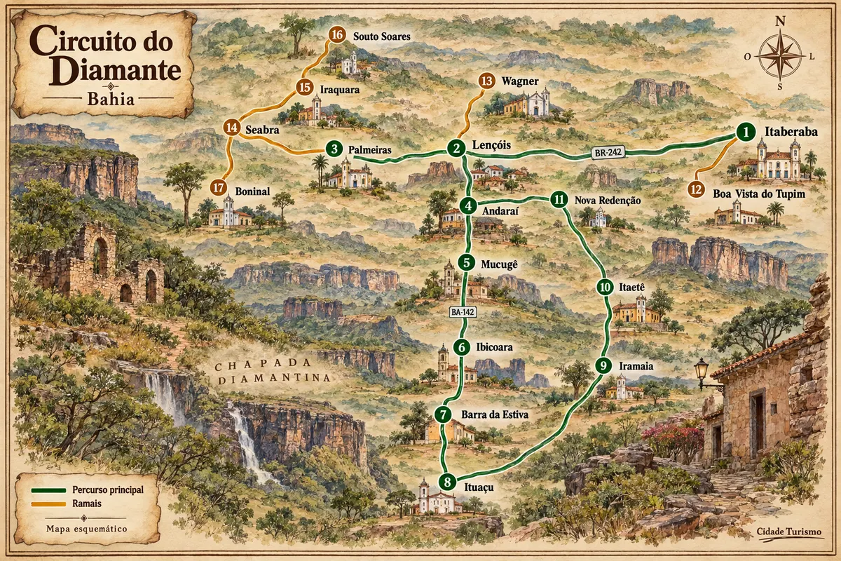
Ituaçu is located in a valley surrounded by limestone formations on the southern edge of the Chapada. The Gruta da Mangabeira combines underground scenery with a tradition of pilgrimage, while the Rio Mato Grosso is part of the municipality's geography. The stop links the BA-142 axis to the eastern routes of the Circuito do Diamante.
Ituaçu – število nastanitev: 11.
kako do tja · koliko dni · načrt poti · vprašanja
Brazilske poti
Mining-era houses, mountain ranges and rural roads among the municipalities of Chapada Diamantina.
Doživite kraj
Gruta de Ituaçu that brings together limestone formations and a tradition of pilgrimage on the southern edge of the Chapada.
Pred odhodom
Ituaçu – BA Destinacija Chapada Diamantina
Ituaçu's town center is accessed via the BA-142 corridor. The Gruta da Mangabeira uses a local access point outside the center; arrange the arrival point with the chosen reception.
One day allows dedicating one stage to the Gruta da Mangabeira and another to the urban core. Circulation in the cave requires reserving the time slot provided by the visit guide.
Between May and September it usually rains less in the southern Chapada. From November to April, rainfall generally increases. At the cave, circulation conditions must be confirmed with those responsible before departure.
The seasons shown are the most usual ones; nature doesn't always follow the calendar.
Road transport makes it easy to connect the town center to the Gruta da Mangabeira. The internal visit involves walking, on terrain different from the streets and the road.
Predlog poti
Pot povezuje znamenitosti na tej strani. Za oglede boste imeli dovolj časa.
Follow the route provided in the cave, respecting the instructions and the authorized areas.
Spend the remainder of the stage on the urban core's streets and interpreting the valley's landscape.
Check before you go. Opening hours and days change, and places may close for renovations, holidays or events. This itinerary is a suggestion from Cidade Turismo, not a commitment: plan yours by checking directly with each place you intend to visit.
Pred odhodom
Mangabeira has a local access point outside the town center. Arrange the reception and meeting point before leaving the center.
Arrange the visit with whoever receives the public and follow the instructions for the underground route.
Activities may use different spaces and routes. Confirm what is included in the reception you choose.
The BA-142 corridor links the regional stages. Allow separate time for the local arrival to the Gruta da Mangabeira.
Več kot vodnik


