

 Brazil
 Argentina
 Chile
Chile Colombia
 Peru
Peru Uruguay
 Germany
 Belgium
 Spain
Spain Greece
 the Netherlands
 Ireland
 Italy
Italy Luxembourg
 Portugal
 the United Kingdom
 Switzerland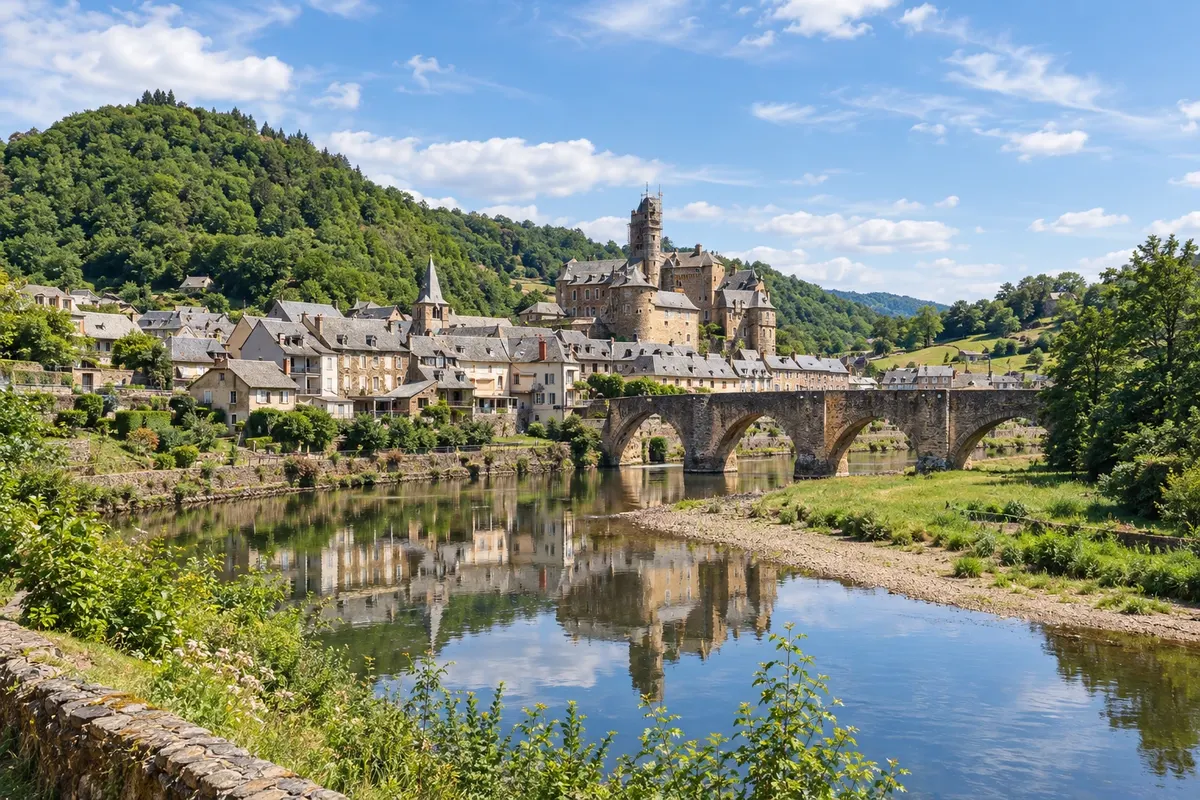
Route · Auvérnia-Ródano-Alpes · Occitânia · Nova Aquitânia
Le Puy route on foot
The most traveled Way of St. James in France: from Le Puy-en-Velay to the Pyrenees, on foot, across the Aubrac plateau, via Conques, Cahors and Moissac, to Saint-Jean-Pied-de-Port, where the Camino Francés begins.
In the photo: The bridge and castle of Estaing over the Lot River, on the Le Puy route.
Illustrative images. The pictures in this guide are illustrations based on the real place, not photographs, and may differ from it.

The route
What the Le Puy route on foot is
The Le Puy Way, the Via Podiensis, is the most traveled Way of St. James in France. It leaves Le Puy-en-Velay in the Massif Central and crosses the southwest of the country to Saint-Jean-Pied-de-Port at the foot of the Pyrenees, where the Camino Francés begins. It's about 755 km, in roughly 32 stages, or about five weeks of walking. The route is marked as a long-distance trail GR 65, with white and red waymarks.
The departure is from Le Puy cathedral, after the morning mass. The route crosses the Aubrac plateau, with high pastures and stone villages, descends to the Lot valley via Espalion and Estaing and reaches Conques, with the abbey of Sainte-Foy. It then continues through Figeac to Cahors and the Pont Valentré, and via Lauzerte to Moissac and its cloister.
In the second half, the route goes through Gascony—via Lectoure, Condom and Eauze—and through Béarn via Navarrenx to the French Basque Country. Near Ostabat it meets paths coming from Paris and Vézelay, and reaches Saint-Jean-Pied-de-Port.
Seven stretches of the route and several monuments, such as Le Puy cathedral, Conques abbey, the Pont Valentré and Moissac abbey, are part of the UNESCO World Heritage listing for the Ways of St. James in France. Travelers with limited time often do only the first week, from Le Puy to Conques.
The map
5 cities along the way
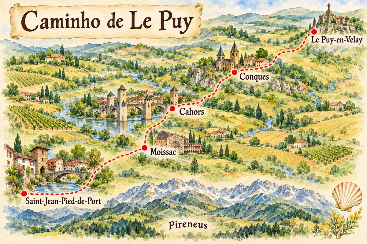
Contornos: © IGN, ADMIN EXPRESS, Licence Ouverte 2.0. Adaptação do Cidade Turismo.
The journey
City by city
Distances and times are approximate: check before you set off.
-
 1 · Auvérnia-Ródano-Alpes
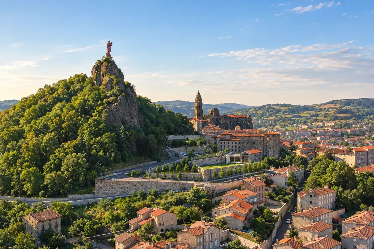
Le Puy-en-Velay
Le Puy-en-Velay is the town of volcanic rock formations and the starting point of the route. Pilgrims pick up the credential, attend the morning mass at the cathedral—which ends with a blessing for those setting out—and descend the staircase of rue des Tables toward Saint-Privat-d'Allier.
→ Conques about 217 km about 10 days on foot 10 stages, from 16 to 27.5 km, through the Velay, the Margeride and the Aubrac plateau: Saint-Privat-d'Allier, Saugues, Aumont-Aubrac, Nasbinals, Espalion and Estaing. On the Aubrac the stages are high and windy.
-
 2 · Occitânia
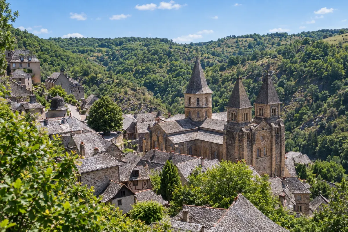
Conques
After the Aubrac plateau, via Saint-Chély-d'Aubrac and the medieval bridges of Espalion and Estaing, the route descends to the Dourdou valley and reaches Conques. The village preserves the abbey of Sainte-Foy, with the tympanum of the Last Judgment and the treasure, and the pilgrims' bridge, a World Heritage site.
→ Cahors about 137 km about 6 days on foot 6 stages, from 17 to 30.5 km: Livinhac-le-Haut, Figeac, Cajarc (already in the Lot valley), Limogne-en-Quercy and Mas-de-Vers. A variant leaves Figeac via the Célé valley, with cliffside villages.
-
 3 · Occitânia
Cahors
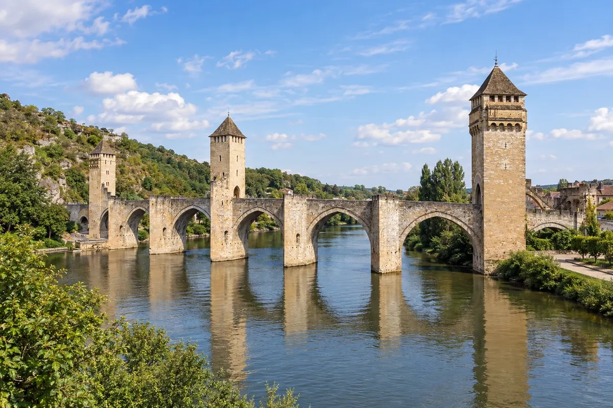
After Figeac, Cajarc in the Lot valley, and the plateaus of the Quercy—or via the Célé valley variant—the route reaches Cahors. The town has the cathedral of Saint-Étienne, and pilgrims leave via the Pont Valentré, the 14th-century fortified bridge and a World Heritage site.
→ Moissac about 73 km about 3 days on foot 3 stages: Cahors–Montcuq (34 km), Montcuq–Lauzerte (14 km, up to the hilltop village) and Lauzerte–Moissac (24.5 km), on the banks of the Tarn.
-
 4 · Occitânia
Moissac
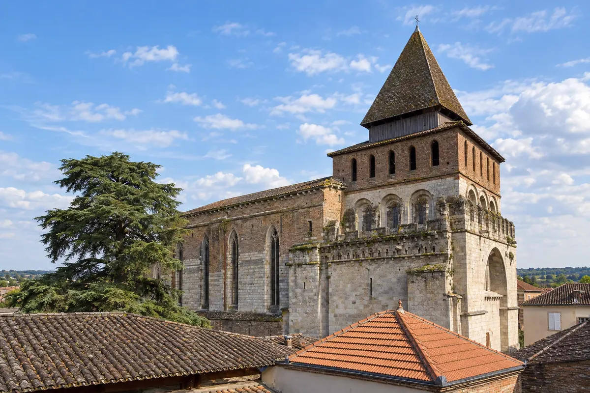
After Montcuq and Lauzerte, a hilltop village, the route reaches Moissac on the banks of the Tarn. The abbey of Saint-Pierre has the tympanum of the Apocalypse and a cloister dating from around 1100. From here the route follows the Canal Latéral à la Garonne and enters Gascony.
→ Saint-Jean-Pied-de-Port about 330 km about 13 days on foot 13 stages, from 16 to 33 km: Auvillar, along the Canal Latéral à la Garonne, Lectoure, La Romieu, Condom, Eauze, Aire-sur-l'Adour, Navarrenx and Ostabat to Saint-Jean-Pied-de-Port.
-
 5 · Nova Aquitânia
Saint-Jean-Pied-de-Port
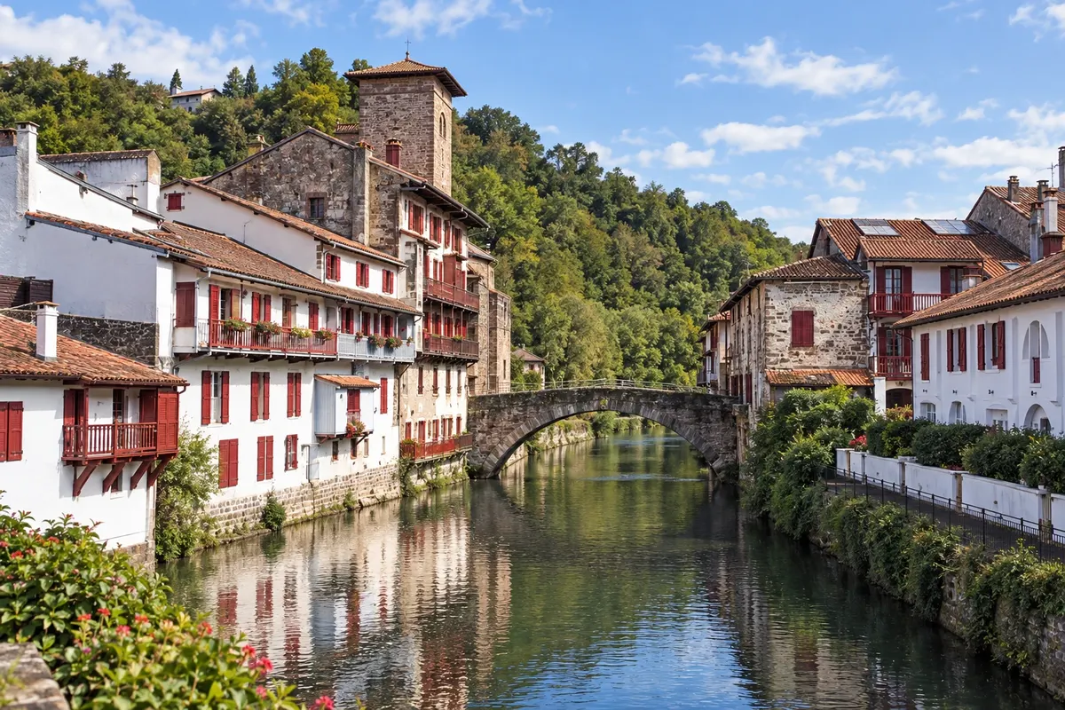
After Lectoure, Condom, Eauze, Aire-sur-l'Adour and Navarrenx, and after meeting the routes from Paris and Vézelay near Ostabat, the route reaches Saint-Jean-Pied-de-Port via the Porte Saint-Jacques. From here the Camino Francés begins, with the crossing of the Pyrenees to Roncesvalles.
How many days
The whole route takes about 5 weeks on foot. From Le Puy to Conques about 10 days; from Conques to Moissac around 9. Allow an extra day in Le Puy before setting out, and additional days to continue from Saint-Jean-Pied-de-Port on the Camino Francés or to return.
Best time to go
From May to June and from September to October. On the Aubrac plateau, above 1,000 meters, it can snow from November to April, and many shelters only open from Easter until the end of October. July and August are hot in the Quercy and Gascony, and the trail is busier, especially during the first week.
The seasons shown are the most usual ones; nature doesn't always follow the calendar.
How to travel it
On foot, following the white and red GR 65 waymarks and the scallop shells of the route, either with a backpack or using luggage transfer, which is common on this trail. Stages range from 18 to 30 km. Accommodations are pilgrim hostels, guesthouses and inns, which usually ask for reservations one or two days in advance. Many people do the route in sections, one or two weeks per year.
Who it's for
For those who want to walk through rural France with medieval villages, Romanesque art and good food; for those who want to reach Saint-Jean-Pied-de-Port and continue on the Camino Francés; and for those with one or two weeks who want to do just a section.
Your questions
Frequently asked questions about the Le Puy route on foot
How many kilometres is the Le Puy route?
About 755 km from Le Puy-en-Velay to Saint-Jean-Pied-de-Port, in roughly 32 stages. From there to Santiago via the Camino Francés is about another 770 km.
Does the Le Puy route qualify for the Compostela?
Not by itself: the Compostela requires the last 100 km to be walked ending in Santiago. Those who do the Le Puy route can continue on the Camino Francés, in the same year or on other trips, with the same credential.
Do I need to book accommodations?
Yes, it is generally recommended to reserve hostels and guesthouses one or two days in advance, and further ahead in spring and summer.
Where to get the credential?
In Le Puy, at the pilgrims' welcome office near the cathedral, or from Camino de Santiago associations before you travel. Check opening hours.
Is the route well signposted?
Yes, as the long-distance trail GR 65 it has white and red waymarks, in addition to the scallop shell markers.
Do I need to speak French?
It helps, especially in villages and in guesthouses where many owners speak only French. Learning basic phrases and having a translator app on your phone will make reservations easier.