

 Brazil
 Argentina
 Chile
Chile Colombia
 Peru
Peru Uruguay
 Germany
 Spain
Spain France
 Greece
 the Netherlands
 Ireland
 Italy
Italy Portugal
 the United Kingdom
 Switzerland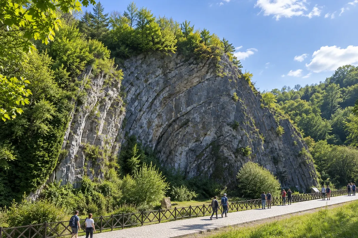
Observation deck · Durbuy, Luxemburgo
Rocher de la Falize
Limestone cliff bent into an arch shape, the anticlinal of Durbuy, first described in 1807. A path skirts the rock, just above the castle.
Illustrative images. The pictures in this guide are illustrations based on the real place, not photographs, and may differ from it.

Discover
About Rocher de la Falize
The Rocher de la Falize is the large limestone mass that rises above Durbuy, next to the castle. What stands out are the rock layers folded into an A-shape, like a tent. Geologists call this type of fold an anticline, which is why the place is also known as the anticlinal de Durbuy or anticlinal d'Omalius.
The name honors Jean-Baptiste-Julien d'Omalius d'Halloy, the geologist who described the rock in 1807. The layers are limestone formed on the bottom of a warm sea around 380 million years ago. Much later, when a mountain range rose in the region about 320 million years ago, the layers were pushed and folded.
The rock is one of the stops of the Geoparque Famenne-Ardenne, recognized by Unesco. The castelo d'Ursel itself is set on this structure. A tourist path skirts the Falize, and at its foot there is a small pond with a fountain.
It is not a climb: the walk is a short hike, with a gentle ascent, that gives views over the slate roofs of the center and the Ourthe valley.
Before you go
Practical information
Cidade Turismo reviews its information regularly, but something may have changed. Check with the place before planning your trip.
How much time to set aside
Between 20 minutes and half an hour to circle the rock and stop at the little pond. Adding the entire geobalade, about an hour.
Best time
In the late afternoon, when the low sun highlights the relief of the limestone layers. After heavy rain the trail can become slippery.
How to get there
It's located in Durbuy's town center, a few minutes' walk from the Place aux Foires. Follow the signs for the tourist path or the Geoparque's geobalade.
Tip
To understand what you're seeing, look at the rock's lines from a distance before getting close: the arch of the layers becomes clearer a few meters away. Combine it with the geobalade, which also passes by the old river arm.
Get your questions answered
Frequently asked questions about Rocher de la Falize
What is an anticline?
It is a fold of rock layers in the shape of an arch or an A. In Durbuy, layers of limestone that were horizontal were pushed and folded when a mountain range formed, about 320 million years ago.
Do you have to pay to see the rock?
There is no ticket office: the rock is beside the tourist path, inside the town.