History and culture
Forte São João
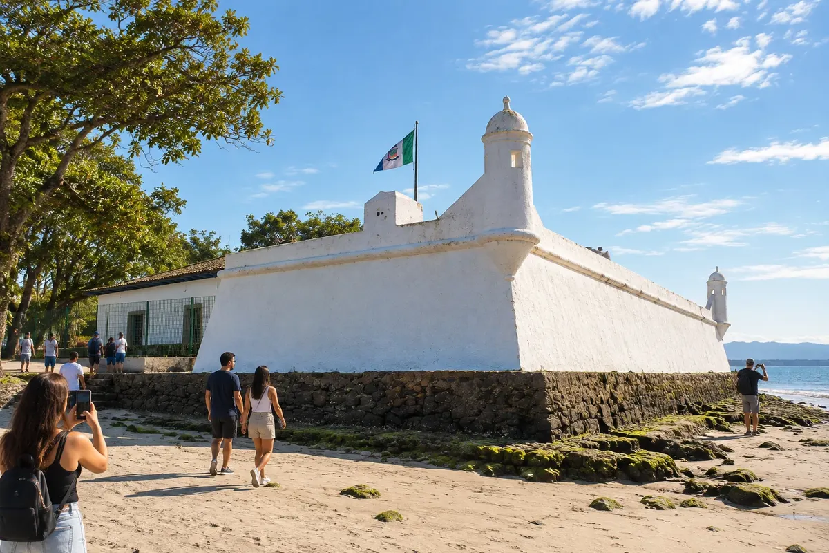
Forte São João stands on the banks of the Canal de Bertioga. Its stone-and-lime construction and position facing the mouth help tell part of the history of coastal defense.

 Išči
Brazilija
 Antarktika
 Argentina
 Bolivija
 Čile
 Kolumbija
 Ekvator
 Gvajana
 Francoska Gvajana
 Falklandski otoki (Malvini)
 Paragvaj
 Peru
 Surinam
 Urugvaj
 Venezuela
 Nemčija
 Avstrija
 Belgija
 Hrvaška
 Danska
 Slovaška
 Slovenija
 Španija
 Finska
 Francija
 Grčija
 Nizozemska
 Madžarska
 Irska
 Islandija
 Italija
 Luksemburg
 Norveška
 Poljska
 Portugalska
 Združeno kraljestvo
 Češka
 Švedska
 Švica
 Turčija
 Bermudi
 Kanada
 Združene države Amerike
 Grenlandija
 Mehika
 Sveta Peter in Mihael
 Dominikanska republika
 JaponskaTurčija
 Južnoafriška republika
 Egipt
 Avstralija
 Fidži
 Nova Zelandija
 Papua Nova Gvineja
São Paulo · Brazilija
Destinacija: Costa da Mata Atlântica.
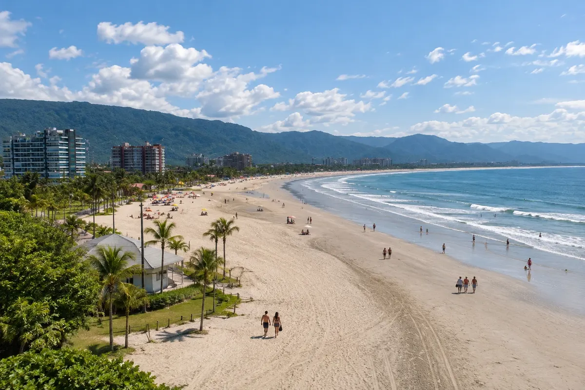
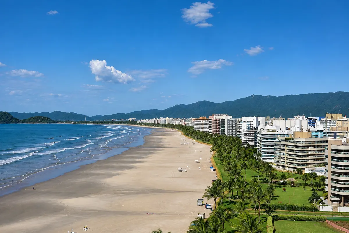
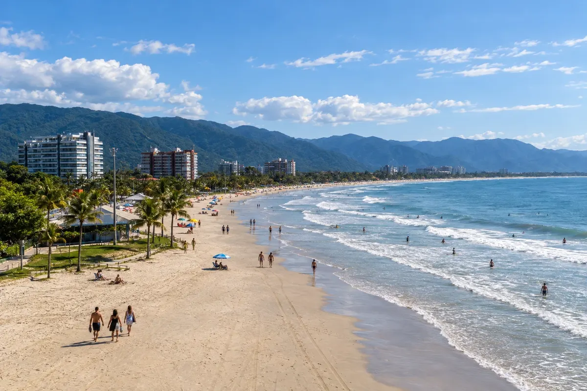
Na fotografiji: Praia da Enseada, in Bertioga
Illustrative images. The pictures in this guide are illustrations based on the real place, not photographs, and may differ from it.
Mesto
Bertioga preserves Forte São João next to the canal and Parque dos Tupiniquins, where the statue of Cunhambebe stands. The coastline includes Praia da Enseada and Praia de Itaguaré, associated with conservation areas. The city lets you combine the history of the São Paulo coast with beach and restinga, with access to each environment organized separately.
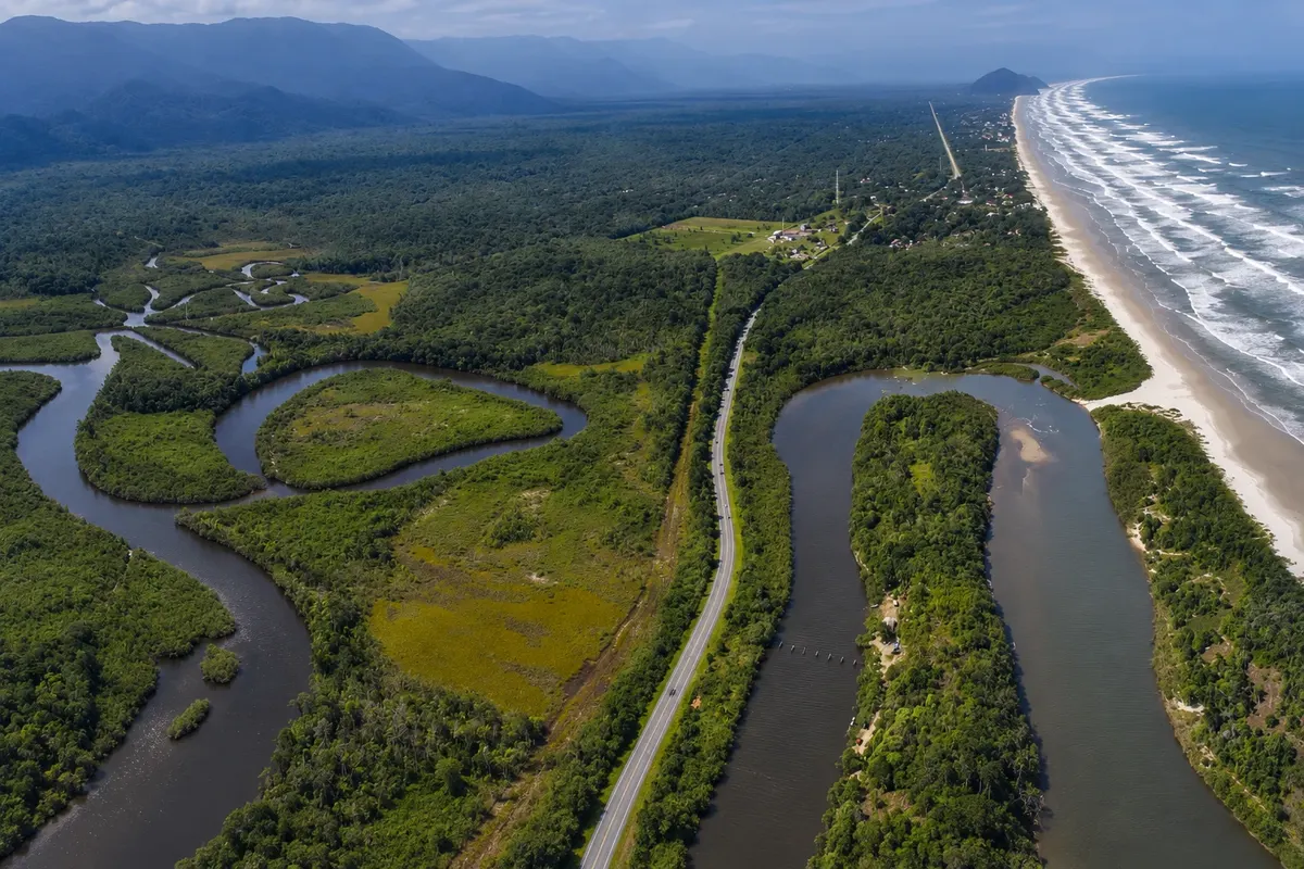
Bertioga is on the coast of the state of São Paulo, about 110 km from the capital and 65 km from Santos, next to Guarujá, at the entrance to São Paulo’s North Coast. A narrow channel separates the city from the Island of Santo Amaro, where Guarujá is located, and the Serra do Mar closes the horizon behind. Between the sea and the mountain range, a plain of rivers, mangroves and restinga occupies most of the municipality, with over 90% of its area protected.
There are 33 km of beaches almost in a straight line, and each stretch has its own character. Enseada runs alongside the center, from the mouth of the channel, with generally calm sea, kiosks and the largest accommodation offer. At its end, about 10 km from the center, Indaiá has the calmest water in the city, sought by families and by those who practice sailing, kayaking and stand up paddle. São Lourenço Beach, about 16 km away, is where the Riviera de São Lourenço is located, a large planned neighborhood with a grassy waterfront, shops and buildings. After it the landscape thins out: Itaguaré, 20 km away, is protected by a state park and has no commerce; Guaratuba, at 24 km, and Boraceia, at 30 km, already on the border with São Sebastião, alternate between condominiums and stretches of forest.
The city’s history is at the mouth of the channel. Forte São João, whose first wooden defense dates to 1532 and whose masonry construction is from 1547, is presented by the municipality as the oldest fortress in Brazil. It is inside Parque dos Tupiniquins, next to a promenade from which schooner tours depart.
The other side of Bertioga is the forest. Parque Estadual Restinga de Bertioga protects the plain behind the beaches, and its trails lead to rivers and waterfalls, almost always with an accredited guide. By the Itapanhaú River you can reach the Village of Itatinga by boat, a worker village of a 1910 hydroelectric plant, with a small cable railway that crosses the forest. In Boraceia, the Guarani village on the Silveira River receives visits by appointment.
The climate is hot and humid, with a lot of rain in summer. From December to March it is hot, with highs near 30 °C, and showers are frequent; this is the beach season. From June to August there is less rain, highs are near 24 °C, nights require a jacket and the sea cools. This period is best for the trails.
The calendar has two long-standing events: the Tainha Festival, which usually takes place between late June and early August, next to Parque dos Tupiniquins, and the city’s anniversary on May 19. Bertioga also hosts a festival of indigenous cultures that brings together peoples from various regions of Brazil.
One day is enough for the fort and Enseada. With two or three days you can include the Riviera, Itaguaré and a boat or trail trip. The beaches are far apart, connected by the Rio-Santos highway: a car makes a difference.
Bertioga – število nastanitev: 78.
Bertioga – število lokalov: 22.
Bertioga – nazivi in posebnosti
Brazilske poti
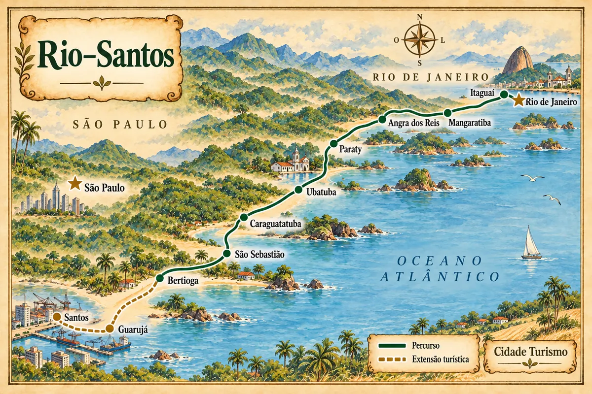
From the Costa Verde to the São Paulo coast, with beaches, heritage and an extension via Guarujá to Santos.
Doživite kraj
Forte São João stands on the banks of the Canal de Bertioga. Its stone-and-lime construction and position facing the mouth help tell part of the history of coastal defense.
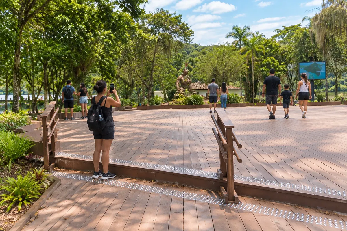
Parque dos Tupiniquins occupies the surroundings of Forte São João, by the Canal de Bertioga. The statue of Cunhambebe and the boardwalks form part of the historical and scenic walk.
Raziščite Parque dos Tupiniquins
Praia da Enseada runs along the urban area of Bertioga, between Forte São João and Cantão do Indaiá. The outing can combine a stretch of sand and references to the historic center.
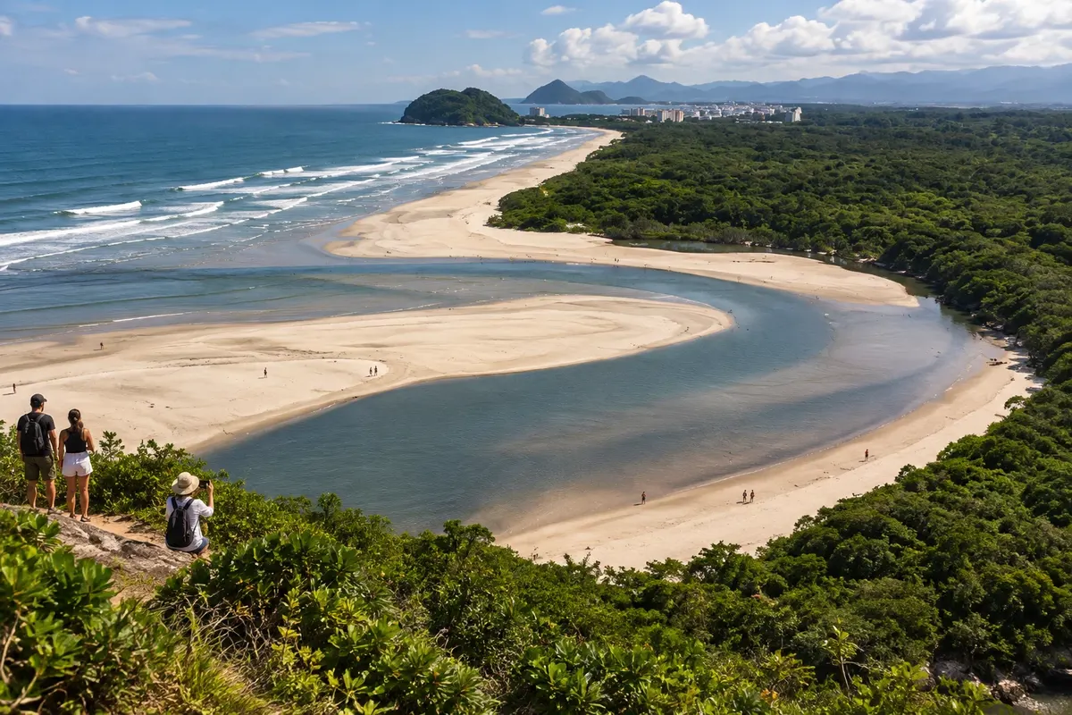
Praia de Itaguaré combines a beach with the mouth of the Rio Itaguaré, which flows into the ocean in Bertioga. The landscape calls for a visit focused on observing the meeting of river and sea.
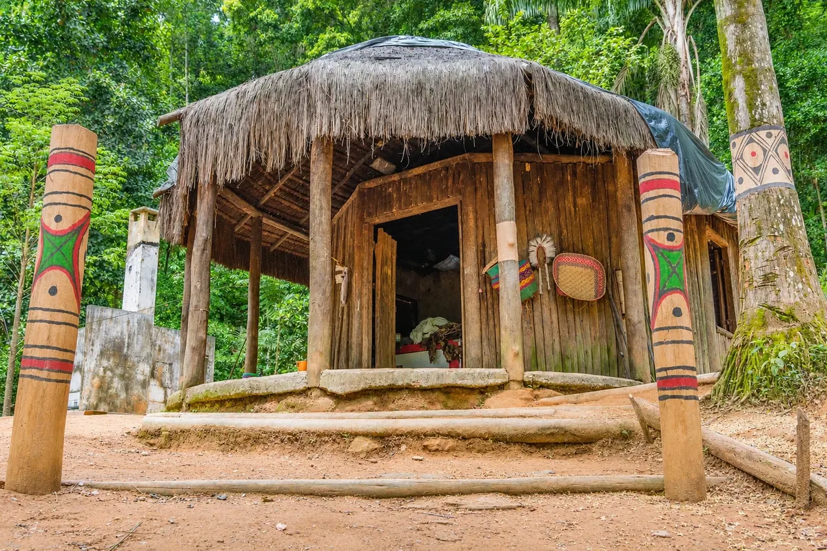
A Guarani village in the Ribeirão Silveira Indigenous Land, in Boracéia, on the border between Bertioga and São Sebastião. Visits are by appointment with an indigenous guide and include a forest trail, a talk about Guarani culture and typical food.
A state park of about 9,300 hectares, entirely in Bertioga, that protects one of the largest stretches of restinga on São Paulo’s coast, linking the shoreline to the Serra do Mar. Visits are done with environmental guides registered in the municipality.
Raziščite Restinga State Park (Bertioga)
A beach of about 4.5 km between Riviera de São Lourenço and Jardim São Lourenço, with firm sand, generally calm sea and a shoreline lined with grass and coconut trees. It is about 16 km from downtown Bertioga via the Rio-Santos Highway.
Kaj izbrati pred odhodom
Izhodišče, trajanje, potek, vključene storitve in okvirna cena vsakega izleta.
Bertioga’s historic center fits into a short walk at the tip where Praia da Enseada meets the canal. Forte São João began in 1532 as a palisade defense, a fence of trunks driven into the ground, and was rebuilt in masonry in 1547. It guarded the canal entrance, the water route to Santos, at a time when the Tupinambás, allied with the French, attacked the Portuguese settlements. In 1563, Jesuits Manuel da Nóbrega and José de Anchieta spent five days there before going on to negotiate peace with the peoples of the Tamoios Confederation. In 1565, it was from Bertioga that Estácio de Sá’s fleet set out to found Rio de Janeiro. The current name came in the 18th century from a chapel dedicated to Saint John built beside it. The fort is listed as national heritage. The structure is a rectangular walled enclosure with sentry boxes at the corners and a terrace that serves as a viewpoint over the canal. Inside are cannons, armor, paintings and sculptures. Visits are guided by monitors and, for those who go on their own, no prior reservation is required. Around it is Parque dos Tupiniquins, a green area with statues and historical pieces. From there starts the canal promenade, about 400 meters long, with a bike lane, benches, bars and restaurants, which ends at the Municipal Fish Market. On the other side of the water is Ilha de Santo Amaro.
Kraji na poti: Forte São João, Parque dos Tupiniquins, Canal Promenade of Bertioga, Municipal Fish Market.
Vključuje: There is no entrance fee to the fort, and the guided visit is included. Parking and purchases at bars and restaurants are paid separately. School and agency groups need to schedule in advance.
Nasvet: Opening days and hours change between the summer season and the rest of the year: check with the city hall before you go. Late afternoon on the promenade is the most popular time.
Najboljši čas za obisk: All year. Between late June and early August, the Mullet Festival takes place next to the park.
Enseada is the city’s main beach. It starts next to Forte São João, at the mouth of the canal, and runs for kilometers in front of downtown and the adjacent neighborhoods, ending at Cantão do Indaiá. It is wide, with light, compact sand, good for walking and sports, with a view of the Serra do Mar. The sea is usually calm, and the beach is popular with families. The stretch closest to downtown has an urbanized waterfront with kiosks, and concentrates hotels, inns and restaurants; this is where the city’s shows and events take place. Near the canal, swimming requires caution: prefer to enter the water away from the canal mouth. As you move away from the center, the beach becomes more residential and quiet, with patches of restinga vegetation along the sand. At the end is Indaiá, about 10 km from downtown. The sea there is the calmest in Bertioga, with few waves, which appeals to travelers with small children and to those who practice sailing, kayaking and stand up paddle. The neighborhood has vacation homes, some lodgings and nearby shops, in a more secluded atmosphere than downtown. Because the name Enseada covers a very long stretch, coordinate with your driver or check the map for the exact section where you want to stay.
Kraji na poti: Enseada Beach, Indaiá Beach, Indaiá Point.
Vključuje: Access to the beaches is free. Chairs, umbrellas, purchases at kiosks and equipment rentals are paid separately.
Nasvet: With children, go to Indaiá. Before entering the sea, check the bathing water bulletin from the state environmental agency and follow lifeguard signage.
Najboljši čas za obisk: December to March for swimming; from April to November the beach is empty and good for walks.
The schooners are moored downtown, near Forte São João, and are the simplest way to see Bertioga from the water. The boat leaves via the channel, passes in front of Forte São João and Forte São Luiz and reaches the sea. The route published by the city follows the coast of the island, which belongs to Guarujá: Praia Branca, Praia Preta and Camburizinho, Ilha do Guará and Ilha Rasa, Praia do Pinheirinho and Praia do Iporanga. These are beaches surrounded by forest, some without road access, reachable by trail from land. When navigation conditions allow, there is a stop for a sea swim. During the trip, the crew tells stories of the early days of Portuguese colonization. From the boat you can also see the mangroves, the marinas and the ferry that crosses to Guarujá. The schooners have onboard service and life jackets. The route and duration change according to the operator and navigation conditions: with wind or rough seas, the itinerary may be altered or the departure canceled.
Kraji na poti: Bertioga Channel, Forte São João, Forte São Luiz, Praia Branca, Praia Preta, Ilha do Guará, Praia do Iporanga.
Vključuje: Generally it includes the cruise and the life jackets. Drinks and snacks on board are paid separately. Check the operator’s current price list.
Nasvet: Ask at the pier, the day before, about the day’s route, the duration and whether there is a stop for swimming. Bring sunscreen, a towel and a light jacket for the return.
Najboljši čas za obisk: All year round, in good weather. In summer, prefer morning departures, before the afternoon downpours.
Vila de Itatinga lies hidden in the forest, next to the Serra do Mar, and visitor access is controlled. It was built in the early 20th century for the workers of the Itatinga Hydroelectric Plant, from 1910, constructed to supply power to the port of Santos and still operating. The route is part of the visit. First you cross the Itapanhaú River by boat. On the far bank you board an old cable car that runs about 7.5 km through the middle of the forest to the village. The village preserves the former workers’ houses, with architecture influenced by English styles. Notable features are the Capela de Nossa Senhora da Conceição and the field of Itatinga Atlético Clube, with the Serra do Mar surrounding them. The visit has rules. It takes place on Saturdays and Sundays, in groups of up to 20 people per period, one in the morning and one in the afternoon, and only with accredited service providers who handle transport and guiding. The plant and operational areas are not part of the route. As places are limited, advance booking is necessary.
Kraji na poti: Itapanhaú River, Vila de Itatinga, Capela de Nossa Senhora da Conceição, Itatinga Hydroelectric Plant.
Vključuje: The tour is paid for and sold by accredited providers; it generally includes the boat, the small cable car and transport. Check the current price list and what is included.
Nasvet: Book in advance, especially during school holidays and public holidays. The list of authorized providers is on the city tourism page. Bring insect repellent and water.
Najboljši čas za obisk: All year on weekends. From April to September there is less rain.
About 16 km from the center along the Rio-Santos Highway, Bertioga changes its face. Riviera de São Lourenço is a planned neighborhood, designed in the late 1970s, with apartment buildings and condominiums, supermarkets, pharmacies, restaurants and a shopping center. The beach is about 4.5 km long, from the Riviera to Jardim São Lourenço, where Morro de São Lourenço separates it from neighboring Itaguaré. The sand is wide and firm, good for walking and cycling, and almost the entire shoreline is lined by a lawn with coconut trees. The sea is usually calm, which makes the beach popular with families. Waves form near the pier, and surfing competitions are held there. This is the stretch of Bertioga with the most beachside services. On summer weekends and holidays the sand fills up and parking spaces near the shore become scarce; off season the beach is quiet. If you want a less crowded view, walk along the sand to the corner of Jardim São Lourenço. On the other side of the hill begins Itaguaré, which has its own access from the highway.
Kraji na poti: Praia de São Lourenço, Riviera de São Lourenço, Píer de São Lourenço, Jardim São Lourenço.
Vključuje: Beach access is free. Parking, chairs, umbrellas and meals are paid separately.
Nasvet: In summer, arrive early to find parking. With children, stay away from the pier, where the sea is calmer. Late afternoon is the time for a walk to the corner of Jardim São Lourenço.
Najboljši čas za obisk: December to March for swimming; January and holidays are the busiest periods.
Itaguaré is Bertioga’s beach without buildings. It is about 20 km from the town center, past Jardim São Lourenço, and is protected by the Parque Estadual Restinga de Bertioga: there are no constructions on the shore and no commerce on the sand. There are about 3.5 km of hard, wide sand facing the open sea. The waves attract surfers, and the beach is also a spot for shore fishing. Behind the sand lies the restinga vegetation protected by the park. At one end, the Itaguaré River flows into the sea. The river mouth is the most sought-after view and changes with the tide and the weather. Kayaks and canoes are rented at the river mouth for river trips. To see the estuary, stand on a firm spot on the bank: the water moves a lot at the mouth, and it is not advisable to cross it. You reach it via the Rio-Santos Highway, heading toward São Sebastião, at the Barra do Itaguaré entrance, or on foot via the corner of Jardim São Lourenço. The Itaguaré trail, inside the park, is the only trail in the municipality that can be done without a guide. Bring water, food and shade, and take your trash back with you.
Kraji na poti: Itaguaré Beach, Itaguaré River Mouth, Parque Estadual Restinga de Bertioga.
Vključuje: Beach access is free. Rental of kayaks and canoes and parking, when available, are paid separately.
Nasvet: Check the tide table: the tide greatly changes the appearance of the river mouth and the available sand. There are no sun umbrellas for rent nor places to buy food; bring everything you need.
Najboljši čas za obisk: From April to November, with less rain and emptier beaches. In summer, prefer the mornings.
Behind the beaches, Bertioga is forest. Parque Estadual Restinga de Bertioga covers about 9,300 hectares, all within the municipality, and protects the plain between the sea and the Serra do Mar: low forests on sand, flooded forests, mangroves and the rivers that descend from the range. The park has 12 trails open to visitors. Except for Itaguaré, all require accompaniment by monitors accredited by the city and by the state agency that manages the park. Tours are scheduled in advance with the local guides’ associations. There are options for different levels. Trilha d'Água begins with a boat crossing of the Itapanhaú River and shows, on the same route, the transition from mangrove to restinga and to the slope forest. Trilha do Vale Verde is suitable for families. Trilha da Torre 47 ends at a waterfall. Trilha do Véu da Noiva leads to the largest waterfall in the region. Besides hikes, monitors organize canoeing, boia-cross (river descent on inner tubes), and birdwatching outings; Bertioga is well known among birdwatchers for its variety of species. The monitor recommends the trail suitable for the group, arranges the meeting point and may postpone the departure in case of heavy rain.
Kraji na poti: Parque Estadual Restinga de Bertioga, Trilha d'Água, Trilha do Vale Verde, Trilha da Torre 47, Trilha do Véu da Noiva.
Vključuje: The monitor’s service is paid and contracted with the associations. Transport to the trailhead, boat and equipment vary by tour: check what is included.
Nasvet: Book a few days in advance. Bring insect repellent, water, lightweight long-sleeve clothing and footwear that can get wet. Do not enter the trails on your own: there are rivers and flooded areas.
Najboljši čas za obisk: From April to September, when there is less rain and the trails are firmer. In summer, start early.
The Itapanhaú River cuts across the plain of Bertioga and flows into the channel. By boat you go slowly upstream between mangrove banks, the aerial-root environment where crabs, fish and birds live. After a stretch of mangrove, the boat enters the Jaguareguava River, a clear-water tributary that comes down from the mountains. The landscape changes: the trees close over the river and the water forms natural pools where you stop to bathe. The tour is offered by local agencies and boatmen, departing from marinas on the Itapanhaú. One commonly advertised format includes the boat, the boatman, parking and, on the return, a typical regional lunch with views of the river. It’s a relaxed outing with no walking, good for those traveling with children or who want to see the forest without hiking. Mangrove birds often appear along the banks. Departure days, duration and what’s included vary by agency. After heavy rain the tour may be postponed.
Kraji na poti: Itapanhaú River, Itapanhaú Mangrove, Jaguareguava River.
Vključuje: Varies by agency: usually boat and boatman, sometimes parking and lunch. Drinks are paid separately. Check the current price list.
Nasvet: Book in advance and ask the minimum age, the boarding point and whether there is a swimming stop. Bring swimwear, insect repellent and sunscreen.
Najboljši čas za obisk: From April to November, when rivers are clearer. In summer, rains can make the water turbid.
On the border between Bertioga and São Sebastião, in Boraceia, is the Rio Silveira Indigenous Land, home to the Guarani people. It covers about 948 hectares of Atlantic Forest, where around 150 families live. The community welcomes visitors by appointment and conducts the tour itself. A visit usually includes a guided walk along a forest trail to one of the rivers in the Silveira basin, a music and dance performance, and the chance to taste Guarani food. Residents talk about life in the village, the houses—some built with palm wood—and the activities they rely on: handicrafts, cultivation of heart of palm, and ornamental plants. Ask permission before photographing people and houses, and follow the instructions of the person leading the group. Bookings are made with the village leadership or through Bertioga’s tourism associations. Boraceia Beach, about 4.7 km long, is next door and rounds out the day.
Kraji na poti: Rio Silveira Village, Rio Silveira Indigenous Land, Boraceia Beach.
Vključuje: Ask when booking about the visit fee and what is included, such as the meal and the performance.
Nasvet: Book in advance and confirm the day before. Bring insect repellent and wear closed-toe shoes for the trail.
Najboljši čas za obisk: All year, by reservation. From April to September the trail is usually drier.
Po dnevih
Predlogi za načrtovanje poti. Vrstni red dni prilagodite vremenu in razpoložljivosti izletov.
Arrive early and start at Parque dos Tupiniquins. Join the guided visit to Forte São João and climb to the terrace to see the channel. Then walk along the promenade to the Municipal Fish Market. If the weather is good, fit in the schooner tour that departs from there; ask the route and duration before boarding. Have lunch at one of the restaurants on the promenade or along the waterfront. Spend the afternoon at Praia da Enseada. The stretch near downtown has kiosks; if you prefer calm water, drive to Indaiá, about 10 km away. Return to the promenade late in the afternoon. Riviera, Itaguaré, Vila de Itatinga and the trails require more time and are left for another visit.
Spend the morning in the center: Forte São João, Parque dos Tupiniquins and the channel promenade. With calm seas, take the schooner tour along the channel and the coast. After lunch, beach at Enseada or Indaiá. Late afternoon, return to the promenade, which concentrates bars and restaurants.
Follow the Rio‑Santos Highway to Barra do Itaguaré, about 20 km from the center, and spend the morning on the undeveloped beach at the river mouth. If you like paddling, you can rent a kayak at the estuary. Bring water and snacks. Have lunch in Riviera de São Lourenço and spend the afternoon at Praia de São Lourenço, usually with calm sea and a grassy waterfront, with a walk along the sand at the end of the day. If you managed to get a spot for Vila de Itatinga, which only accepts visits on weekends, swap the morning at Itaguaré for the boat and the little cable car. Leave the road outside the Sunday peak.
Start at Forte São João and Parque dos Tupiniquins and walk along the channel promenade to the fish market. In the afternoon, beach at Enseada or Indaiá. If the sea is calm, the schooner tour can fit before lunch or mid‑afternoon.
Reserve the second day for the green side, with a tour booked before the trip. On a Saturday or Sunday the choice is Vila de Itatinga, with the crossing of Rio Itapanhaú and the little cable car through the forest. On other days, take a guided trail in Parque Estadual Restinga de Bertioga, such as Trilha d'Água or Vale Verde, or a boat along the Itapanhaú and Jaguareguava rivers, with a river swim. On the return, relax at the beach closest to your accommodation. If it rains heavily, the tour can be postponed: keep the third day as an alternative.
Leave early for Itaguaré and see the river mouth at low tide. Then head to Riviera de São Lourenço for lunch and the beach. If you have a car and energy, the afternoon can go further: Guaratuba, about 24 km from the center, has the mouth of another river at its northern tip, and Boraceia, 30 km away, sits on the border with São Sebastião. If you booked a visit to the Guarani village of Rio Silveira in Boraceia, plan the day around that visit. If you’re continuing your trip, Guarujá is on the other side of the channel; take the ferry that leaves from the town center.
Najboljši čas za obisk
The seasons shown are the most usual ones; nature doesn't always follow the calendar.
High season · Rainiest month
Hot, humid summer, with highs near 30 °C. It’s the wettest month, with heavy showers, almost always in the afternoon or evening. The beaches and the Rio-Santos highway get crowded, especially on weekends. Go to the beach in the morning, book accommodation in advance and confirm trail and river tours, which are postponed when the water rises.
Carnival · Very hot
Highs around 31 °C and frequent rain. During Carnival the town fills up and access roads become slow; on weekdays outside the holiday the traffic drops a lot. Waterfalls and rivers are full: trails are only run with evaluation by the guide.
End of summer · Less crowded beaches
Still hot, with highs near 30 °C, and still rainy. After the holidays there’s more space on the sand from Monday to Friday. The sea remains good for swimming. Trails get muddy after downpours: wear footwear that can get wet.
Rain easing · Holy Week
Rain decreases and highs stay near 28 °C. Clear days become more frequent, good for the schooner trips and for Itaguaré. Holy Week, when it falls in April, fills the town again for a few days.
City anniversary (May 19) · Mild weather
Highs near 26 °C and lows around 17 °C, with less rain. Cold fronts bring some windy days and rough seas, followed by clear days. The best season for the state park trails begins. The city celebrates its anniversary on the 19th with programming from the city hall.
Start of the Tainha Festival · Dry month
One of the driest months, with highs near 25 °C and lows around 16 °C. The sea water is cold; the beach is better for walking. At the end of the month the Tainha Festival usually starts next to Parque dos Tupiniquins, with charcoal-grilled tainha and live music on weekends. Good period for trails, Itatinga and birdwatching.
Mullet Festival · School holidays
It’s the coldest month, with highs near 24 °C and lows around 15 °C, and little rain. The Mullet Festival takes place next to Parque dos Tupiniquins, and Brazilian school holidays increase the crowds. Trails are usually firmer. Bring warm clothes for the evening and for boat trips.
End of the Mullet Festival · Little rain
Little rain, highs near 24 °C and lows around 16 °C. The Mullet Festival usually ends at the start of the month. Wind can roughen the sea and cancel the schooner. Weekdays are quiet—good for trails and river trips.
Start of spring · Unstable weather
Variable weather, with highs near 25 °C and lows around 17 °C. Rain increases again, and clear days alternate with drizzly days. Confirm trail and boat tours the day before.
Heat rising · October 12 holiday
Highs near 26 °C, lows around 19 °C and more frequent showers. The beach becomes an all-day plan again. The October 12 holiday, when it extends into the weekend, fills the town; on other days the pace is calm.
Heat returns · November holidays
Highs near 27 °C and lows around 20 °C, with showers often late in the afternoon. The month’s holidays bring activity to the beaches and the ferry. Outside those dates, it’s a good time for uncrowded beach days. Do outdoor tours in the morning.
Start of summer · New Year’s Eve
Highs near 29 °C, lows around 21 °C and heavy, intense showers. Activity increases through the month and reaches a peak between Christmas and New Year’s. Book accommodation well in advance and arrive outside peak hours on the road.
Načrtujte pot
Bertioga has no airport. Arrival by air is via São Paulo, and the trip finishes by road.
Those arriving at São Paulo–Guarulhos International Airport (GRU) in the São Paulo metro area usually follow Rodovia Ayrton Senna and descend the mountain via Mogi–Bertioga. Those flying into Congonhas (CGH) in the city for domestic flights descend via the Anchieta–Imigrantes system.
From the airports you continue by rental car, prebooked transfer or bus. For the bus you need to go first to one of São Paulo’s bus terminals: Tietê or Jabaquara. Allow plenty of time for connections, as traffic leaving São Paulo varies greatly.
From São Paulo there are two connections. From Tietê Bus Terminal in the north zone, Pássaro Marron runs the line to Bertioga; the trip takes about 3h20, with stops. From Jabaquara Terminal in the south zone, Viação Ultra descends via the Anchieta–Imigrantes system in about 2 hours.
Some buses continue to Riviera de São Lourenço. Check the arrival point when buying your ticket, because the center and the Riviera are about 16 km apart.
From Santos and Guarujá there are metropolitan buses that travel by road: the channel ferry does not carry buses. From the North Coast, the lines along the Rio-Santos stop in Bertioga.
On holidays and summer weekends tickets sell out. Buy in advance, including the return.
From São Paulo it’s about 110 km, around 1h45 in normal traffic. There are two routes.
The first follows Rodovia Ayrton Senna to Mogi das Cruzes and descends the mountain via Rodovia Mogi–Bertioga (SP-098), which reaches the city entrance where the tourist information gateway is located. This is the usual route for those coming from Guarulhos Airport.
The second descends via the Anchieta–Imigrantes system, follows Rodovia Cônego Domênico Rangoni and continues along Rio-Santos (SP-055) to Bertioga. The system has tolls: check the current rates with the operator.
From Santos it’s about 65 km by road. From Guarujá, the ferry crosses the channel directly to the center. From Rio de Janeiro and the North Coast of São Paulo you reach the area via Rio-Santos, which crosses the municipality and gives access to all the beaches.
On holidays and summer Sundays, the mountain ascent on both routes often congests. Leave early or plan to return at night. Buses and tour vans need prior authorization from the city to enter.
From Bertioga, near the center, a ferry crosses the channel to the northern tip of Ilha de Santo Amaro in Guarujá. It carries cars, motorcycles, cyclists and pedestrians and runs every day, with departures every 20 minutes during busy periods and every 40 minutes otherwise.
Vehicles pay when boarding in both directions, with higher fares on Saturdays, Sundays and public holidays. Pedestrians and cyclists do not pay. Cash, debit and credit cards, instant payment and electronic-tag automatic charging are accepted.
The ferry does not carry buses or heavy vehicles. On summer weekends and holidays the line grows; the operator reports the wait time on each side.
On the other side, the road continues about 28 km to Guarujá town center. The trail to Prainha Branca starts next to the landing and belongs to Guarujá.
R$ 6,15 do R$ 9,20 · by car or pickup, per crossing (charged both ways; lowest fare on weekdays, highest on Saturdays, Sundays and public holidays)· uradna cenaThe town center is walkable: Forte São João, Parque dos Tupiniquins, the canal promenade, the schooner docks and the start of Enseada Beach are all close together.
For everything else, distances matter. The beaches follow one another along the Rio-Santos Highway: Indaiá about 10 km from the center, Riviera de São Lourenço 16 km, Itaguaré 20 km, Guaratuba 24 km and Boraceia 30 km. Each beach has its own access from the highway.
A car is the most practical way to combine several beaches in one day. Without a car there are buses, taxis and ride-hailing apps; check routes in advance and, for the more distant beaches, arrange your return before you go.
The firm sand at São Lourenço is good for cycling, and the canal promenade has a bike lane.
For trails, river tours and the village of Itatinga, the guide or the provider will indicate the meeting point and often organizes transport.
Odgovori na vaša vprašanja
Forte São João is located in Parque dos Tupiniquins, between Praia da Enseada and the Canal de Bertioga. These points of interest can be included in the same central visit.
No: The Itaguaré trail is listed as self-guided; the other trails in the municipal programme require accredited accompaniment. Confirm the rule for the route you select.
Don't count on that: the beach has its own access in another stretch of the municipal coastline and requires planned transport.
Indaiá, at the end of Enseada, has the calmest sea in town with few waves. São Lourenço Beach, in the Riviera, also usually has calm water away from the pier and lots of facilities nearby. Enseada, in front of the town center, is wide and generally tranquil; just avoid the stretch next to the canal. Itaguaré has open sea and no infrastructure.
Itaguaré is the most popular beach with surfers, featuring open sea and no buildings. Waves form near the pier at São Lourenço Beach, where competitions are held. The rest of the shore usually has calm water.
With a reservation and through an accredited provider. Visits take place on Saturdays and Sundays, in groups of up to 20 people per session, one in the morning and one in the afternoon. The route includes a boat crossing on the Itapanhaú River and about 7.5 km by small train through the forest to the workers’ village of the 1910 hydroelectric plant. The list of authorized providers is on the city tourism page. The power plant itself is not visited.
By prior appointment, made with the village leadership or through Bertioga’s tourism associations. The Guarani village is in Boraceia, on the border with São Sebastião, about 30 km from the center. Visits usually include a trail through the forest to a river, music and dance performances, and typical food. Ask for permission before photographing.
It’s about 110 km. By car, with normal traffic, the trip takes around 1h45 via Mogi–Bertioga or the Anchieta–Imigrantes system. By bus, it’s about 2 hours from Terminal Jabaquara and around 3h20 from Tietê. On holidays and summer Sundays, mountain traffic can multiply these times.
By the ferry that leaves from downtown Bertioga and crosses the channel to the north of Ilha de Santo Amaro. It operates daily; vehicles pay in both directions, and pedestrians and cyclists travel free. From disembarkation to Guarujá center it’s about 28 km by road. When the ferry line is long, the alternative is to go by highway via Rio-Santos and Cônego Domênico Rangoni.
Prainha Branca is in Guarujá, on the other side of the channel. From Bertioga there are two ways: cross by ferry and take the roughly 30-minute trail that starts next to the landing, or go by boat, arranging the crossing with Bertioga boatmen. sightseeing schooners also pass in front of the beach.
Downtown is close to the fort, the canal promenade, restaurants and the ferry, and has evening activity. Indaiá, about 10 km away, is quieter, with calm sea. Riviera de São Lourenço, about 16 km away, is a planned neighborhood with shops, restaurants and a grassy beachfront promenade. If you want to do trails and river trips, you’ll be fine in any of the three by car.
It usually takes place between late June and early August in the event tent next to Parque dos Tupiniquins, on Enseada Beach. The festival is organized by a local service club with city support and serves whole mackerel split and grilled over embers, with live music. Dates change each year: check the program before you travel.
You can in the center: the fort, the canal promenade, the sightseeing schooners and the start of Enseada are walkable. The other beaches are 10 to 30 km along the Rio-Santos; there are buses, taxis and ride-hailing cars, but it’s wise to arrange your return. For trails, rivers and Vila de Itatinga, ask the guide whether transport is included.
Yes, especially if you like nature. From June to August it rains less, the trails are firmer, the rivers clearer, and the town is quiet on weekdays. It’s also the season of the Tainha Festival. Highs are around 24 °C and the sea cools down, so the beach is better for walking than for swimming.
One day is enough for Forte São João, the canal promenade and Enseada Beach. With two days you can add Riviera de São Lourenço and Itaguaré. With three days you have time for the forest: a guided trail, a boat trip along the rivers, or a visit to the village of Itatinga, which only receives visitors on weekends.
Forte São João has an indoor exhibition and guided visits. The canal promenade and Riviera de São Lourenço offer restaurants and shops. Between June and August, the Tainha Festival takes place under a tent. Trails, river trips and schooner cruises depend on the weather and can be postponed: leave one free day in your itinerary to reschedule.
Več kot vodnik