

 Brazil
 Argentina
 Chile
Chile Colombia
 Peru
Peru Uruguay
 Germany
 Belgium
 Spain
Spain France
 Greece
 the Netherlands
 Ireland
 Italy
Italy Luxembourg
 Portugal
 Switzerland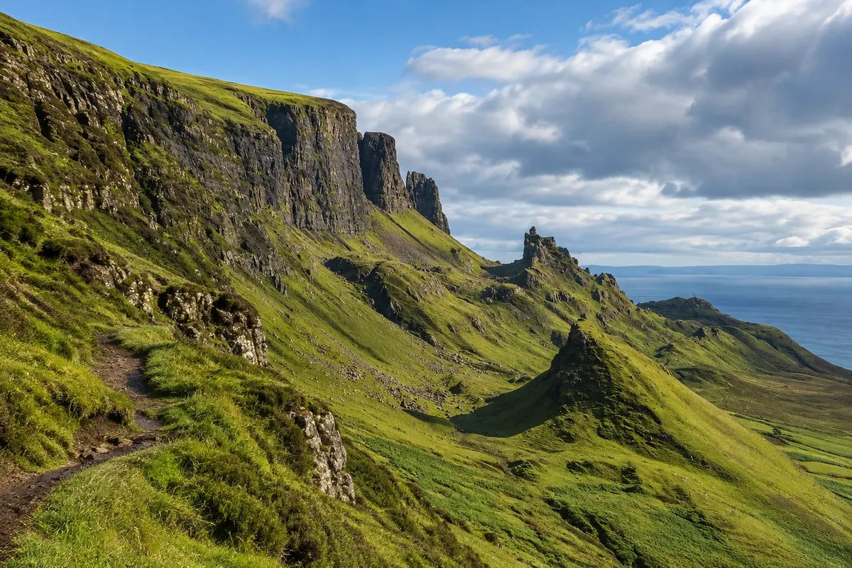
Nature · Portree, Escócia
Quiraing
The cliffs, rock towers and plateaus formed by a large landslide at the northern end of the Trotternish peninsula on Skye, traversed by a circular trail, with Kilt Rock and the Mealt waterfall along the route.
Illustrative images. The pictures in this guide are illustrations based on the real place, not photographs, and may differ from it.

Discover
About Quiraing
The Quiraing is a landslip landscape at the northern tip of the Trotternish ridge on the Isle of Skye. The eastern slope of the mountain has slipped over thousands of years, creating escarpments, loose hills, rock towers and small plateaux in an area that continues to move slowly; the road that crosses the site is repaired every year. Some features have individual names, such as The Needle, a 37-metre pinnacle, The Prison, a block that looks like a fortress, and The Table, a grassy plateau hidden among the rocks.
The single-track road between Staffin and Uig climbs to a car park on the top, from which the trail starts. The most common circuit follows the base of the escarpments to The Needle and The Prison and returns over the top, a loop of about 6.8 km, taking 2 to 3 hours. Even the first section alone, 20–30 minutes, already shows the landscape. The view includes Staffin Bay and, on clear days, the mainland mountains.
On the route between Portree and the Quiraing, the A855 passes Kilt Rock, a basalt cliff with vertical columns resembling the folds of a kilt, and the Mealt waterfall, which drops straight into the sea; a viewpoint with parking shows both. At Staffin, dinosaur footprints appear on the beach at low tide.
The access road is narrow and steep, with tight bends and passing places; it is not recommended for large trailers and motorhomes.
Before you go
Practical information
Cidade Turismo reviews its information regularly, but something may have changed. Check with the place before planning your trip.
How much time to set aside
2 to 3 hours for the full circuit; about 1 hour for a short section and the viewpoints.
Best time
From May to September, on dry days with no low cloud. Early morning or late afternoon there are more parking spaces and side light on the rocks. In rain the trail becomes slippery.
How to get there
It is on the road between Staffin and Uig, about 32 km north of Portree, roughly a 40-minute drive. The Trotternish peninsula bus runs to Staffin, about 4 km from the car park. Tours departing from Portree often include the Quiraing.
Tip
On the same outing do the Old Man of Storr, the Kilt Rock viewpoint and the Quiraing, all on the circuit around the Trotternish peninsula. Stop at the Kilt Rock viewpoint to see the Mealt waterfall dropping into the sea.
Official website
Get your questions answered
Frequently asked questions about Quiraing
What is the Quiraing?
A landscape of escarpments and rock towers formed by a large landslip in north Skye, crossed by trails.
How long does the trail take?
The full circuit is about 6.8 km and takes 2 to 3 hours. A short 30-minute section already shows the scenery.
What is Kilt Rock?
A basalt cliff with vertical columns resembling the pleats of a kilt, with the Mealt waterfall plunging into the sea beside it.
Is the road to the Quiraing difficult?
It's narrow, steep and single-track, with passing places. Drive slowly and give way at the passing places.