

 Brazil
 Argentina
 Chile
Chile Colombia
 Peru
Peru Uruguay
 Germany
 Belgium
 Spain
Spain France
 Greece
 the Netherlands
 Ireland
 Italy
Italy Luxembourg
 Portugal
 Switzerland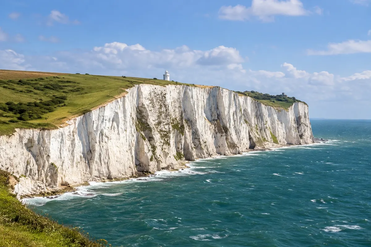
Nature · Dover, Inglaterra
White Cliffs of Dover
The white limestone cliffs above the English Channel, rising to about 110 metres, traversed by a National Trust trail to the South Foreland lighthouse, with views to France on clear days.
Illustrative images. The pictures in this guide are illustrations based on the real place, not photographs, and may differ from it.

Discover
About White Cliffs of Dover
As Falésias Brancas de Dover are chalk cliffs that stretch for about 13 km along the coast of Kent, on both sides of the port of Dover, and reach around 110 metres high. The chalk was formed tens of millions of years ago from the remains of tiny marine organisms, and the white colour is highlighted by dark bands of flint. For the British, the cliffs symbolize coming home, celebrated in songs of the Second World War.
The most visited section lies east of the port and belongs to the National Trust, with a visitor centre atop the Langdon Cliffs. From there the trail runs along the cliff top across short-grass pastures where Exmoor ponies graze, used to manage the vegetation. The trail continues to the Victorian lighthouse South Foreland, from which Marconi conducted radio experiments and which can be visited on certain days, and goes on to the village of St Margaret's at Cliffe.
Along the way, the Fan Bay Deep Shelter, Second World War tunnels dug into the cliff, offer guided visits with helmets, and the viewpoints show the ferries entering and leaving the port. On clear days, the coast of França, about 33 km away, appears on the horizon. Seabirds, such as fulmars, nest on the cliffs.
The trail is on dirt and grass, with ups and downs, and there is no protection at the cliff edge: keep away from the edge, which can give way.
Before you go
Practical information
Cidade Turismo reviews its information regularly, but something may have changed. Check with the place before planning your trip.
How much time to set aside
About 1.5 to 3 hours to go from the visitor centre to the South Foreland lighthouse and back, roughly 6 km in total.
Best time
On clear days, from spring to autumn, to see França on the horizon. In the late afternoon the low light enhances the white of the cliffs. It is very windy at the top: bring a coat.
How to get there
The National Trust visitor centre is on Upper Road, about 3 km from Dover town centre. From Dover Priory station, take local buses or a taxi; on foot there's a path that climbs from the port, about 45 minutes. By car, paid parking is available at the visitor centre.
Tip
To see the cliffs head to the Dover waterfront or take a boat trip from the port when available. On the cliff top, keep away from the edge and stay on the marked trails.
Official website
Get your questions answered
Frequently asked questions about White Cliffs of Dover
Can you see França from the Falésias Brancas?
On clear days, yes: the coast of França is about 33 km away and appears on the horizon.
Is the trail difficult?
It's a dirt-and-grass path with moderate ups and downs. From the visitor centre to the South Foreland lighthouse is about 3 km.
Where to see the cliffs head-on?
From the Dover waterfront and beach near the port, or on a boat trip when available.
Is there protection at the edge?
No. Stay on the paths and well away from the edge, which can give way.