

 Brazil
 Argentina
 Chile
Chile Colombia
 Peru
Peru Uruguay
 Germany
 Belgium
 Spain
Spain France
 Greece
 the Netherlands
 Ireland
 Italy
Italy Luxembourg
 the United Kingdom
 Switzerland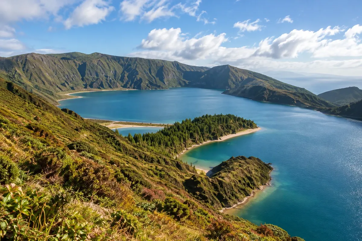
Lagoon · Ponta Delgada, Açores
Lagoa do Fogo
Lake in a volcanic crater in central São Miguel, at about 575 metres altitude, with blue water and a white-sand beach, in a nature reserve with no buildings.
Illustrative images. The pictures in this guide are illustrations based on the real place, not photographs, and may differ from it.

Discover
About Lagoa do Fogo
Lagoa do Fogo lies in the volcanic massif of the Serra de Água de Pau, in central São Miguel, about 30 km from Ponta Delgada. It occupies a crater formed in a 16th-century eruption.
The lake has blue water, margins with small pale-sand beaches and slopes covered in native vegetation. The area is a nature reserve and has no buildings.
On the road that runs along the crater rim there are viewpoints overlooking the lake and, on the other side, the sea on both coasts of the island. A trail descends to the shore.
In summer, car access to the lake road is often replaced by a shuttle service from Lagoa and Ribeira Grande to protect the area.
Before you go
Practical information
Cidade Turismo reviews its information regularly, but something may have changed. Check with the place before planning your trip.
How much time to set aside
From one hour up to half a day, including the trail down to the shore.
Best time
On clear days: with clouds, the lake disappears. In summer, check access rules and the shuttle timetable before you go.
How to get there
It is about 30 km from Ponta Delgada, on the road between Lagoa and Ribeira Grande. Outside summer you can drive to the viewpoints; in summer use the organised transport.
Tip
The trail down to the shore is steep and can be muddy; wear hiking shoes. Do not leave litter: it is a nature reserve.
Get your questions answered
Frequently asked questions about Lagoa do Fogo
Can you get to Lagoa do Fogo by car?
Outside of summer, yes, up to the viewpoints. In summer, access is usually by organized transport.
Can you go down to the lake?
Yes, by a steep trail from the viewpoint.
At what altitude is Lagoa do Fogo?
About 575 meters.