

 Brazil
 Argentina
 Chile
Chile Colombia
 Peru
Peru Uruguay
 Germany
 Belgium
 Spain
Spain France
 Greece
 the Netherlands
 Ireland
 Portugal
 the United Kingdom
 Switzerland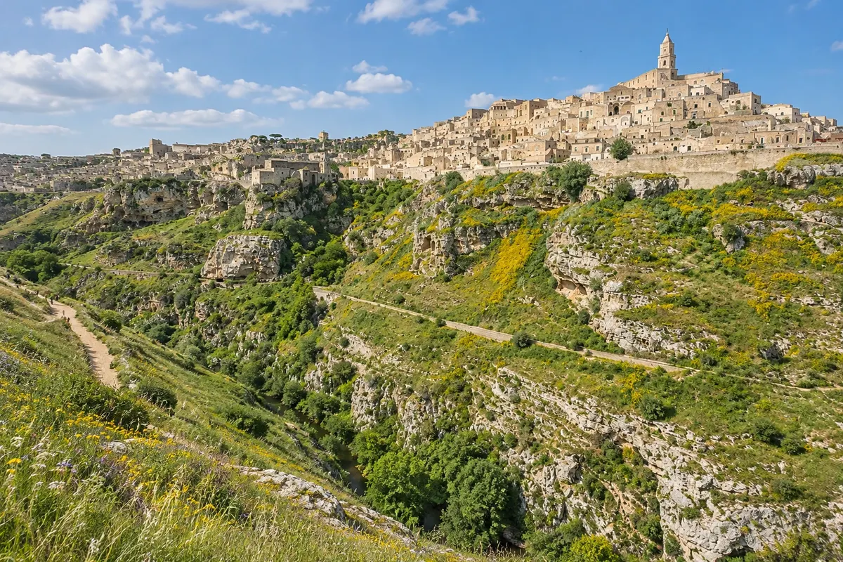
Park · Matera, Basilicata
Parco della Murgia Materana
Park of the rock-cut churches on the other side of the Gravina ravine, with dozens of excavated churches, Neolithic villages and the Belvedere di Murgia Timone, which faces Matera.
Illustrative images. The pictures in this guide are illustrations based on the real place, not photographs, and may differ from it.

Discover
About Parco della Murgia Materana
The Parco della Murgia Materana, officially Parco archeologico storico naturale delle Chiese rupestri del Materano, was created in 1990. In 2007 the area became part of the UNESCO heritage along with the Sassi. It covers the limestone plateau of the Murgia and the slopes of the Gravina, between Matera and Montescaglioso.
The park has about 150 rock-cut churches scattered along the slopes, many with frescoes, as well as Paleolithic remains and Neolithic villages surrounded by ditches. The vegetation is typical Mediterranean scrub, with shrubs and aromatic herbs.
The most visited spot is the Belvedere di Murgia Timone, overlooking the Sassi. From there you can see the whole town perched on the ravine, with the cathedral at the top. Near the viewpoint there are rock churches such as the Madonna delle Tre Porte.
A trail links the Sassi to the Murgia, descending to the bottom of the Gravina and crossing the stream. It is a walk with elevation change and loose stones, for those who are prepared.
Before you go
Practical information
Cidade Turismo reviews its information regularly, but something may have changed. Check with the place before planning your trip.
How much time to set aside
From 1 to 3 hours, depending on whether you only go to the viewpoint or do the trail.
Best time
In spring, from March to May, when flowers bloom, or at sunset when the light hits the Sassi directly. In summer, from June to August, avoid the trails during the hottest hours: there is little shade.
How to get there
By car, about 15 minutes via the road to Laterza, with signs for Murgia Timone. On foot, via the trail that descends from the Sasso Caveoso to the bottom of the Gravina and climbs up the other side, with elevation change. The park headquarters are in the Sassi.
Tip
Bring water, a hat and hiking shoes. To visit the park's rock churches, look for authorized guided tours; many caves remain closed without a guide. Check trail conditions before going.
Official website
Get your questions answered
Frequently asked questions about Parco della Murgia Materana
From where can you get a frontal view of the Sassi?
From the Belvedere di Murgia Timone, on the other side of the ravine, inside the park.
Can you walk there from the Sassi?
Yes, via a trail that descends to the bottom of the Gravina and climbs up the other side. Requires fitness and appropriate footwear.
Are the rock-cut churches in the park open?
Many can only be visited with a guide. Look for authorized guided tours.
How much time should you allow?
From 1 hour, just for the viewpoint, up to 3 hours with the trail.