

 Brazil
 Argentina
 Chile
Chile Colombia
 Peru
Peru Uruguay
 Germany
 Belgium
 Spain
Spain France
 Greece
 the Netherlands
 Italy
Italy Luxembourg
 Portugal
 the United Kingdom
 Switzerland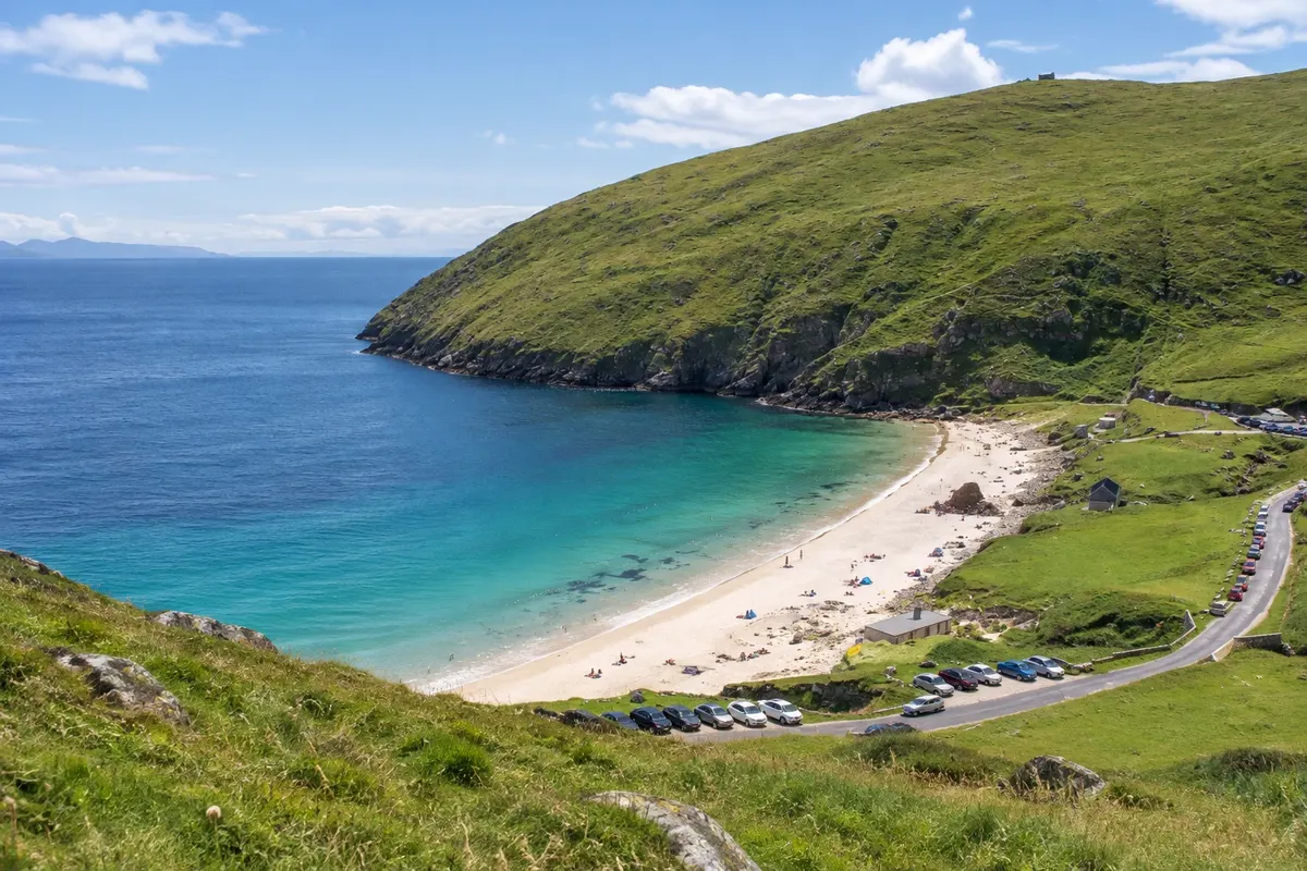
Beach · Westport, Mayo
Achill Island
The largest island in Ireland, connected to the mainland by a bridge, with Keem Bay tucked between cliffs, sandy beaches, the Atlantic Drive and the deserted village of Slievemore.
Illustrative images. The pictures in this guide are illustrations based on the real place, not photographs, and may differ from it.

Discover
About Achill Island
Achill is Ireland's largest island, about 148 km², on the west coast of Mayo, connected to the mainland by a bridge at Achill Sound. The island has mountains, bogland, cliffs among the highest in Europe at Croaghaun, and sandy beaches; part of it is Gaeltacht, where Irish is spoken.
The Atlantic Drive, the southern coastal road, passes coves, tower ruins and viewpoints. At the western extreme, after the village of Dooagh, the road winds up and down to Keem Bay, a cove of pale sand and green water between the slopes of Croaghaun. It is Achill's best-known image. Keel and Dugort have other long beaches, popular for surfing and walking.
On the slope of Slievemore lies the Deserted Village, a settlement of some 80–100 abandoned stone cottages, lined along a track. People lived there until the 19th century and later used the houses only in summer for grazing cattle, until the early 20th century. The walls remain standing, without roofs.
The island marks the end of the Great Western Greenway and has guesthouses, pubs and restaurants in Keel, Dooagh and Achill Sound. Painter Paul Henry and writer Heinrich Böll spent seasons on Achill, and Böll's house hosts artists.
Before you go
Practical information
Cidade Turismo reviews its information regularly, but something may have changed. Check with the place before planning your trip.
How much time to set aside
A full day by car, covering the Atlantic Drive, Keem Bay and the Deserted Village; two days for hikes and beaches.
Best time
From May to September on clear days for Keem Bay and the Atlantic Drive. The road to Keem is narrow and gets busy on summer weekends: go early. In strong winds the cliffs can be obscured.
How to get there
The Achill Sound bridge is about 40 km northwest of Westport via the N59 and R319. Keem Bay is about 20 km beyond the bridge. There are buses from Westport to the island at certain times, and the Greenway ends at Achill Sound.
Tip
Do the Atlantic Drive on the outward leg and leave Keem Bay for late afternoon, with low light. In the Deserted Village, follow the path between the cottages to the old cemetery at the start of the settlement.
Get your questions answered
Frequently asked questions about Achill Island
How do you get to Achill?
Via the Achill Sound bridge, about 40 km northwest of Westport. No boat is needed.
What is the Deserted Village?
A village of about 80 to 100 abandoned stone houses on the slope of Slievemore, occupied until the 19th century and later used only in summer.
Can you swim at Keem Bay?
Yes, on the warmest days, but the water is cold even in summer. The cove is usually sheltered from the wind.