

 Brazil
 Argentina
 Chile
Chile Colombia
 Peru
Peru Uruguay
 Germany
 Belgium
 Spain
Spain France
 Greece
 the Netherlands
 Italy
Italy Luxembourg
 Portugal
 the United Kingdom
 Switzerland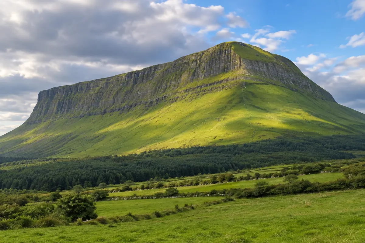
Trail · Sligo, Sligo
Benbulben
A 526-metre limestone mountain with a flat top and grooved slopes, dominating the landscape north of Sligo, with a 4 km forest trail at the foot of the escarpment.
Illustrative images. The pictures in this guide are illustrations based on the real place, not photographs, and may differ from it.

Discover
About Benbulben
Benbulben, in Irish Binn Ghulbain, is a 526-metre limestone mountain rising north of Sligo, between Drumcliff and the coast. It was sculpted by the glaciers of the last Ice Age, which left the flat top and steep slopes with vertical grooves, a shape that makes it recognizable from afar. It is part of the Dartry Mountains.
The mountain appears in Irish legends: it is the place of Diarmuid's death, pursued by Fionn mac Cumhaill in the Fenian cycle. It also appears in Yeats's work; he asked to be buried beneath Benbulben, in Drumcliff.
The flat summit supports rare arctic and alpine plants that have survived since the end of the Ice Age. The ascent to the top has no official path and crosses private land and steep slopes. For visitors, the suggested route is the Benbulbin Forest Walk, a circular trail of about 4 km on a dirt track through the forest at the foot of the northern escarpment, with views of the mountain and Sligo Bay.
The best place to see Benbulben head-on is the N15 road near Drumcliff, or the churchyard itself where Yeats is buried.
Before you go
Practical information
Cidade Turismo reviews its information regularly, but something may have changed. Check with the place before planning your trip.
How much time to set aside
1.5 to 2 hours for the forest trail; 20 minutes for the view from Drumcliff.
Best time
Late afternoon, when the low light highlights the grooves in the slopes. With low cloud the summit disappears. The forest trail is suitable at any time of year.
How to get there
The Benbulbin Forest Walk starts from a car park on the local Ballintrillick road, about 15 km north of Sligo, off the N15. There is no public transport to the trail.
Tip
Do the forest walk clockwise and stop at the clearing with a view of the escarpment. Combine it with Drumcliff, 8 km away, from where the classic photo of the mountain is taken.
Get your questions answered
Frequently asked questions about Benbulben
Can you climb to the top of Benbulben?
There is no official trail to the summit, and the route crosses private land and steep slopes. The suggested trail is the forest track, about 4 km, at the foot of the mountain.
How high is Benbulben?
526 metres, with a flat top and steeply grooved cliffs.
Where can you see the mountain head-on?
From the N15 road near Drumcliff and from the churchyard of Drumcliff, where Yeats is buried.