

 Brazilija
 Antarktika
 Bolivija
 Čile
 Kolumbija
 Ekvator
 Gvajana
 Francoska Gvajana
 Falklandski otoki (Malvini)
 Paragvaj
 Peru
 Surinam
 Urugvaj
 Venezuela
 Nemčija
 Avstrija
 Belgija
 Hrvaška
 Danska
 Slovaška
 Slovenija
 Španija
 Finska
 Francija
 Grčija
 Nizozemska
 Madžarska
 Irska
 Islandija
 Italija
 Luksemburg
 Norveška
 Poljska
 Portugalska
 Združeno kraljestvo
 Češka
 Švedska
 Švica
 Turčija
 Bermudi
 Kanada
 Združene države Amerike
 Grenlandija
 Mehika
 Sveta Peter in Mihael
 Dominikanska republika
 Japonska
 Južnoafriška republika
 Egipt
 Avstralija
 Fidži
 Nova Zelandija
 Papua Nova Gvineja
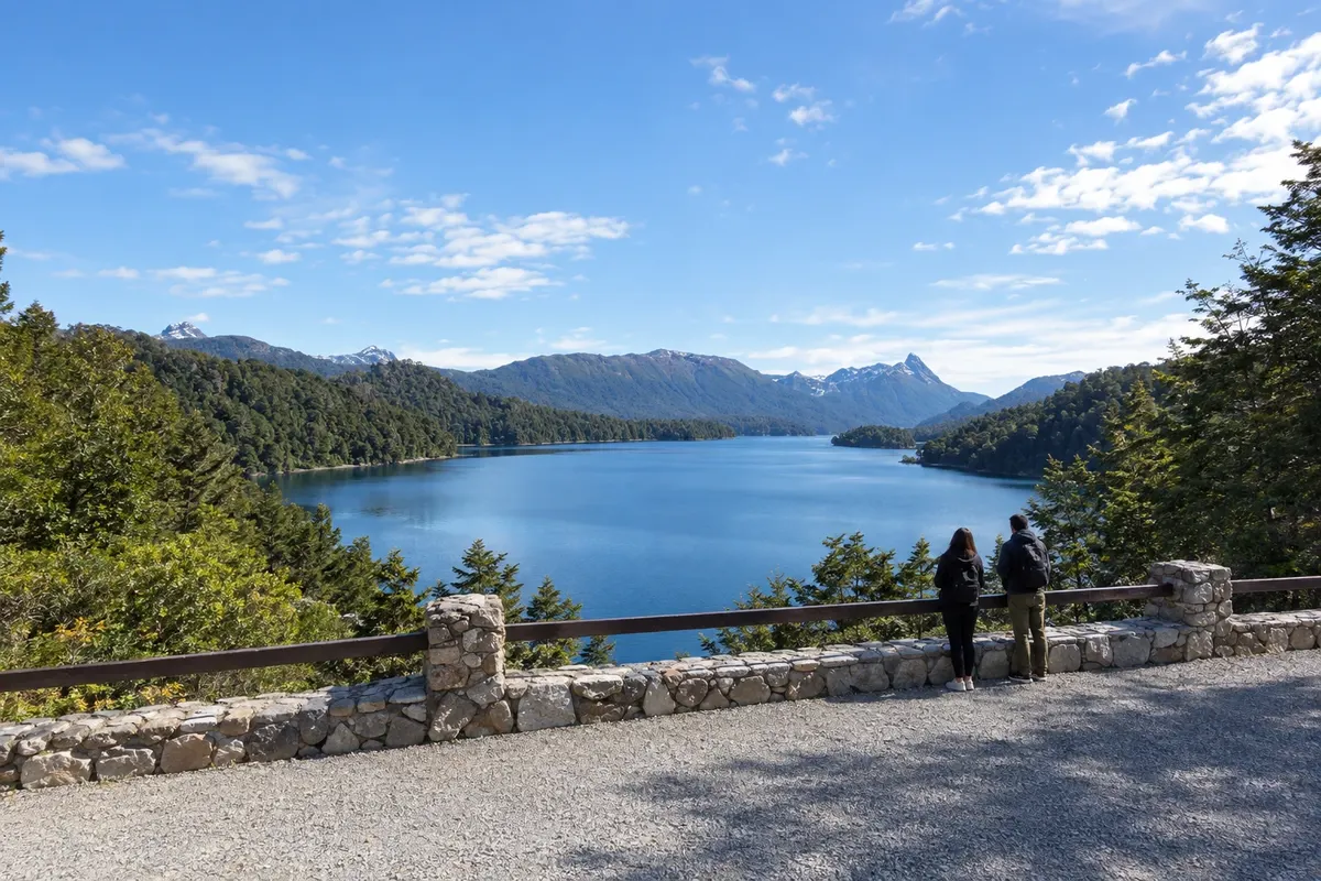
Pot · Río Negro · Neuquén
Road of the Seven Lakes
From the Nahuel Huapi shoreline in Bariloche to the lakes along RN 40, via Villa La Angostura and San Martín de los Andes.
Na fotografiji: Lago Espejo, Camino de los Siete Lagos
Illustrative images. The pictures in this guide are illustrations based on the real place, not photographs, and may differ from it.


Pot
Road of the Seven Lakes – predstavitev
The Road of the Seven Lakes connects San Carlos de Bariloche, Villa La Angostura and San Martín de los Andes. RN 40 leaves along the Nahuel Huapi shore, passes through Dina Huapi and crosses the Limay River before reaching Villa La Angostura. This first stage brings travelers closer to Neuquén’s lake corridor.
Between Villa La Angostura and San Martín de los Andes, RN 40 crosses Nahuel Huapi and Lanín national parks. Espejo, Correntoso and Escondido appear in the southern section. Villarino and Falkner are nearby; Machónico precedes the arrival at the Lácar shore. Viewpoints and local access points let you space out stops to enjoy the scenery.
The three towns serve as bases, and road stops take time in addition to travel. The RN 40 axis is paved. Access roads to shores, beaches and side excursions can have a different surface than RN 40.
Zemljevid
Število mest na poti: 3
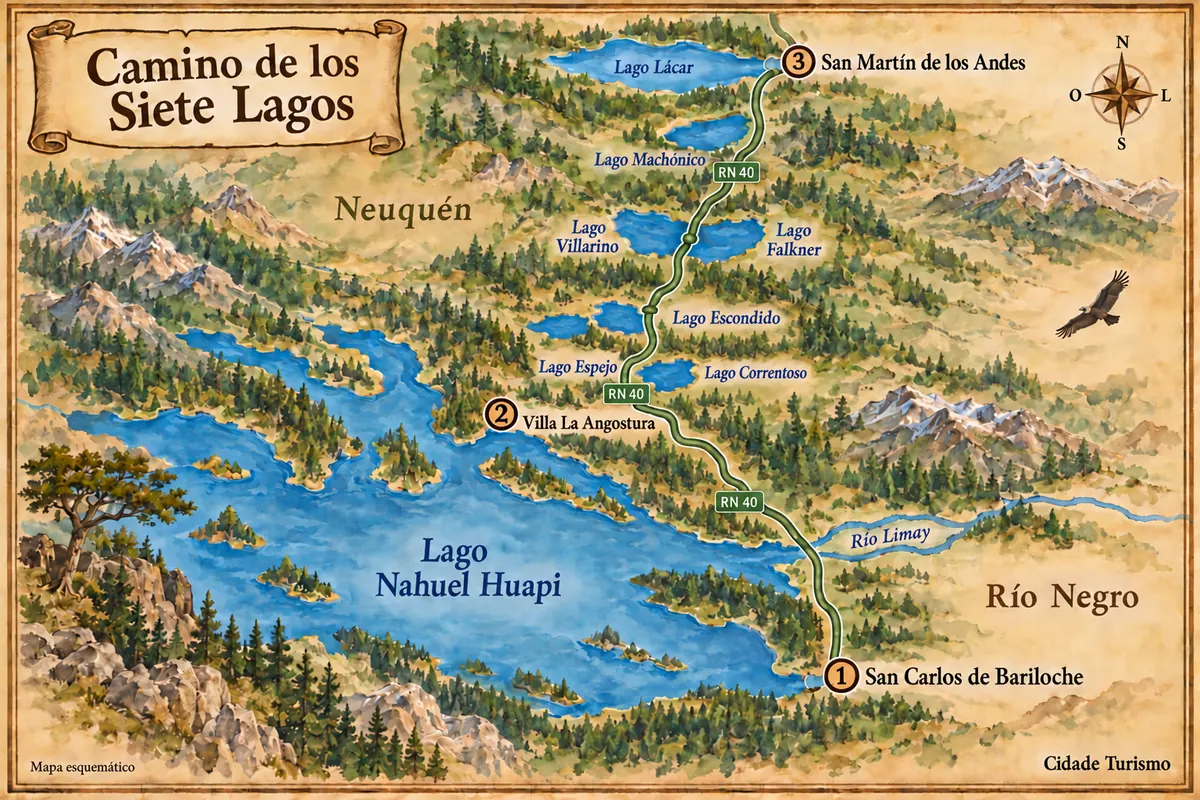
Vir: Instituto Geográfico Nacional de la República Argentina (IGN), obrisi iz leta 2019. Priredba: Cidade Turismo.
Potek poti
Od mesta do mesta
Razdalje in časi so okvirni. Preverite jih pred odhodom.
-
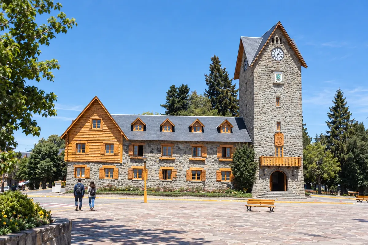 1 · Río Negro
Bariloche
San Carlos de Bariloche lies on the southern shore of Nahuel Huapi and receives flights at BRC airport. The Centro Cívico and lake excursions provide context for the first base. The departure along RN 40 passes through Dina Huapi and crosses the Limay, adding an approach stage to Neuquén's Seven Lakes core.
→ Villa La Angostura približno 83 km RN 40 pela costa do Nahuel Huapi, com passagem por Dina Huapi e travessia do rio Limay. A estrada asfaltada contorna o setor nordeste do lago antes de entrar em Villa La Angostura.
-
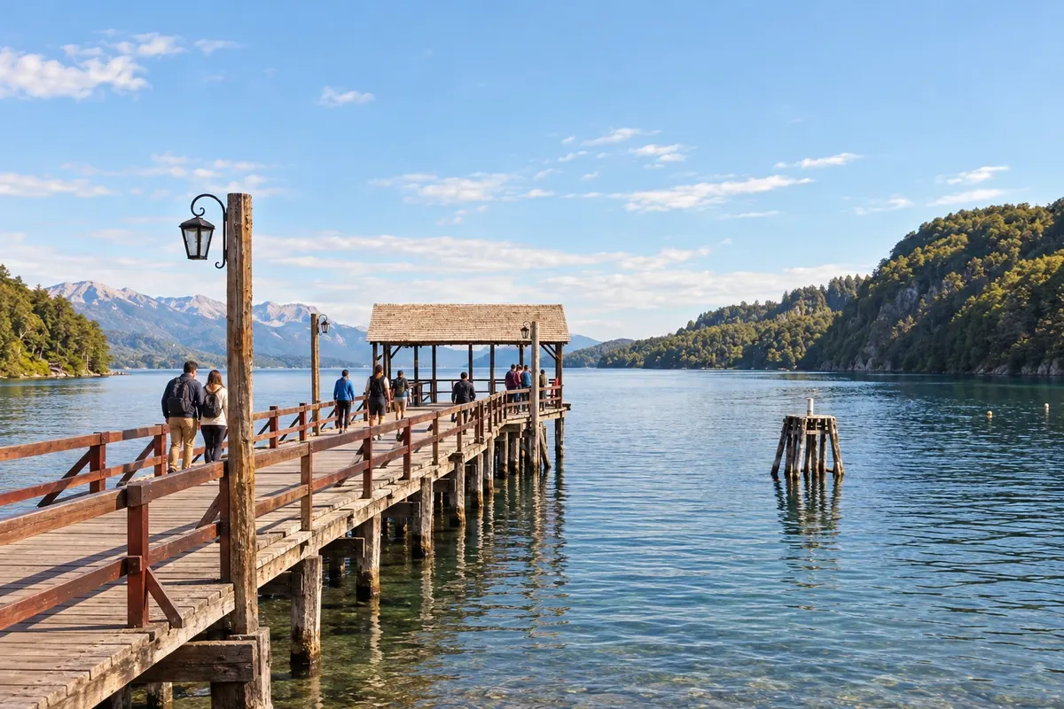 2 · Neuquén
Villa La Angostura
Villa La Angostura sits beside Nahuel Huapi and the southern sector of Correntoso. The town marks the transition from the arrival from Bariloche to the scenic RN 40 corridor. Bahía Mansa and the Bosque de Arrayanes are local excursions with their own access points, separate from roadside stops.
→ San Martín de los Andes približno 110 km RN 40 asfaltada, entre bosques dos parques Nahuel Huapi e Lanín. Mirantes aproximam a visita de Espejo, Correntoso, Escondido, Villarino, Falkner e Machónico; a chegada a San Martín acompanha o Lácar.
-
 3 · Neuquén
San Martín de los Andes
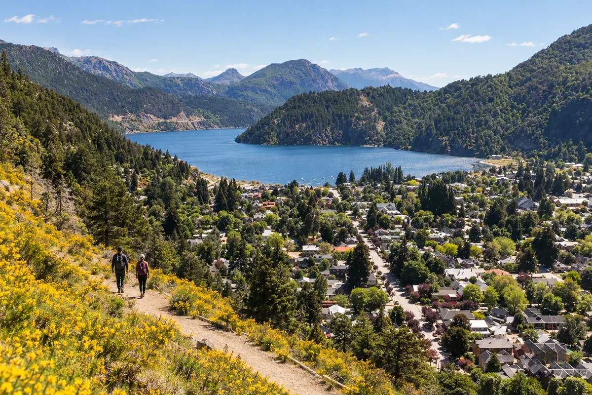
San Martín de los Andes sits on the eastern shore of Lago Lácar and serves as a base in Lanín National Park. RN 40 arrives via the forest corridor and brings the traveler close to the costanera. The Bandurrias and Arrayán viewpoints extend the time spent in town beyond the road arrival.
Koliko dni
Allow three to five days to split time between the three bases and the lake stops. A full-day tour provides a first look at the road; staying overnight in Angostura or San Martín increases the time to walk along the shores. The return to Bariloche should also be included in your planning.
Najboljši čas za obisk
From September to March, longer days favor spreading out the stops. December to February usually concentrates summer activity. From June to September, snow often appears in mountain areas and can change the pace of travel. April and May have shorter days and temperatures that usually drop late in the afternoon.
The seasons shown are the most usual ones; nature doesn't always follow the calendar.
Kako prepotovati pot
Follow RN 40 and use designated stopping areas, without parking on the roadway. Car, motorcycle or organized tour allow stopping at viewpoints; scheduled buses do not offer the same sequence of stops. Top up fuel and meals in the towns. Check the requirements to drive with a Brazilian license before traveling.
Komu je pot namenjena
For travelers combining Patagonian roads, lake viewpoints and excursions in the three towns, with time for the shores and the woods.
Odgovori na vaša vprašanja
Pogosta vprašanja – Road of the Seven Lakes
Preciso de carro para percorrer os lagos?
Carro ou excursão permitem parar nos pontos de observação. Ônibus entre cidades percorrem o corredor, mas não oferecem a mesma sequência de mirantes.
Há trecho de terra obrigatório no caminho principal?
O eixo da RN 40 é asfaltado. Desvios para margens e outros lagos podem ter outro piso; verifique o acesso de cada passeio.
Dá para fazer em um dia saindo de Bariloche?
Uma excursão de dia inteiro permite percorrer a estrada e escolher paradas. Dormir em Villa La Angostura ou San Martín dá mais tempo aos lagos e reduz os deslocamentos de ida e volta no mesmo dia.
Quais lagos dão nome ao núcleo do caminho?
Espejo, Correntoso, Escondido, Villarino, Falkner, Machónico e Lácar. O Nahuel Huapi aparece na chegada desde Bariloche e na região de Angostura, como parte de um contexto maior de lagos.
Como muda a viagem de junho a setembro?
Neve e temperaturas baixas costumam mudar a paisagem e o tempo de deslocamento. Consulte as condições da RN 40 e dos acessos antes de sair.
Več kot vodnik


