

 Brazil
 Argentina
 Chile
Chile Colombia
 Peru
Peru Uruguay
 Germany
 Belgium
 France
 Greece
 the Netherlands
 Ireland
 Italy
Italy Portugal
 the United Kingdom
 Switzerland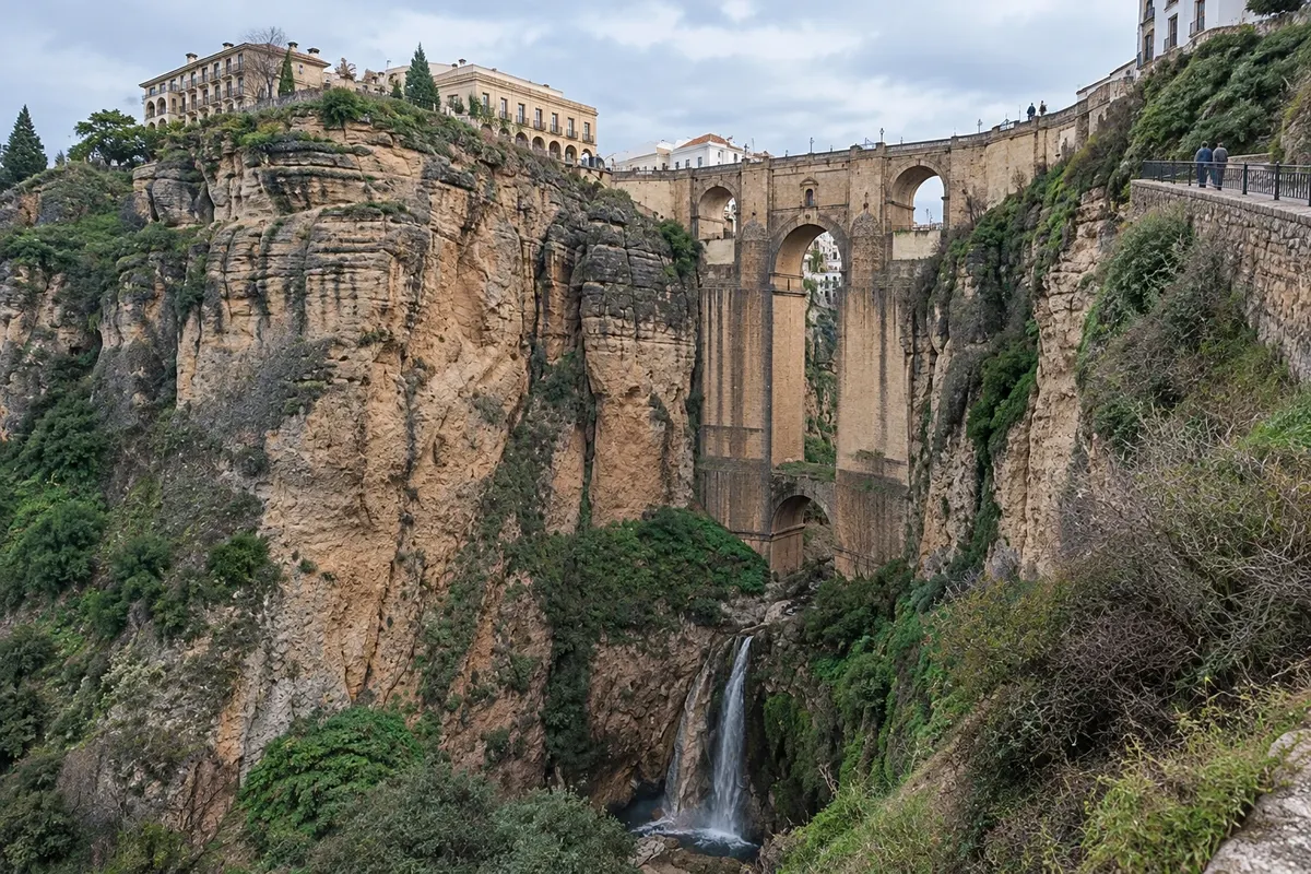
Bridge · Ronda, Andaluzia
Puente Nuevo
The stone bridge, 98 meters high, completed in 1793, spans the Tajo de Ronda and links the old town to the Mercadillo neighbourhood. An interpretation center operates inside it.
Illustrative images. The pictures in this guide are illustrations based on the real place, not photographs, and may differ from it.

Discover
About Puente Nuevo
Ronda occupies a rocky plateau 723 meters above sea level, split in half by the Tajo, a gorge about 100 meters deep carved by the Guadalevín River. On one side is La Ciudad, the old Muslim medina. On the other is the Mercadillo, a neighborhood that grew after the Christian conquest of 1485. The Puente Nuevo links the two halves.
The first attempt was in 1735, during the reign of Felipe V: a single 35-meter arch built in eight months. Six years later the structure collapsed and killed around 50 people. The current work began in the 1750s and was inaugurated in May 1793, during the Feria de Mayo. The architect who completed it was José Martín de Aldehuela, born in Manzanera, in the province of Teruel.
After the disaster, the solution was conservative: instead of a huge span, the gorge was filled with masonry until a smaller central arch could be built, supported by another arch next to the river. The bridge measures 98 meters in height and about 70 meters in length. The stone was quarried from the bottom of the gorge itself, which is why its color blends with the walls of the Tajo.
Above the central arch there is a chamber that has served as a prison and later as a tavern. Today it houses the Centro de Interpretación del Puente Nuevo, with the history of the construction and its surroundings. Next to the bridge are two viewpoints: the Mirador de Aldehuela, named after the architect, and, a little below, the Jardines de Cuenca, terraced on the edge of the Tajo with a view of the bridge.
Before you go
Practical information
Cidade Turismo reviews its information regularly, but something may have changed. Check with the place before planning your trip.
How much time to set aside
Crossing the bridge and looking from the viewpoints takes 20 to 30 minutes. The interpretation center adds about 30 minutes. Those who descend the trails to see the bridge from below should allow an additional 1 to 2 hours.
Best time
Early in the morning, before the tour buses arrive from the Costa del Sol, and in the late afternoon, when the low light illuminates the stone. At night the bridge is lit.
How to get there
It is in the center of Ronda, next to the Plaza de España. From the train station it is about 1 km on foot, roughly 15 minutes via Calle Carrera Espinel or Calle Virgen de la Paz. From the bus station it's about 10 minutes.
Tip
Cross the bridge and turn left toward the Mirador de Aldehuela and the Jardines de Cuenca: from there you can see the bridge side-on. The interpretation center is included in the municipal tourist pass, along with the Baños Árabes and the Palacio de Mondragón. The trails that descend to the bottom of the Tajo have steps and loose soil: wear sneakers. Confirm opening times before you go.
Official website
Get your questions answered
Frequently asked questions about Puente Nuevo
How high is the Puente Nuevo in Ronda?
It is 98 metres high from the riverbed of the Guadalevín to the bridge deck. The length is about 70 metres.
Who built the Puente Nuevo?
The work was completed by architect José Martín de Aldehuela and inaugurated in May 1793. An earlier bridge from 1735 collapsed six years after it was finished.
Can you enter the Puente Nuevo?
Yes. The chamber above the central arch, which was once a prison, houses the Centro de Interpretación del Puente Nuevo, with paid entry and access by stairs. It is not wheelchair accessible.
Where is the best viewpoint for the Puente Nuevo?
From the old town side, the Mirador de Aldehuela and the Jardines de Cuenca offer a side view of the bridge. To see it from below there are trails descending the slope from the Plaza de María Auxiliadora, with steps and dirt stretches.