

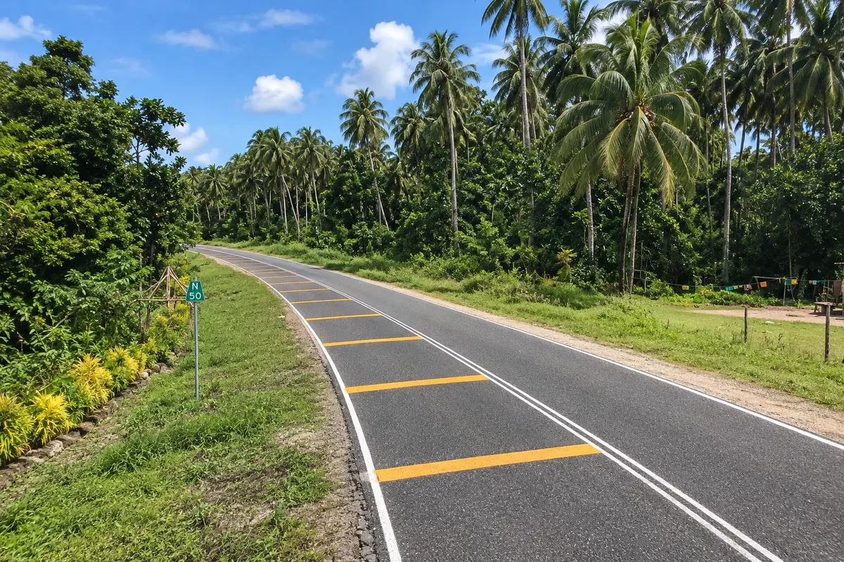
Scenic road
Boluminski Highway
A paved road of about 293 km along New Ireland’s east coast, from Kavieng to Namatanai, passing beaches, villages and coconut plantations, popular for cycling trips.

 Išči
 Brazilija
 Antarktika
 Argentina
 Bolivija
 Čile
 Kolumbija
 Ekvator
 Gvajana
 Francoska Gvajana
 Falklandski otoki (Malvini)
 Paragvaj
 Peru
 Surinam
 Urugvaj
 Venezuela
 Nemčija
 Avstrija
 Belgija
 Hrvaška
 Danska
 Slovaška
 Slovenija
 Španija
 Finska
 Francija
 Grčija
 Nizozemska
 Madžarska
 Irska
 Islandija
 Italija
 Luksemburg
 Norveška
 Poljska
 Portugalska
 Združeno kraljestvo
 Češka
 Švedska
 Švica
 Turčija
 Bermudi
 Kanada
 Združene države Amerike
 Grenlandija
 Mehika
 Sveta Peter in Mihael
 Dominikanska republika
 JaponskaTurčija
 Južnoafriška republika
 Egipt
 Avstralija
 Fidži
 Nova ZelandijaPapua Nova Gvineja
Nova Irlanda · Papua Nova Gvineja Capital
Destinacija: Kavieng and New Ireland.
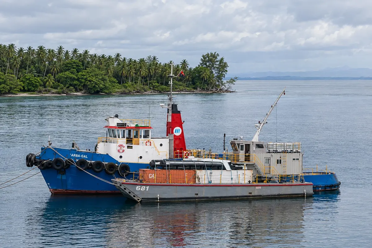
Na fotografiji: Kavieng Harbor
Illustrative images. The pictures in this guide are illustrations based on the real place, not photographs, and may differ from it.
Mesto
Kavieng is the capital and largest town of New Ireland, at the island’s northern tip on Balgai Bay. It survives on diving, surfing and fishing, with islets and reefs a few minutes by boat. On Harbour Road a Japanese cannon atop a bunker recalls the Second World War occupation. From there the Boluminski Highway departs, following the east coast to Namatanai and passing the Laraibina eel sanctuary.
V vodniku še ni nastanitev – Kavieng.
kako do tja · koliko dni · načrt poti · vprašanja
Doživite kraj
A paved road of about 293 km along New Ireland’s east coast, from Kavieng to Namatanai, passing beaches, villages and coconut plantations, popular for cycling trips.
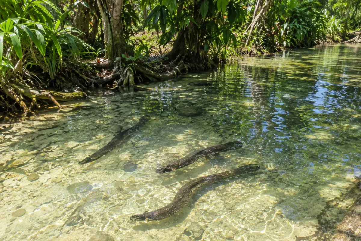
Stream at the village of Laraibina on the east coast of New Ireland, where large freshwater eels, considered sacred by the community, come to be fed.
Large World War II gun mounted atop a bunker on Harbour Road in Kavieng, one of the remains of the Japanese occupation of New Ireland between 1942 and 1945.
Pred odhodom
Kavieng – New Ireland Capital
Razdalje so približne. Pred potovanjem preverite lete in vozne rede avtobusov, vlakov ali ladij.
Via Kavieng Airport (KVG), a few minutes from town, with daily flights from Port Moresby.
Three or four days: two for diving or surfing, one for the town and the cannon on Harbour Road, and one for the Boluminski Highway to Laraibina.
Surfing runs from November to April. From May to October the sea is usually calmer, good for diving and boat trips. It rains throughout the year.
The seasons shown are the most usual ones; nature doesn't always follow the calendar.
Not for the town and boats. For the Boluminski Highway, visitors usually take tours with a driver or ride a bicycle, organized by local operators.
Predlog poti
Pot povezuje znamenitosti na tej strani. Za oglede boste imeli dovolj časa.
Take a boat out to the reefs and channels around Kavieng for diving or, in the November–April season, for reef waves.
In the afternoon stroll through town, the market and Harbour Road, where the Japanese cannon sits atop a Second World War bunker.
At sunset watch Balgai Bay and the islets off the town, with fishing boats returning.
Have dinner at your lodging, which usually serves fish and seafood, and arrange your Boluminski Highway trip.
Dan 2
Follow the Boluminski Highway past beaches and villages to Laraibina to see the stream’s eels, with a stop for a swim in a freshwater pool.
Check before you go. Opening hours and days change, and places may close for renovations, holidays or events. This itinerary is a suggestion from Cidade Turismo, not a commitment: plan yours by checking directly with each place you intend to visit.
Pred odhodom
Dive in channels and wrecks, surf from November to April, see the Japanese cannon on Harbour Road, and travel the Boluminski Highway to Laraibina’s eels.
Yes. Kavieng Airport receives daily flights from Port Moresby.
In the town center or along the bay near the airport, or on one of the nearby islands reached by boat. Accommodations organize diving and surfing trips.
Yes. The town was occupied by the Japanese from 1942 to 1945 and was nearly destroyed. The cannon on the Harbour Road bunker and the sunken wrecks in the area recall that period.
Več kot vodnik


