

Yakushima · Kagoshima · Forest
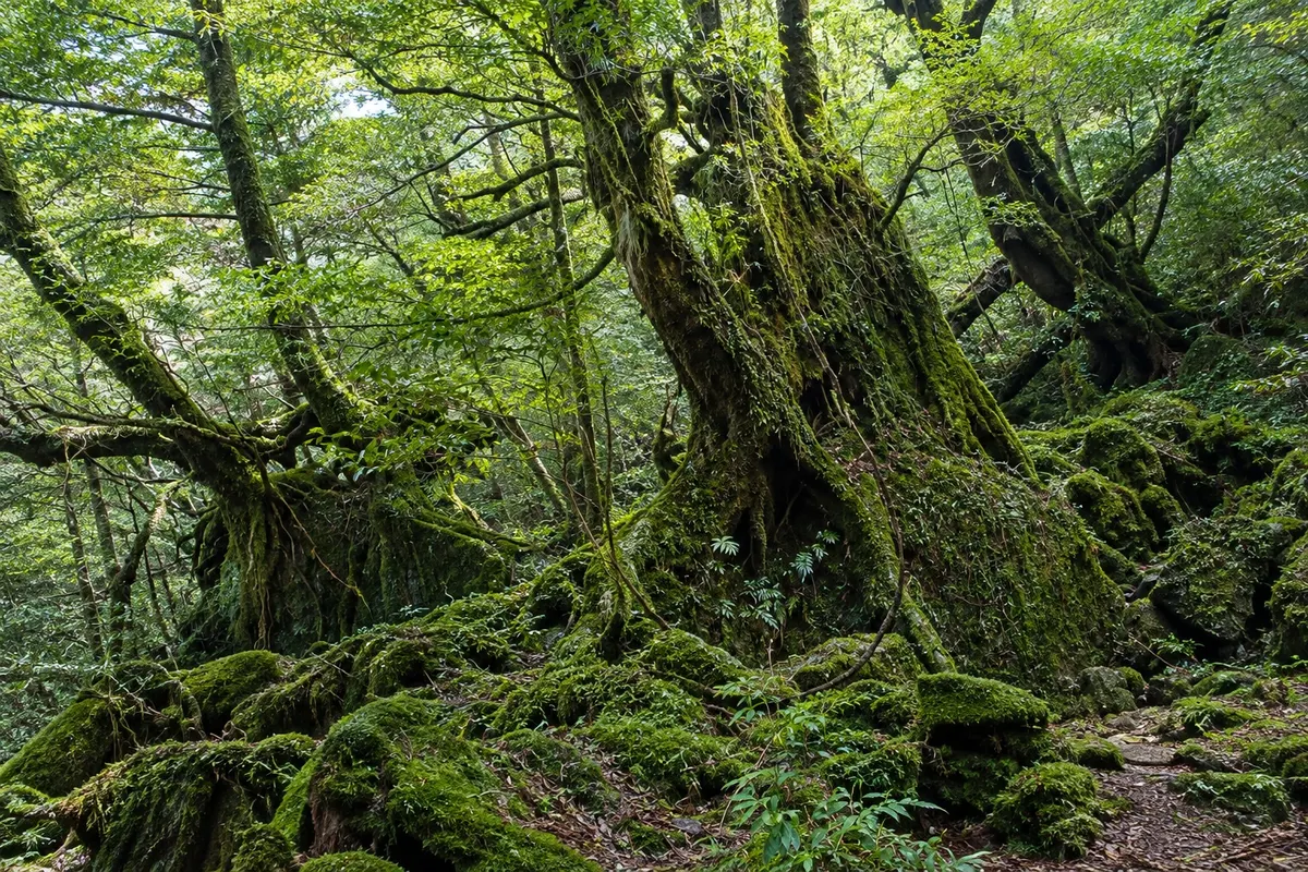
Shiratani Unsuikyo
A humid forest valley above Miyanoura, with millenary cedars, streams and moss-covered rocks; trails of 1 to 5 hours lead to the Moss Forest and the Taikoiwa rock.

 Išči
 Brazilija
 Antarktika
 Argentina
 Bolivija
 Čile
 Kolumbija
 Ekvator
 Gvajana
 Francoska Gvajana
 Falklandski otoki (Malvini)
 Paragvaj
 Peru
 Surinam
 Urugvaj
 Venezuela
 Nemčija
 Avstrija
 Belgija
 Hrvaška
 Danska
 Slovaška
 Slovenija
 Španija
 Finska
 Francija
 Grčija
 Nizozemska
 Madžarska
 Irska
 Islandija
 Italija
 Luksemburg
 Norveška
 Poljska
 Portugalska
 Združeno kraljestvo
 Češka
 Švedska
 Švica
 Turčija
 Bermudi
 Kanada
 Združene države Amerike
 Grenlandija
 Mehika
 Sveta Peter in Mihael
 Dominikanska republikaJaponskaTurčija
 Južnoafriška republika
 Egipt
 Avstralija
 Fidži
 Nova Zelandija
 Papua Nova Gvineja
Kagoshima · Japonska
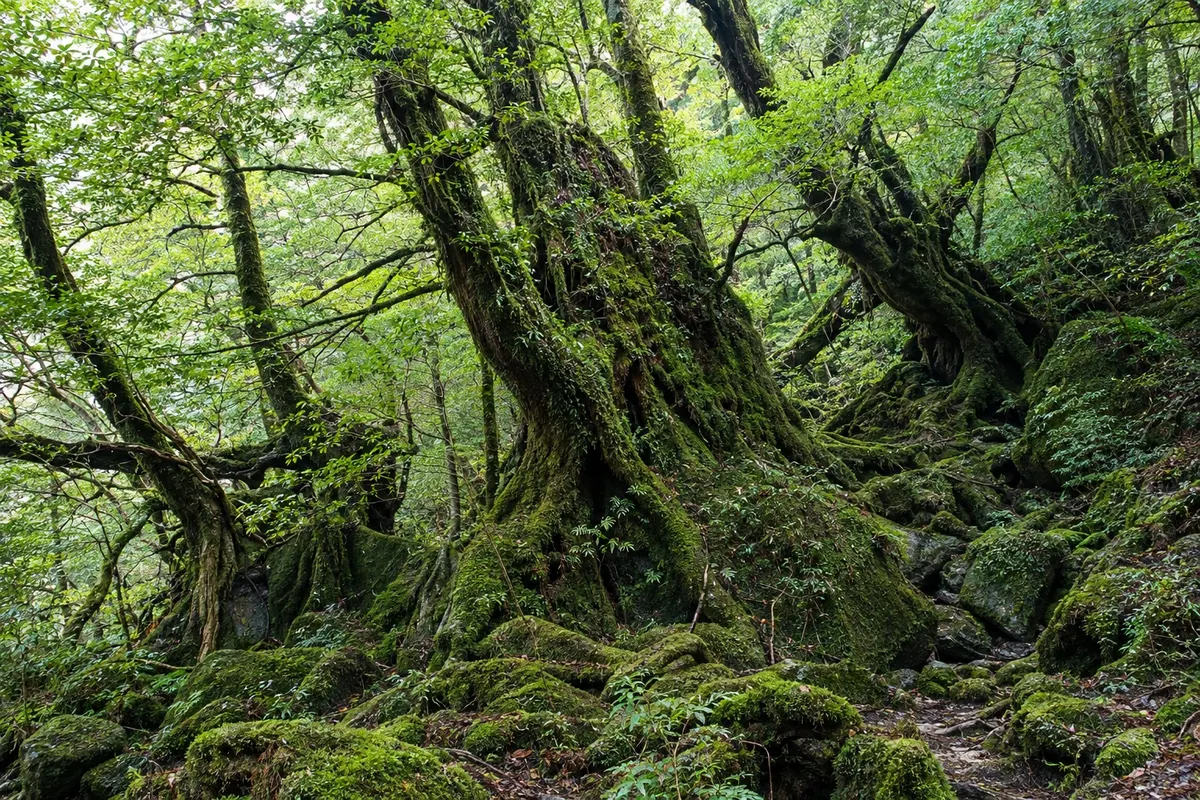
The island of ancient cedar forests south of Kagoshima, home to Jomon Sugi, the moss-covered Shiratani Unsuikyo woods, waterfalls and mountains approaching 2,000 meters.
Na fotografiji: Shiratani Unsuikyo Forest, on Yakushima
Illustrative images. The pictures in this guide are illustrations based on the real place, not photographs, and may differ from it.
Spoznajte kraj
Yakushima is a roughly 500 km² round island about 60 km off the southern tip of Kyushu, in Kagoshima Prefecture. In the center, mountains rise to 1,936 meters at Miyanoura-dake, Kyushu’s highest peak, and receive some of Japan’s heaviest rainfall. The humidity sustains very old cedar forests, the yakusugi, covered in moss and ferns.
Part of the island has been a UNESCO World Heritage Site since 1993 for its forest and the sequence of vegetation that ranges from subtropical beaches to high-elevation grasslands. The most famous cedar is the Jomon Sugi, whose age is estimated in thousands of years, reached by an all-day trail. Closer to the coast, the Shiratani Unsuikyo and Yakusugi Land woodlands let you walk among millennial cedars on short hikes of a few hours.
The coastline has fishing villages, waterfalls that fall almost into the sea, like Oko Falls, and beaches where loggerhead turtles typically nest between May and July. Yakushima macaques and deer, smaller than those elsewhere in the country, are often seen along the western road. There are seaside hot springs, one of them accessible only at low tide.
The island requires time and preparation: long trails start at dawn, rain is frequent in any month, and some access points rely on buses with limited schedules. Miyanoura, in the north, and Anbo, in the east, are the two main villages and the ports where boats from Kagoshima arrive.
V vodniku še ni nastanitev – Yakushima.
kako do tja · koliko dni · načrt poti · vprašanja
✈ Aeroporto de Yakushima (KUM)· 12 km do cilja (Yakushima)
From Kagoshima, fast ferries reach Miyanoura or Anbo in about 2 to 3 hours, and the car ferry takes about 4 hours. Yakushima Airport receives flights from Kagoshima, Fukuoka and Osaka. Ferries and flights can be canceled in rough seas or bad weather.
Doživite kraj
A humid forest valley above Miyanoura, with millenary cedars, streams and moss-covered rocks; trails of 1 to 5 hours lead to the Moss Forest and the Taikoiwa rock.
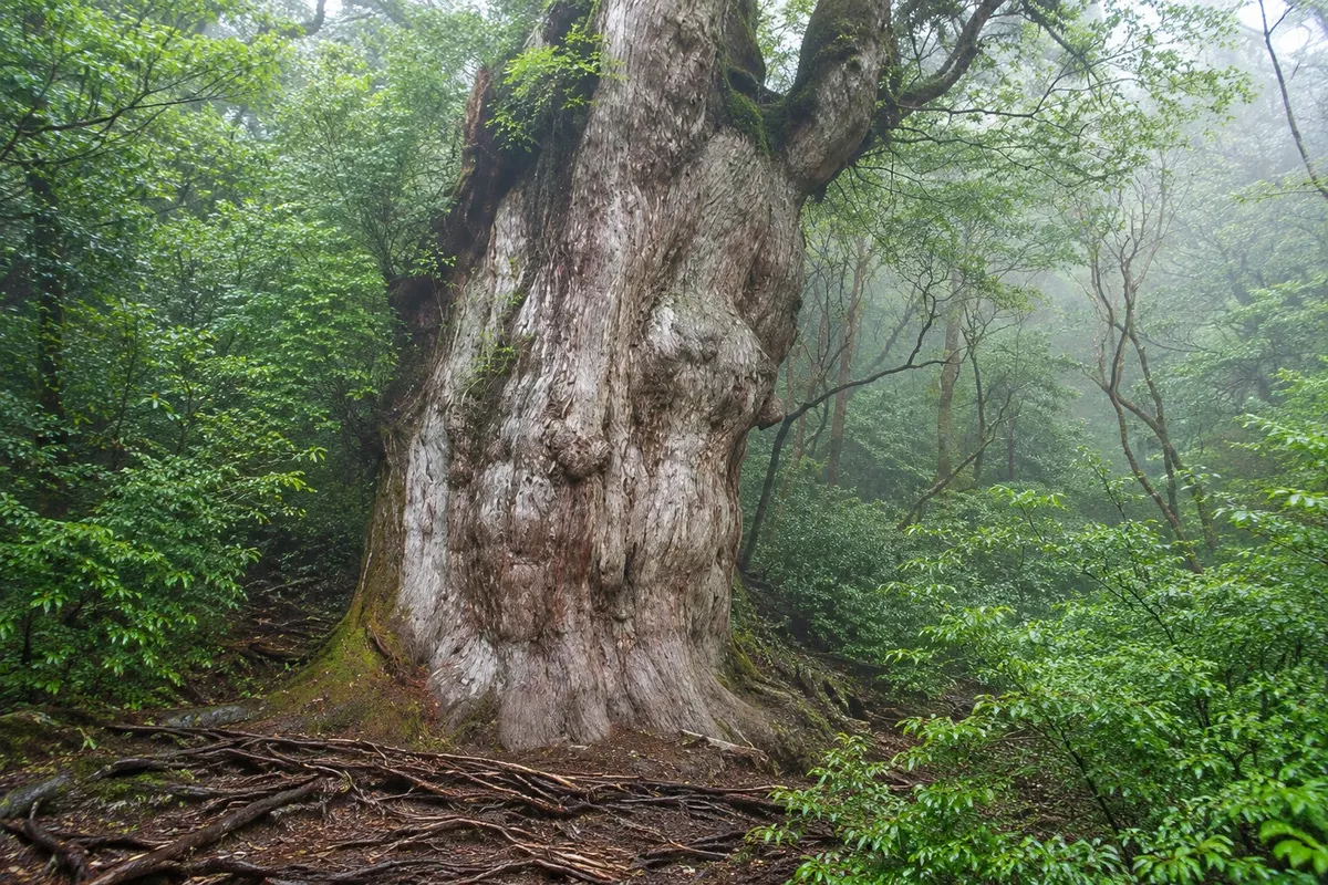
The largest cedar on Yakushima, about 25 meters tall and 16 meters in circumference, reached by a trail of about 22 km round trip from Arakawa.
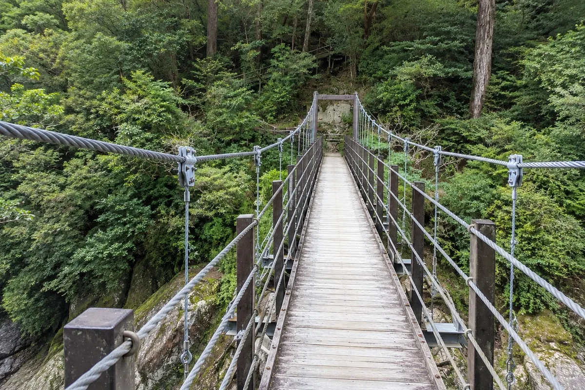
A mountain forest park above Anbo, between 1,000 and 1,300 meters, with routes of 30 minutes to 2½ hours among millenary cedars, bridges and stone rivers.
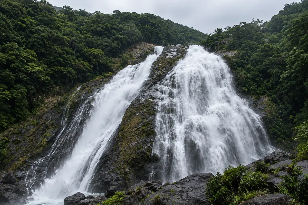
An 88-meter drop in the southwest of Yakushima that falls into a pool a few steps from the coastal road, near the sea; it is the island’s largest waterfall.
Pred odhodom
Yakushima – Kagoshima približno 135 km stran (izhodišče: Kagoshima)
Razdalje so približne. Pred potovanjem preverite lete in vozne rede avtobusov, vlakov ali ladij.
Fast ferries from Kagoshima reach Miyanoura or Anbo in about 2 to 3 hours; the car ferry goes to Miyanoura in about 4 hours. Yakushima Airport, on the northeast coast, receives flights from Kagoshima, Fukuoka and Osaka. With rough seas or a typhoon, ferries may not run.
Three days cover Jomon Sugi, Shiratani Unsuikyo and a circumnavigation of the island. If you don’t go to Jomon Sugi you can see Shiratani, Yakusugi Land and the coast in two days. Adding an extra day protects you against cancellations.
Trails are usually hiked from March to November, with more pleasant temperatures in April, May, October and November. Rain is frequent in all months and heavier in May and June. Typhoons are more common from August to October. Turtles usually nest from May to July, and hatchlings emerge between July and September.
The seasons shown are the most usual ones; nature doesn't always follow the calendar.
A car makes things easier because buses have few departures and some villages are remote. There are rental agencies in Miyanoura, Anbo and at the airport. From March to November, access to the Jomon Sugi trailhead is closed to cars: you leave the car at the Yakusugi Museum in Anbo and continue by bus.
Predlog poti
Pot povezuje znamenitosti na tej strani. Za oglede boste imeli dovolj časa.
Take the bus from Miyanoura to Shiratani Unsuikyo and walk the route to Moss Forest, among cedars and streams.
Go down to Miyanoura for lunch and follow the coastal road to Anbo, stopping at the Senpiro waterfalls.
Continue south to Oko Waterfall, 88 meters high, which drops a few steps from the road.
If the tide is low at night, bathe in the hot spring among the rocks at Hirauchi; check the tide table.
Dan 1
Arrive early by boat to Miyanoura and catch a bus up to Shiratani Unsuikyo for the short forest walk.
Visit the island’s environmental center near the harbor, and prepare your purchases and the bus for the next day’s trail.
Move to Anbo, near the departure point of the Jomon Sugi bus, and buy the trail bus ticket.
Have an early dinner and prepare a snack and a raincoat: the trail bus leaves at dawn.
Dan 2
Depart at dawn on the bus to Arakawa and walk along the tracks of the old logging railway to Wilson stump.
Climb the mountain section up to the viewing platform in front of Jomon Sugi and start the return with time for the last bus.
Take the bus back to the Yakusugi Museum and rest; the hike usually takes about 10 hours.
Try the fried flying fish and the mackerel sashimi of the island at a restaurant in Anbo.
Dan 3
Climb to Yakusugi Land above Anbo for a short route among ancient cedars, without the distance of the Jomon Sugi hike.
Follow the southern coast of the island to Oko waterfall and Kurio Beach, stopping in the coastal villages.
If weather permits, follow the narrow west road, where monkeys and deer often appear on the lane; drive slowly.
Finish in Nagata, in the northwest. Between May and July, turtles often nest on Inakahama Beach, with community-organized viewing.
Check before you go. Opening hours and days change, and places may close for renovations, holidays or events. This itinerary is a suggestion from Cidade Turismo, not a commitment: plan yours by checking directly with each place you intend to visit.
Pred odhodom
Miyanoura has more services and is close to Shiratani Unsuikyo. Anbo is better for Jomon Sugi and Yakusugi Land, because the trail bus leaves from there. Travelers staying three nights usually split their stay between the two villages.
They go to Shiratani Unsuikyo, Yakusugi Land and, in season, to the start of the Jomon Sugi trail, but with few departures. The western road has no buses. Check the schedules when you arrive on the island.
Inakahama Beach, in Nagata, is one of Japan’s main nesting sites for loggerhead turtles. Nesting usually occurs from May to July at night, and visits are organized by the local community with specific rules and limited places.
Yes. Hirauchi Kaichu is located among the rocks on the beach and can only be used at low tide; Yudomari is also seaside. There are hot baths in Onoaida and in hotels on the island.
A road goes around the island, about 100 km long. The western section is narrow, winding and can have animals on the road; drive slowly. Mountain roads lead to Shiratani and Yakusugi Land.
Pred odhodom
Z nekaj načrtovanja boste imeli več časa za uživanje na poti.
The hiking season generally runs from March to November, with April, May, October and November tending to have more comfortable temperatures. It rains year-round, especially in May and June; summer is humid, and typhoons from August to October frequently cancel boats. In winter it can snow in the mountains.
The seasons shown are the most usual ones; nature doesn't always follow the calendar.
Three days allow one day for the Jomon Sugi, another for Shiratani Unsuikyo and one for a circuit of the island, with waterfalls, the western road and a hot spring. With two days, choose between the Jomon Sugi and Shiratani. Reserve an extra day in case a ferry or flight is canceled.
In the north, Miyanoura hosts the main port and most services, near Shiratani Unsuikyo. On the east side, Anbo is the village where the bus to the Jomon Sugi and Yakusugi Land trails departs. The south, around Onoaida and Hirauchi, has quiet inns near hot springs and waterfalls.
Odnesite svoje odpadke, upoštevajte oznake in podprite lokalne ponudnike. V naravi upoštevajte navodila za obiskovalce.
Odgovori na vaša vprašanja
At least three: one for the Jomon Sugi, one for Shiratani Unsuikyo or Yakusugi Land, and one for a loop around the island. Since ferries and flights can be canceled by bad weather, it’s wise to have an extra day at the end.
No, it’s not mandatory, and the main trails are signposted. A local guide is helpful for the Jomon Sugi because of the distance and the dawn start time, and for those without experience on long hikes.
Yes, the island is among Japan’s wettest places, especially in the mountains. It rains every month, more so in May and June. Bring a rain jacket, waterproof footwear and a change of clothes.
It helps a lot. There are buses that circle much of the island and climb to Shiratani and Yakusugi Land, but they have few departures. For the Jomon Sugi, between March and November the final access is by trail bus only, even for those who have a car.
Only for a short visit, such as Shiratani Unsuikyo, using the morning fast ferry and the afternoon return. The island deserves at least two nights.
Več kot vodnik


