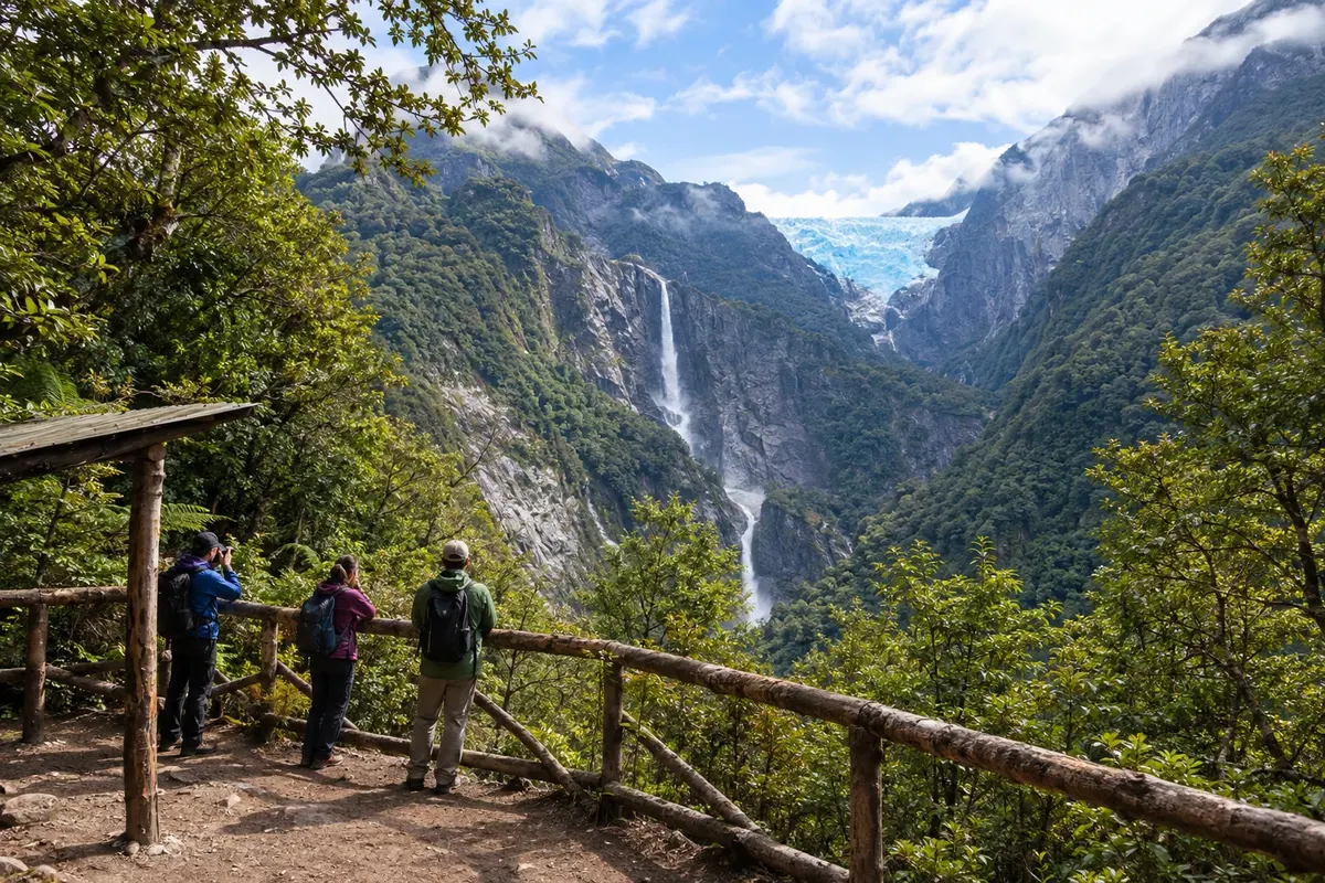
Río Simpson and Velo de la Novia, on the road to Puerto Aysén
Odhod: Coyhaique Own car via Route 240, paved road about 3 to 4 hours Popoldne Lahko
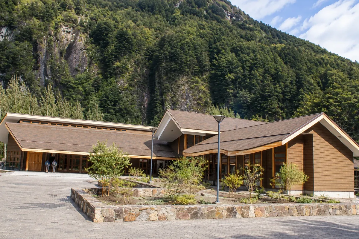
Ruta 240, paved, connects Coyhaique to Puerto Aysén, 65 km away, and follows the valley of the Río Simpson, a tributary of the Río Aysén. The Mirador Marchant, 10 km north of Coyhaique, overlooks the valley. Further on, the road crosses the Reserva Nacional Río Simpson, a CONAF area of about 40,000 hectares of forest and rock cliffs. Two waterfalls are by the road and signposted: the Velo de la Novia (Veil of the Bride), with about a 30 m drop, and the Cascada de la Virgen, named for a grotto that contains an image of the Virgin Mary. The reserve has an information center and short trails; the main trail, about 2.5 km, follows the riverbank and is easy. Those who continue reach Puerto Aysén and, 15 km later, Puerto Chacabuco, a port on the fjord.
Kraji na poti: Reserva Nacional Río Simpson, Velo de la Novia, Cascada de la Virgen, Mirador Marchant, Puerto Aysén, Puerto Chacabuco.
Vključuje: There is no entrance fee for the roadside waterfalls. Check with the information center whether there is a ticket required for the reserve trails.
Nasvet: Ask at the information center about trail conditions, which are not always maintained. Stop only in designated parking areas.
Najboljši čas za obisk: Year-round. After rainy days the waterfalls are more voluminous.
Confluence of the Baker and Neff rivers and Lake Bertrand
Odhod: Puerto Río Tranquilo or Cochrane Private car via Route 7, with stops at viewpoints about 2 hours of stops Dopoldne Lahko
Between Puerto Río Tranquilo and Cochrane there are about 115 km of gravel road. Route 7 follows Lake General Carrera and, in roughly 1 hour, reaches Lake Bertrand, with turquoise water. On the north shore is Puerto Bertrand, a village of about 90 residents outside summer. The Baker River originates from the lake; it is Chile’s highest-discharge river, running about 200 km to the sea near Caleta Tortel. The road follows the river and climbs the Cuesta del Diablo. Up there, a viewpoint shows the meeting of the Baker, turquoise-blue, with the Neff River, milky from glacier sediments: the two colors run side by side before mixing. About 3 km ahead is the turnoff to Valle Chacabuco in Patagonia National Park, and to Paso Roballos on the border with Argentina. In Puerto Bertrand, operators offer short boat trips on the lake and rafting and kayaking runs on the Baker.
Kraji na poti: Puerto Bertrand, Lake Bertrand, Baker River, Neff River, Cuesta del Diablo.
Vključuje: Boat trips and rafting in Puerto Bertrand are charged separately. Check the current fee table.
Nasvet: Leave with a full tank; there is a fuel station in Cochrane. Combine the stop with a visit to Valle Chacabuco the same day en route to Cochrane.
Najboljši čas za obisk: From November to March.
Parque Nacional Patagonia: Valle Chacabuco
Odhod: Cochrane (about 27 km from the park headquarters) Private car via road X-83; hiking trails od 4 do 6 ur Ves dan easy to moderate
Parque Nacional Patagonia was created in 2018 from land donated by the Fundación Tompkins and is managed by CONAF. Valle Chacabuco, the main sector, is a Patagonian steppe valley between mountains, with lagoons, woods and wetlands. The park headquarters are about 27 km from Cochrane; access leaves Ruta 7 just before the town and follows the gravel road X-83, which crosses the valley to Paso Roballos on the Argentine border. Along the way you can see guanacos; pumas, foxes, ñandúes and condors also live in the park, and it is home to about 10% of the huemules remaining in Chile. Among the trails: La Vega, an easy circuit of about 7 km and 1.5 hours; Lodge–Lagunas (Lagunas Altas), a circuit of about 16 km and 6 hours, with valley views; and Avilés, a circuit of about 16 km and 5 hours, which starts from the Casa de Piedra campground. The Tamango sector, about 4 km from downtown Cochrane, has short forest trails and a boat trip on the Río Cochrane.
Kraji na poti: Parque Nacional Patagonia, Valle Chacabuco, Lagunas Altas, Valle Avilés, Sector Tamango, Cochrane.
Vključuje: There is an entrance fee, sold online through the parks pass system; campgrounds and the boat are paid separately. Check the current fee table.
Nasvet: There is no cellphone signal in Valle Chacabuco: download maps beforehand. Cochrane has a gas station, an ATM and markets. Several trails and the campgrounds operate only from October to April.
Najboljši čas za obisk: From October to April, when the trails and campgrounds in Valle Chacabuco are open.
Caleta Tortel: cypress boardwalks over the fjord
Odhod: Cochrane (about 125 km) By car via Route 7 and the X-904 road; in the village, on foot about 3 hours on foot in the village Dopoldne ali popoldne easy (many stairs)
Caleta Tortel has no streets or cars: houses, square, school and church are linked by about 7 km of boardwalks, stairs and wooden bridges made from Guaitecas cypress, a native tree resistant to cold and rain. The village, with around 500 inhabitants, was founded in 1955 for the extraction of this wood and sits on the rocks of an inlet near the mouth of the Río Baker. It is a Typical Zone, protected by the National Monuments Council. The X-904 road, opened in 2003, connects Tortel to Route 7; from Cochrane it is about 125 km, almost all gravel. Cars are left at the village entrance, and the visit is all on foot, climbing and descending stairs between sectors, with views of the fjord, the islands and the mountains. Boats to the Jorge Montt and Steffens glaciers depart from the pier. Puerto Yungay, where the ferry leaves for the final stretch to Villa O'Higgins, is about 45 km away.
Kraji na poti: Caleta Tortel, Río Baker, Puerto Yungay.
Vključuje: The walk along the boardwalks is free. boat trips to the glaciers are paid separately. Check the current price table.
Nasvet: Wear sturdy, non-slip footwear: when it rains the wood becomes slippery, and there are many stairs. If you sleep in Tortel, bring only a small backpack, because everything is carried by hand.
Najboljši čas za obisk: From November to March; boats to the glaciers usually operate from September to March.
Boat trip to Jorge Montt Glacier
Odhod: Caleta Tortel Boat with a local operator, from the Tortel pier about 7 hours Ves dan Lahko
The Jorge Montt Glacier is one of the ice tongues of the Southern Ice Field that reach the fjords around Caleta Tortel. The boat departs from Tortel’s pier, next to the port captaincy, and takes almost 2 hours through the fjords, with the guide explaining the region’s flora, fauna, and geology. In front of the glacier face, if conditions allow, the boat stays about 3 hours among ice floes floating on the water to observe and photograph. Afterwards it returns the same way to Tortel. The whole trip takes about 7 hours and depends on the weather and a minimum number of passengers.
Kraji na poti: Jorge Montt Glacier, Caleta Tortel, Southern Ice Field.
Vključuje: In general: boat trip and bilingual guide; food is usually the passenger’s responsibility. It is paid separately. Check the current price table.
Nasvet: Go with warm layered clothing, a hat, gloves, sunglasses and closed footwear. The tour only runs in good weather and with a minimum group: allow a day of flexibility in Tortel.
Najboljši čas za obisk: The season usually runs from September to March.
Villa O'Higgins: the end of the Carretera Austral and O'Higgins Glacier
Odhod: Villa O'Higgins By car via Ruta 7, using the Puerto Yungay–Río Bravo ferry; boat to the glacier about 12 hours (glacier boat trip) Ves dan Lahko
Villa O'Higgins is the terminus of Ruta 7, about 1,240 km from Puerto Montt. From Cochrane it is roughly 230 km: the road goes to Puerto Yungay, about 150 km of gravel, where the ferry crosses the Fiordo Mitchell in about 45 minutes to Río Bravo; from there about 100 km remain to the village, passing lakes, rivers and forests. In Villa O'Higgins, those who complete the road can request a certificate that they reached the end of the Carretera Austral. The main outing is the boat trip on Lago O'Higgins to the Glaciar O'Higgins, one of the major ice masses of the Patagonia and the gateway to the Campo de Hielo Sur. Boats depart from Bahía Bahamondes, about 7 km south of the village, and arrive in front of an ice front roughly 3 km wide and 70 m high. The boat day takes about 12 hours round trip. From Villa O'Higgins you can also start the crossing to El Chaltén in Argentina, which combines boat, hike and bus and cannot be done by car.
Kraji na poti: Villa O'Higgins, Lago O'Higgins, Glaciar O'Higgins, Bahía Bahamondes, Puerto Yungay, Río Bravo, Campo de Hielo Sur.
Vključuje: The glacier boat trip is paid separately and requires a reservation, with limited spaces. Check the current rate and departure days.
Nasvet: Plan the trip around the Puerto Yungay–Río Bravo ferry schedule: there are few departures per day, and even fewer in winter. Fuel up in Cochrane and carry extra fuel, because stations are rare on the final stretch.
Najboljši čas za obisk: From November to March; glacier boat trips usually operate from September to April.
Chaitén and Pumalín Douglas Tompkins National Park
Odhod: Chaitén Private car via Route 7; walks on foot 3 to 6 hours of trails Ves dan easy to medium-high
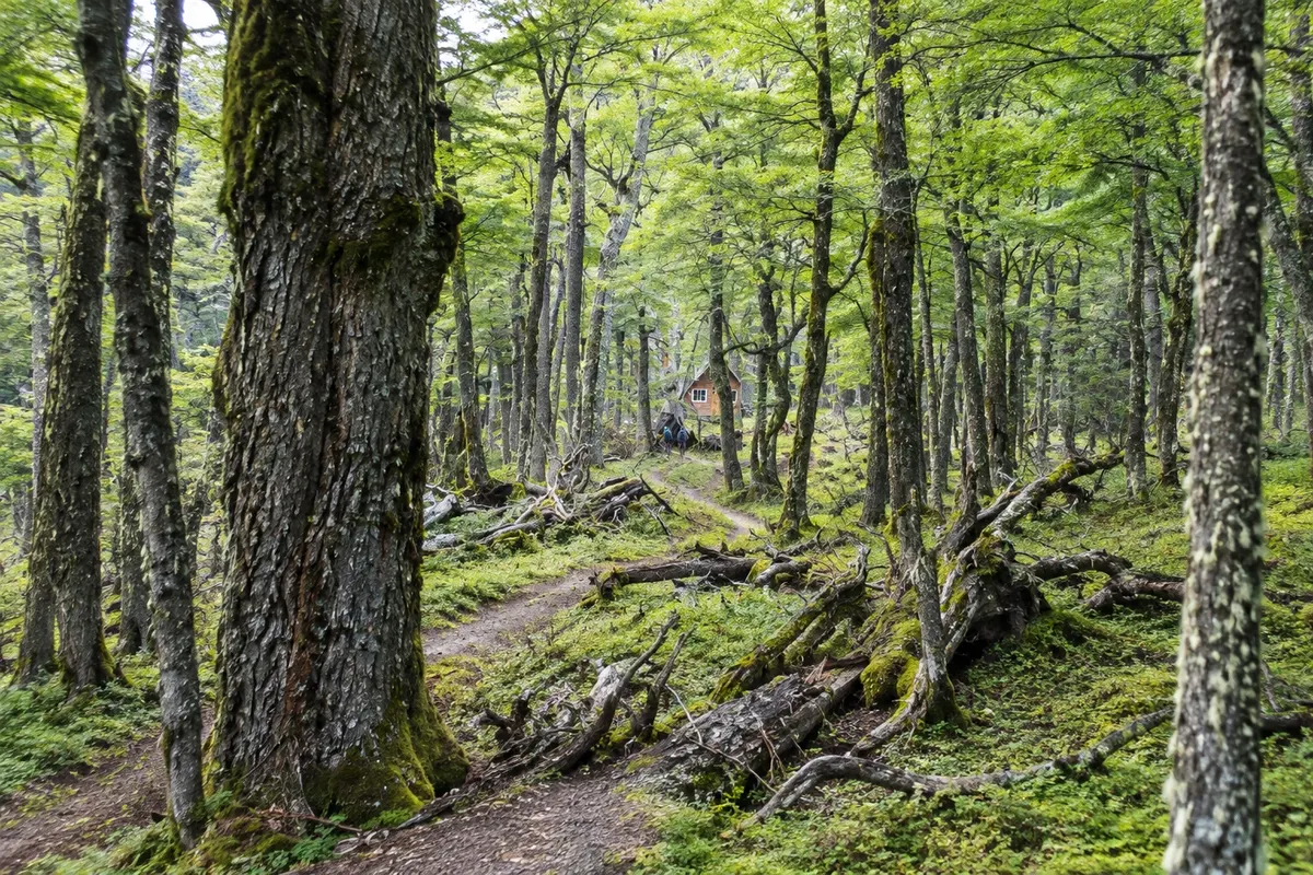
Pumalín Douglas Tompkins National Park protects temperate rainforest, fjords, volcanoes and alerce forests in a roughly 80 km band along Route 7, between Caleta Gonzalo in the north and El Amarillo in the south. Chaitén, the service town, is about 55 km south of Caleta Gonzalo, where the ferry from Hornopirén arrives. Trails start from the road. The Volcán Chaitén trail climbs almost 600 meters to the rim of the volcano’s crater, which erupted in 2008; it is about 4.5 km round trip, taking around 2.5 hours, with medium to high difficulty. The Cascadas Escondidas trail leads to three waterfalls in the forest, about 3.5 km round trip and 2 hours. The Sendero Los Alerces is a short, easy circuit of 40 minutes among alerces nearly 3,000 years old. With more time there are long trails, such as Volcán Michimahuida and the Ventisquero trail, near El Amarillo. It is a rainy forest: it rains a lot year-round.
Kraji na poti: Pumalín Douglas Tompkins National Park, Chaitén, Volcán Chaitén, Cascadas Escondidas, Sendero Los Alerces, Caleta Gonzalo, El Amarillo.
Vključuje: Park entry is free; campgrounds are charged separately. Check the current fee table.
Nasvet: There is no cell signal or electrical power inside the park: refuel and buy what you need in Chaitén or Hornopirén. Bring a waterproof jacket and pants even in summer.
Najboljši čas za obisk: From December to March; campgrounds open from mid-December.
Futaleufú: rafting on the Río Futaleufú
Odhod: Futaleufú (about 155 km from Chaitén) Rafting excursion with a local operator varies depending on the river section Dopoldne ali popoldne high (class IV and V rapids)
Futaleufú is a small village about 10 km from the Argentina border, in a valley of mountains and forests. It lies off Route 7: the turnoff is at Villa Santa Lucía, and from there it is about 75 km east; from Chaitén it’s about 155 km, roughly 4 hours by car or bus. The Río Futaleufú, with turquoise water, is known among rafters for its class IV and V rapids, always run with a guide and local operator. The village is also a base for kayaking, horseback riding and hikes in the Reserva Nacional Futaleufú, home to the huemul, with trails to waterfalls and viewpoints such as Piedra del Águila, Laguna Tronador and Laguna Pinilla. In January and February, temperatures can exceed 20 °C.
Kraji na poti: Futaleufú, Río Futaleufú, Reserva Nacional Futaleufú, Piedra del Águila, Laguna Tronador, Laguna Pinilla, Villa Santa Lucía.
Vključuje: On excursions, in general: guide and safety equipment. Paid separately. Check the current price table.
Nasvet: Hire only operators registered with Sernatur. The stronger rapids require good physical fitness; if it’s your first time, ask for gentler sections.
Najboljši čas za obisk: The season runs from October to April; the high season for rafting is from December to March.


 Brazilija
 Antarktika
 Argentina
 Bolivija
 Kolumbija
 Ekvator
 Gvajana
 Francoska Gvajana
 Falklandski otoki (Malvini)
 Paragvaj
 Peru
 Surinam
 Urugvaj
 Venezuela
 Nemčija
 Avstrija
 Belgija
 Hrvaška
 Danska
 Slovaška
 Slovenija
 Španija
 Finska
 Francija
 Grčija
 Nizozemska
 Madžarska
 Irska
 Islandija
 Italija
 Luksemburg
 Norveška
 Poljska
 Portugalska
 Združeno kraljestvo
 Češka
 Švedska
 Švica
 Turčija
 Bermudi
 Kanada
 Združene države Amerike
 Grenlandija
 Mehika
 Sveta Peter in Mihael
 Dominikanska republika
 Japonska
 Južnoafriška republika
 Egipt
 Avstralija
 Fidži
 Nova Zelandija
 Papua Nova Gvineja