

La Paz · La Paz · Trg
Plaza Murillo
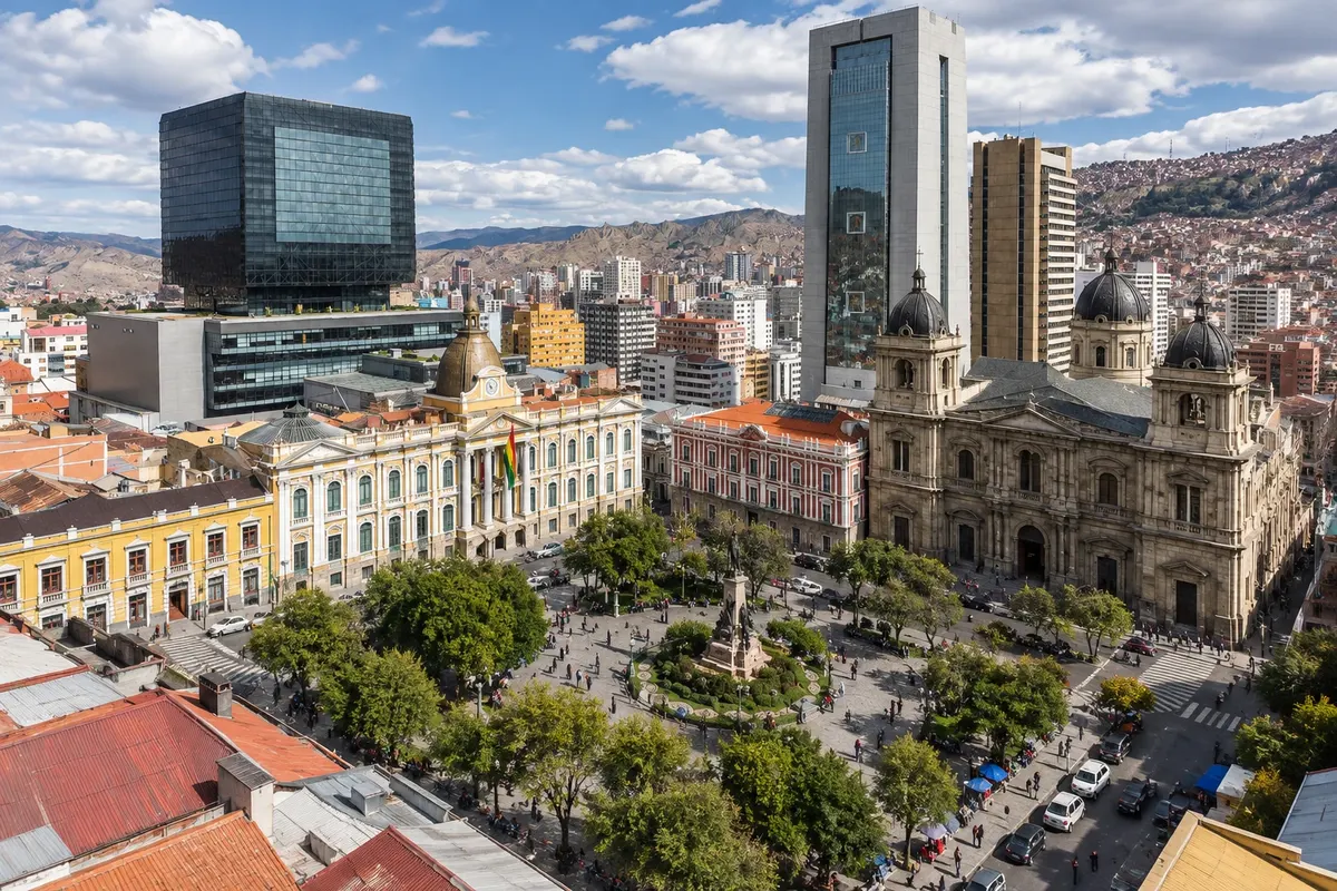
The central square of La Paz, with the Catedral Metropolitana, the Palacio de Gobierno (known as Palacio Quemado), and the Legislative Assembly, with the clock that runs backwards.

 Išči
 Brazilija
 Antarktika
 ArgentinaBolivija
 Čile
 Kolumbija
 Ekvator
 Gvajana
 Francoska Gvajana
 Falklandski otoki (Malvini)
 Paragvaj
 Peru
 Surinam
 Urugvaj
 Venezuela
 Nemčija
 Avstrija
 Belgija
 Hrvaška
 Danska
 Slovaška
 Slovenija
 Španija
 Finska
 Francija
 Grčija
 Nizozemska
 Madžarska
 Irska
 Islandija
 Italija
 Luksemburg
 Norveška
 Poljska
 Portugalska
 Združeno kraljestvo
 Češka
 Švedska
 Švica
 Turčija
 Bermudi
 Kanada
 Združene države Amerike
 Grenlandija
 Mehika
 Sveta Peter in Mihael
 Dominikanska republika
 JaponskaTurčija
 Južnoafriška republika
 Egipt
 Avstralija
 Fidži
 Nova Zelandija
 Papua Nova Gvineja
La Paz · Bolivija
Seat of the Bolivian government in an Andean canyon at about 3,600 m, with the snow-capped Illimani in the background, the colonial center on hillsides, the cable car above the neighborhoods and the ruins of Tiwanaku 70 km away.
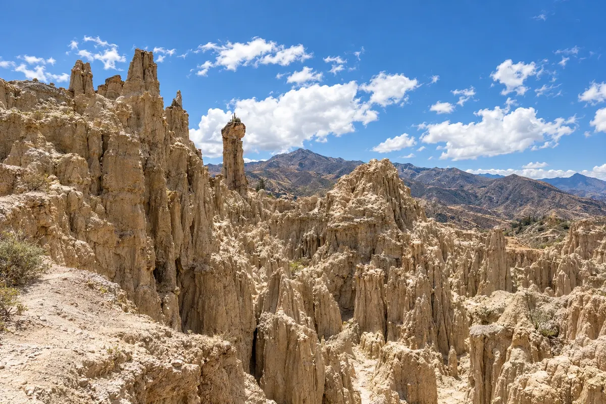
Na fotografiji: Valle de la Luna, La Paz
Illustrative images. The pictures in this guide are illustrations based on the real place, not photographs, and may differ from it.
Spoznajte kraj
La Paz sits in a canyon carved by the Choqueyapu River on the edge of the Altiplano, with the downtown at about 3,600 meters altitude and neighborhoods climbing the slopes up to El Alto on the upper plain, around 4,000 meters. Founded by the Spanish in 1548, it is the seat of Bolivia's government, housing the presidency and parliament; the constitutional capital is Sucre. In the background, the snow-capped Illimani, over 6,400 meters high, can be seen from almost the whole city.
The historic center revolves around Plaza Murillo, with the Cathedral, the Government Palace and the Legislative Assembly. A few blocks away are Calle Jaén, a colonial street of colorful houses with museums, and the Basílica de San Francisco, with a carved stone façade in the mestizo baroque style. On the streets above the church, the Mercado de las Brujas sells herbs, amulets and offerings used in Aymara rituals to Pachamama.
Mi Teleférico, the urban cable car network that links La Paz with El Alto, is everyday transport and also the easiest way to see the city from above. Viewpoints such as Killi Killi show the whole canyon with Illimani behind. To the south, Valle de la Luna has clay formations sculpted by erosion, and 70 km away on the Altiplano, Tiwanaku preserves the ruins of the culture that dominated the region before the Incas.
Take it easy on the first day.
V vodniku še ni nastanitev – La Paz.
kako do tja · koliko dni · načrt poti · vprašanja
✈ Aeropuerto Internacional El Alto (LPB), kraj: El Alto· 14 km do cilja (La Paz)
Check before buying. El Alto International Airport is at about 4,000 meters, 14 km from the center, a 30–45 minute taxi ride. Buses from other cities arrive at the Terminal de Buses, near the center.
Doživite kraj
The central square of La Paz, with the Catedral Metropolitana, the Palacio de Gobierno (known as Palacio Quemado), and the Legislative Assembly, with the clock that runs backwards.
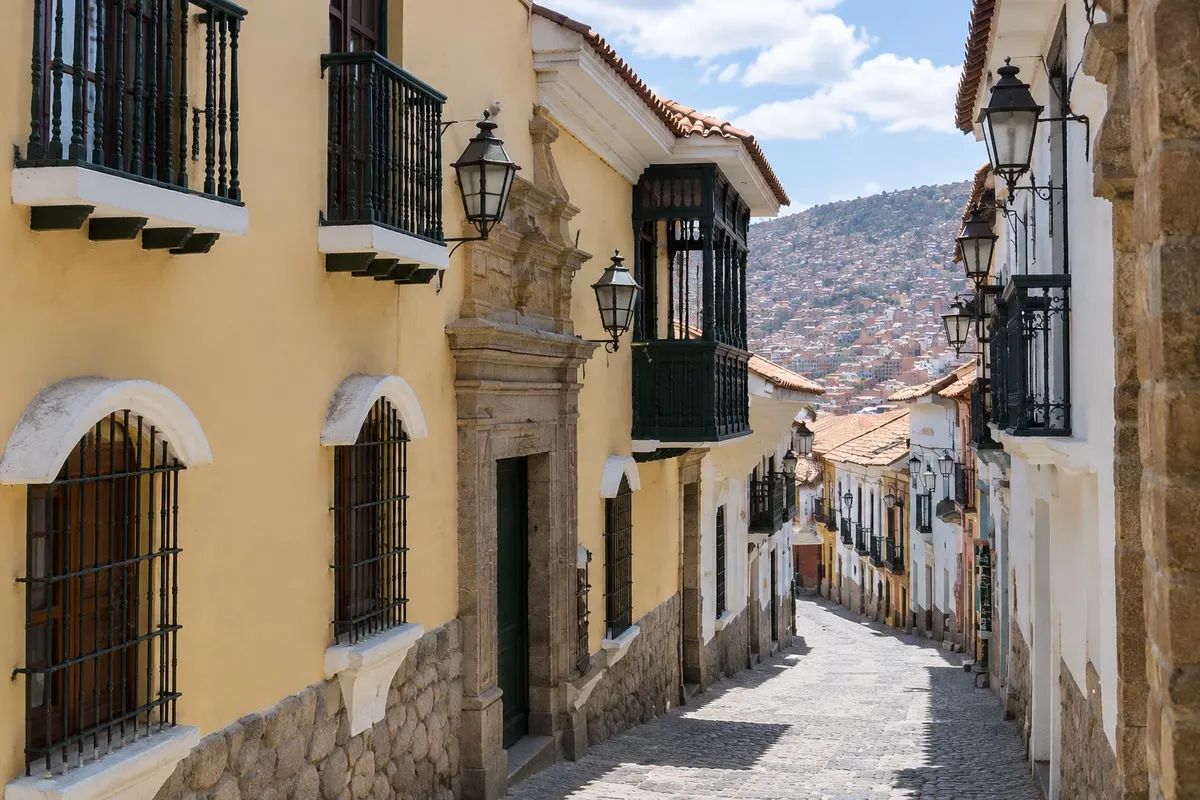
Colonial stone street with colorful houses in central La Paz, with four municipal museums, including the Museo de Metales Preciosos and the Museo Costumbrista, and the Museo de Instrumentos Musicales.
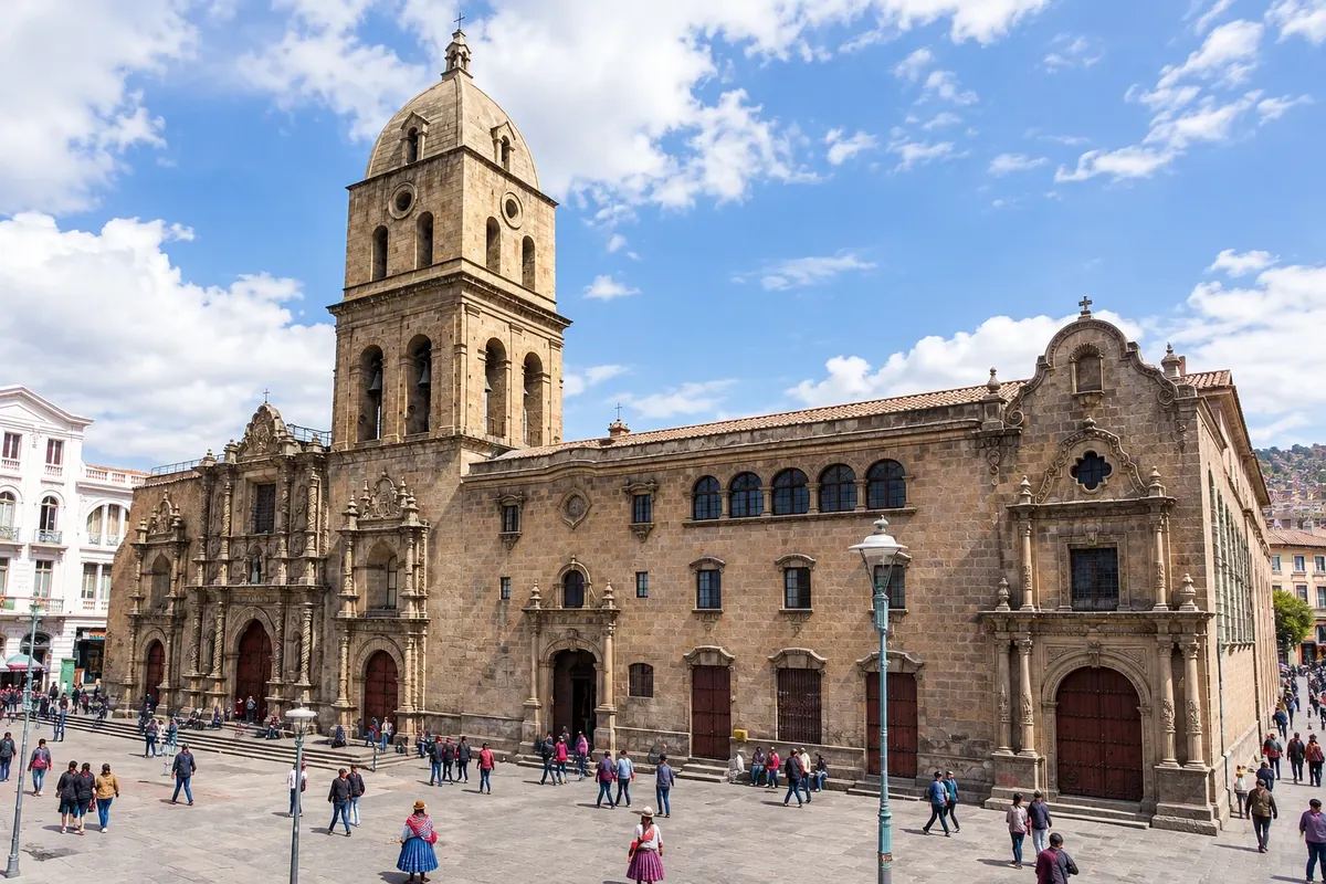
18th-century Franciscan church in the center of La Paz, with a carved stone façade in the mestizo baroque style featuring Andean figures, and a museum in the convent that reaches up to the roof.
The stalls on the streets Linares and Sagárnaga, above San Francisco, that sell herbs, amulets, Ekeko figures and offerings for Aymara rituals to Pachamama, alongside alpaca and craft shops.
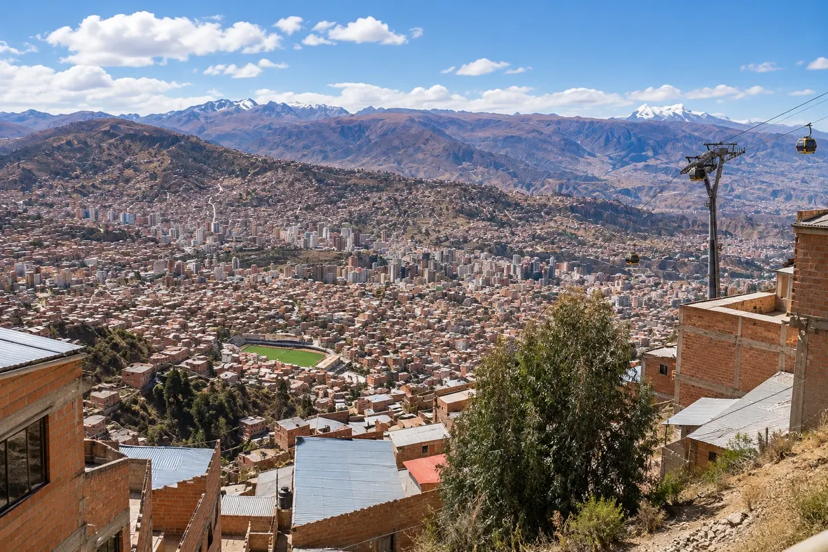
The urban cable car network of La Paz and El Alto, with color-coded lines over the canyon neighborhoods, used daily by residents and offering views of Illimani and the Altiplano.
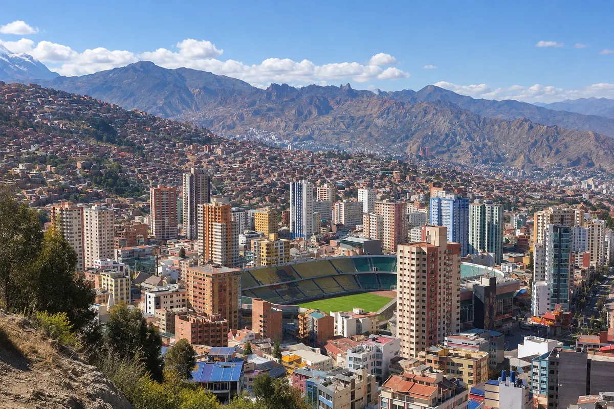
Circular viewpoint high in the Villa Pabón neighborhood, a few minutes from the center, with 360-degree views of the La Paz canyon, El Alto and the snow-capped Illimani.
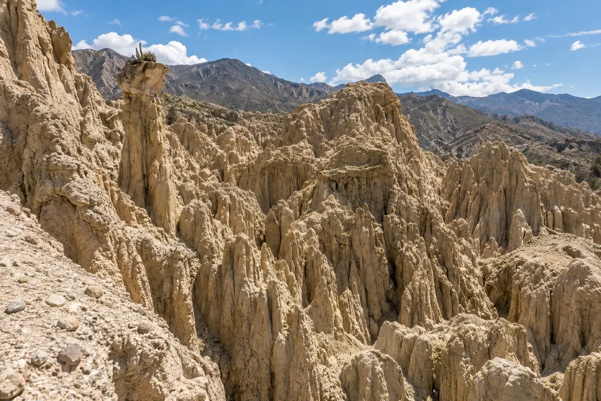
Clay and sandstone formations carved by erosion into spires and canyons, about 10 km south of downtown La Paz, with short waymarked trails among the peaks.
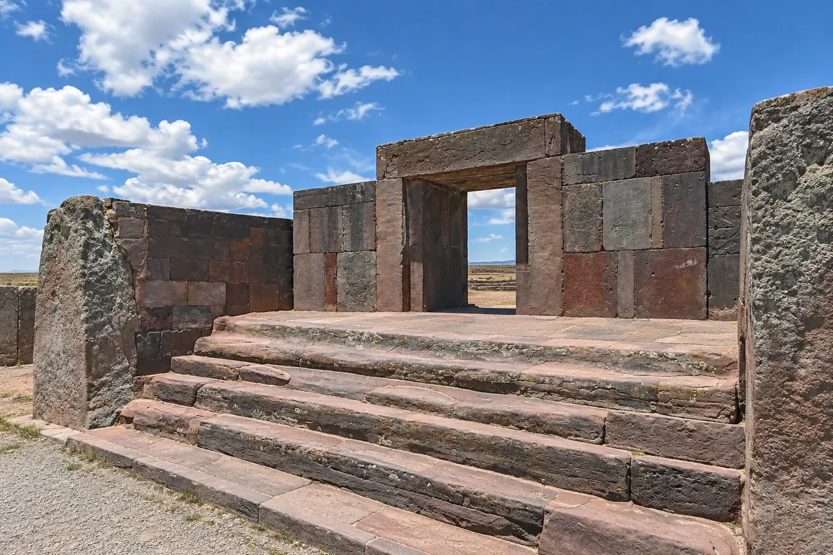
Center of the Tiwanaku culture, which dominated the southern Andes before the Incas, about 70 km from La Paz, with the Akapana pyramid, the Kalasasaya, the Puerta del Sol and the blocks of Puma Punku. A World Heritage Site since 2000.
Pred odhodom
La Paz – La Paz Capital
Razdalje so približne. Pred potovanjem preverite lete in vozne rede avtobusov, vlakov ali ladij.
Confirm before buying. El Alto International Airport is at about 4,000 meters and 14 km from the center; a taxi descends the highway into the canyon in 30 to 45 minutes. La Paz's Terminal de Buses receives buses from Oruro, Cochabamba, Sucre, Potosí and Uyuni; buses to Copacabana depart from the area near the general cemetery.
Two to three days. The first should be light, because of the altitude: Plaza Murillo and Calle Jaén. On the second day: San Francisco, the Mercado de las Brujas, the cable car and Killi Killi. On the third day, Tiwanaku in the morning or Valle de la Luna.
The dry season usually runs from May to October, with sunny days and very cold nights. From December to March it usually rains in the afternoons. On January 24 the Alasitas fair begins, with miniatures used to ask Ekeko for prosperity, and in May or June the Gran Poder festival takes place, with thousands of dancers.
The seasons shown are the most usual ones; nature doesn't always follow the calendar.
No. The streets are steep and traffic is slow. Taxis, minibuses and the Mi Teleférico lines link the center with the Zona Sul and El Alto. For Tiwanaku and Valle de la Luna there are agency tours and taxis that wait.
Predlog poti
Pot povezuje znamenitosti na tej strani. Za oglede boste imeli dovolj časa.
Start slowly at Plaza Murillo, with the Cathedral, the Government Palace and the Assembly, and look for the clock opposite the parliament building.
Go up Calle Jaén to the municipal museums and go down to the Basílica de San Francisco, with its mestizo façade and the rooftop viewpoint.
Take a line of the Mi Teleférico to see the canyon from above and finish at the Killi Killi viewpoint, with the light on Illimani.
Dine near rua Sagárnaga. At altitude, opt for a light meal and go easy on alcohol.
Dan 1
Easy first day: Plaza Murillo and the Cathedral, with breaks.
The museums on Calle Jaén and the colorful colonial houses.
Rest at the hotel and drink water.
Dine near the hotel.
Dan 2
Basílica de San Francisco, the convent museum and the rooftop.
Ruas Linares e Sagárnaga, with stalls selling herbs, amulets and offerings.
Take the Mi Teleférico to El Alto and back, then go up to Killi Killi.
Dinner in the Sopocachi neighborhood.
Dan 3
Leave early for Tiwanaku, 70 km away: museums, Akapana, Kalasasaya and the Puerta del Sol.
Visit Puma Punku, with its cut stone blocks, and return to La Paz.
If there's time, go down to Valle de la Luna, in the Zona Sur, for the short trail among the clay formations.
Dinner in Zona Sur or downtown.
Check before you go. Opening hours and days change, and places may close for renovations, holidays or events. This itinerary is a suggestion from Cidade Turismo, not a commitment: plan yours by checking directly with each place you intend to visit.
Pred odhodom
It's the urban cable car network of La Paz and El Alto, opened in 2014, with several lines in different colors. Locals use it as transport and it provides views of the canyon and Illimani.
Nights are cold year-round, and from May to August they are often near or below freezing. By day, when the sun is out, temperatures are mild. Bring layered clothing.
Salteñas, juicy breakfast empanadas; sopa de maní (peanut soup); plato paceño, with corn, fava beans, potato and cheese; and api with pastel, a hot purple-corn drink served with a pastry on cold mornings.
It's the fair that begins on January 24, where people buy miniatures of houses, cars, money and diplomas to ask Ekeko — a figure of the Aymara tradition — for prosperity. It's on UNESCO's Intangible Cultural Heritage list.
Pred odhodom
Z nekaj načrtovanja boste imeli več časa za uživanje na poti.
The dry season usually runs from May to October, with sunny days, clear skies and very cold nights, near or below zero. Rains come from December to March, generally in the afternoons. In February or March, depending on the year, the city celebrates Carnival and in January the Alasitas fair takes place.
The seasons shown are the most usual ones; nature doesn't always follow the calendar.
Three days: a light first day with Plaza Murillo and Calle Jaén; a second day for San Francisco, the Mercado de las Brujas, the cable car and Killi Killi; and a third day for Tiwanaku or Valle de la Luna. Those heading to Copacabana can fit Tiwanaku into a separate day.
The historic center, between Plaza Murillo and the Basílica de San Francisco, has hotels and guesthouses near the streets Sagárnaga and Jaén, a few minutes from the museums. Sopocachi, a little lower down, is a residential neighborhood of cafés and squares. The Zona Sul, lower and warmer, has modern hotels and restaurants, but is about 20 minutes from the center.
Odnesite svoje odpadke, upoštevajte oznake in podprite lokalne ponudnike. V naravi upoštevajte navodila za obiskovalce.
Odgovori na vaša vprašanja
The city center is at about 3,600 meters, and the airport in El Alto is around 4,000 meters. Many travelers feel the effects of altitude in the first days. Take it easy on the first day, avoid strenuous outings, and talk with your doctor before the trip.
La Paz is the seat of government, where the presidency and parliament are located. The constitutional capital is Sucre, where the Judiciary operates.
Two to three days. Two for the center, the cable car and the viewpoints; the third for Tiwanaku or Valle de la Luna.
No. Traffic is heavy and the streets are steep. Taxis, minibuses and Mi Teleférico handle most transfers, and agencies sell tours to Tiwanaku and Valle de la Luna.
Več kot vodnik


