San Carlos and Guaymas

Sonora · Mehika

San Carlos and Guaymas

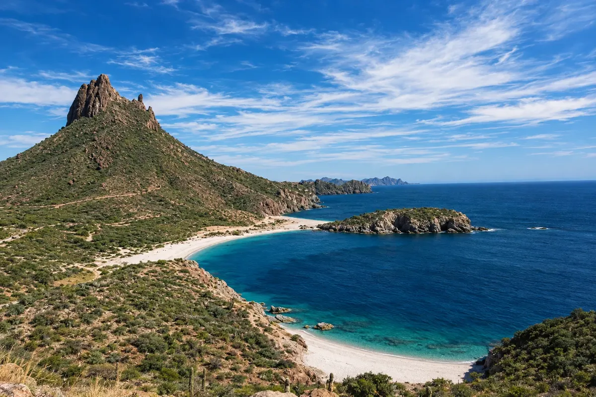
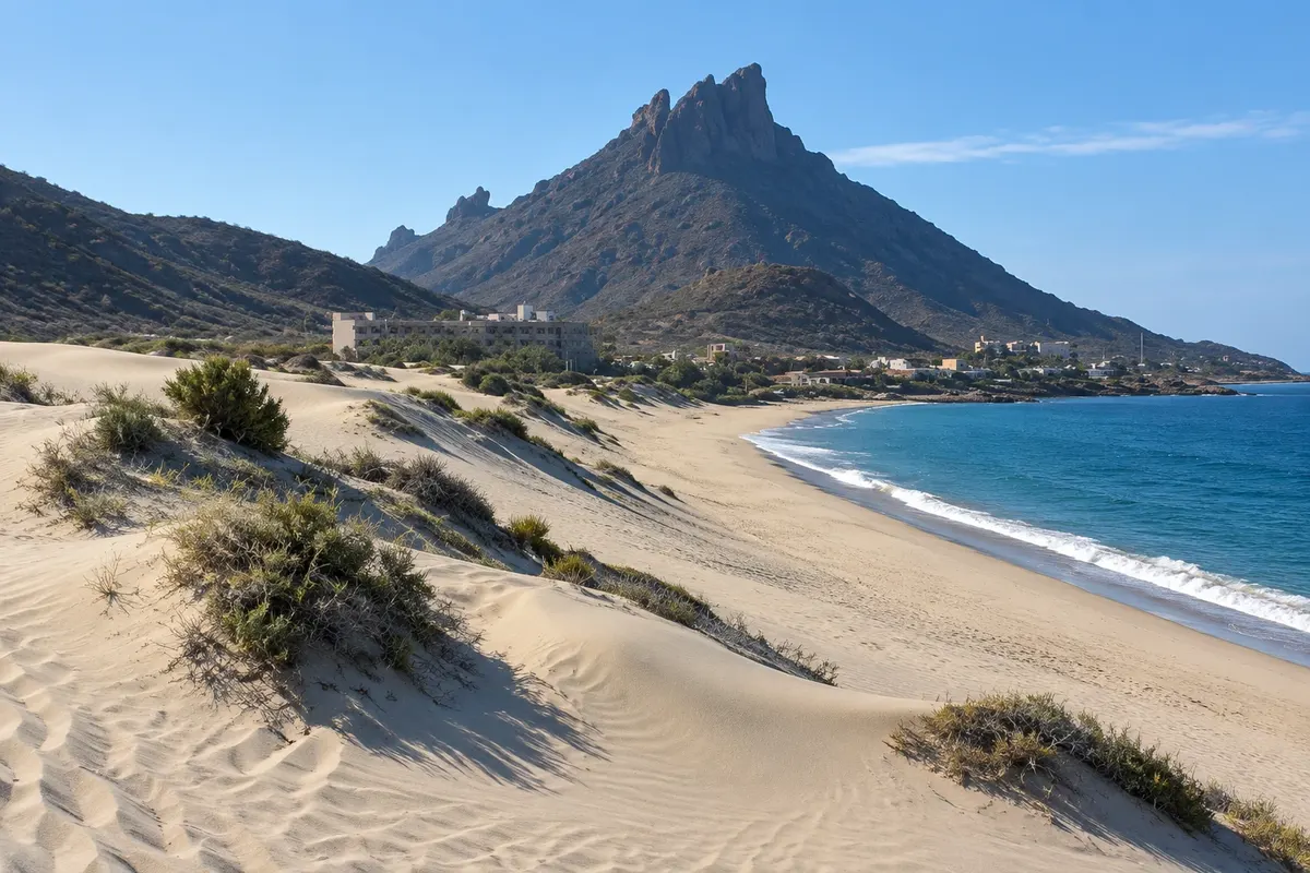
The volcanic mountains over the Sea of Cortez: Cerro Tetakawi, the Mirador Escénico, Los Algodones beach and the coves of San Carlos, next to the port of Guaymas.

Northwest and Copper Canyon

Na fotografiji: Piedras Pintas coves, in San Carlos.

Illustrative images. The pictures in this guide are illustrations based on the real place, not photographs, and may differ from it.

Na voljo v trgovini Google Play Pošljite svoje fotografije

Spoznajte kraj

Pokrajina, ki jo doživite
v svojem ritmu.

San Carlos lies on the central coast of Sonora, on the Gulf of California, about 20 km from the port of Guaymas and about 130 km from Hermosillo, the state capital. The landscape combines desert, with saguaro and pitaya cacti, and volcanic rock mountains that drop straight into the blue sea.

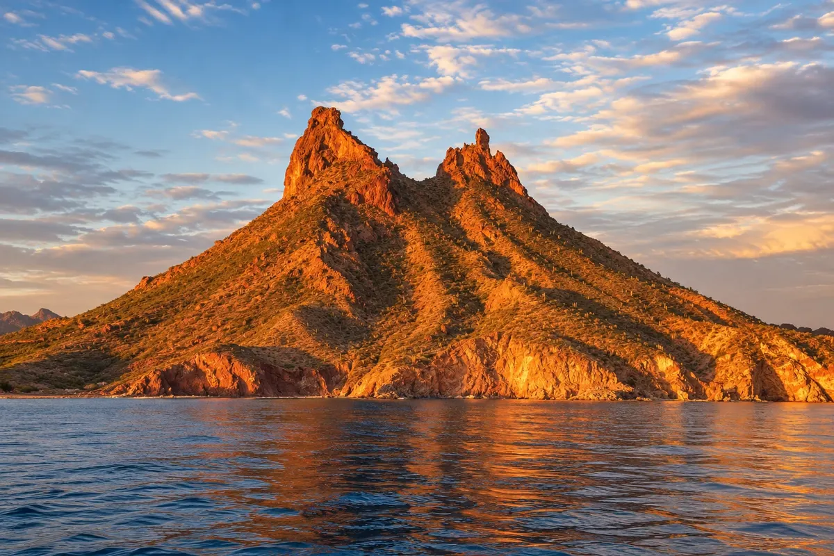
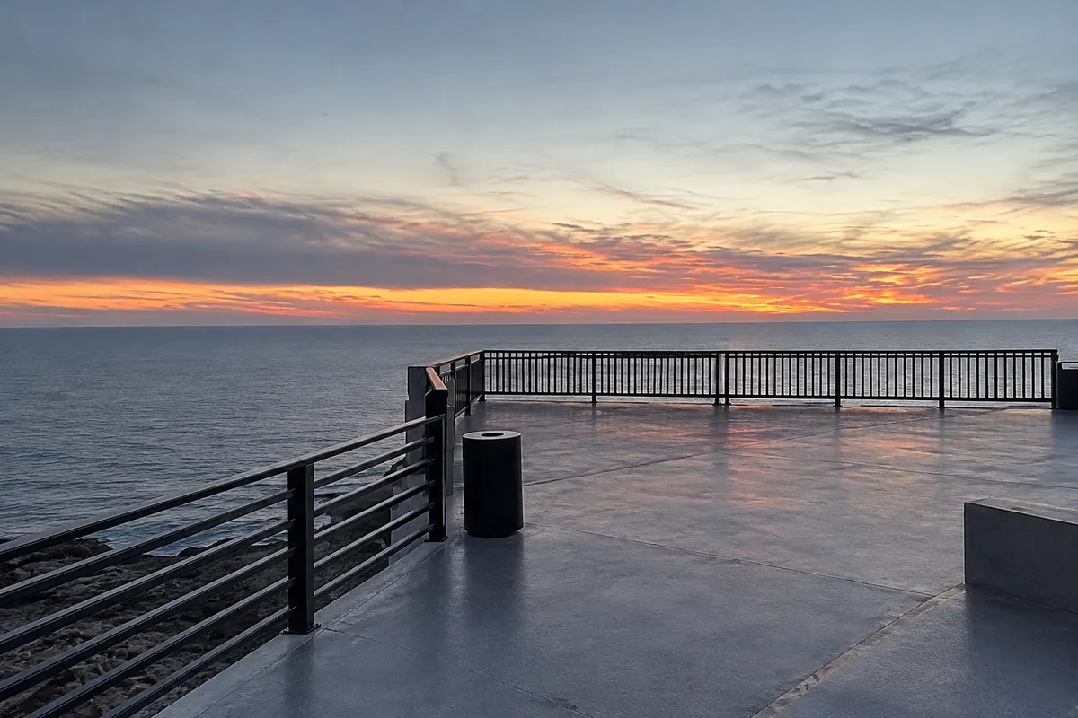
The symbol is Cerro Tetakawi, a two‑peaked hill above the bay. The Mirador Escénico, among coves, has one of the gulf’s best‑known views, and Los Algodones beach, with light dunes, sits at the foot of the range.

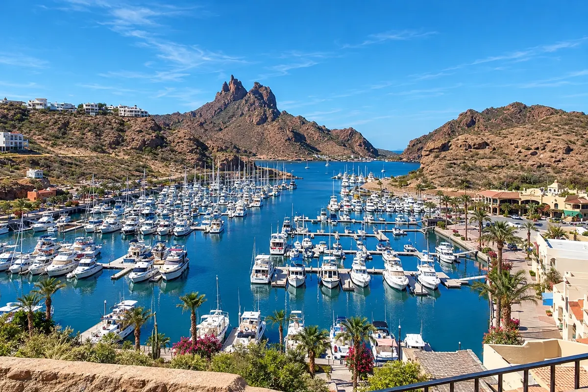
The surrounding waters are popular for diving, sport fishing and boat trips to San Pedro Nolasco Island, with sea lions. In the marina, yachts from the United States and Canada spend the winter.

Guaymas, adjacent, is a fishing and shipping port founded in the 18th century, with a malecón and a cathedral, and it has the region’s airport. San Carlos and Guaymas follow UTC−7, Mexico Pacific Time, year‑round without daylight saving time.

This destination brings together 1 city: San Carlos.

Delite: WhatsApp
Delite svoja popotniška doživetja s fotografijami Pošljite fotografije vsakega kraja, ki ste ga obiskali. Največje število fotografij na kraj: 5.

Ena destinacija, več poti

Mesta na tej poti

Začnite v enem mestu ali v načrt poti vključite več mest.

San Carlos and Guaymas – lega
San Carlos

Meje: INEGI / geoBoundaries (CC BY 3.0 IGO). Priredba: Cidade Turismo.

Kako do tja:San Carlos and Guaymas

✈ Aeropuerto Internacional General José María Yáñez (GYM), kraj: Guaymas· 15 km do cilja (San Carlos)

Guaymas International Airport (GYM) is about 15 km from San Carlos, with few flights; Hermosillo (HMO), with more connections, is about 130 km away. Federal Highway 15 links Guaymas to Hermosillo and to the border with Arizona at Nogales, about 400 km.

Doživite kraj

Kaj početi – San Carlos and Guaymas

Tetakawi Hill
San Carlos · Sonora · Mountain and trail

Tetakawi Hill

Two‑peaked volcanic hill above San Carlos bay, symbol of the village, with a trail to the top and views of the Sea of Cortez.

Scenic Lookout San Carlos
San Carlos · Sonora · Razgledišče

Scenic Lookout San Carlos

Lookout over the coves of San Carlos, with views of the cliffs, blue water and the gulf’s islands.

Playa Los Algodones
San Carlos · Sonora · Plaža

Playa Los Algodones

Long beach of light sand and dunes at the foot of the range, north of San Carlos, facing the Sea of Cortez.

Pred odhodom

Praktične informacije

Z nekaj načrtovanja boste imeli več časa za uživanje na poti.

Kdaj se odpraviti

From October to May the weather is mild and the sea is usually good for diving and boat trips. From June to September it is very hot and the air is humid. The Pacific hurricane season runs from June to November.

The seasons shown are the most usual ones; nature doesn't always follow the calendar.

Koliko dni ostati

Three days: one for Tetakawi and the Mirador Escénico, one for Los Algodones beach and one for a boat trip or diving. Guaymas can be visited in half a day.

V katerem mestu prenočiti

San Carlos has hotels, condominiums and vacation rentals near the marina, the beach and the coves. Guaymas has hotels downtown and alongside the highway, closer to the airport.

Spoštujte kraj

Odnesite svoje odpadke, upoštevajte oznake in podprite lokalne ponudnike. V naravi upoštevajte navodila za obiskovalce.

Odgovori na vaša vprašanja

Pogosta vprašanja – San Carlos and Guaymas

How many days should you book for San Carlos?

Three days: Tetakawi and the Mirador Escénico, Los Algodones beach and a boat trip or dive.

What is the distance between San Carlos and Guaymas?

About 20 km, roughly a 20‑minute drive.

Can you dive in San Carlos?

Yes, the coves and San Pedro Nolasco Island are sought after for diving and snorkeling, with operators in the marina.

Is a car needed to explore the region?

It helps: the beaches, the mirador and the marina are spread out along the coast. There are taxis and buses between Guaymas and San Carlos. In Mexico you drive on the right.

Do you need a visa to travel to Mexico?

Entry requirements for Mexico depend on nationality and travel documents: travellers from many countries enter for tourism without a visa, and others need a visa which in some cases can be applied for online. Requirements can change: confirm before you travel.

Odkrijte druge destinacije Iskanje po zvezni državi in mestu

Več kot vodnik