Plaža
Praia do Forte
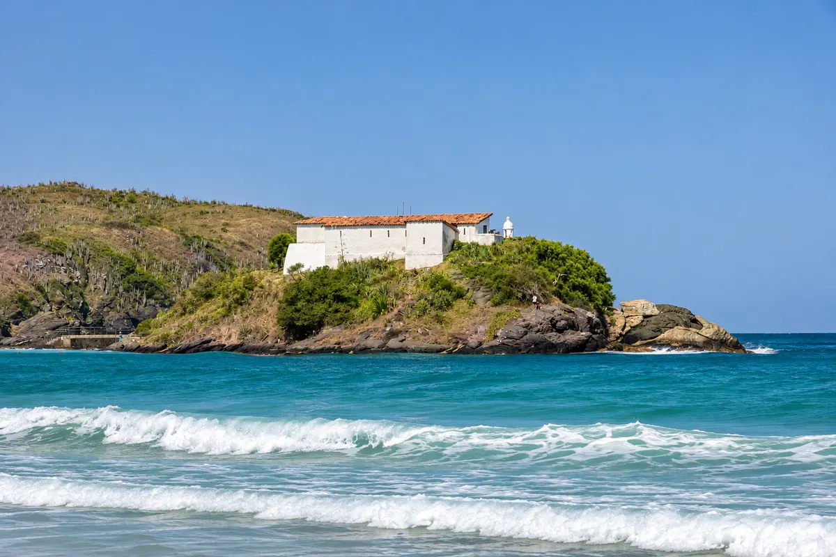
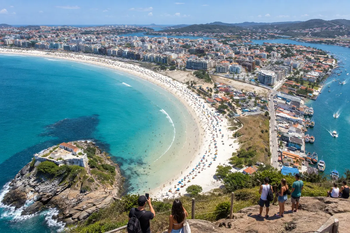
Praia do Forte is a landmark of Cabo Frio, with light sand, open sea and a waterfront promenade. Forte São Mateus is part of the landscape at one end of the beach.

 Išči
Brazilija
 Antarktika
 Argentina
 Bolivija
 Čile
 Kolumbija
 Ekvator
 Gvajana
 Francoska Gvajana
 Falklandski otoki (Malvini)
 Paragvaj
 Peru
 Surinam
 Urugvaj
 Venezuela
 Nemčija
 Avstrija
 Belgija
 Hrvaška
 Danska
 Slovaška
 Slovenija
 Španija
 Finska
 Francija
 Grčija
 Nizozemska
 Madžarska
 Irska
 Islandija
 Italija
 Luksemburg
 Norveška
 Poljska
 Portugalska
 Združeno kraljestvo
 Češka
 Švedska
 Švica
 Turčija
 Bermudi
 Kanada
 Združene države Amerike
 Grenlandija
 Mehika
 Sveta Peter in Mihael
 Dominikanska republika
 JaponskaTurčija
 Južnoafriška republika
 Egipt
 Avstralija
 Fidži
 Nova Zelandija
 Papua Nova Gvineja
Rio de Janeiro · Brazilija
Destinacija: Região dos Lagos.
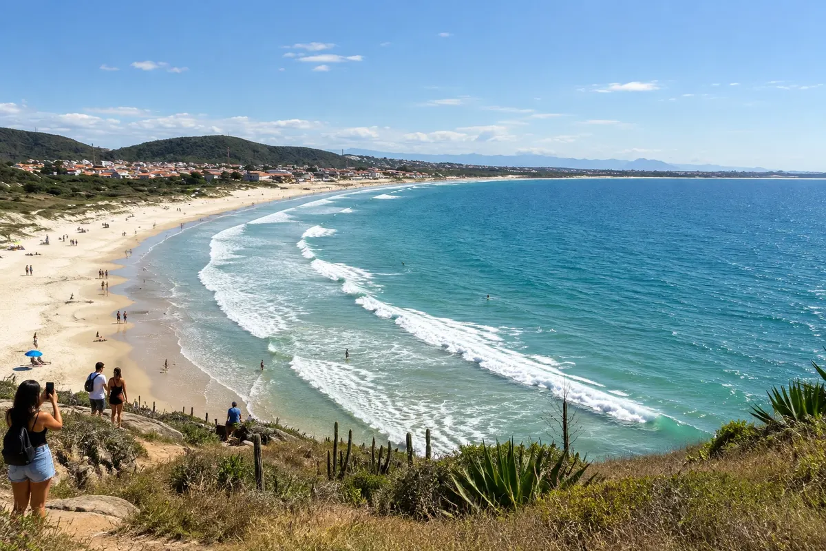
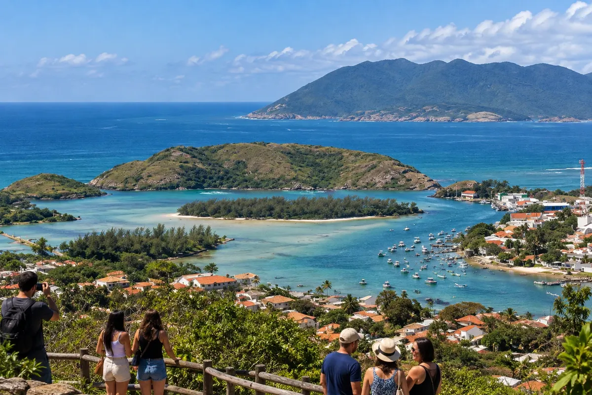
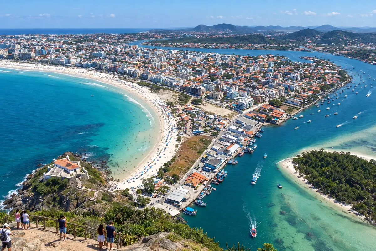
Na fotografiji: Cabo Frio: Praia do Forte, downtown, Canal do Itajuru and Ilha do Japonês.
Illustrative images. The pictures in this guide are illustrations based on the real place, not photographs, and may differ from it.
Mesto
Cabo Frio combines beach, waterside scenery along the canal and urban walks. Praia do Forte is one of the city's highlights, while the neighborhood of Passagem brings together heritage and gastronomy. Peró and Ilha do Japonês expand the options for those who want to spread outings over several days.
Cabo Frio is the largest city in the Região dos Lagos, on the coast of the state of Rio de Janeiro, about 156 km from the capital. It lies between Arraial do Cabo, 13 km away, and Búzios, 25 km away, and therefore serves as a base for the whole region. But it has attractions of its own: long beaches of white, fine sand, a channel of transparent water that cuts through the city, dunes and one of the country’s oldest colonial cores.
The city was founded on November 13, 1615 and presents itself as the seventh oldest in Brazil. The Portuguese occupied the channel mouth to ward off the French and Dutch and secure brazilwood extraction; Forte São Mateus, from the 17th century, built of stone, lime and whale oil at the entrance of the Itajuru Channel, dates from that era. From the colonial period also remain the Convent of Our Lady of the Angels, of the Franciscans, the Church of Our Lady of the Assumption, from 1667, and the Chapel of Our Lady of the Guide, from 1740, atop a hill overlooking the town. Later came the salt cycle, which also left marks in the city.
The geography is understood from the channel. The Itajuru links Lagoa de Araruama to the sea and separates the Center on one side from the Gamboa, Ogiva and Peró neighborhoods on the other. On the Center side are Praia do Forte, over 7 km long, and its continuations, Praia das Dunas and Praia do Foguete, already on the border with Arraial do Cabo. Along the channel are the Passagem neighborhood, the first urban core with colorful houses now filled with bars and restaurants, and the Boulevard Canal, the promenade from which tour boats depart. At the channel mouth lies Ilha do Japonês, surrounded by shallow, clear water. Crossing the bridge, the road leads to Praia do Peró, 7 km long and mostly bordered by restinga, to the small Praia das Conchas and to the dune fields.
Cabo Frio is also a center for swimwear manufacturing: Rua dos Biquínis in Gamboa brings together dozens of shops side by side.
The municipality also includes Tamoios, the second district toward Rio das Ostras, with Fazenda Campos Novos, founded by Jesuits in 1690, and Praia do Pontal de Santo Antônio, where the river meets the sea.
The Região dos Lagos climate is the driest on the state’s coast. In summer temperatures range from 23 °C to 28 °C; in winter from 19 °C to 24 °C, still with beach-friendly sun. From May to August little rain falls and the city is empty; November and December are the most unstable months. The sea water is usually cold, even in summer. It’s often windy, which explains the dunes and the sails at Foguete.
It is a large city, with beaches far from one another: you can’t walk from Forte to Peró. Four days cover the main beaches, the channel and the historic center, and leave time for a day in Arraial do Cabo or Búzios. On holidays and in summer the crowds are intense, especially on Praia do Forte.
Cabo Frio – število nastanitev: 92.
Cabo Frio – število lokalov: 21.
Cabo Frio – nazivi in posebnosti
Doživite kraj
Praia do Forte is a landmark of Cabo Frio, with light sand, open sea and a waterfront promenade. Forte São Mateus is part of the landscape at one end of the beach.
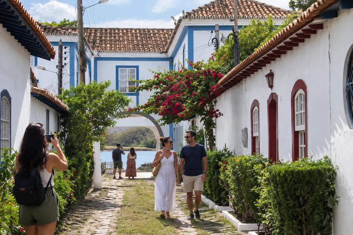
The neighborhood of Passagem brings together historic buildings, Igreja de São Benedito and a dining hub. It's a good option for a stroll and to end the day in Cabo Frio.
Praia do Peró is one of Cabo Frio's options for spending time at the sea and on the sand. It is also known for the presence of surfers.
Ilha do Japonês sits where the Lagoa de Araruama meets the sea, in Cabo Frio. Visiting it requires planning access and monitoring local conditions.
Portuguese fort from the early 17th century, built on the rocks at the corner of Praia do Forte, at the entrance to the Itajuru Channel. Listed by the national heritage institute, it welcomes visitors and offers views over Cabo Frio’s waterfront.
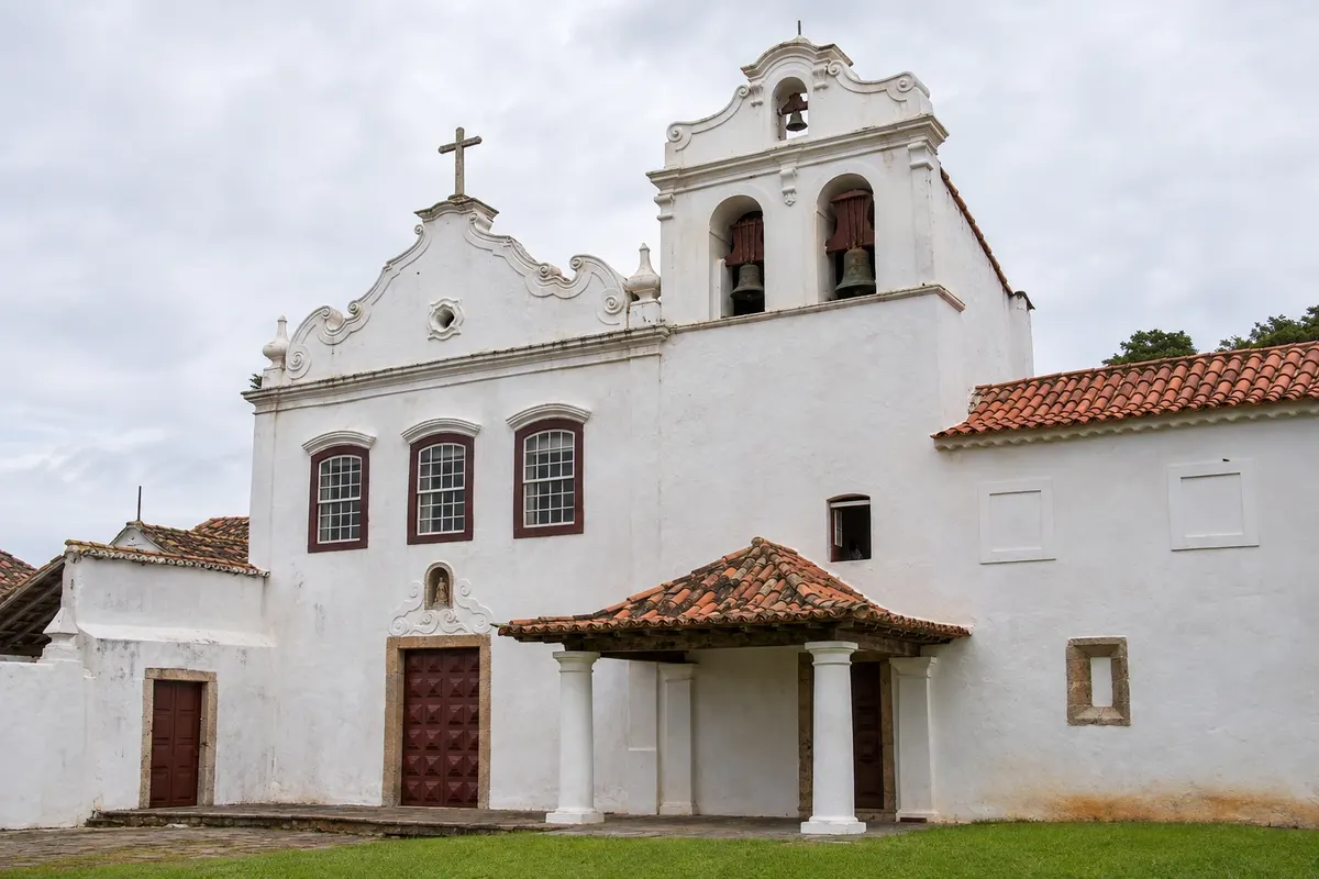
Former Franciscan convent from the late 17th century, at the foot of Morro da Guia in Cabo Frio. The church houses the Museum of Religious and Traditional Art, with sacred art and items from the region’s history.
Raziščite Convent of Our Lady of the Angels and Museum of Religious and Traditional Art
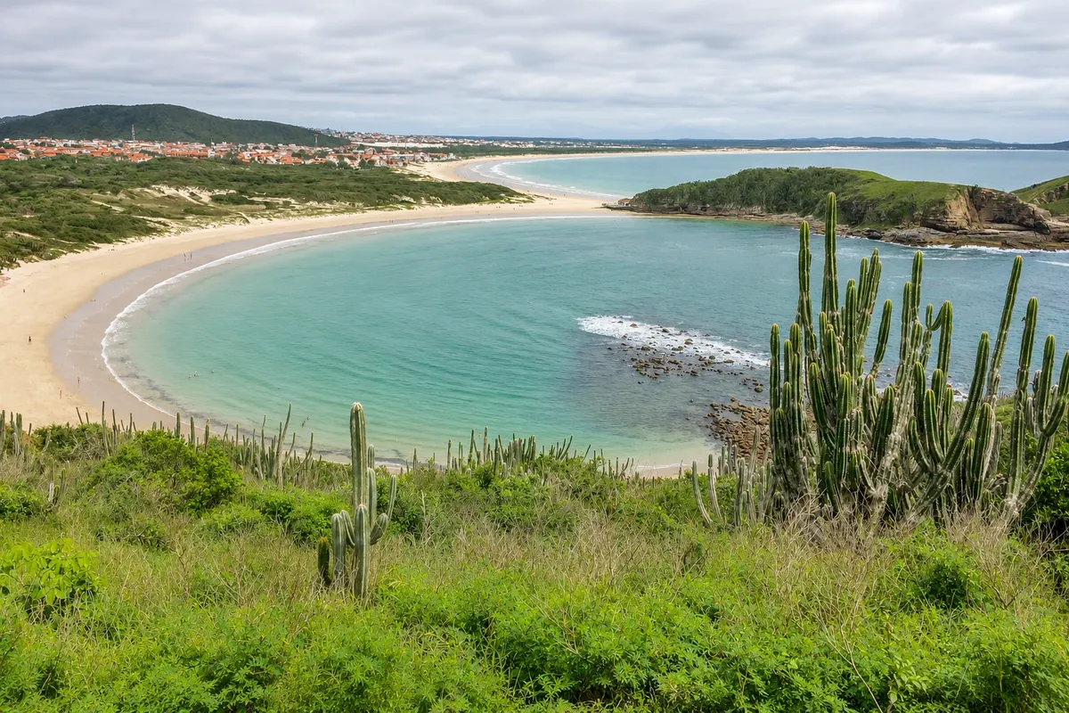
A crescent-shaped cove between two hills in the Peró neighborhood of Cabo Frio. It has about 600 meters of sand and calmer water than the neighboring beaches, so it is favored by families.
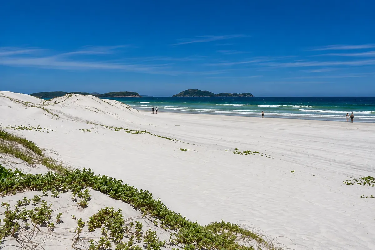
Open-ocean beach in Cabo Frio, a continuation of Praia do Forte, bordered by white sand dunes. It has stronger waves than Praia do Forte and is popular with surfers and people who enjoy walking along the shoreline.
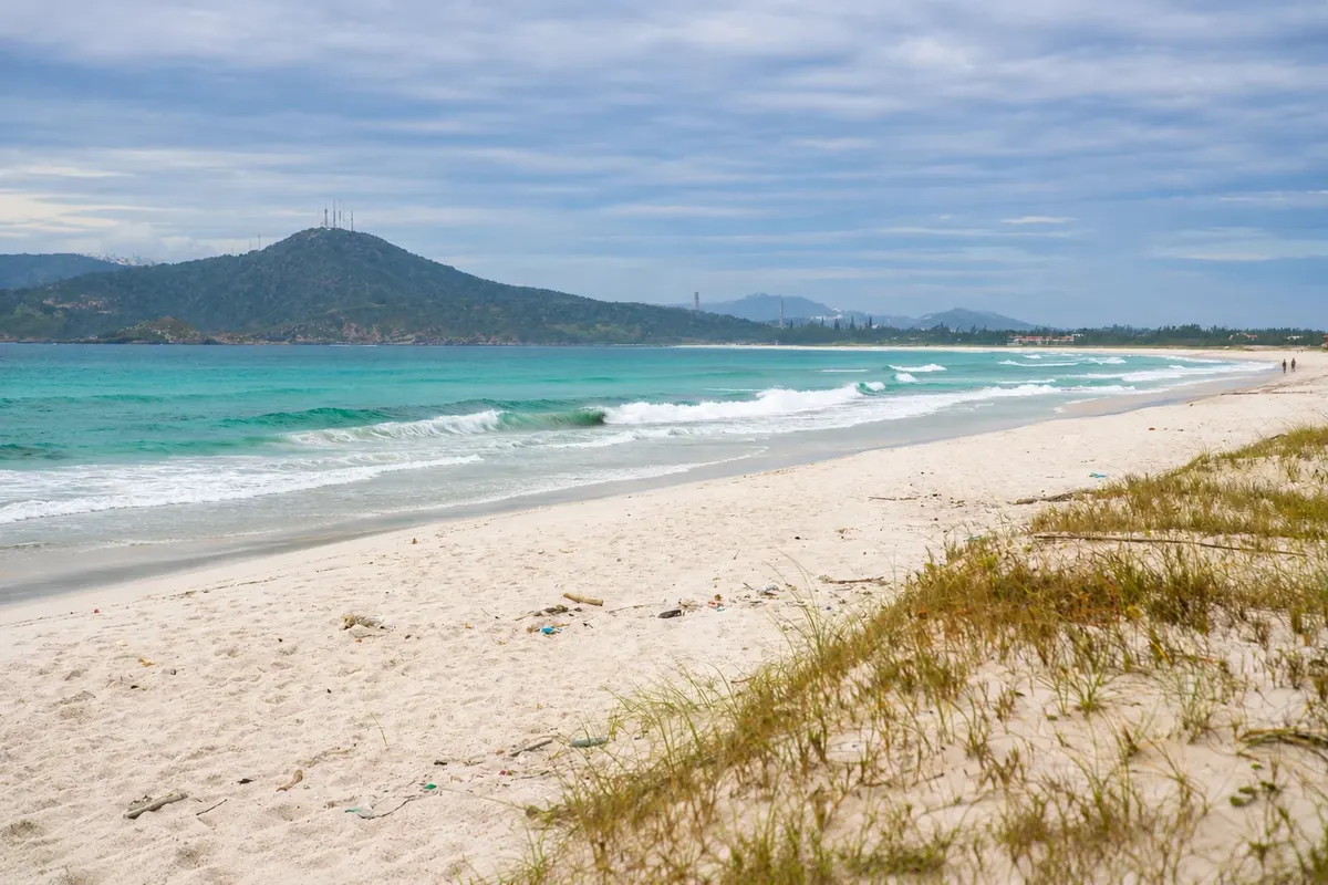
Open-ocean beach, cold deep water along the road between Cabo Frio and Arraial do Cabo. It has strong waves, attracts surfers and kitesurfers, and is usually less crowded than the downtown beaches.
Kaj izbrati pred odhodom
Izhodišče, trajanje, potek, vključene storitve in okvirna cena vsakega izleta.
Praia do Forte is Cabo Frio’s main urban beach and its best-known: more than 7 km of fine white sand, blue transparent sea, a boardwalk and kiosks along its entire length. It is exposed ocean, with waves along much of the beach, and is also used for water sports. The stretch of interest for those with children is the left corner, which locals call Lido. There, near the rocks and close to the entrance of the Itajuru Channel, the water stands still and small tide pools form among the rocks. In that same corner is Forte São Mateus, the structure that gives the beach its name. The Portuguese built it in the 17th century to defend the channel mouth from French and Dutch ships and to protect brazilwood extraction. The walls are stone and mortar, made with lime and whale oil. It is listed by Iphan, the federal heritage agency, and sits at the entrance of the Itajuru Channel, at the start of the beach. Confirm before you go whether the interior is open for visits; from the outside it can be seen at any time. In the middle of the waterfront, Praça da Cidadania has a craft fair that runs every day and gets busy at night, when most booths open and the food stalls fill up. Next to it is the Espaço Cultural do Surfe, which keeps hundreds of boards from the 1950s onward, trophies and photos that tell the history of the sport in Brazil.
Kraji na poti: Praia do Forte, Forte São Mateus, Praça da Cidadania, Espaço Cultural do Surfe.
Vključuje: There is no charge to enter the beach or to view the fort from the outside. Chairs, umbrellas and purchases at the kiosks are paid separately; city rules prohibit a minimum-consumption charge at beach stalls. Check the current price list.
Nasvet: Arrive early at the fort corner on weekends: it’s the stretch that fills first. Loudspeakers and barbecues are prohibited on the city’s beaches, and pets are not allowed on the sand. A red flag indicates the sea is unsafe for bathing.
Najboljši čas za obisk: All year. From May to August there are fewer people; in January and on holidays the beach gets very crowded.
Passagem is where Cabo Frio began. It was the oldest Portuguese settlement area and, between 1616 and 1660, the only urban nucleus. The name comes from the port that once stood there, where people and goods crossed the Itajuru Channel. The neighborhood is small and can be walked in a few minutes. The 19th- and 20th-century houses are painted in strong colors and face the canal, full of fishing boats. In the center is Praça São Benedito, with the Church of São Benedito, built in 1761 for the brotherhoods of enslaved people, and a sculpture of boys playing capoeira. Around the square and on the nearby streets are bars and restaurants with sidewalk tables, some right on the water: it is the city’s main nightlife spot. Before sitting down, climb Morro da Guia. The path is a cobblestone slope, covered in about 15 minutes. On top stands the Chapel of Nossa Senhora da Guia, built in 1740, small and white, listed by Iphan. It opens only on feast days, but the courtyard in front serves as a lookout and is always accessible. From there you can see the channel, the boats and much of the town, and the place is popular at sunset. On the hill there are also stones with grooves left by the Tupinambá for sharpening axes and arrows. Back on the waterfront, follow the Boulevard Canal, a promenade along the Itajuru, with launches and schooners docked on one side and restaurants with verandas on the other.
Kraji na poti: Bairro da Passagem, Igreja de São Benedito, Canal do Itajuru, Morro da Guia, Capela de Nossa Senhora da Guia, Boulevard Canal.
Vključuje: Self-guided visit, no entrance fee. Food and drinks at bars and restaurants are each person’s responsibility.
Nasvet: Climb the hill with a light and come down to dine in the Passagem. Wear sturdy shoes for the slope. On weekends, the restaurants around the square fill up early; reserve or arrive before dinner.
Najboljši čas za obisk: Year-round, preferably at late afternoon with a clear sky.
This is the itinerary for a rainy day, strong wind or sunburn, and it shows why Cabo Frio is among Brazil’s oldest towns. Start at the Convent of Nossa Senhora dos Anjos in Largo de Santo Antônio. It was built by the Franciscans at the end of the 17th century and is protected by Iphan. Inside is the Museum of Religious and Traditional Art, linked to the Brazilian Institute of Museums, with terracotta and wooden images, furniture and other pieces that belonged to the convent, plus temporary exhibitions and concerts. The Church of Nossa Senhora da Assunção, the main church, is on Praça Porto Rocha. It was built in 1667 in a Jesuit style and has Baroque altars; on the high altar, brightly colored, is the patron saint’s image, carved in wood in Lisbon. Notice the baptismal font, made of lioz stone. On Avenida Assunção, the Casa de Cultura José de Dome, known as Charitas, occupies an 18th-century building originally intended as a charitable house. It hosts exhibitions and musical performances, and the rear courtyard preserves the city’s pillory, a stone column dated 1660. Near Boulevard Canal on the Itajuru waterfront, the Casa-Ateliê Carlos Scliar preserves the painter’s studio and works; he lived for decades in Cabo Frio. To finish with shopping, cross the Feliciano Sodré Bridge to Gamboa: Rua dos Biquínis has dozens of beachwear shops, and in many of them tops and bottoms are sold separately.
Kraji na poti: Convent of Nossa Senhora dos Anjos, Museum of Religious and Traditional Art, Church of Nossa Senhora da Assunção, Charitas, Casa-Ateliê Carlos Scliar, Rua dos Biquínis.
Vključuje: Charitas does not charge admission, and the church is open to visitors. Check with the museum and the Casa-Ateliê for opening days and whether there is a fee. Purchases are each person’s responsibility.
Nasvet: Museum, cultural center and artist’s studio close on some days of the week and have different visiting hours: confirm before you go and start with the one that closes earliest. In the church, avoid mass times.
Najboljši čas za obisk: All year; it’s the option for days without beach.
Ilha do Japonês is a tiny island of sand and vegetation at the point where Lagoa de Araruama, via the Canal do Itajuru, meets the sea. The water around it is brackish, shallow, wave-free and very transparent, and it changes tone depending on the sun and the tide. The island is so small that you can walk around it in about 10 minutes. It is part of the Parque Estadual da Costa do Sol. There are two ways in. The simplest is the water taxi that departs from the sand of the Passagem neighborhood: the crossing takes about 5 minutes and no reservation is needed. The other is by land: cross the Ponte Feliciano Sodré toward Ogiva and continue to the end of Avenida dos Espadartes, where there is parking. From there it is a 5–10 minute walk to the shore. At low tide you can cross on foot through the water; at high tide the foot passage should not be attempted, and a small boat makes the crossing in 2 minutes. There is no fixed kiosk or chair rental on the island; shade comes from the trees. At low tide a wide sandbank appears, good for children, and the still water is suitable for kayaking, canoeing and paddleboarding. Birds and crabs are part of the landscape: do not feed them. From the same point in Ogiva the trails to Farol da Lajinha and Praia Brava depart, which can be combined with the island on the same day.
Kraji na poti: Ilha do Japonês, Canal do Itajuru, Passagem neighborhood, Ogiva, Parque Estadual da Costa do Sol.
Vključuje: Access to the island is free. Water taxi, parking and kayak or paddleboard rentals are paid separately. Check prices on site.
Nasvet: Check the tide table before you go and try to go on a weekday: on holidays and weekends the island gets crowded. Bring water, snacks, a hat and a bag to take your trash back. Glass and speakers are not allowed on the boats.
Najboljši čas za obisk: All year round, on sunny, low-wind days when the water gets clearer. Avoid holidays.
On the other side of the channel, the Boca da Barra Municipal Park brings together, among cacti and low vegetation, the trails with the most open views of Cabo Frio. The starting point is the same as for Ilha do Japonês by land: the end of Avenida dos Espadartes, in Ogiva. After the parking area, follow a wide dirt road until a sign indicating the region’s trails. The trail to Farol da Lajinha is about 1.3 km. Go left, following the channel’s water, until the trailhead sign; then there is a stretch of ascent. The lighthouse dates from 1913. From the top you can see Boca da Barra, where the channel meets the sea, Praia do Forte and its continuations, Ilha do Japonês and the Itajuru. Round trip takes about 1 hour 30 minutes. The Praia Brava trail is about 1 km and is described by the city as difficult access. The beach sits between cliffs about 20 meters high, with clear water and rough sea. It’s frequented by surfers in one section, and by naturists in another, reserved for those who practice nudism. If you just want to see it from above, use the lookout indicated near the lighthouse. From the same access point there is also the roughly 1.5 km path to the so-called Caverna dos Escravos, a 50-meter-long gallery whose origin is told in legends.
Kraji na poti: Boca da Barra Municipal Park, Farol da Lajinha, Praia Brava, Itajuru Channel.
Vključuje: Trails have no entrance fee. Parking and local guide are paid separately.
Nasvet: The city recommends doing the trails with a licensed guide. Bring water, a hat and closed shoes; there is little shade. At Praia Brava, respect the naturism area and do not enter the sea when waves are strong.
Najboljši čas za obisk: From April to September, when it’s cooler. Avoid the middle of the day in summer.
Peró is the beach for those who want distance from the downtown crowds. It is 7 km long, and the urban area occupies only 1 km of the shoreline: the rest is a wide stretch of sand bordered by preserved restinga. The sea is blue and wavy, attracting surfers, with calmer sections where families settle. The right corner concentrates the kiosks, with chairs and snacks; the left side is almost deserted. The beach holds the international Blue Flag, which it received in 2018—the first in the state of Rio de Janeiro to obtain it—and has renewed it in consecutive seasons. The program assesses water and sand quality, accessibility and services. At the end of the right corner, Morro do Vigia separates Peró from Praia das Conchas. A gateway beside a restaurant marks the start of the circular trail, about 860 meters, with climbs; allow 1 hour 30 minutes including stops. It passes viewpoints over both beaches and small coves, like Pesqueirinho, where fishermen’s boats and nets sit. Gruta do Vigia is reachable only at low tide, over the rocks, and requires a guide. Praia das Conchas is 600 meters long, has a shell shape and a more sheltered sea than Peró. Tide pools form among the rocks, about 200 meters from the parking area, along a flat path. From the top of the headland on the right side, the two beaches together make a heart shape. You can reach Conchas by walking along Peró’s sand or by a dirt road.
Kraji na poti: Praia do Peró, Morro do Vigia, Praia das Conchas, Praia do Pesqueirinho, Gruta do Vigia.
Vključuje: Access to the beaches and the trail is free. Parking, chairs, purchases and guides are paid separately. Check the current price list.
Nasvet: Do the trail in the morning and end the day at the Conchas, which has calmer water. At the natural pools, watch the tide: waves can come in between the rocks. Do not bring a speaker or animals onto the sand, and do not feed the birds.
Najboljši čas za obisk: All year. From May to August the weather is more stable and the beach is almost empty.
Cabo Frio has two fields of very white sand dunes formed by the constant wind along this stretch of coast. Both can be visited on foot and are located in protected areas. The Peró Dunes stretch behind the beach of the same name, between the Parque Estadual da Costa do Sol and the Área de Proteção Ambiental do Pau-Brasil. The shortest access is via a dead-end street in the Peró neighborhood: park the car and climb the sand for about 5 minutes. From the top you can see the beach in the distance and the surrounding restinga. After periods of rain, small freshwater lagoons form between the sand mounds; these are temporary and may not be present. The Duna Mãe, also called Dama Branca, is in the Parque das Dunas, near the Dunas and Foguete beaches, on the road that connects Cabo Frio to Arraial do Cabo. Park in front of the Praia das Dunas condominium, cross the road, and a sign from the Parque Estadual da Costa do Sol marks the start of the sand path. The climb takes about 20 minutes and is tiring because of the surface. It is one of the spots sought at sunset. The rules are the same in both places. The dunes and the restinga are permanent preservation areas: circulation of buggies, ATVs, motorcycles and cars is prohibited and monitored by the municipal environmental guard. Walk only on already opened paths, without stepping on the vegetation that holds the sand, and take your trash back with you. No bonfires are allowed. Local guides offer sandboarding lessons with equipment, by reservation.
Kraji na poti: Peró Dunes, Praia do Peró, Duna Mãe, Parque das Dunas, Parque Estadual da Costa do Sol, Área de Proteção Ambiental do Pau-Brasil.
Vključuje: Access on foot with no entrance fee. Sandboarding with guide and equipment is paid separately and requires reservation.
Nasvet: Go early in the morning or late in the afternoon: at midday the sand burns and there is no shade. Bring water, a hat and sunglasses because of the wind and glare. Do not accept motorized-vehicle rides over the dunes.
Najboljši čas za obisk: All year. The lagoons between the dunes depend on rainfall.
Seeing Cabo Frio from the water helps you understand how the town is organized around the channel. Boats depart from Boulevard Canal, and there are two itineraries. The short one stays inside the Itajuru and lasts about 1 hour 30 minutes. The schooner goes slowly down the channel, passing the houses of Passagem, Japonês Island and the final stretch, from where you can see Praia do Forte. There is a bar on board and departures are in the afternoon at more than one time; some departures are scheduled to coincide with sunset, with live music. The channel’s water is calm, and the trip is suitable for any age. The long one takes about 3 hours and goes out to sea via Boca da Barra. It passes in front of Forte São Mateus and Lajinha Lighthouse, skirts Praia Brava and reaches Ilha dos Papagaios, where there is usually a stop for snorkeling with a mask. There are two swim stops beside the boat, which serves drinks and snacks. The sea departure depends on the day’s conditions. Smaller boats also leave from Passagem and from the channel itself, including those that cross to Ilha do Japonês and to Gamboa, where Rua dos Biquínis is located. The city hall recommends boarding only registered boats with a permit. It is not allowed to board with speakers or glass containers.
Kraji na poti: Itajuru Channel, Passagem neighborhood, Japonês Island, Forte São Mateus, Lajinha Lighthouse, Praia Brava, Ilha dos Papagaios.
Vključuje: Usually navigation, life jacket, and buoys are included. Drinks, snacks, snorkeling mask and the boarding fee are paid separately. Check the current price list with the operator.
Nasvet: For the sea itinerary, choose days with light wind and bring a light jacket. Bring cash for the boarding fee. If you get seasick, you’ll be better off on the tour that stays inside the channel.
Najboljši čas za obisk: All year round, depending on sea and wind conditions.
The sand strip of Praia do Forte does not end: it simply changes name. Continuing toward Arraial do Cabo, it becomes Praia das Dunas and then Praia do Foguete. The sand and the sea color are the same; what changes is the level of activity, which decreases the farther you get from the center. Praia das Dunas has more waves than the section by the fort and is frequented by surfers. The name comes from the sand dunes that line the shore. Foguete is about 4 km from the center, on the border with Arraial do Cabo. It is the emptiest of the three. The waters are cold and deep and the waves are strong; the constant wind makes it a kitesurfing and windsurfing spot. It’s a beach for walking, watching and practicing sports rather than for swimming. In front of a stretch of Foguete is Lagoa do Foguete, with dark, still water where you can bathe with the sea in view. There is no gate or infrastructure on the shore. Access is via one of the streets that lead from the road toward the beach, and map apps often get the route wrong: ask your accommodation which entrance to use. To complete the day, the Duna Mãe is on the same stretch of road, and late afternoon is the right time to climb it.
Kraji na poti: Praia das Dunas, Praia do Foguete, Lagoa do Foguete.
Vključuje: Free access to the beaches and the lagoon. Bring what you will consume.
Nasvet: With children, stay at the stretch by the fort or go to Conchas: here the sea is strong. Respect the signal flags. Bring a sunshade and water.
Najboljši čas za obisk: All year round. For sailing, choose days with steady wind.
Tamoios is Cabo Frio’s second district, located toward Rio das Ostras along the Amaral Peixoto Highway. Few people staying in downtown go there, and the trip shows a different Cabo Frio — farms, native forest and a river mouth. Fazenda Campos Novos is accessed directly from the highway. It was founded by the Jesuits in 1690, when they built the residence and the Church of Santo Inácio, and the 17th-century complex is listed by the state heritage authority. The site’s history includes slavery and the resistance of the region’s Black population. Notable visitors include the naturalist Charles Darwin, in 1832, and Emperor Dom Pedro II, in 1847. Also in Tamoios is the Municipal Natural Park of the Golden Lion Tamarin, created in 1997 to protect one of the municipality’s last remnants of Atlantic Forest. It is home to the golden lion tamarin, the two-toed sloth and the beach butterfly, and it receives visitors; large groups need to schedule in advance. The day ends at Pontal de Santo Antônio Beach, where the São João River flows into the sea. The water there is calm, suitable for children and older people, and the kiosks serve fish. Access is via the seaside avenue toward Barra de São João. From Tamoios there are also boat trips along the São João River. This is an itinerary to do by car.
Kraji na poti: Tamoios, Fazenda Campos Novos, Church of Santo Inácio, Municipal Natural Park of the Golden Lion Tamarin, Pontal de Santo Antônio Beach, São João River.
Vključuje: Visiting the farm and the park has no entrance fee. Purchases at kiosks and boat rides are paid separately.
Nasvet: Confirm the farm and park opening days before you go. Bring insect repellent for the forest area. The park animals are wild: they appear when they want and must not be fed.
Najboljši čas za obisk: All year round, on dry days; from May to August there is less rain.
Odgovori na vaša vprašanja
Yes. The city has an airport, bus station, accommodation and dining options. Choose your base according to planned outings and allow time to visit the other towns.
We suggest Praia do Forte and the neighborhood of Passagem. This combination reduces travel time and includes beach, heritage and dining.
Confirm boat access, local conditions and the return. Avoid attempting the crossing on your own without knowing the tide and local guidance.
No. They are different beaches. Allocate a separate period for Peró and plan transport between it and your accommodation.
No. It's also possible to arrive by road or bus. If you choose to fly, check available services for your dates before organizing the rest of the trip.
From May to August there is little rain, temperatures range from 19 °C to 25 °C, and the town is quiet while still having sun for the beach. From December to March it’s warmer, 23 °C to 28 °C, and the beaches fill up, especially at New Year’s Eve, in January and during Carnival. November and December have the most unstable weather. Weekdays are quieter at any time of year.
Four days allow you to see Praia do Forte, Ilha do Japonês, Peró and the Conchas, the dunes, Passagem and the historic center. With five or six days you can add a day in Arraial do Cabo and another in Búzios. In two days, focus on the Centro side one day and the Peró side the other.
It helps a lot. Beaches are far from each other, and you can’t walk from the Forte to Peró. Without a car, use taxis, ride apps and city buses, and stay near Praia do Forte or Passagem, from where you can walk many Centro-area attractions and catch the boat to Ilha do Japonês.
It usually is, even in summer: this part of the coast receives cold waters that rise from the ocean floor. The city government describes the waters at Praia do Foguete as cold and deep. Around Ilha do Japonês, inside the Itajuru Channel, the water is shallow and still.
The left corner of Praia do Forte, near the fort, has calm water and small tide pools among the rocks. Ilha do Japonês is shallow and wave-free. Praia das Conchas is a more sheltered cove than Peró. In the Tamoios district, Pontal de Santo Antônio has calm water at the river mouth. Dunas and Foguete have strong surf.
No. City rules prohibit sound equipment and barbecues on the beaches, and domestic animals are not allowed on the sand. You should also not feed birds or other wild animals. On sightseeing boats, speakers and glass containers are not permitted aboard.
No. The dunes and the restinga are permanent preservation areas, and the circulation of motorized vehicles is prohibited and monitored by the municipal environmental guard. Visits are made on foot along already opened paths. Local guides offer sandboarding, which does not use motors.
The fort is at the left corner of Praia do Forte, at the channel entrance, and can be seen up close at any time. Access to the interior depends on specific days and times set by the administration. Confirm with the tourism office before going.
Visit the Convento de Nossa Senhora dos Anjos, which houses the Museum of Religious and Traditional Art, the Igreja de Nossa Senhora da Assunção, Charitas and the Casa-Ateliê Carlos Scliar. The Surf Cultural Space is next to Praia do Forte. There are also the shops on Rua dos Biquínis and the restaurants in Passagem and along Boulevard Canal.
Nightlife centers on the Passagem neighborhood, around Praça São Benedito, with bars and restaurants with sidewalk seating and live music. Boulevard Canal has restaurants with balconies facing the water. At Praia do Forte, the Praça da Cidadania craft fair operates at night, with food stalls.
Arraial do Cabo is 13 km away, about a 20-minute drive. Búzios is 25 km away, a 30–45 minute drive. There are urban buses to both towns, as well as taxis and ride‑hailing apps, and agencies in Cabo Frio sell full‑day tours with transport and boat.
It’s a street in the Gamboa neighborhood with dozens of beachwear shops side by side. The city is one of the country’s garment production centers for the sector. You reach it via the Feliciano Sodré Bridge or by boat on a short crossing from the channel in the city center.
Več kot vodnik