Costa de la Roca

Rocha · Urugvaj

Costa de la Roca

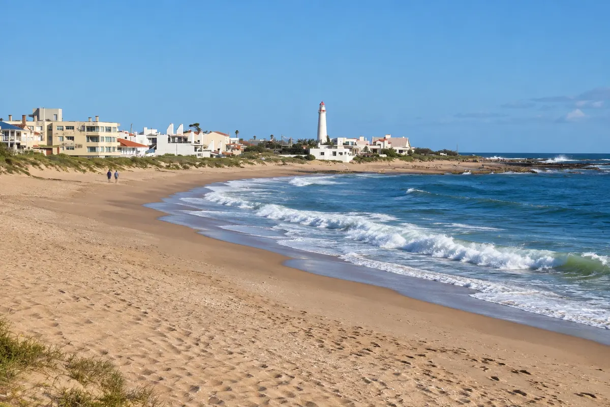
Atlantic coast of the department of Rocha, with the lighthouse of La Paloma, the car-free village of Cabo Polonio and Punta del Diablo, near Chuí and two colonial fortresses.

East Coast

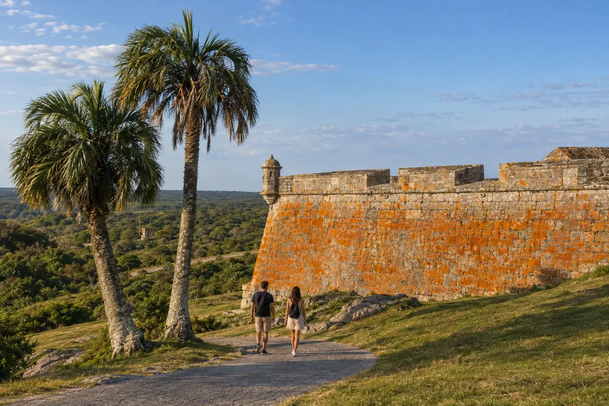
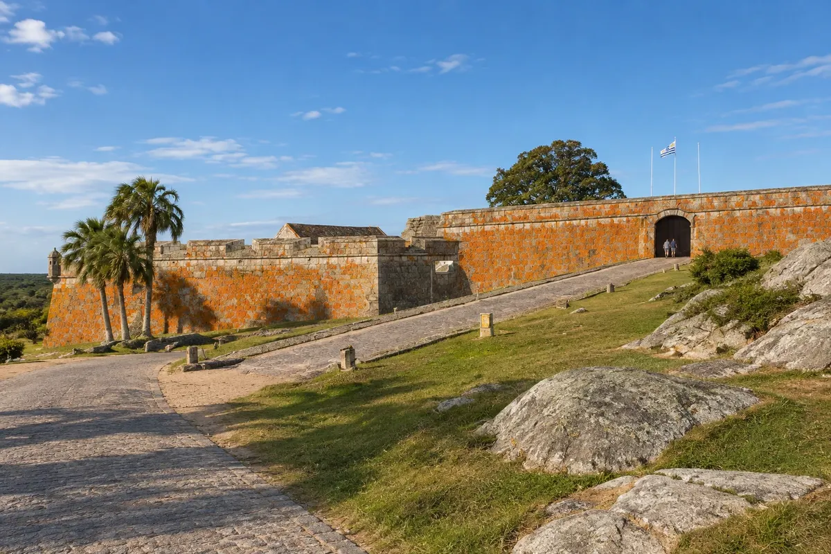
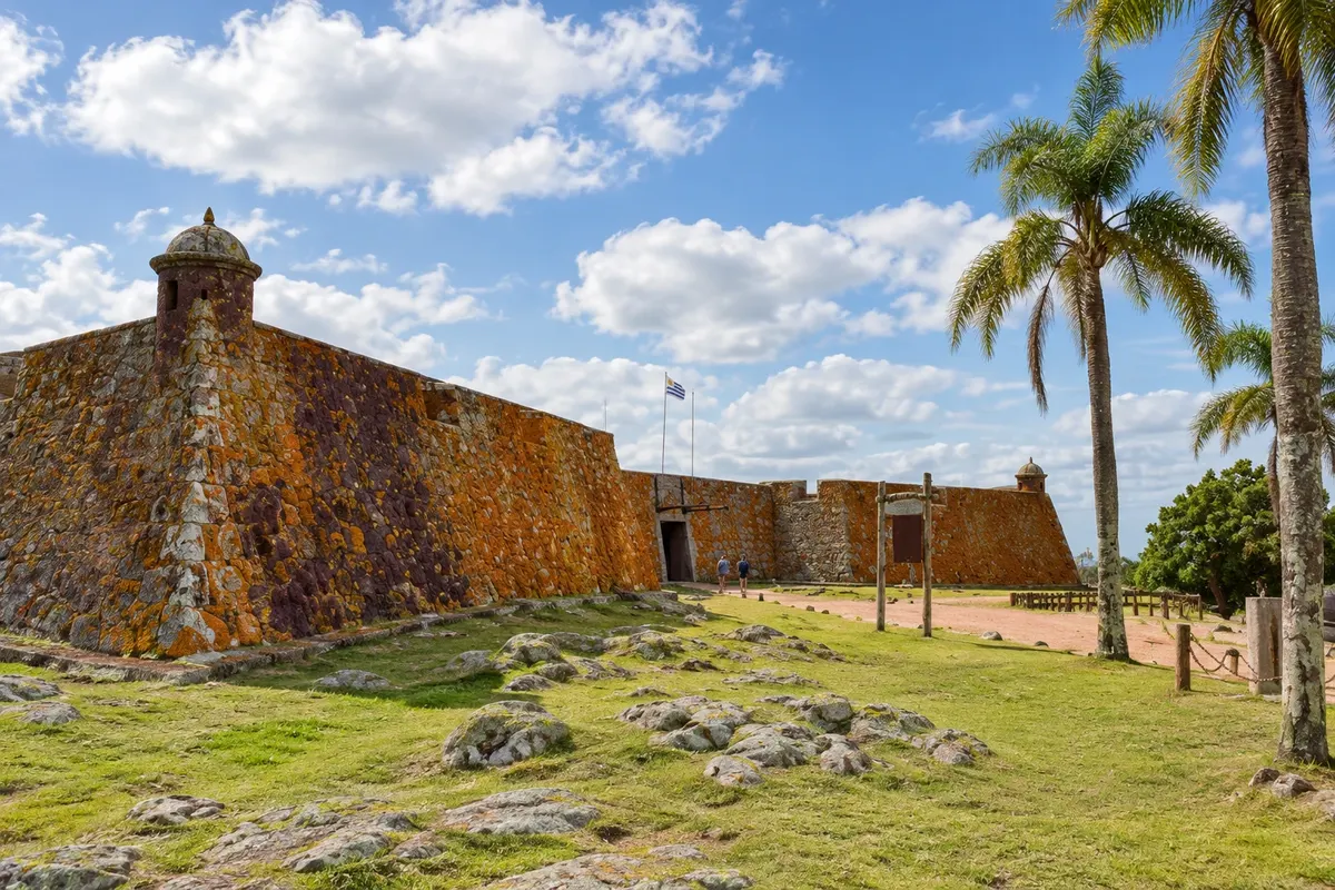
Na fotografiji: Fortaleza de Santa Teresa, Rocha

Illustrative images. The pictures in this guide are illustrations based on the real place, not photographs, and may differ from it.

Na voljo v trgovini Google Play Pošljite svoje fotografije

Spoznajte kraj

Pokrajina, ki jo doživite
v svojem ritmu.

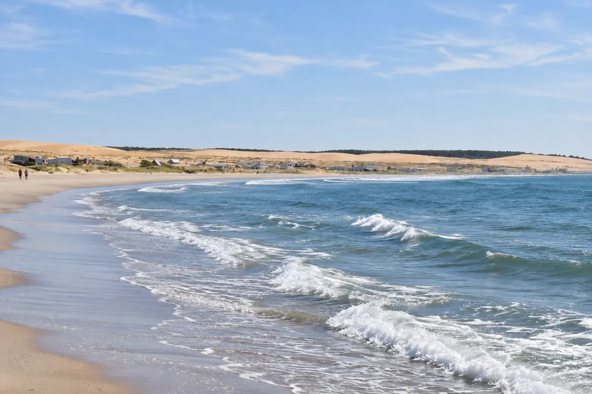
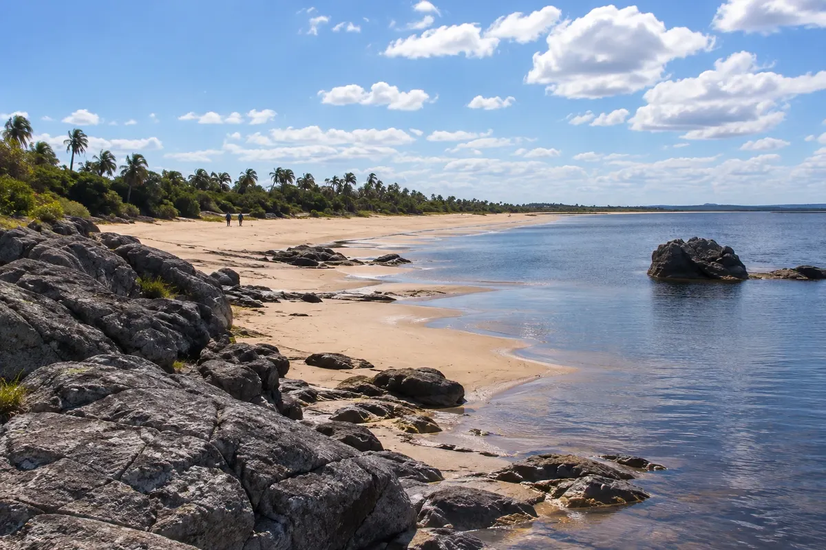
The Costa de Rocha occupies the Atlantic coastline of the department of Rocha, in eastern Uruguay, between Laguna Garzón and the Chuí border. It has more than 180 km of ocean beaches, interspersed with coastal lagoons, dunes and small fishing villages.

La Paloma, on Cabo Santa María, is the most developed town on the coast. It grew up around the lighthouse lit in 1874 and has beaches for every taste, from calm coves to surf stretches. Next to it is Laguna de Rocha, a protected area with more than 220 bird species.

Further north, Cabo Polonio is a village inside a national park, without an electrical grid and no access for private cars: you enter in authorized vehicles that cross the dunes. On the cape, at the foot of the 1881 lighthouse, there is a colony of sea lions.

Punta del Diablo, 42 km from Chuí, began as a shark-fishing village and today combines ranchos, surf beaches and a craft fair. Nearby are Parque Nacional de Santa Teresa, with its 18th-century fortress, Laguna Negra and, near the border, Fuerte de San Miguel.

This destination brings together 3 cities: La Paloma, Cabo Polonio, Punta del Diablo.

Delite: WhatsApp
Delite svoja popotniška doživetja s fotografijami Pošljite fotografije vsakega kraja, ki ste ga obiskali. Največje število fotografij na kraj: 5.

Ena destinacija, več poti

Mesta na tej poti

Začnite v enem mestu ali v načrt poti vključite več mest.

Costa de la Roca – lega
La PalomaCabo PolonioPunta del Diablo

Obrisi: Servicio Geográfico Militar / IDE Uruguay, Licença de Dados Abertos. Priredba: Cidade Turismo.

Kako do tja:Costa de la Roca

✈ Aeropuerto Internacional de Punta del Este Capitán de Corbeta Carlos A. Curbelo (PDP), kraj: Maldonado· 123 km do cilja (La Paloma)

✈ Aeropuerto Internacional de Carrasco (MVD), kraj: Ciudad de la Costa· 208 km do cilja (La Paloma)

From Rio Grande do Sul, you enter via Chuí/Chuy and follow Ruta 9: Punta del Diablo is about 42 km from the border and La Paloma about 160 km. From Montevideo, La Paloma is about 240 km away, with buses from Terminal Tres Cruces. Confirm before booking.

Predlagana točka prihoda:La Paloma

Doživite kraj

Kaj početi – Costa de la Roca

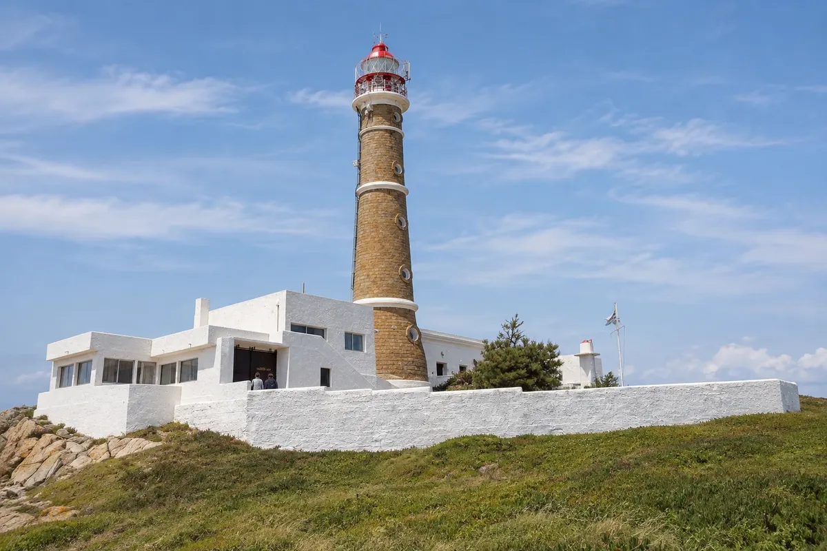
Cabo Polonio Lighthouse
Cabo Polonio · Rocha · Lighthouse

Cabo Polonio Lighthouse

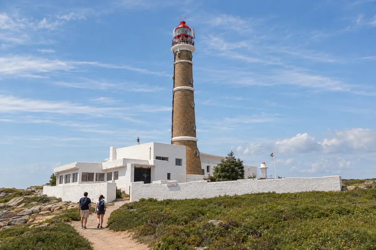
Stone lighthouse first lit in 1881 on the rocky tip of Cabo Polonio, a National Historic Monument. From the top, after 132 steps, you can see the village, the dunes, the Torres islands, and the colony of sea lions.

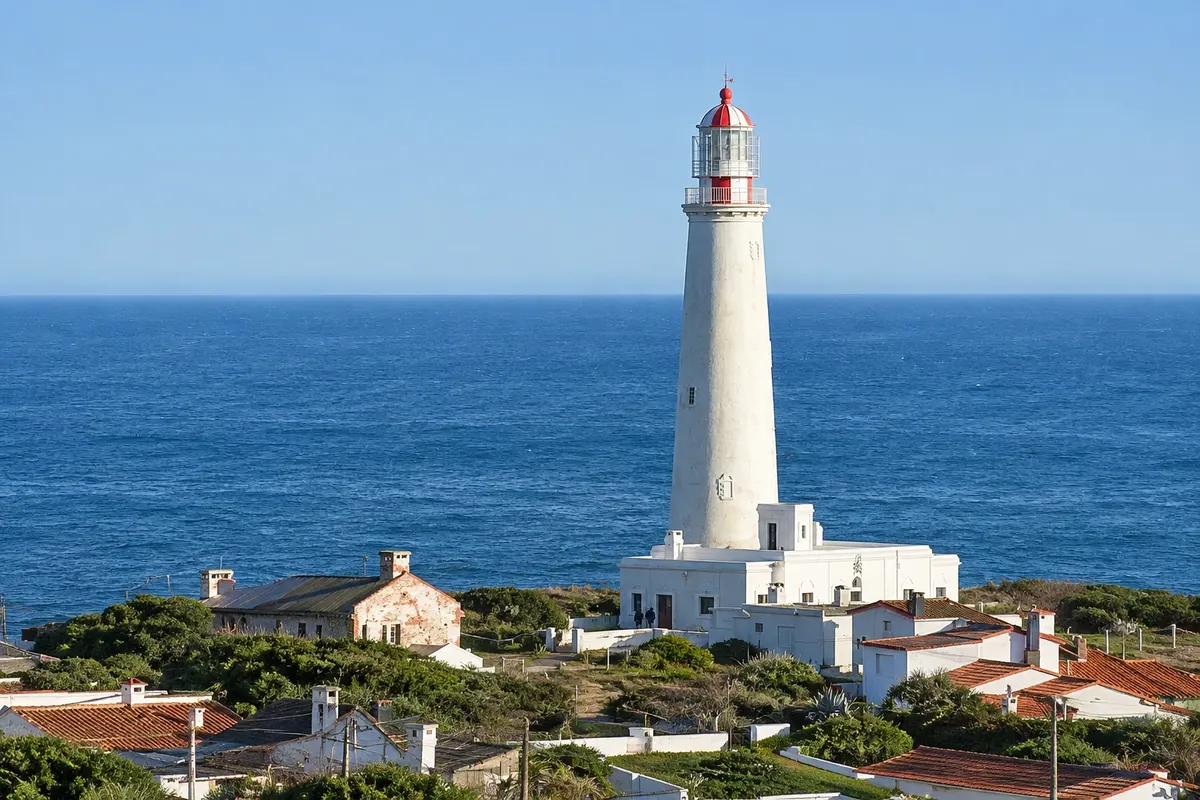
Cabo Santa María Lighthouse (Faro de La Paloma)
La Paloma · Rocha · Lighthouse

Cabo Santa María Lighthouse (Faro de La Paloma)

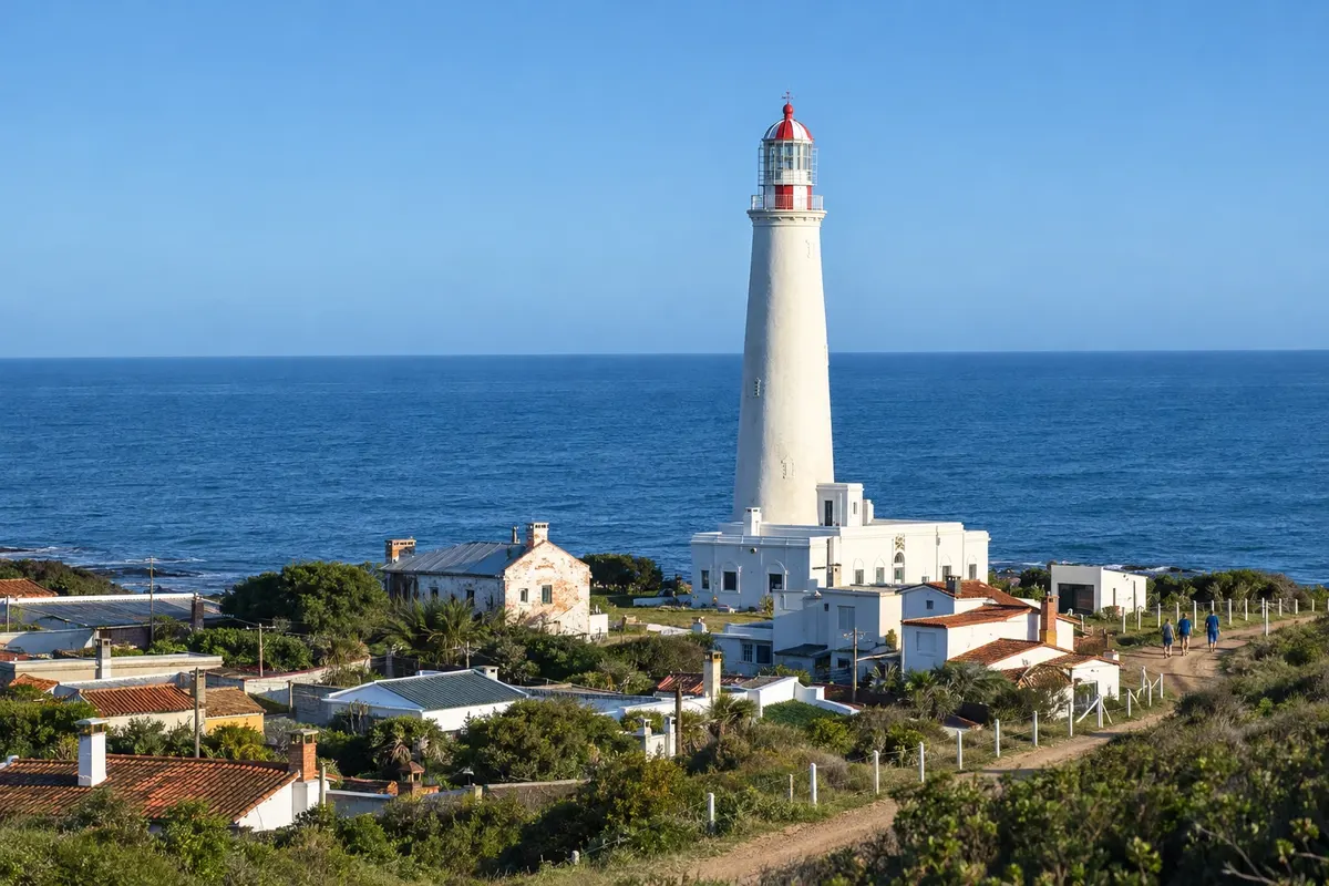
30-meter lighthouse lit in 1874 on cabo Santa María, a landmark in the founding of La Paloma. A spiral staircase of 143 steps leads to the balcony, with views over the town and the beaches.

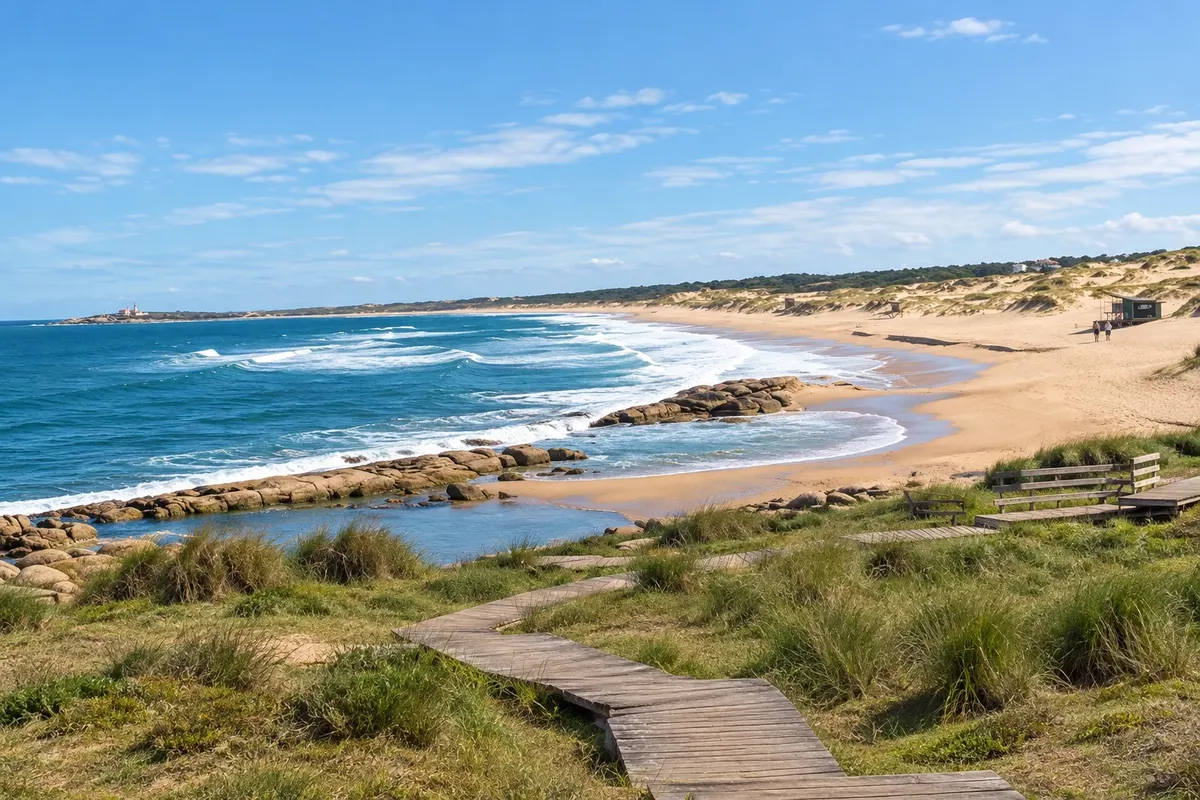
Playa de la Viuda
Punta del Diablo · Rocha · Plaža

Playa de la Viuda

Long beach south of the village of Punta del Diablo, popular with surfers for the waves that form offshore. In summer it hosts competitions with athletes from the region.

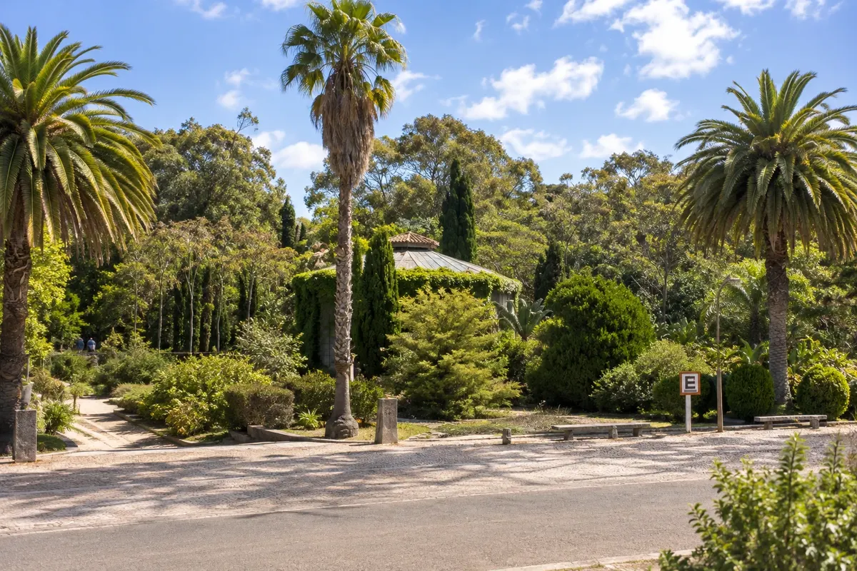
Santa Teresa National Park
Punta del Diablo · Rocha · Park

Santa Teresa National Park

A 3,000-hectare park on Ruta 9, between Punta del Diablo and La Coronilla, with more than 2 million trees, a greenhouse, rose garden, wildlife refuge, camping and four ocean beaches.

Costa de la Roca – prikaži dodatne kraje (7)
La Balconada Beach
La Paloma · Rocha · Plaža

La Balconada Beach

Open-sea beach west of La Paloma's lighthouse, where locals and tourists often gather late in the afternoon to watch the sun set over the sea and applaud.

Playa de la Calavera
Cabo Polonio · Rocha · Plaža

Playa de la Calavera

Beach north of the cape of Cabo Polonio, back-to-back with Playa Sur. It stretches for kilometers between the sea and the moving dunes, heading toward Barra de Valizas.

Fortaleza de Santa Teresa
Punta del Diablo · Rocha · Fort

Fortaleza de Santa Teresa

Stone fortress begun by the Portuguese in 1762 and completed by the Spanish, on a rise beside Ruta 9. Restored in the 20th century, it now operates as a museum within the national park.

Laguna de Rocha
La Paloma · Rocha · Lagoon

Laguna de Rocha

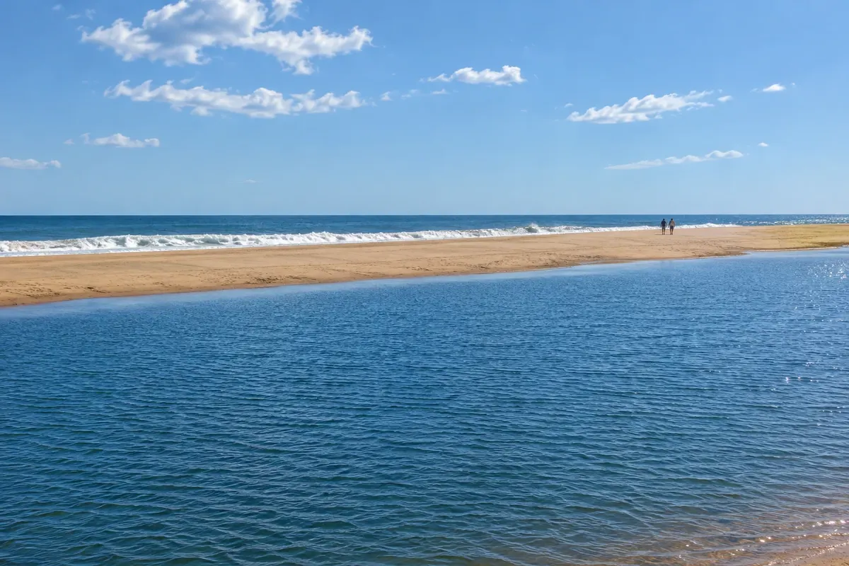
Shallow coastal lagoon separated from the sea by a sandbar, a protected area with more than 220 bird species, black-necked swans and flamingos, a few kilometers from La Paloma.

Monte de Ombúes
Cabo Polonio · Rocha · Naravni rezervat

Monte de Ombúes

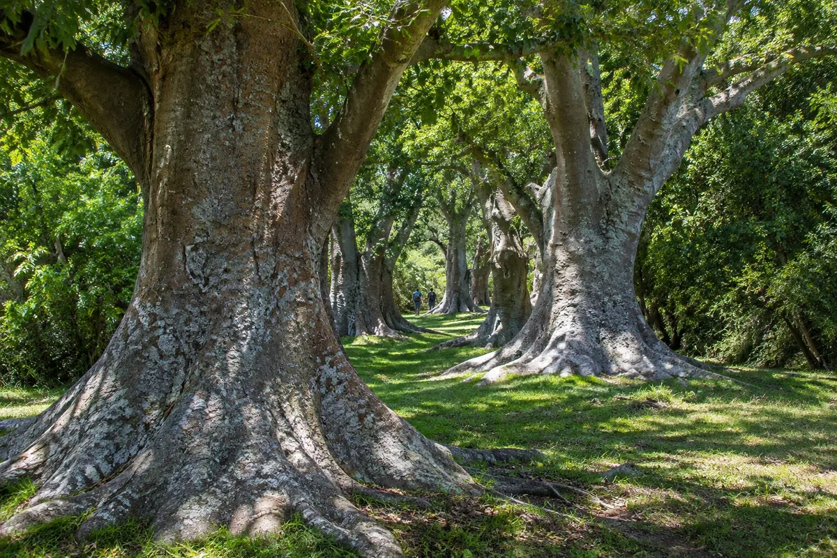
Largest grouping of ombu trees in the Río de la Plata region, along a stretch of about 20 km on the shores of the Laguna de Castillos. The visit is guided, with arrival by boat via the Arroyo Valizas or on foot.

Fortaleza de San Miguel
Punta del Diablo · Rocha · Fort

Fortaleza de San Miguel

Colonial fort of pink granite stone atop Cerro de San Miguel, 7 km from Chuí, with a drawbridge and the Military History Museum. Next to it, Cerro Picudo has a marked trail to the summit.

Laguna Negra
Punta del Diablo · Rocha · Lagoon

Laguna Negra

Large dark freshwater lagoon west of the Parque Nacional de Santa Teresa, a protected area with small calm-water beaches, native forest, rocky hills and many birds.

Kaj izbrati pred odhodom

Izleti – Costa de la Roca

Izhodišče, trajanje, potek, vključene storitve in okvirna cena vsakega izleta.

Cabo Polonio: access via Puerta del Polonio and the village

Odhod: Puerta del Polonio (Route 10, km 264.5) Dune-authorized vehicle or on foot around 6 hours, or with an overnight in the village Ves dan Lahko

Cabo Polonio lies within Parque Nacional Cabo Polonio, a protected area on Rocha’s Atlantic coast. Private cars are not allowed into the park: the parking lot and terminal are at Puerta del Polonio on Route 10, km 264.5. From there, authorized vehicles take visitors across the dunes to the village on a roughly 7 km route that usually takes 20–30 minutes. You can also walk there in more than two hours over sand. The village has no streets: small houses are connected by paths, with no electrical grid or piped water. The day is typically split between the lighthouse, the rocky point where the sea lions are, and the two beaches. Playa de la Calavera, to the north, has artisanal fishing boats on the sand, a rocky point on one side and high dunes on the other. Playa Sur is long and open, popular with surfers. The dune field around the village is one of the few mobile dune systems in the area, with dunes over 20 meters high.

Kraji na poti: Puerta del Polonio, Parque Nacional Cabo Polonio, Cabo Polonio, Playa de la Calavera, Playa Sur, Faro de Cabo Polonio.

Vključuje: Transport from Puerta del Polonio to the village is paid separately, with a round-trip ticket; parking at Puerta del Polonio is also paid. Check the current rates.

Nasvet: Allow plenty of time for the return vehicle: the last departures from the village are in the late afternoon. Bring cash and a flashlight if you plan to sleep in the Cabo, because the village has no electrical grid. Tents and pets are not allowed in the park.

Najboljši čas za obisk: December to March for beach season; the village receives visitors year-round, with fewer services open outside summer.

Cabo Polonio Lighthouse and the sea lion colony

Odhod: Cabo Polonio village Peš Približno 2 uri Dopoldne Lahko

The Cabo Polonio Lighthouse sits on the rocks at the tip of the cape and has been a national historic monument since 1976. There are 132 steps to the top, where you can see the village, the dunes, the stretch of beaches and the islands in front of the cape. On the rocks beside the lighthouse there is usually a colony of sea lions. It is the only point on the continent, in Uruguay, with a colony of the one-haired sea lion, and the nearby islands host almost half the country’s population of that species and of the two-haired sea lion, which use the area for breeding. The breeding season is in summer: in late December the males form harems and the colonies become noisy. The number of animals on the rocks varies throughout the day and year. Watch from a distance, do not approach and do not feed them.

Kraji na poti: Cabo Polonio Lighthouse, Cabo Polonio, Cabo Polonio National Park.

Vključuje: The climb to the lighthouse requires a separate paid ticket; check the current fee. Children under 8 years do not climb.

Nasvet: The lighthouse is open to visitors only some days of the week; check the opening days before you go. Go early, before most visitors arriving from Puerta del Polonio.

Najboljši čas za obisk: Year-round; in summer the colony is usually busier.

Ombú grove by boat along the Arroyo Valizas

Odhod: Arroyo Valizas Bridge (Ruta 10, km 267) Boat with local guide and guided walk Pol dneva Dopoldne Lahko

Monte de Ombúes is the largest grouping of ombú trees in the Río de la Plata region and stretches along a strip of about 20 km around Laguna de Castillos. The ombú is a tree with a wide, hollow trunk: the older it is, the more space inside. The most common access is by boat. From the bridge over Arroyo Valizas on Ruta 10 at km 267, a guided boat travels up the arroyo for about 5 km, in roughly 20 minutes, to the Rincón de los Oliveras estate, where the guided walk through the grove begins. On the way you will often see herons, great cormorants (biguás), southern lapwings (chajás) and other birds. Another option is from the north side of the lagoon: a tourism establishment runs a guided 2 km walk through a cork-tree forest to the ombúes. Laguna de Castillos is part of the Bañados del Este Biosphere Reserve and has 256 bird species recorded.

Kraji na poti: Arroyo Valizas, Laguna de Castillos, Monte de Ombúes, Rincón de los Oliveras.

Vključuje: Boat and local guide, paid separately; check the current schedule and rates with the operator.

Nasvet: Departures depend on the weather and the number of passengers; arrange in advance, especially outside summer. Bring insect repellent and binoculars. The bridge is a few kilometers from Puerta del Polonio, and you can combine both excursions on the same day.

Najboljši čas za obisk: Spring and summer; outside the season, confirm whether departures run.

Fortaleza de Santa Teresa

Odhod: Punta del Diablo By car, via Route 9 Približno 2 uri Dopoldne Lahko

The Fortaleza de Santa Teresa was begun by the Portuguese in 1762 and continued by the Spanish, who took the region in 1763. It has the shape of an irregular pentagon, with five bastions and a 642-meter perimeter. The walls are double, made of stone, with the gap filled with earth and rubble, which formed a patrol path and absorbed artillery impact. The fortress changed hands several times in the wars of the early 19th century, was declared a national historic monument in 1927 and restored from 1928 onward. Inside are the command house, the chapel, the powder magazine, the infirmary, the smithy and troop quarters, as well as a museum that shows what an 18th-century fortress was like. It lies next to Santa Teresa National Park, near km 302 of Ruta 9, a few kilometers from Punta del Diablo.

Kraji na poti: Fortaleza de Santa Teresa, Santa Teresa National Park.

Vključuje: Separate paid admission, only in Uruguayan pesos; children under 12 and people over 65 with ID do not pay. Check the current price table.

Nasvet: The fortress is open every day, including outside the high season. Combine the visit with Santa Teresa National Park on the same day.

Najboljši čas za obisk: Vse leto.

Santa Teresa National Park: gardens, trails and beaches

Odhod: Punta del Diablo By car, via Ruta 9 (km 302) Od pol dneva do celega dne Ves dan Lahko

Santa Teresa National Park covers about 3,000 hectares between Punta del Diablo and La Coronilla, with some 1,400 hectares of forest and roughly 12 km of beaches, from Cerro Verde to Punta del Diablo. The park entrance is at km 302 on Ruta 9. Inside the park there are self-guided trails, a 1939 greenhouse with tropical plants, a small aquarium and cacti, a shade house with aquatic plants and a rose garden with more than 300 varieties. Laguna de Peña has a viewpoint over a capybara reserve, and La Pajarera breeds threatened birds and has boardwalks over a wetland with capybaras, peacocks and free-roaming deer. El Chorro is a natural stone pool near the main services, with restrooms, a market and a restaurant. Among the beaches, Playa Grande borders Punta del Diablo, Playa del Barco is usually the emptiest, Playa Las Achiras has easy access and is popular for fishing, and Playa La Moza has waves for surfing.

Kraji na poti: Santa Teresa National Park, Playa Grande, Playa del Barco, Playa Las Achiras, Playa La Moza, Laguna de Peña, La Pajarera, El Chorro, Cerro Verde.

Vključuje: Self-guided visit. The Fortaleza de Santa Teresa has a separate admission.

Nasvet: Check the park opening days before you go. It is not permitted to enter with animals or to feed the refuge’s animals.

Najboljši čas za obisk: December to March for the beach; trails and gardens year-round.

Punta del Diablo: fishing village and beaches

Odhod: Punta del Diablo town center Peš Pol dneva Popoldne Lahko

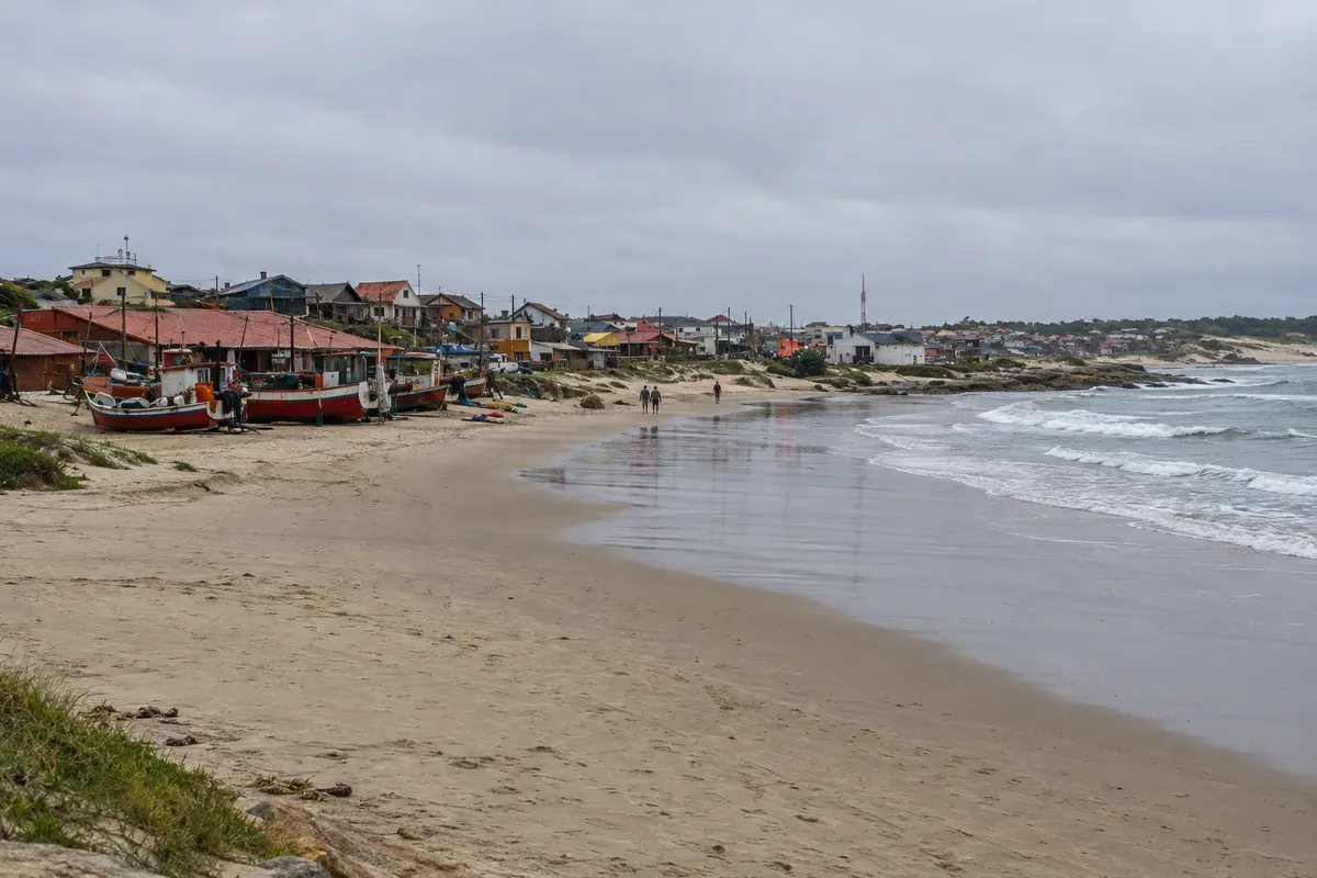
Punta del Diablo began as a fishing village in 1942, when shark fishing supplied oil exports. The name comes from the many shipwrecks of past centuries. In the center, Playa de los Pescadores gathers the artisanal fishing boats: they leave early and return a few hours before sunset, when they are pulled onto the sand by hand and the fishers clean and display the catch. It is a flat, calm beach popular with families. In front is the craft fair, with shell, wood and ceramic pieces and food stalls. On one side is Playa del Rivero, a small bay facing east with waves suitable for beginner surfers. On the other side of the rocky point is Playa de la Viuda, with stronger waves and favored by experienced surfers. Further north, Playa Grande stretches to Parque Nacional de Santa Teresa. In summer, the village hosts surf competitions.

Kraji na poti: Punta del Diablo, Playa de los Pescadores, Playa del Rivero, Playa de la Viuda, Playa Grande.

Vključuje: Self-guided walk through the village and the beaches.

Nasvet: Arrive at Playa de los Pescadores in the late afternoon to see the boats return. For swimming with children, Playa de los Pescadores is the calmest.

Najboljši čas za obisk: December to March; off season the village is much quieter and some businesses close.

Prikaži dodatne izlete (8)

Cabo Santa María Lighthouse

Odhod: La Paloma town center Peš Približno 1 uro Popoldne Lahko

The Cabo Santa María Lighthouse is La Paloma’s lighthouse. Construction began in 1870, the tower collapsed in 1872 while still under construction, and the lighthouse was inaugurated in 1874. A spiral staircase of 143 steps leads to the top, with views of the resort, the port and the coastline around the cape. At the foot of the lighthouse is Playa del Faro, with rocks and natural tide pools, and next to it is Playa La Balconada, where many people gather late in the afternoon to watch the sunset.

Kraji na poti: Cabo Santa María Lighthouse, Playa del Faro, Playa La Balconada.

Vključuje: Separate paid admission, cash only; check the current rates. The climb is not allowed for children under 8 years old.

Nasvet: Go up late in the afternoon and come down in time for sunset at Playa La Balconada, which is next to it.

Najboljši čas za obisk: Vse leto.

La Paloma beaches and sunset at Playa La Balconada

Odhod: La Paloma town center Peš Pol dneva Popoldne Lahko

La Paloma occupies Cabo Santa María and has small and large beaches close to each other. Playa El Cabito is popular with families with small children and features the Cola de Ballena viewpoint. Bahía Grande has adapted access. In Los Botes is the Cristo de Lucho viewpoint. Playa del Faro has rocks and natural pools at the foot of the lighthouse. Playa La Serena attracts families and young people in summer, facing the open sea. At sunset the activity moves to Playa La Balconada, next to the lighthouse, where people gather to watch the sunset and often applaud when it ends. At the fishing port, artisanal fishers usually arrive with corvina, sole and small shark near dusk.

Kraji na poti: Playa La Balconada, Playa El Cabito, Bahía Grande, Playa Los Botes, Playa del Faro, Playa La Serena.

Vključuje: Beaches with free access; no services included.

Nasvet: Most beach services operate only in the summer season. For sunset, arrive at Playa La Balconada a little earlier.

Najboljši čas za obisk: December to February for swimming; the sunset at Playa La Balconada draws people year-round.

Laguna de Rocha: Barra de la Laguna trail and birdwatching

Odhod: Rincón de la Laguna (intersection of Routes 10 and 15) On foot, via a self-guided trail about a 1-hour trail Dopoldne Lahko

Laguna de Rocha is a protected area (Paisaje Protegido) of about 22,000 hectares, near La Paloma. The lagoon is shallow and connects to the sea from time to time through a sandbar that opens and closes depending on water volume, wind and waves. More than 220 bird species use the area, both resident and migratory. It is one of the few places in Uruguay with flamingos, and the black-necked swan population is among the largest in the world. The self-guided Barra de la Laguna trail starts at Rincón de la Laguna, at the intersection of Routes 10 and 15, and is 2.8 km. The path passes a bird hide and information panels explaining how the sandbar works, and ends on the dunes facing the sea. The first section is wheelchair accessible; after that the trail continues over sand. A community of artisanal fishers lives on the sandbar, harvesting shrimp, crab and fish. Operators from La Paloma run guided birdwatching departures.

Kraji na poti: Laguna de Rocha, Paisaje Protegido Laguna de Rocha, Rincón de la Laguna, Barra de la Laguna.

Vključuje: Self-guided trail; guided departures are charged separately. Check the current fee schedule.

Nasvet: Bring binoculars and footwear suitable for wet terrain. Walk carefully: some nests are on the ground and are hard to see. There are no lifeguards on the lagoon beach.

Najboljši čas za obisk: All year; there are resident and migratory birds in every season.

La Pedrera: cliff, beaches and the Cathay VIII

Odhod: La Paloma By car, along the coast Približno 3 ure Popoldne Lahko

La Pedrera is a small resort on a rocky cliff, neighboring La Paloma; from Cerro de la Virgen in La Paloma you can see it in the distance to the northeast. Playa El Desplayado is a small bay between rocks, popular with families. Playa del Barco attracts young people and surfers and preserves the remains of the fishing vessel Cathay VIII, which ran aground there in 1971. On the main avenue are the social and sports club, with shows in season, an artisan market and shops. In summer, La Pedrera holds a multi-day carnival. Southern right whales can also be seen from the shore: the season usually runs from July to October.

Kraji na poti: La Pedrera, Playa El Desplayado, Playa del Barco.

Vključuje: Self-guided visit, by car or taxi from La Paloma.

Nasvet: Go at late afternoon and stay for the activity on the main avenue, which is busier during the summer season.

Najboljši čas za obisk: December to February; carnival takes place in summer.

Laguna Negra

Odhod: Roundabout at Santa Teresa National Park (Route 9, km 302) By car, on a dirt road Približno 3 ure Popoldne Lahko

Laguna Negra, also called Laguna de los Difuntos, is the largest coastal lagoon in Uruguay and has no contact with the sea: it is fed by rain. Its dark color comes from a peat bottom. The second name comes from indigenous peoples, who used the caves in the nearby hills as a cemetery. To get there, follow Route 9 to km 302 and at the roundabout of Santa Teresa National Park take the road on the side opposite the park; it is a few kilometers of dirt road to the lagoon. The lagoon forms a protected area together with the Estación Biológica Potrerillo de Santa Teresa. Surrounding it are native forest, marshes, fields and rocky hills, as well as small calm-water beaches. You can hike, birdwatch, kayak and watch the sunset over the water. Local operators run guided departures.

Kraji na poti: Laguna Negra, Laguna de los Difuntos, Estación Biológica Potrerillo de Santa Teresa.

Vključuje: Visit on your own; guided departures and kayaking are charged separately. Check the current fee schedule.

Nasvet: Bring insect repellent, binoculars and water. After heavy rain, check the condition of the dirt road before you go.

Najboljši čas za obisk: Spring and summer.

Fuerte de San Miguel and Cerro Picudo

Odhod: Chuy (Chuí) By car, via Ruta 19 Približno 2 uri Dopoldne Lahko

Fuerte de San Miguel sits atop Cerro San Miguel, on Ruta 19, about 7 km from Chuy (Chuí) and 6 km from Laguna Merín (Lagoa Mirim). It was built by the Spanish in 1734, taken by the Portuguese in 1737—who gave it its definitive shape—and retaken by the Spanish in 1763. It has been a national historic monument since 1937 and is part of San Miguel National Park. After crossing the drawbridge, there are reconstructions of the quarters and a military history museum with uniforms, weapons, decorations and replicas of colonial-period objects. Nearby are the old cemetery (Campo Santo), a creole museum with a 1816 stagecoach and an 1880 wagon, a clay-and-straw ranch and a replica of an old pulpería, the country store. A marked trail climbs Cerro Picudo, about 100 meters, with views of Laguna Merín, Chuy, the rice fields and the Fortaleza de Santa Teresa in the distance.

Kraji na poti: Fuerte de San Miguel, Cerro Picudo, San Miguel National Park, Laguna Merín.

Vključuje: Separate admission paid on site, paid only in Uruguayan pesos. Children under 12 and people over 65, with ID, do not pay. Check the current price table.

Nasvet: The fort is open every day.

Najboljši čas za obisk: Vse leto.

Hike across the dunes from Cabo Polonio to Cerro de la Buena Vista

Odhod: Playa de la Calavera (Cabo Polonio) On foot, across sand and dunes more than 4 hours, round trip Ves dan Zmerno zahtevno

From Playa de la Calavera, north of the Cabo Polonio village, a walk of about 7 km across the dunes leads to Cerro de la Buena Vista, near Barra de Valizas. The hill is the highest point on the Uruguayan coast and, between 1750 and 1777, marked the border between the Spanish and Portuguese empires under the Treaty of Madrid. The route crosses one of the few mobile dune fields in the region, with no shade and no services. Barra de Valizas is a small village at the mouth of Arroyo Valizas, which links Laguna de Castillos to the sea.

Kraji na poti: Playa de la Calavera, Cerro de la Buena Vista, Barra de Valizas, Arroyo Valizas.

Vključuje: Self-guided walk, no services included.

Nasvet: Bring water, a hat and sunscreen. Avoid very windy days that lift sand, and leave early so you can return in daylight. If you don’t know the route, consider hiring local guides.

Najboljši čas za obisk: Spring and autumn, with mild temperatures; in summer, depart very early.

southern right whales from coastal viewpoints

Odhod: La Paloma, Cabo Polonio or Punta del Diablo On foot, from onshore viewpoints od ene do dveh ur Dopoldne Lahko

The southern right whale passes along the Rocha coast in winter and spring; the season typically runs from July to October. Watching is done from shore, at high points along the coast. In La Paloma, Cerro de la Virgen, between La Aguada and Costa Azul, is the highest point in that stretch and has a wooden platform with benches. At Laguna de Rocha, the dunes at the end of the Barra de la Laguna trail also serve as a viewpoint. In La Coronilla, north of Santa Teresa National Park, the protected Cerro Verde area has two wooden viewpoints. Cabo Polonio and Punta del Diablo are also among the observation spots. The most common sign is a V-shaped blow, which can reach about 4 meters high. Whale presence close to the coast varies day to day.

Kraji na poti: Cerro de la Virgen, Barra de la Laguna, Cerro Verde, Cabo Polonio, Punta del Diablo.

Vključuje: Observation on your own, from shore.

Nasvet: Bring binoculars and warm clothes, because the wind on the coast is strong in winter. Ask at tourist information centers if there were sightings in the previous days.

Najboljši čas za obisk: July to October.

Po dnevih

Costa de la Roca – načrt poti. Število dni: 3, 5in7

Predlogi za načrtovanje poti. Vrstni red dni prilagodite vremenu in razpoložljivosti izletov.

3 dni · 3 days in Punta del Diablo and Cabo Polonio, arriving via Chuí

ZaFor those coming by car from Rio Grande do Sul who want beaches, history and Cabo Polonio on a long weekend. · Izhodišče:Punta del Diablo
  1. Dan 1 · Arrival via Chuí and the village of Punta del Diablo

    Cross the border at Chuí and complete immigration procedures to enter Uruguay. Follow Route 9 to Punta del Diablo, 42 km away. In the afternoon, take the Punta del Diablo tour: fishing village and beaches, watch the boats return at Playa de los Pescadores and visit the craft fair in front of the beach.

  2. Dan 2 · Fortaleza and Santa Teresa National Park

    In the morning, visit the Fortaleza de Santa Teresa. Afterwards, head to Santa Teresa National Park: greenhouse, rose garden, Laguna de Peña and La Pajarera. End the day at one of the park’s beaches, such as Playa del Barco or Playa La Moza.

  3. Dan 3 · Cabo Polonio and return to Brazil

    Leave early for Puerta del Polonio on Route 10 at km 264.5, and visit Cabo Polonio: entry through Puerta del Polonio and the village, including the Faro de Cabo Polonio and the sea lion colony. Catch the return vehicle in mid-afternoon and continue to Chuí, 96 km away.

5 dni · 5 days in La Paloma and Cabo Polonio, arriving by plane
ZaFor those flying from Brazil to Montevideo who want to explore the southern part of Rocha’s coast using regular bus services. · Izhodišče:La Paloma
  1. Dan 1 · Flight to Montevideo and bus to La Paloma

    Flight from Brazil to Montevideo and transfer to the Tres Cruces terminal, where buses depart for La Paloma. On arrival, walk through the town center and along the waterfront to get your bearings.

  2. Dan 2 · Lighthouse and beaches of La Paloma

    Morning at La Paloma’s beaches and sunset at Playa La Balconada, starting with Playa El Cabito and Bahía Grande. At late afternoon, climb the Faro del Cabo Santa María and descend to watch the sunset at Playa La Balconada.

  3. Dan 3 · Laguna de Rocha and La Pedrera

    Morning at Laguna de Rocha, with the Barra de la Laguna trail and the birdwatching observatory. In the afternoon, go to La Pedrera to see Playa del Barco, the remains of the Cathay VIII and the activity along the main avenue. Between July and October, stop at Cerro de la Virgen to try to spot whales.

  4. Dan 4 · Full day in Cabo Polonio

    Go by bus or combined transport to Puerta del Polonio and do Cabo Polonio: go through Puerta del Polonio and the village. Include the Faro de Cabo Polonio and the sea lion colony and allow time for Playa de la Calavera. Return to La Paloma in the late afternoon.

  5. Dan 5 · Return to Montevideo

    Free morning in La Paloma, with one last walk along the waterfront. Bus back to Terminal Tres Cruces and transfer to Carrasco airport for the flight to Brazil.

7 dni · 7 days along the Rocha coast, from Chuí to La Paloma
ZaFor those driving from Brazil who want to travel the entire Rocha coast, with one night in Cabo Polonio. · Izhodišče:Punta del Diablo, Cabo Polonio and La Paloma
  1. Dan 1 · Chuí, Fuerte de San Miguel and Punta del Diablo

    Cross the border at Chuí and complete entry procedures. Visit Fuerte de San Miguel and Cerro Picudo on Route 19. In the afternoon, continue on Route 9 to Punta del Diablo and see the boats return at Playa de los Pescadores.

  2. Dan 2 · Santa Teresa

    Morning at Fortaleza de Santa Teresa. Afternoon in Santa Teresa National Park: gardens, trails and beaches, including the greenhouse, Laguna de Peña and one of the park’s beaches.

  3. Dan 3 · Laguna Negra and the beaches of Punta del Diablo

    In the morning, do Punta del Diablo: a fishing village and beaches, passing Playa del Rivero and Playa de la Viuda. In the afternoon, head to Laguna Negra via the dirt road that leaves the roundabout at km 302 and stay for the sunset over the lagoon.

  4. Dan 4 · Monte de Ombúes and arrival at Cabo Polonio

    Drive down the coast to the bridge over Arroyo Valizas on Ruta 10 at km 267, and do Monte de Ombúes by boat along Arroyo Valizas. Then leave the car at Puerta del Polonio and enter Cabo Polonio with the authorized vehicle. Late afternoon at Playa de la Calavera and night in the village.

  5. Dan 5 · Cabo Polonio and road to La Paloma

    Morning at the Faro de Cabo Polonio and the sea lion colony. Those who feel like it can swap the morning for the hike across Cabo Polonio’s dunes to Cerro de la Buena Vista. In the afternoon, return to Puerta del Polonio and drive on to La Paloma.

  6. Dan 6 · La Paloma

    Day on La Paloma’s beaches and sunset at Playa La Balconada. Climb the Faro del Cabo Santa María before sunset. Between July and October, stop by Cerro de la Virgen.

  7. Dan 7 · Laguna de Rocha, La Pedrera and return

    Morning at Laguna de Rocha, with the Barra de la Laguna trail. Pass through La Pedrera before getting on the road: it’s 159 km to Chuí, or continue to Montevideo via Ruta 9 and the Ruta Interbalnearia.

Najboljši čas za obisk

Kdaj se odpraviti:Costa de la Roca po mesecih

Summer, from December to March, is the season: the villages fill up, especially in January, and businesses are more active. Spring and autumn are calm with mild weather. From June to August it's cold and very windy. Southern right whales typically appear off the coast between July and October.

The seasons shown are the most usual ones; nature doesn't always follow the calendar.

januar Zmerne padavine

Peak season · Long days

January is the warmest month, averaging 19 °C to 26 °C. It’s the peak of the season: beaches, markets, boats and transport run more often, and Punta del Diablo, La Paloma and Cabo Polonio get crowded. Book bus tickets in advance. Sea water is often cool even in summer. The sea lion breeding season in Cabo Polonio remains busy.

februar Zmerne padavine

Beach season · Carnival

February is still summer, averaging 19 °C to 25 °C with slightly more rain than January. Beaches stay busy until Carnival, which in La Pedrera lasts several days. After Carnival the crowds begin to drop and some beach services reduce their hours.

marec Zmerne padavine

End of summer · Shrimp season

March ranges from 18 °C to 24 °C, with days still suitable for the beach but colder sea. Visitor numbers drop significantly and some beach services close. Between March and April is the shrimp season in the lagoons, and in Arroyo Valizas the fishermen’s lanterns appear on moonless nights. Semana de Turismo, in March or April depending on the year, fills the resorts again.

april Zmerne padavine

Autumn · Semana de Turismo

April averages 15 °C to 21 °C and is one of the rainier months, though rain is fairly spread across the year. Outside Semana de Turismo the coast is quiet and many services operate only on weekends. Good month for hikes, forts and birdwatching.

maj Zmerne padavine

Low season · Shorter days

May averages 12 °C to 18 °C and has shorter days. Resorts are empty and some businesses close until summer. Forts, lighthouses and lagoons remain open to visitors; check bus days and frequencies before you go.

junij Zmerne padavine

Winter · Cold wind

June averages 9 °C to 15 °C, with cold wind coming from the sea. It’s low season: few services at the resorts and reduced bus frequencies. Bring warm and windproof clothing. Visits to Fortaleza de Santa Teresa and Fuerte de San Miguel operate normally.

julij Zmerne padavine

Coldest month · Start of the whale season

July is the coldest month, averaging 8 °C to 14 °C. The southern right whale season usually runs from July to October, and the viewpoints at Cerro de la Virgen, Laguna de Rocha and Cerro Verde begin to attract observers. Resorts are quiet and many services are closed.

avgust Zmerne padavine

Whale season · Windy winter

August averages 9 °C to 16 °C with frequent wind. It’s southern right whale season, usually July to October; their presence near the shore varies day to day. Bring binoculars and warm clothing. Services at the resorts remain reduced.

september Zmerne padavine

Whales · Start of spring

September ranges from 10 °C to 16 °C, still cold and windy. The southern right whale season continues. With spring there is increased bird activity in the lagoons. Resorts remain quiet, with some businesses closed.

oktober Zmerne padavine

Spring · End of the whale season

October averages 12 °C to 19 °C and is one of the rainier months, without much difference from the others. It is the last month of the southern right whale season, which typically runs from July to October. Good for trails, Laguna de Rocha, Laguna Negra and Monte de Ombúes; check whether boat departures are operating.

november Zmerne padavine

Shoulder season · Long days

November averages 14 °C to 21 °C and longer days. Resorts start preparing for summer and some services reopen, still with little activity. The sea remains cold for most people. Good month for Cabo Polonio without the crowds.

december Zmerne padavine

Start of the season · Year-end holidays

December averages 17 °C to 24 °C and marks the beginning of the beach season, which runs from December to February. Activity increases from the second half of the month and during the year-end holidays. In late December the sea lion breeding season begins in Cabo Polonio. Buy bus tickets in advance.

Načrtujte pot

Kako do tja:Costa de la Roca

By bus from Montevideo

Buses to the Rocha coast depart from Tres Cruces Terminal in Montevideo. COT, Rutas del Sol and Cynsa operate the route; it takes about 3 hours to reach the city of Rocha. There are services to La Paloma, to the Puerta del Polonio and to Punta del Diablo. To the Puerta del Polonio the trip takes 4.5 to 5 hours, and to Punta del Diablo about 4.5 hours. In summer there are more departures; outside that season frequencies decrease. In January and February, buy your ticket in advance.

By car from Montevideo

Leave Montevideo via the Ruta Interbalnearia to the junction with Ruta 9 and follow Ruta 9 east. At the height of the city of Rocha, Ruta 15 leads to La Paloma. Cabo Polonio is on Ruta 10 at km 264.5: cars are left at the Puerta del Polonio parking lot. Access to Punta del Diablo is at km 298 of Ruta 9, and to Santa Teresa National Park at km 302. To Punta del Diablo is about 300 km, roughly a 4-hour drive.

By boat from Buenos Aires

From Buenos Aires, Buquebus and Colonia Express boats cross the Río de la Plata to Colonia del Sacramento or Montevideo. From there, continue by bus from the Tres Cruces Terminal or by car via the Ruta Interbalnearia and Ruta 9. There are also direct buses from Buenos Aires to Rocha, departing from Retiro terminal.

How to get around Rocha’s coast

A car gives you more freedom: attractions are spread along Routes 9, 10 and 15, and some, like Laguna Negra, are accessed by dirt road. By bus, lines from Montevideo and Chuy stop at the resorts, and at Puerta del Polonio there is a ticket desk for other Rocha towns. Private cars are not allowed into Cabo Polonio: only authorized vehicles that leave from Puerta del Polonio on a roughly 7 km dune route, or on foot. Within the villages you can do almost everything on foot. Outside the high season, check bus timetables in advance, because frequencies decrease.

Fees and tickets

Transport from the Puerta del Polonio to Cabo Polonio is paid, with a round‑trip ticket, and small children travel free; parking at the Puerta del Polonio is also paid. There are separate paid admissions for the climb to the Faro de Cabo Polonio and the Faro del Cabo Santa María, the Fortaleza de Santa Teresa and Fuerte de San Miguel. At the two fortresses, payment is only accepted in Uruguayan pesos. Check the current fee table.

Pred odhodom

Praktične informacije

Z nekaj načrtovanja boste imeli več časa za uživanje na poti.

Kdaj se odpraviti

Summer, from December to March, is the season: the villages fill up, especially in January, and businesses are more active. Spring and autumn are calm with mild weather. From June to August it's cold and very windy. Southern right whales typically appear off the coast between July and October.

The seasons shown are the most usual ones; nature doesn't always follow the calendar.

Koliko dni ostati

Four or five days allow you to split the trip among La Paloma, Cabo Polonio and Punta del Diablo, with an afternoon for the fortresses. With three days, pick two bases. Cabo Polonio requires at least a full day because of the dune crossing.

V katerem mestu prenočiti

La Paloma has the largest range of services year-round, with accommodation in the center, near the lighthouse, and in the beach neighborhoods La Aguada and Costa Azul. La Pedrera, next door, is quieter. In Cabo Polonio there are inns and simple houses, without electricity. Punta del Diablo has cabins scattered among the beaches; the campground and cabins of Parque Nacional de Santa Teresa are another option, with advance reservation.

Spoštujte kraj

Odnesite svoje odpadke, upoštevajte oznake in podprite lokalne ponudnike. V naravi upoštevajte navodila za obiskovalce.

Odgovori na vaša vprašanja

Pogosta vprašanja – Costa de la Roca

How many days to allow for the Costa de Rocha?

Four or five days are ideal to see La Paloma, Cabo Polonio and Punta del Diablo without rushing. With two or three days, choose one base and one excursion: La Paloma with Cabo Polonio, or Punta del Diablo with Santa Teresa.

What is the best time to go?

From December to March is the beach season, with more activity in January. Outside summer, the villages are quiet and some businesses close. From June to August the winter is cold and windy. Between July and October southern right whales often pass along the coast.

Do you need a car in the Costa de Rocha?

A car helps, because the towns are far apart and the lagoons and fortresses are outside them. There are regional buses along Ruta 9 and Ruta 10. In Cabo Polonio, the car does not enter: it stays in the parking lot at Puerta del Polonio on Ruta 10.

Can you do a day trip from Montevideo?

It's not ideal. La Paloma is about 240 km from the capital, more than three hours by bus, and Punta del Diablo even farther. For those coming from Rio Grande do Sul, a day trip makes more sense starting from Chuí to Punta del Diablo and Santa Teresa.

Odkrijte druge destinacije Iskanje po zvezni državi in mestu

Več kot vodnik