Flåm and the Sognefjord

Vestland · Norveška

Flåm and the Sognefjord

The village at the end of the Aurlandsfjord where the Flåm railway arrives; a base for the boat on the Nærøyfjord, the Stegastein viewpoint, and the medieval wooden churches of Borgund and Urnes.

Westfjords

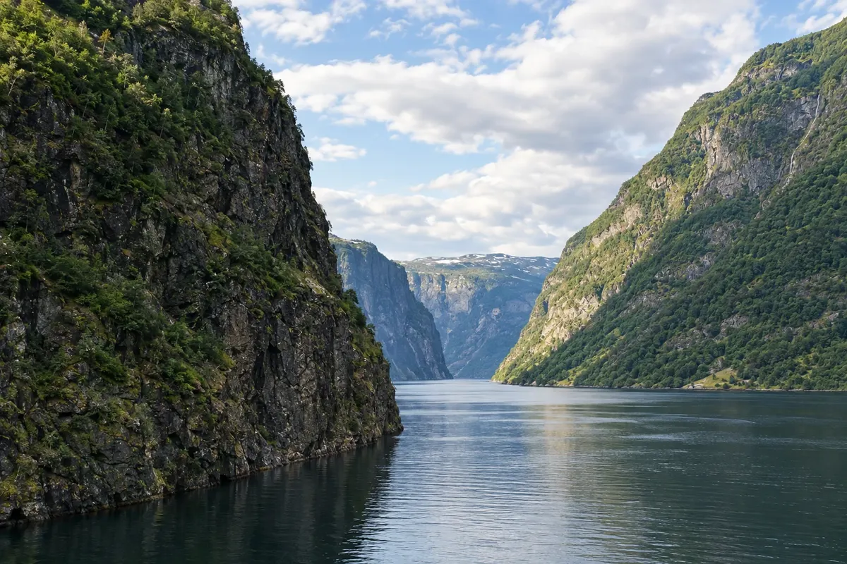
Na fotografiji: Nærøyfjord

Illustrative images. The pictures in this guide are illustrations based on the real place, not photographs, and may differ from it.

Na voljo v trgovini Google Play Pošljite svoje fotografije

Spoznajte kraj

Pokrajina, ki jo doživite
v svojem ritmu.

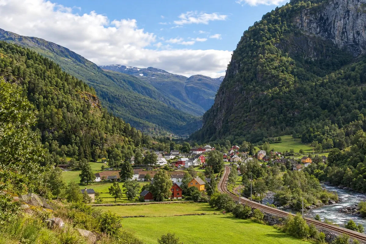
The Sognefjord is Norway’s longest and deepest fjord: it cuts about 200 km inland from the coast north of Bergen and splits into narrow arms between mountains over a thousand meters high. Flåm lies at the end of one of those arms, the Aurlandsfjord, in a small village of wooden houses, hotels and the quay where boats—and in summer, cruise ships—dock.

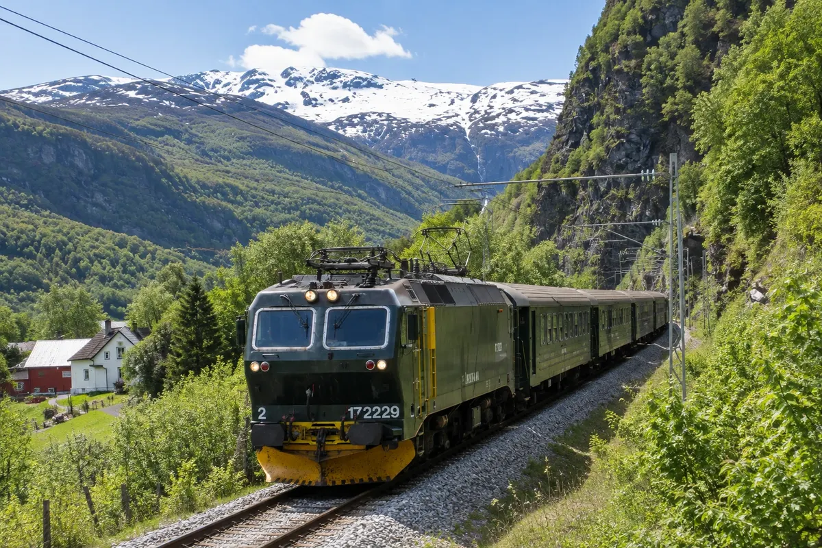
Flåm is known for the railway that reaches it. The Flåmsbana departs from Myrdal on the Oslo–Bergen line and drops roughly 860 meters over 20 km, passing tunnels, waterfalls and the Flåmselvi valley. From the quay boats depart for the Nærøyfjord, a narrow arm of the Sognefjord that is a UNESCO World Heritage site, with rock walls up to 1,700 meters and villages like Undredal and Gudvangen.

Around the village the road climbs from Aurland to the Stegastein viewpoint, a wooden platform over the fjord, and continues along the Aurlandsfjellet mountain road, which is often closed in winter. To the east, in the Lærdal valley, Borgund stave church is the best-preserved medieval stavkirke in the country; to the north, on the other side of the fjord, Urnes is a World Heritage site.

Spending a night in the village lets you see the fjord without the groups and add Stegastein and the churches.

This destination brings together 1 city: Flåm.

Delite: WhatsApp
Delite svoja popotniška doživetja s fotografijami Pošljite fotografije vsakega kraja, ki ste ga obiskali. Največje število fotografij na kraj: 5.

Ena destinacija, več poti

Mesta na tej poti

Začnite v enem mestu ali v načrt poti vključite več mest.

Flåm and the Sognefjord – lega
Flåm

Obrisi: © Kartverket (CC BY 4.0), meje iz leta 2024, podatki o obali: geoBoundaries. Priredba: Cidade Turismo.

Kako do tja:Flåm and the Sognefjord

✈ Bergen lufthavn, Flesland (BGO), kraj: Bergen· 175 km do cilja (Flåm)

Confirm before booking. From Oslo or Bergen, take the Bergen line train to Myrdal and change to the Flåmsbana, which descends in about an hour. From Bergen, the fast boat to Flåm typically operates in summer. By car, the E16 links Bergen to Flåm via the Gudvangen tunnel.

Doživite kraj

Kaj početi – Flåm and the Sognefjord

Flåm Railway (Flåmsbana)
Flåm · Vestland · Railway

Flåm Railway (Flåmsbana)

The railway that descends from Myrdal, at 866 meters, down to Flåm at fjord level in about an hour: 20 km of tunnels, curves and waterfalls, with a stop at Kjosfossen waterfall.

Nærøyfjord (Nærøyfjorden)
Flåm · Vestland · Fjord

Nærøyfjord (Nærøyfjorden)

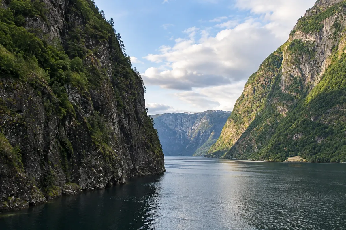
The narrow arm of the Sognefjord between the Aurlandsfjord and Gudvangen: 17 km of water between rock walls up to 1,700 meters high, waterfalls and small villages. UNESCO World Heritage Site.

Stegastein viewpoint (Stegastein)
Flåm · Vestland · Razgledišče

Stegastein viewpoint (Stegastein)

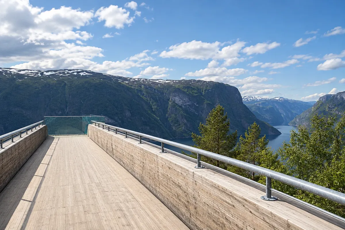
A wooden-and-steel platform that extends 30 meters over the Aurlandsfjord, at 650 meters altitude, on the mountain road rising from Aurland, with views of the fjord as far as Flåm.

Borgund Stave Church (Borgund stavkyrkje)
Flåm · Vestland · Igreja de madeira

Borgund Stave Church (Borgund stavkyrkje)

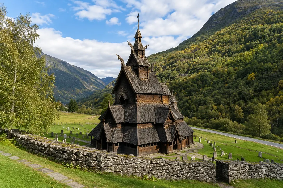
The medieval wooden church in the Lærdal valley, built around 1180 and preserved almost as it was: layered roofs, dragon heads and the outer gallery. There is a visitor centre next to it.

Flåm and the Sognefjord – prikaži še 1 kraj
Urnes Stave Church (Urnes stavkyrkje)
Flåm · Vestland · Igreja de madeira

Urnes Stave Church (Urnes stavkyrkje)

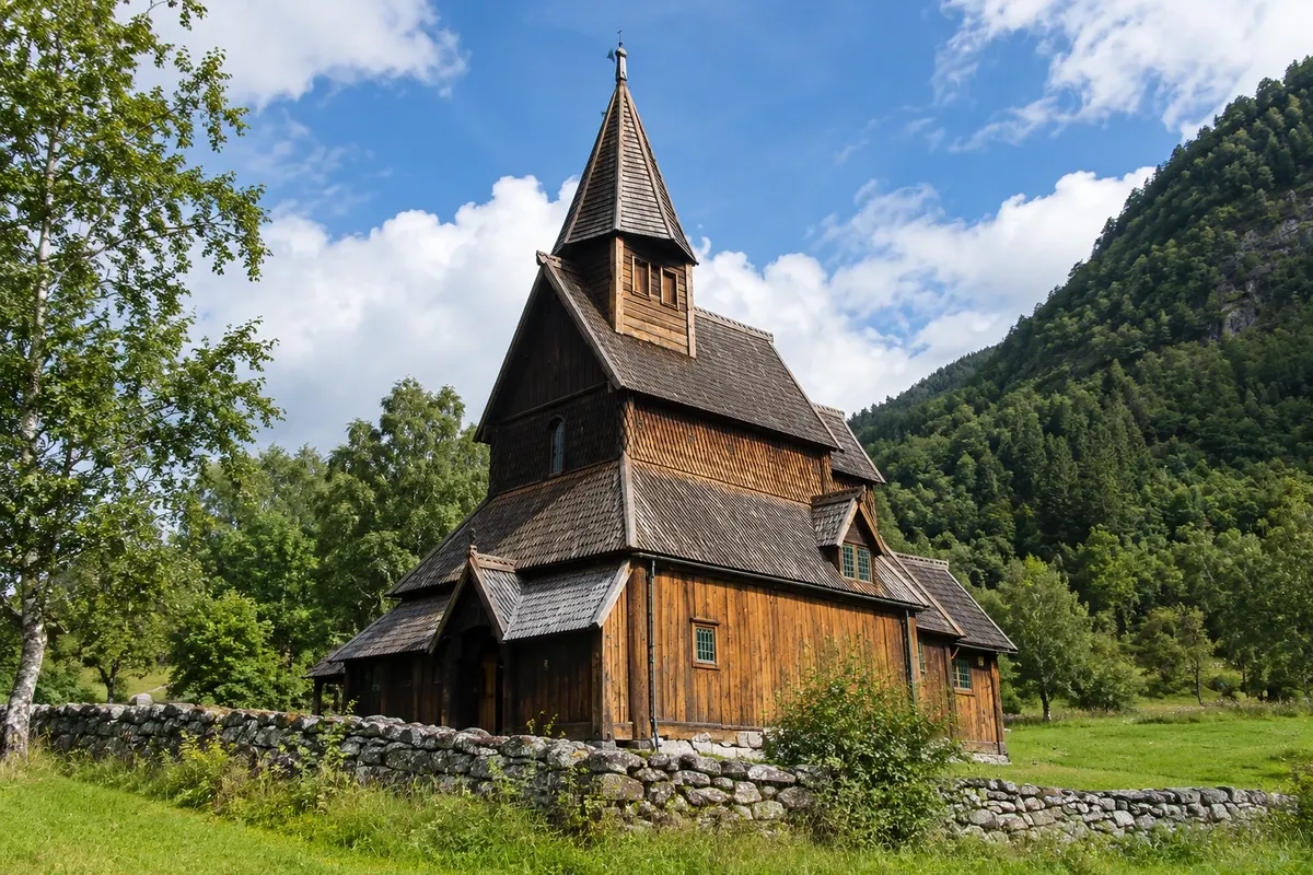
Norway's oldest wooden church, from the 12th century, on a promontory above the Lustrafjord, with a portal carved with interlaced animals in Viking style. A UNESCO World Heritage Site.

Kaj izbrati pred odhodom

Izleti – Flåm and the Sognefjord

Izhodišče, trajanje, potek, vključene storitve in okvirna cena vsakega izleta.

Flåmsbana

Odhod: Flåm In Flåm, the station is next to the quay About 1 hour each way during the day depending on the route chosen

The Flåmsbana is the branch railway that links Myrdal, a station on the Oslo–Bergen line, to Flåm at the head of the Aurlandsfjord. It is about 20 km of track with an elevation change of 863 meters, with gradients up to 5.5% climbed without a rack railway. The line was built between the 1920s and 1940s, and 18 of the 20 tunnels were hand-excavated. The journey takes about one hour each way. The train descends in curves and spiral tunnels down the Myrdal escarpment, enters the Flåm valley and follows the river to the village. The windows show mountains, farms on the valley floor and waterfalls tumbling down the slopes. The left side, when descending, usually has the better view of the valley.

Kraji na poti: Flåmsbana.

Vključuje: Arrange access to the site and transport separately. Guided activities and tickets have their own conditions.

Nasvet: Travel down from Myrdal to Flåm and sit on the left side, in the direction of descent. If you have time, get off at Vatnahalsen or Berekvam and do a section of the valley on foot or by bicycle.

Najboljši čas za obisk: From May to September trains are usually more frequent and crowded; book in advance

Nærøyfjorden

Odhod: Flåm Boats depart from Flåm pier, next to the station, and from Gudvangen About 2 hours by boat between Flåm and Gudvangen during the day depending on the route chosen

The Nærøyfjord is a branch of the Sognefjord about 17 km long, which begins where the Aurlandsfjord meets it and ends at the village of Gudvangen. In some places it is only 250 meters wide, and the surrounding mountains rise above 1,700 meters, giving the feeling of navigating inside a valley. Together with the Geirangerfjord, it is a UNESCO World Heritage Site as an example of the western Norway fjords. The most common way to see it is by boat between Flåm and Gudvangen, which takes about two hours. The route departs across the Aurlandsfjord, passes the village of Undredal, with its small white wooden church and goat cheese production, and enters the Nærøyfjord, with waterfalls falling down the cliffs and old farms on narrow strips of land, some accessible only by boat.

Kraji na poti: Nærøyfjorden.

Vključuje: Arrange access to the site and transport separately. Guided activities and tickets have their own conditions.

Nasvet: Do the Flåm–Gudvangen boat trip and return by bus through the tunnel, or continue on to Voss and Bergen. Stay on the outer deck with a coat: it’s windy in the fjord, even in summer.

Najboljši čas za obisk: From May to September, with more boat departures

Stegastein

Odhod: Flåm From Flåm, follow 10 km to Aurland and climb 8 km on the Aurlandsfjellet road, on 20 to 40 minutes at the viewpoint during the day depending on the route chosen

The Stegastein viewpoint is on the road that climbs from Aurland toward the Aurlandsfjellet mountain, about 8 km from the village. It is a wooden platform with a steel frame that extends out from the hillside about 30 meters into the air, ending in glass, 650 meters above the Aurlandsfjord. From the end of the platform you can see the fjord almost its entire length: Flåm in the distance, Aurland below, Undredal on the opposite side and, to the right, the entrance to the Nærøyfjord between the mountains. The platform was designed by architects Todd Saunders and Tommie Wilhelmsen and is part of the National Tourist Routes, Norway’s network of scenic roads, with viewpoints and restrooms designed by architects.

Kraji na poti: Stegastein.

Vključuje: Arrange access to the site and transport separately. Guided activities and tickets have their own conditions.

Nasvet: If you are driving in summer, continue after the viewpoint on the snow road to Lærdal and return via the Lærdal Tunnel, 24.5 km long.

Najboljši čas za obisk: In clear weather, from May to September

Borgund stavkyrkje

Odhod: Flåm It sits in the Lærdal valley, beside the E16, about 60 km from Flåm via the Lærdal Tunnel. About 45 minutes to 1 hour, including the visitor centre. during the day depending on the route chosen

Borgund Church is the medieval Norwegian stavkirke that best preserves its original form. It stands in the Lærdal valley, about 60 km from Flåm, and was built around 1180, entirely of wood, with no metal nails in the main structure: vertical posts, the stav, support the nave, and the roof rises in six stepped layers, with dragon heads on the ends and a small tower at the top. Inside, the nave is dark and lofty, lit only by small openings and the doors. The posts, the St. Andrew crosses and the beams reveal the construction technique, and medieval runic inscriptions can still be seen on the walls. Around it, the covered gallery, the svalgang, once sheltered people from rain and wind before the service. The portals are carved with dragons and foliage.

Kraji na poti: Borgund stavkyrkje.

Vključuje: Arrange access to the site and transport separately. Guided activities and tickets have their own conditions.

Nasvet: Buy the ticket at the visitor centre and see the exhibition before entering the church. Walk around the outer gallery and look at the carved portals, especially the one on the west side.

Najboljši čas za obisk: From May to September, when the church and visitor centre are usually open

Urnes stavkyrkje

Odhod: Flåm From Flåm, drive to Sogndal and Solvorn, about during the day, and take the About 1 hour in the church during the day depending on the route chosen

The church at Urnes sits on the hillside of farmsteads above the Lustrafjord, the innermost arm of the Sognefjord, on the opposite side from the village of Solvorn. It is considered the oldest standing stavkirke, built around 1130, and reuses parts from an earlier 11th-century church. Since 1979 it has been a UNESCO World Heritage Site. What makes it unique is the decoration. On the north side, the portal and wall boards—salvaged from the older church—are carved with long, interlaced animals, serpents and a fighting quadruped, in the style art historians call the Urnes style, the final phase of Viking art. Inside, the column capitals have figures of animals and people, and there is a medieval crucifix and 17th-century furnishings.

Kraji na poti: Urnes stavkyrkje.

Vključuje: Arrange access to the site and transport separately. Guided activities and tickets have their own conditions.

Nasvet: Cross by ferry and climb on foot: the path between the farms is part of the visit. Ask to see the north portal, with the Urnes-style carvings.

Najboljši čas za obisk: From May to September, when the church usually opens for guided visits and the ferry runs more frequently


Po dnevih

Flåm and the Sognefjord – načrt poti. Število dni: 1, 2in3

Predlogi za načrtovanje poti. Vrstni red dni prilagodite vremenu in razpoložljivosti izletov.

1 dni · Flåm and the Sognefjord in 1 day

ZaTo organize visits by day, allowing time for travel. · Izhodišče:Flåm
  1. Dan 1 · Flåmsbana

    Book the Flåmsbana trip between Flåm and Myrdal, with the valley’s gradients visible from the window. Check whether your booking is round-trip or part of a rail connection.

2 dni · Flåm and the Sognefjord in 2 days
ZaTo organize visits by day, allowing time for travel. · Izhodišče:Flåm
  1. Dan 1 · Flåmsbana

    Book the Flåmsbana trip between Flåm and Myrdal, with the valley’s gradients visible from the window. Check whether your booking is round-trip or part of a rail connection.

  2. Dan 2 · Nærøyfjorden / Stegastein

    Combine a cruise on the Nærøyfjord with a separate transfer to the Stegastein viewpoint. Departure and return times to the pier determine the order; do not rely on immediate connections.

3 dni · Flåm and the Sognefjord in 3 days
ZaTo organize visits by day, allowing time for travel. · Izhodišče:Flåm
  1. Dan 1 · Flåmsbana

    Book the Flåmsbana trip between Flåm and Myrdal, with the valley’s gradients visible from the window. Check whether your booking is round-trip or part of a rail connection.

  2. Dan 2 · Nærøyfjorden / Stegastein

    Combine a cruise on the Nærøyfjord with a separate transfer to the Stegastein viewpoint. Departure and return times to the pier determine the order; do not rely on immediate connections.

  3. Dan 3 · Borgund stavkyrkje

    Travel to Borgund to see the wooden church and its visitor centre. This is a day of driving, not a walk from central Flåm.

Najboljši čas za obisk

Kdaj se odpraviti:Flåm and the Sognefjord po mesecih

From May to September the boats and the railway usually run more frequently, and the Aurlandsfjellet road generally opens from June to October; check in advance. June and July have very long days. In winter, from November to March, the fjord is often calm and the slopes snowy, with fewer boats and short daylight hours.

The seasons shown are the most usual ones; nature doesn't always follow the calendar.

januar Malo padavin

Winter · plan your travel

The monthly average at the reference station is usually around -0.7 °C. Normal precipitation for the month is about 50 mm, combining rain and snow in water equivalent. Cold tends to be persistent and days are usually short. Prioritize outings with confirmed access for the period.

februar Malo padavin

Winter · plan your travel

The monthly average at the reference station is usually around -0.7 °C. Normal precipitation for the month is about 31 mm, combining rain and snow in water equivalent. Cold tends to be persistent and days are usually short. Prioritize outings with confirmed access for the period.

marec Malo padavin

Spring · plan your travel

The monthly average at the reference station is usually around 2.3 °C. Normal precipitation for the month is about 31 mm, combining rain and snow in water equivalent. Light tends to increase through the season, while snow usually remains on the mountains. High-altitude routes follow their own calendar.

april Malo padavin

Spring · plan your travel

The monthly average at the reference station is usually around 6.4 °C. Normal precipitation for the month is about 26 mm, combining rain and snow in water equivalent. Light tends to increase through the season, while snow usually remains on the mountains. High-altitude routes follow their own calendar.

maj Malo padavin

Spring · long days

The monthly average at the reference station is usually around 10.2 °C. Normal precipitation for the month is about 31 mm, combining rain and snow in water equivalent. Light tends to increase through the season, while snow usually remains on the mountains. High-altitude routes follow their own calendar.

junij Malo padavin

Summer · long days

The monthly average at the reference station is usually around 13.6 °C. Normal precipitation for the month is about 44 mm, combining rain and snow in water equivalent. The weather is generally mild and days are usually very long. There is greater demand for outdoor activities; make reservations in advance.

julij Malo padavin

Summer · long days

The monthly average at the reference station is usually around 15.9 °C. Normal precipitation for the month is about 51 mm, combining rain and snow in water equivalent. The weather is generally mild and days are usually very long. There is greater demand for outdoor activities; make reservations in advance.

avgust Malo padavin

Summer · long days

The monthly average at the reference station is usually around 14.8 °C. Normal precipitation for the month is about 53 mm, combining rain and snow in water equivalent. The weather is generally mild and days are usually very long. There is greater demand for outdoor activities; make reservations in advance.

september Malo padavin

Autumn · plan your travel

The monthly average at the reference station is typically around 10.9 °C. Normal monthly precipitation is about 55 mm, combining rain and snow in water equivalent. Temperatures and day length tend to fall. Long hikes and travel in the mountains require planning before you set out.

oktober Malo padavin

Autumn · plan your travel

The monthly average at the reference station is usually around 5.9 °C. The typical monthly precipitation is about 47 mm, combining rain and snow expressed as water equivalent. Temperatures and day length tend to fall. Long hikes and mountain travel require planning before you head out.

november Malo padavin

Autumn · plan your travel

The monthly average at the reference station is usually around 2.2 °C. Normal precipitation for the month is about 48 mm, combining rain and snow in water equivalent. Temperatures and day length usually decline. Long hikes and travel through the mountains require planning before departure.

december Malo padavin

Winter · plan your travel

The monthly average at the reference station is usually around -0.5 °C. Normal precipitation for the month is about 48 mm, combining rain and snow in water equivalent. Cold tends to be persistent and days are usually short. Prioritize outings with confirmed access for the period.

Načrtujte pot

Kako do tja:Flåm and the Sognefjord

Public transport and reservations

Check train, bus and boat services to Flåm for your travel date. Verify each leg and the return connection before combining different services. On boat routes, confirm the pier and the direction of travel.

Car and local travel

It does not stop for the railway, the boat or the village. A car is helpful for Stegastein, the snow road, Borgund and Urnes. In summer there are tour buses to Stegastein and organized trips to the churches.

Pred odhodom

Praktične informacije

Z nekaj načrtovanja boste imeli več časa za uživanje na poti.

Kdaj se odpraviti

From May to September the boats and the railway usually run more frequently, and the Aurlandsfjellet road generally opens from June to October; check in advance. June and July have very long days. In winter, from November to March, the fjord is often calm and the slopes snowy, with fewer boats and short daylight hours.

The seasons shown are the most usual ones; nature doesn't always follow the calendar.

Koliko dni ostati

One day on the train-and-boat itinerary is enough for the Flåmsbana and the Nærøyfjord. With one night you can include the Stegastein viewpoint and a kayak trip or a valley hike. With two days and a car, add the churches of Borgund and Urnes and the Aurlandsfjellet road.

V katerem mestu prenočiti

Flåm has few hotels located by the quay and the station, and they fill up in summer. Aurland, 10 km away, has guesthouses and rental homes with fjord views. Gudvangen, at the end of the Nærøyfjord, has a hotel and cabins. Lærdal and Sogndal, about an hour's drive away, serve those continuing to Borgund and Urnes.

Spoštujte kraj

Odnesite svoje odpadke, upoštevajte oznake in podprite lokalne ponudnike. V naravi upoštevajte navodila za obiskovalce.

Odgovori na vaša vprašanja

Pogosta vprašanja – Flåm and the Sognefjord

Can you visit Flåm as a day trip?

Yes. The "Norway in a Nutshell" itinerary departs from Bergen or Oslo and combines train, the Flåmsbana, a boat on the Nærøyfjord, and bus in a single day. From Oslo the day is long; from Bergen it's more relaxed.

Do I need a car in Flåm?

Not for the Flåmsbana, the boat or getting around the village. A car is helpful for Stegastein, the Aurlandsfjellet road and the churches of Borgund and Urnes; in summer there are excursion buses to Stegastein.

What is the best time to go?

From May to September, when trains and boats run more often. The Aurlandsfjellet mountain road usually opens from June to October. In winter the fjord often has snow and fewer visitors.

What is the Nærøyfjord?

A narrow arm of the Sognefjord, between Flåm and Gudvangen, with very high rock walls. It is a UNESCO World Heritage site and is traversed by boat in about two hours.

How many days to stay?

One day for the Flåmsbana and the boat; one night to see the fjord without the groups and visit Stegastein; two days with a car to include the wooden churches.

Odkrijte druge destinacije Iskanje po zvezni državi in mestu

Več kot vodnik