Lakes and Volcanoes

Los Lagos · Araucanía · Čile

Lakes and Volcanoes

Cold-water lakes, snow-capped volcanoes and towns of German heritage in southern Chile, between Puerto Varas, Frutillar, Puerto Montt and Pucón.

South

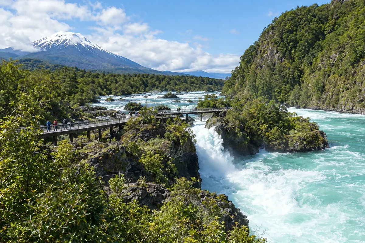
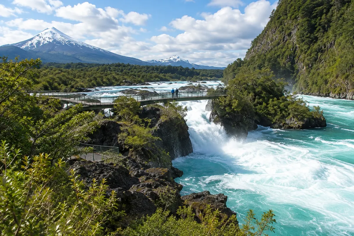
Na fotografiji: Saltos del Petrohué, Parque Nacional Vicente Pérez Rosales

Illustrative images. The pictures in this guide are illustrations based on the real place, not photographs, and may differ from it.

Na voljo v trgovini Google Play Pošljite svoje fotografije

Spoznajte kraj

Pokrajina, ki jo doživite
v svojem ritmu.

The Região dos Lagos occupies southern Chile, between the Cordilheira dos Andes and the Pacific, about a thousand kilometers south of Santiago. It is a land of glacial lakes, humid forests and perfectly conical volcanoes. This destination brings together two hubs: the shore of Lago Llanquihue, with Puerto Varas, Frutillar and Puerto Montt, and Pucón, further north, on the shore of Lago Villarrica.

Puerto Varas is the most commonly used base. From the Costanera de Puerto Varas you can see the Volcán Osorno on the far side of the lake, and the Iglesia del Sagrado Corazón de Jesús sits above the town. Along the road that circles the lake you reach the Saltos del Petrohué and the Lago Todos los Santos, inside Parque Nacional Vicente Pérez Rosales. In Frutillar, the Teatro del Lago, the Museo Colonial Alemán and the Costanera de Frutillar sum up the history of those who colonized the western shore.

The German imprint comes from colonization promoted by the Chilean government starting in 1852. Families from Hesse, Silésia, Vestfália and other regions were granted land around the Llanquihue, cleared areas of forest and built wooden houses with steep roofs. From that time remain surnames, Lutheran churches, clubs and the tradition of kuchen, the German sweet pie made with a soft dough topped with fruit, served in the afternoon with coffee.

Puerto Montt, the regional capital, is the air gateway and the starting point for Chiloé and Patagonia. Activity concentrates at Caleta Angelmó and the Plaza de Armas de Puerto Montt; to the southeast is Parque Nacional Alerce Andino. Pucón, in the Araucanía, sits at the foot of the Volcán Villarrica and serves as a base for Lago Villarrica, Parque Nacional Huerquehue and the Ojos del Caburgua.

The climate is wet: it rains in every season, and summer, from December to March, is the driest and most popular period. Bring a waterproof jacket even in January, because temperatures fall quickly at the lakeshores.

This destination brings together 4 cities: Puerto Varas, Frutillar, Puerto Montt, Pucón.

Delite: WhatsApp
Delite svoja popotniška doživetja s fotografijami Pošljite fotografije vsakega kraja, ki ste ga obiskali. Največje število fotografij na kraj: 5.

Ena destinacija, več poti

Mesta na tej poti

Začnite v enem mestu ali v načrt poti vključite več mest.

Lakes and Volcanoes – lega
Puerto VarasFrutillarPuerto MonttPucón

Obrisi: Natural Earth (javna domena). Priredba: Cidade Turismo.

Kako do tja:Lakes and Volcanoes

✈ Aeropuerto El Tepual (PMC), kraj: Puerto Montt· 30 km do cilja (Puerto Varas)

The most practical entry point is El Tepual airport in Puerto Montt, about a two-hour flight from Santiago. Confirm before purchasing. For Pucón, the airport used is Temuco. Overnight buses link Santiago with the four towns.

Predlagana točka prihoda:Puerto Varas

Doživite kraj

Kaj početi – Lakes and Volcanoes

Angelmó Cove
Puerto Montt · Los Lagos · Market and fair

Angelmó Cove

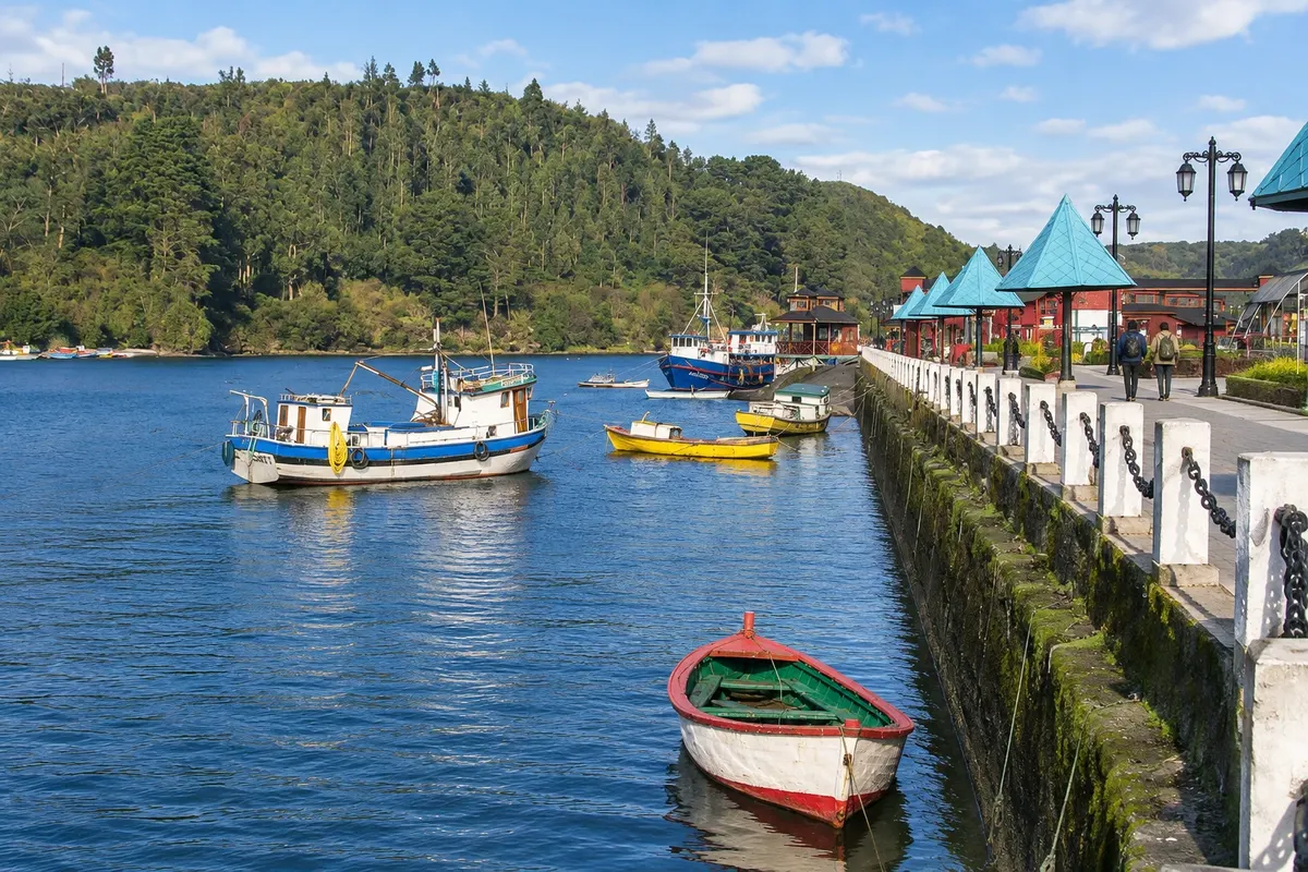
Fishermen's cove west of Puerto Montt's center, with a craft fair, fish and seafood market, small seafood eateries (cocinerías) and boats to Isla Tenglo.

Puerto Varas Waterfront
Puerto Varas · Los Lagos · Lake waterfront

Puerto Varas Waterfront

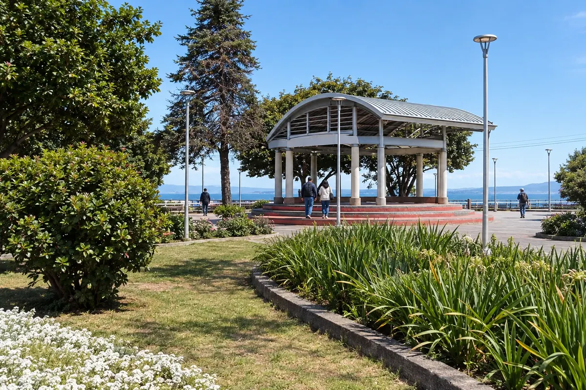
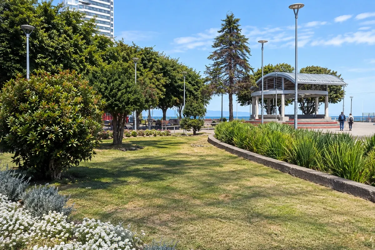
Lago Llanquihue waterfront in the centre of Puerto Varas, with Muelle Piedraplén, the urban beach and views of the volcanoes Osorno and Calbuco across the water.

Teatro del Lago
Frutillar · Los Lagos · Cultural center

Teatro del Lago

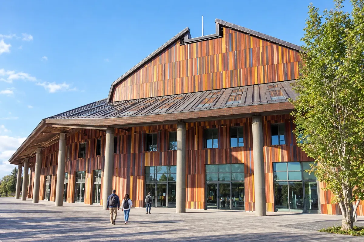
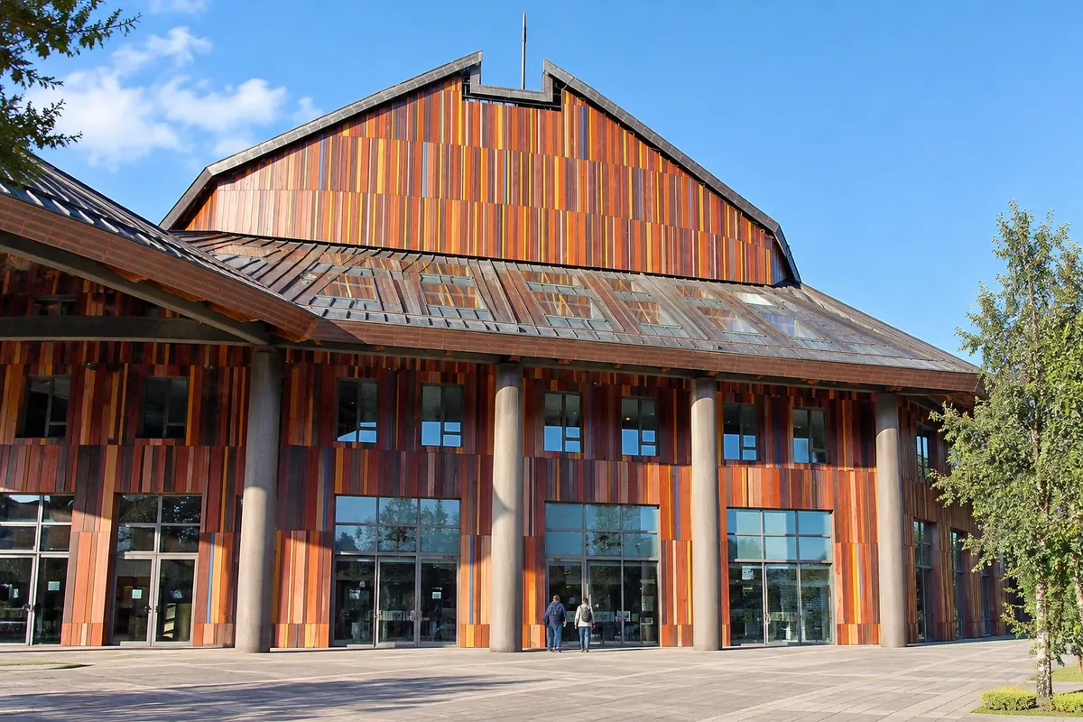
Arts center on the shore of Lago Llanquihue, with a main hall for about 1,200 people, a wooden façade and a program of classical music, opera and dance.

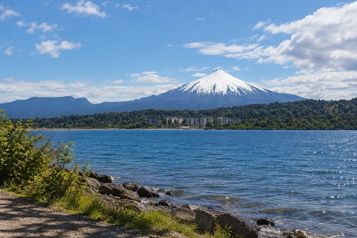
Villarrica Volcano
Pucón · Araucanía · Volcano

Villarrica Volcano

Active volcano of 2,860 meters south of Pucón, with glaciers on the summit and an intermittent lava lake in the crater. Guided climbs depend on alert levels and weather.

Lakes and Volcanoes – prikaži dodatne kraje (11)
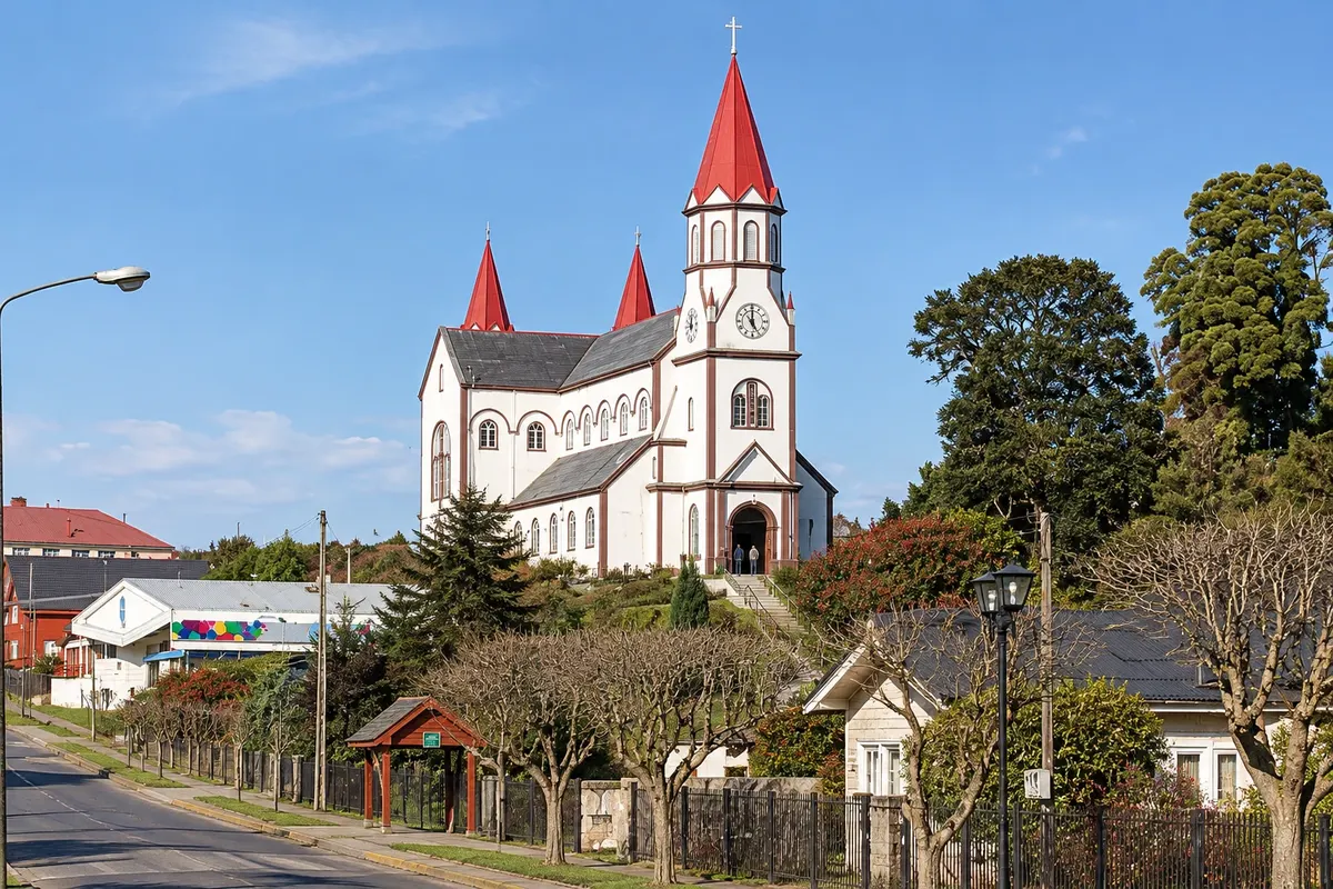
Church of the Sacred Heart of Jesus
Puerto Varas · Los Lagos · Historic church

Church of the Sacred Heart of Jesus

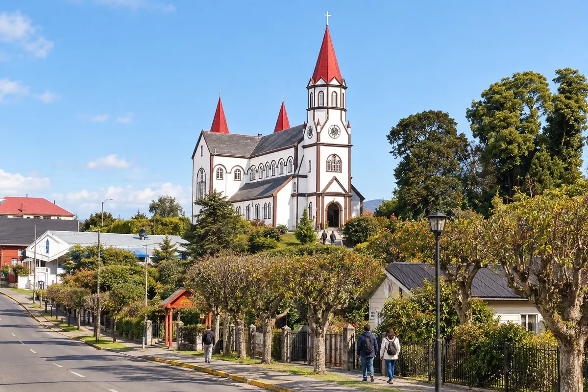
Wooden Catholic church built between 1915 and 1918 on one of the highest points of Puerto Varas, with a pointed tower and red roof visible from the whole waterfront.

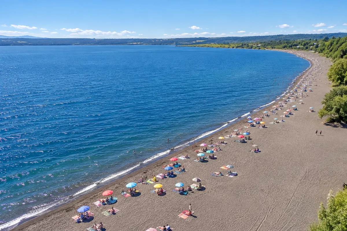
Lake Villarrica
Pucón · Araucanía · Lake and beach

Lake Villarrica

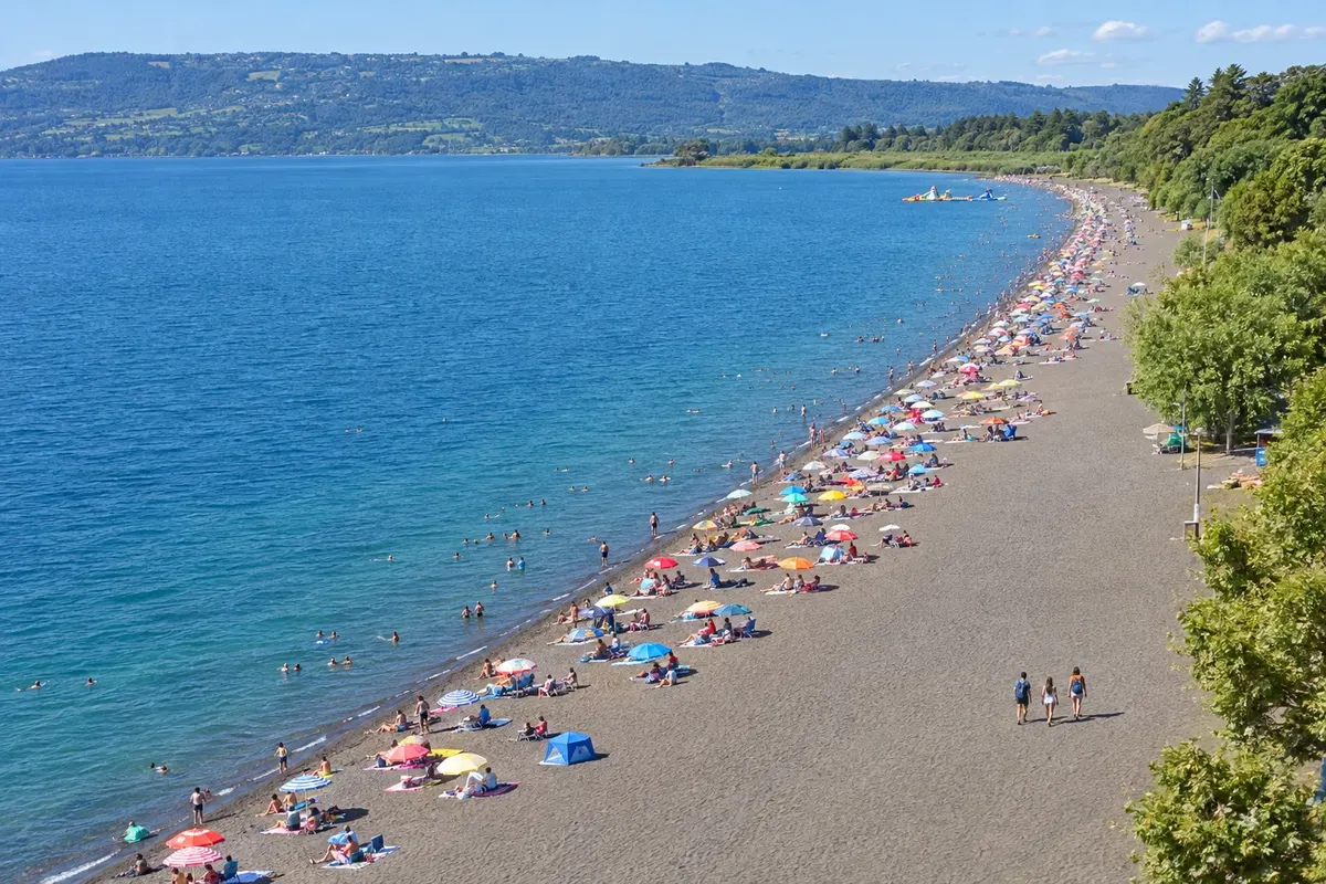
Glacial-origin lake whose eastern shore is home to Pucón, with the cove of La Poza, the Playa Grande of dark volcanic sand and views of the volcano.

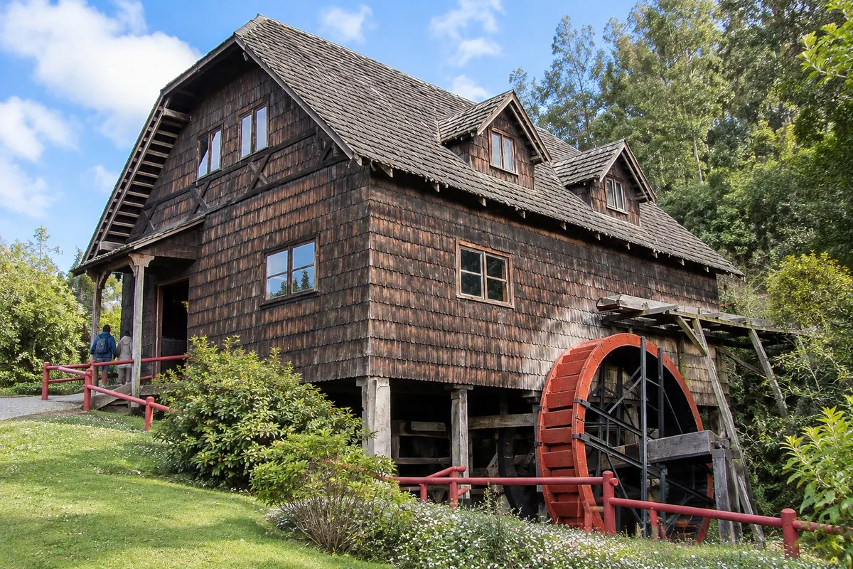
German Colonial Museum of Frutillar
Frutillar · Los Lagos · Open-air museum

German Colonial Museum of Frutillar

Open-air museum about the German colonization of Llanquihue, with a water mill, smithy, a circular machine shed and a settler's house from 1889, set in a three-hectare garden.

Plaza de Armas of Puerto Montt
Puerto Montt · Los Lagos · Historic square

Plaza de Armas of Puerto Montt

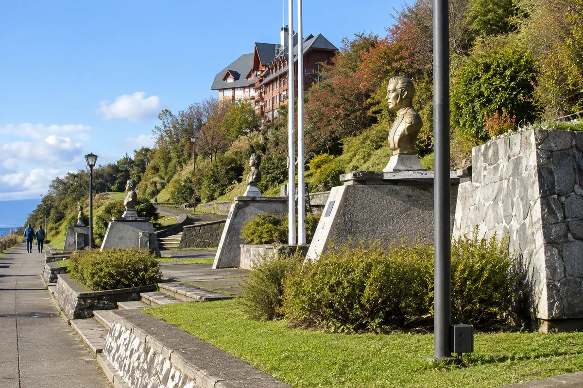
Central square of Puerto Montt, one block from the sea, with the wooden cathedral with a columned façade and, near the waterfront, the monument to German colonization.

Frutillar Waterfront
Frutillar · Los Lagos · Lake waterfront

Frutillar Waterfront

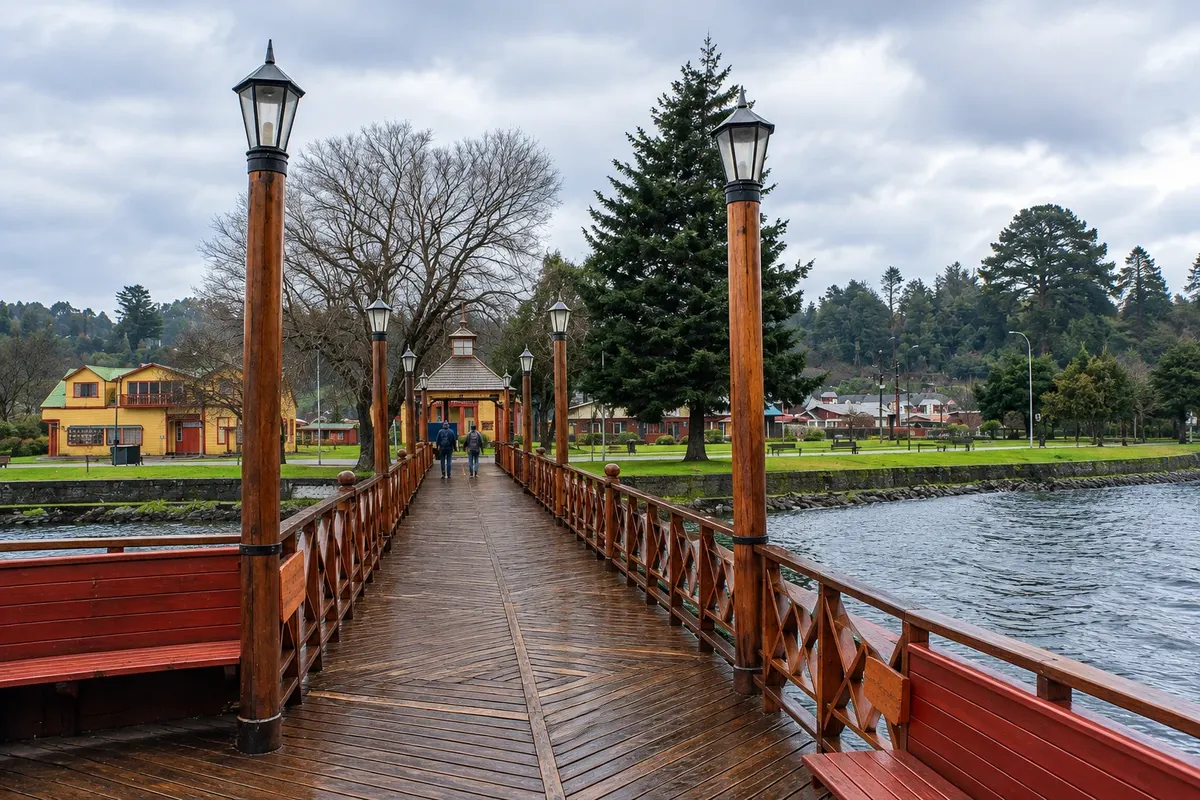
Promenade on the edge of the Bahía de Frutillar, with a beach, a pier and wooden houses from the settlers' era, facing the volcanoes Osorno, Calbuco, Puntiagudo and Tronador.

Alerce Andino National Park
Puerto Montt · Los Lagos · National park

Alerce Andino National Park

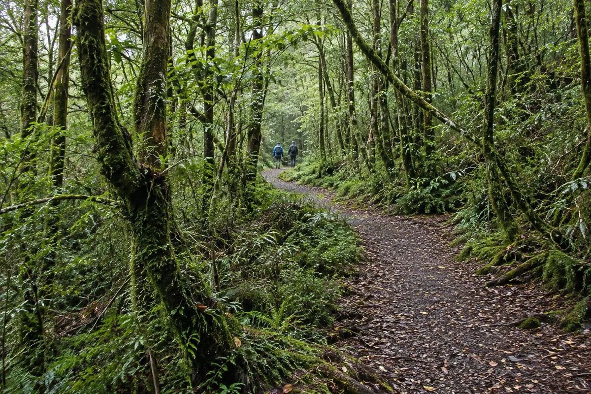
CONAF park southeast of Puerto Montt with alerce forests up to 3,000 years old, about 50 lakes and ponds, and trails in the Correntoso, Sargazo and Chaicas sectors.

Huerquehue National Park
Pucón · Araucanía · National park

Huerquehue National Park

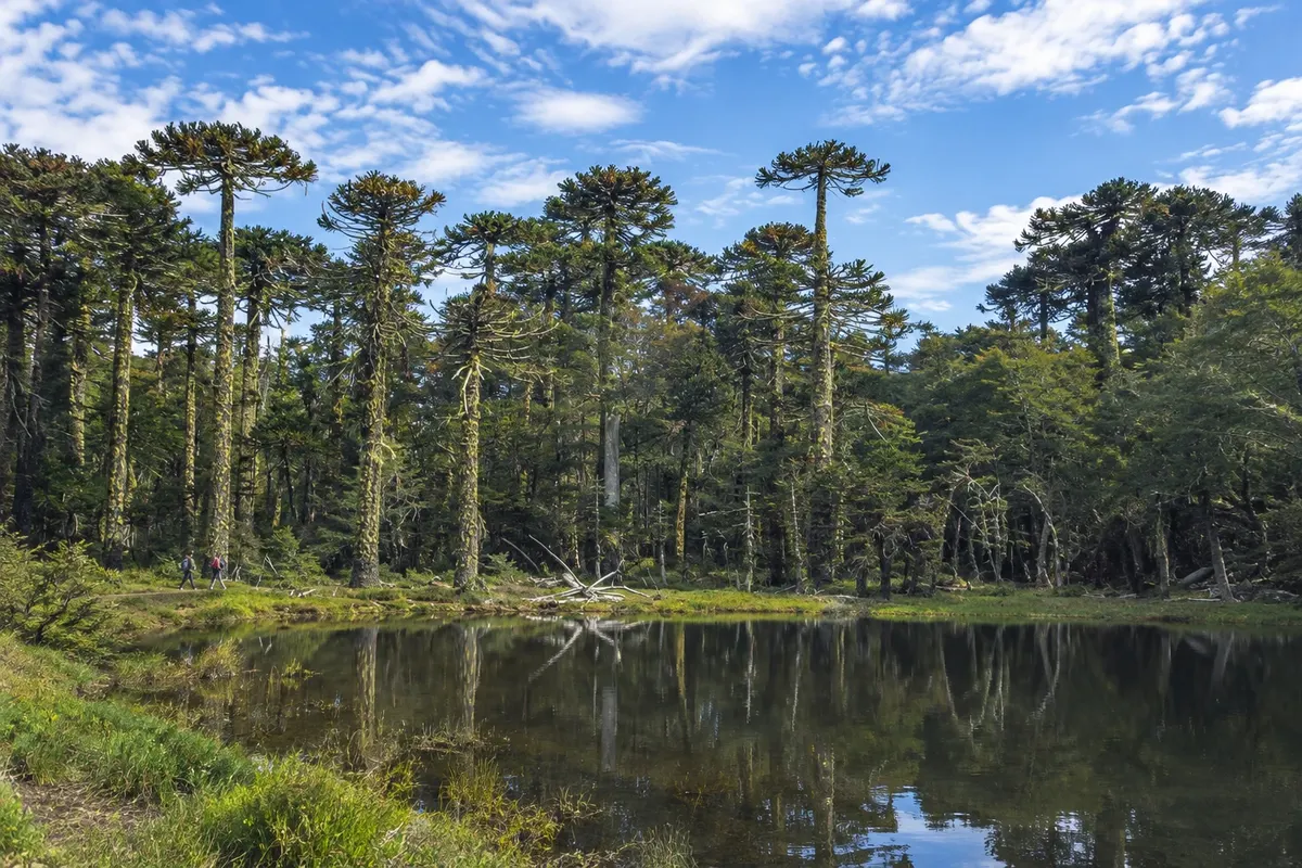
CONAF park northeast of Pucón with araucarias, waterfalls and mountain lakes such as Tinquilco, Chico, Verde and Toro, connected by trails.

Osorno Volcano
Puerto Varas · Los Lagos · Volcano

Osorno Volcano

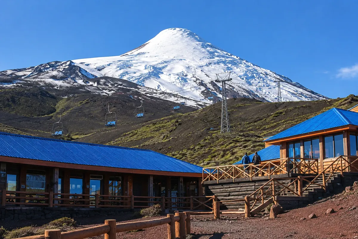
A 2,652-meter volcano with a symmetrical cone and a summit that's white year-round, between Lago Llanquihue and Lago Todos los Santos. A road climbs the slope up to the ski and mountain center.

Ojos del Caburgua
Pucón · Araucanía · Waterfalls

Ojos del Caburgua

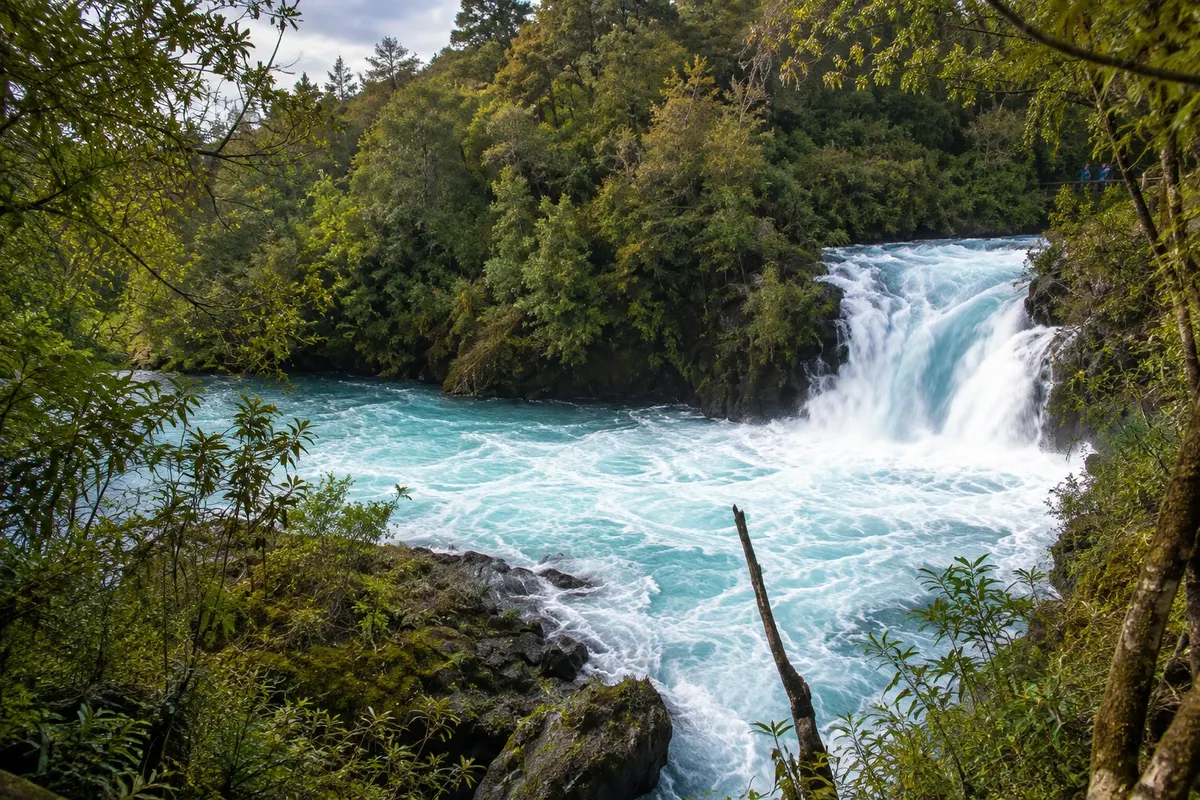
Pools of turquoise-colored water fed by an underground flow from Lago Caburgua, with 15 to 20 meter drops surrounded by forest, east of Pucón.

Petrohué Falls
Puerto Varas · Los Lagos · Slap

Petrohué Falls

Rapids of the Rio Petrohué over lava from Volcán Osorno, with green-blue water and the volcano in the background, inside Parque Nacional Vicente Pérez Rosales.

Lake Todos los Santos
Puerto Varas · Los Lagos · Jezero

Lake Todos los Santos

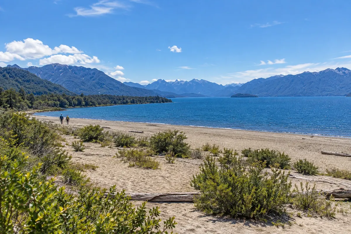
Lake of emerald‑green water surrounded by the volcanoes Osorno and Puntiagudo and by Cerro Tronador. The Petrohué pier is the departure point for boat tours.

Kaj izbrati pred odhodom

Izleti – Lakes and Volcanoes

Izhodišče, trajanje, potek, vključene storitve in okvirna cena vsakega izleta.

Puerto Varas on foot: Lago Llanquihue waterfront and Iglesia del Sagrado Corazón

Odhod: Puerto Varas town center Samostojno peš Približno 3 ure Dopoldne ali popoldne easy (short uphill to the church)

Puerto Varas sits on the southwest shore of Lago Llanquihue, Chile’s second-largest lake, about 860 km². The town grew out of German colonization: the first settlers arrived at the lakeshore between 1852 and 1853, and the name Puerto Varas was adopted in 1859. The center has a historic district protected since 1992, with wooden settler houses, and is known as the city of roses for the rose bushes planted along the streets. The walk starts at the Costanera de Puerto Varas, the lakefront avenue. On a clear day, Volcán Osorno, at 2,652 m, appears across the water, and Volcán Calbuco is further to the right. Muelle Piedraplén, a stone pier extending into the lake, is the most photographed spot. From the waterfront, climb the streets of the center to the Iglesia del Sagrado Corazón de Jesús, built between 1915 and 1918 by German settlers, with a design inspired by churches from the Baden-Württemberg region in Germany. The structure is made of native wood (ulmo and roble), the interior is lined with mañío and laurel, the exterior walls are covered with metal sheets and the roof has alerce shingles. It has been a National Monument since 1992. Return through the center, where cafés serve kuchen, the German-style fruit tart.

Kraji na poti: Costanera de Puerto Varas, Muelle Piedraplén, Lago Llanquihue, Iglesia del Sagrado Corazón de Jesús.

Vključuje: Self-guided walk. Entrance to the church is free; respect mass times.

Nasvet: Leave the waterfront for late afternoon, when the light hits Volcán Osorno. Try the region’s red-fruit kuchen. Always carry a waterproof jacket: the weather changes quickly by the lake.

Najboljši čas za obisk: All year. From December to March days are longer and the chance of seeing the volcano is higher.

Saltos del Petrohué and boat on Lago Todos los Santos

Odhod: Puerto Varas Excursion, rental car or minibus to Petrohué about 7 hours Ves dan Lahko

The trip goes into Vicente Pérez Rosales National Park, created in 1926, Chile’s oldest conservation unit, with more than 253,000 hectares. From Puerto Varas, Route 225, fully paved, skirts Lago Llanquihue for about 45 km to Ensenada, at the base of Volcán Osorno, and continues to Saltos del Petrohué, roughly 55 km from Puerto Varas. At the falls, the Petrohué River, which originates in Lago Todos los Santos, rushes through channels of dark volcanic rock. Wooden walkways and short trails through coigüe and ulmo forest lead to viewpoints over the rapids, with Volcán Osorno in the background; the water is turquoise-green because of fine particles coming from the lake. About 6 km further is Petrohué, on the shore of Lago Todos los Santos, around 60 km from Puerto Varas. Boats depart from there: there are short lake tours with views of the Osorno and Puntiagudo volcanoes and of Mount Tronador, and navigation to Peulla, at the eastern end, which takes about 1 hour 45 minutes. Lago Todos los Santos is also called Lago Esmeralda for the color of its water. In Petrohué there is a small dark-sand beach and a CONAF post.

Kraji na poti: Vicente Pérez Rosales National Park, Ensenada, Saltos del Petrohué, Petrohué, Lago Todos los Santos, Peulla.

Vključuje: On excursions, generally: transport from Puerto Varas or Puerto Montt and a guide. The national park entrance fee and the boat on the lake are usually paid separately. Check the current table.

Nasvet: The ticket for Saltos del Petrohué is purchased online in advance through CONAF’s park pass system. Bring a raincoat and footwear that can handle mud. If you go independently you can combine the minibus to Petrohué with the boat.

Najboljši čas za obisk: All year. From December to March there are more boat departures and longer days; in winter it rains more.

Volcán Osorno: viewpoints and Volcán Osorno Mountain Center

Odhod: Puerto Varas Rental car, transfer or excursion (not by regular bus) Približno 4 ure Dopoldne ali popoldne easy (cold and wind on the mountain)

Volcán Osorno is an almost perfect cone, at 2,652 m with snow high on its slopes, visible in every photo of Lago Llanquihue. It lies within Vicente Pérez Rosales National Park. From Puerto Varas, follow Ruta 225 along the lakeshore for about 45 km; near Ensenada take the turn that climbs roughly 12 km up the slope to the Volcán Osorno Mountain Center. The road leaves the forest and enters an area of volcanic rock, and from viewpoints along the ascent and from the base of the center you can see the whole Lago Llanquihue, with Volcán Calbuco to the south and, on a clear day, Lago Todos los Santos. In winter the center operates as a ski and snowboard area, with a school, equipment rental, tubing and sledding; the ski season usually runs from June to September or October, depending on snow, which is not guaranteed. Outside the ski season the center receives visitors for the viewpoints and for hikes on the slope, and the panoramic cable cars may operate depending on the weather. The climb to the summit is mountaineering, requires a guide and mandatory registration with CONAF, and is not part of this outing.

Kraji na poti: Volcán Osorno, Volcán Osorno Mountain Center, Ensenada, Lago Llanquihue, Vicente Pérez Rosales National Park.

Vključuje: On excursions, generally: transport and guide; many combine the volcano with the Petrohué Falls. The cable car, equipment rental and ski passes are paid separately. Check the current rates table.

Nasvet: Go early: clouds often cover the volcano from midday. Bring layered clothing, a windbreaker, sunglasses and sunscreen, even in summer. With snow on the road, tire chains may be required.

Najboljši čas za obisk: Viewpoints year-round, on clear days. Skiing from June to September or October, depending on snow.

Frutillar: costanera, Teatro del Lago and Museo Colonial Alemán

Odhod: Puerto Varas or Puerto Montt Car, tour or micro (local bus) to Frutillar Bajo Približno 5 ur Dopoldne ali popoldne Lahko

Frutillar sits on the west bank of Lago Llanquihue, facing Volcán Osorno. The town has two parts: Frutillar Alto, by Ruta 5, residential, and Frutillar Bajo, on the lakeshore, where most visitor attractions are located. Start at the Costanera de Frutillar, the waterfront avenue, with wooden houses from German settlers, a pier and a lake beach. In the middle of the waterfront stands the Teatro del Lago, an arts center opened in 2010 after about 12 years of construction. The building was designed to host the Semanas Musicales de Frutillar, a classical music festival that lost its hall in a 1996 fire. The design evokes Chiloe architecture, with wooden slats and a copper roof; the main hall has 1,178 seats, with wooden walls for acoustics. There are guided tours of the theater, as well as concerts, opera and performances throughout the year. Then visit the Museo Colonial Alemán de Frutillar, an open-air museum of the Universidad Austral de Chile, opened in 1984 on three hectares of gardens. The route passes the mill house, with a water mill and objects from 19th-century settlers; the blacksmith shop; the campanario, a circular barn with old agricultural machines; and the country house of a settler family, with furniture and utensils brought from Germany. Finish at one of the waterfront cafés with kuchen.

Kraji na poti: Frutillar Bajo, Costanera de Frutillar, Teatro del Lago, Museo Colonial Alemán de Frutillar, Lago Llanquihue.

Vključuje: Self-guided outing. The Museo Colonial Alemán charges admission, and the guided tour of the Teatro del Lago is paid separately. Check the current price list and the theater schedule.

Nasvet: On the micros that depart from Puerto Montt and Puerto Varas, confirm the bus goes to Frutillar Bajo, not only to Frutillar Alto. If you want to attend a concert, buy the ticket before you travel.

Najboljši čas za obisk: All year. The Semanas Musicales usually take place between late January and early February; check the dates each year.

Andean Crossing: from Puerto Varas to Bariloche via the lakes, crossing the border

Odhod: Puerto Varas (also in the reverse direction, from Bariloche) Organized crossing by bus and boat, with an operator about 12 hours (or 2 days with an overnight) Ves dan easy (long day)

The Cruce Andino is the Andes crossing by lakes between Puerto Varas, Chile, and San Carlos de Bariloche, Argentina. It is not a same-day round trip: the route crosses the border, and travelers need to sleep at least one night in Bariloche (most commonly two or more) or continue onward through Argentina. The journey combines bus sections and three boat rides. It departs Puerto Varas along the shore of Lago Llanquihue, with views of Volcán Osorno, and stops at the Saltos del Petrohué (a stop that usually does not occur from April to September). In Petrohué, the boat crosses Lago Todos los Santos to Peulla, at the eastern end of Parque Nacional Vicente Pérez Rosales. From Peulla, a bus climbs the Paso Vicente Pérez Rosales to Puerto Frías, already in Argentina, where migration formalities are completed. A short boat ride of about 25 minutes follows on Lago Frías, surrounded by mountains, then a bus section to Puerto Blest. The final navigation crosses an arm of Lago Nahuel Huapi, with waterfalls and islets, to Puerto Pañuelo, near Bariloche, from where the bus continues to the city center. The trip can be split over two days, with an overnight in Peulla or Puerto Blest.

Kraji na poti: Lago Llanquihue, Saltos del Petrohué, Petrohué, Lago Todos los Santos, Peulla, Puerto Frías, Lago Frías, Puerto Blest, Lago Nahuel Huapi, Bariloche.

Vključuje: Generally: buses and boats for the entire route and a guide. Entrance fees to Vicente Pérez Rosales National Park in Chile and Nahuel Huapi National Park in Argentina, lunch and accommodation are paid separately. Check the current price table.

Nasvet: Bring your RG or valid passport: there is migration control at the border. Confirm the departure time and meeting point when you book, because Chile and Argentina can be in different time zones depending on the season. The Chilean park entrance ticket is purchased online before the trip.

Najboljši čas za obisk: All year. From October to April days are longer and there are more departures; in winter the stop at the Saltos del Petrohué is often omitted from the itinerary.

Puerto Montt: Plaza de Armas, cathedral, waterfront and Caleta Angelmó

Odhod: Puerto Montt Plaza de Armas On foot along the waterfront, or taxi and colectivo to Angelmó Približno 4 ure Dopoldne ali popoldne Lahko

Puerto Montt is the capital of the Los Lagos Region and the port from which boats depart to Chiloé, the Carretera Austral and the southern fjords. The city is about 20 km from Puerto Varas, on the shore of the Seno de Reloncaví, a sea inlet. The walk starts at Puerto Montt’s Plaza de Armas. On one side is the Cathedral of Puerto Montt, made of native wood, with a four-column façade that resembles the Parthenon and beams supported by 12 larch columns; it was blessed as a parish in 1892, became a cathedral in 1939 and underwent repairs after the 1960 earthquake. From the square, descend to the costanera, the waterfront avenue, with monuments facing the sea, such as the sculpture Sentados frente al mar. If you want to understand the city’s history, from German colonization to the 1960 earthquake, stop at the Museo Patrimonial de Puerto Montt near the waterfront. Continue along the costanera westward to Caleta Angelmó, a cove that originated as a port at the end of the 19th century. There you’ll find the fish and seafood market, the cocinerías (simple stilted restaurants) and the craft fair, offering wool garments, smoked products, preserves and souvenirs from Chiloé and the south. It’s the traditional place to try curanto, a stew of seafood, meats and potatoes, and the milcaos and chapaleles, the region’s potato breads.

Kraji na poti: Puerto Montt Plaza de Armas, Cathedral of Puerto Montt, Puerto Montt waterfront, Museo Patrimonial de Puerto Montt, Caleta Angelmó.

Vključuje: Self-guided outing. The museum may charge admission; check the current fee.

Nasvet: Go to Angelmó at lunchtime, when the cocinerías are in full operation. Compare before buying crafts. Boats to Isla Tenglo depart from Angelmó’s pier.

Najboljši čas za obisk: All year. In rain, the covered market and the cocinerías remain open.

Prikaži dodatne izlete (9)

Isla Tenglo: boat crossing from Angelmó

Odhod: Caleta Angelmó pier, in Puerto Montt Local fishermen's boat and hike Približno 2 uri Dopoldne ali popoldne easy to moderate (steep ascent)

Isla Tenglo lies opposite Puerto Montt, across the channel that shelters Caleta Angelmó. Boats depart from a small pier at the entrance to the Angelmó market: wooden chalanas, many rowed, used by island residents and visitors, and the crossing takes about 8 minutes. From the boat you can see the port, the waterfront road and the stilted restaurants of Angelmó. On the island, the path along the channel leads to La Puntilla, a sheltered volcanic-sand beach with a small fishing community and colorful boats. The highlight is the hill crowned by a large cross, lit at night and visible from the city. The trail up is steep and takes about 20 minutes. From the top, on a clear day, you can see the Osorno, Puntiagudo and Calbuco volcanoes on the horizon, with Puerto Montt’s waterfront buildings in the foreground. The island’s south coast has rougher trails for experienced visitors.

Kraji na poti: Caleta Angelmó, Isla Tenglo, La Puntilla, Cross of Isla Tenglo.

Vključuje: The boat crossing is paid separately, directly to the boatmen. There are no services on the island.

Nasvet: Go during the day and bring water and a snack. Wear shoes with good grip for the climb to the cross. Arrange your return time with the boatman before disembarking.

Najboljši čas za obisk: From October to April, with less rain and longer days. Avoid days with strong wind.

Alerce Andino National Park: trails among millenary alerces

Odhod: Puerto Montt Rental car or tour; rural buses to the entrances Približno 6 ur Ves dan Lahka do srednje zahtevna pot

Alerce Andino National Park, created in 1982, protects 393 km² of mountains, about 50 lakes and lagoons, and alerce forests—the native tree of southern Chile that can live more than 3,000 years and exceed 50 m in height. The park has two entrances. The northern one, at the Correntoso sector, is about 46 km from Puerto Montt: take Ruta 7 toward Chamiza and then the V-65 road, beside Lago Chapo. From there an internal road continues to the Sargazo sector, where the most popular trails are located: Los Ulmos, a short loop of about 30 minutes; Laguna Sargazo, roughly 1.5 hours round trip to a mountain lagoon; and Alerce Milenario, about 50 minutes round trip to an alerce of around 2,500 years. In Correntoso is the Huillifoten trail, about 1 hour. The southern entrance, at the Chaica sector, leaves from Lenca on the Carretera Austral, about 36 km from Puerto Montt, with a final unpaved stretch. There are the El Encanto, Los Canelos and Salto Río Chaica trails, which lead to a waterfall and to alerces nearly 3,000 years old. The trail to the Chaiquenes and Triángulo lagoons, the longest, opens only in summer and requires crossing the Río La Plata on foot, without a bridge.

Kraji na poti: Alerce Andino National Park, Correntoso, Sargazo, Laguna Sargazo, Chaica, Lenca, Lago Chapo.

Vključuje: Self-guided or with an operator. Park admission is paid separately; check the current rate table.

Nasvet: Buy the ticket in advance online through CONAF’s park pass system and arrive early: the last entry is in the early afternoon. Bring a raincoat, boots and food, as services are limited. For higher internal roads, a vehicle with traction helps.

Najboljši čas za obisk: From November to March, with less rain. The trail to the Chaiquenes and Triángulo lagoons opens only in summer.

Cochamó and the Reloncaví Estuary

Odhod: Puerto Varas Rented car or tour, via Ruta 225 and via V-69 about 9 hours Ves dan Lahko

The Reloncaví Estuary is a sea inlet that reaches between the mountains southeast of Puerto Varas, with forested slopes descending to the water. From Puerto Varas, follow Ruta 225 along the shore of Lago Llanquihue to Ensenada and, a few kilometers later, take the turnoff to Ralún and Cochamó, the V-69 road. In Ralún, a bridge crosses the point where the Río Petrohué empties into the estuary. From there to the village of Cochamó is about 17 km on a narrow, winding road with views of the water and the mountains. Cochamó is a fishing and farming village on the east bank of the estuary. From the village, a dirt road of about 6 km leads to the visitor center and the start of the trails into the Valle de Cochamó, a granite-walled valley sought by climbers; the hike to the valley takes several days and is not part of this outing. Along the way there are hot springs on the estuary shore, with outdoor pools amid a stand of arrayanes. The drive from Puerto Varas to Cochamó takes about 2 hours by car.

Kraji na poti: Ensenada, Ralún, Reloncaví Estuary, Cochamó, Río Petrohué, Valle de Cochamó.

Vključuje: Self-guided or with an operator. Hot springs, parking and meals are paid separately. Check the current price table.

Nasvet: Leave early and refuel beforehand: services along the road are few and cellphone signal is weak. Access to the Valle de Cochamó trails closes in the early afternoon. Bring waterproof clothing.

Najboljši čas za obisk: From November to March, with less rain and longer days.

Pucón and Lake Villarrica

Odhod: Pucón town center Samostojno peš Približno 3 ure Popoldne Lahko

Pucón lies on the east shore of Lake Villarrica, in the Araucanía Region, about 100 km from Temuco. The lake was called Mallalafquén before the arrival of the Spanish; on the west shore is the town of Villarrica. South of Pucón, about 17 km away, is Volcán Villarrica, a snow-capped cone of roughly 2,850 m, one of Chile’s most active volcanoes, which often emits a column of smoke visible from town. Pucón is the base for the region’s adventure sports: trekking, rafting, kayaking, horseback riding, hot springs and, in winter, snow on the volcano’s slope. The walk around town starts in the center, with shops and cafés in wooden houses, and continues to the lakeshore. Playa Grande is the dark-sand beach of volcanic origin next to the center, with the volcano in the background. On the other side of the peninsula is La Poza, a sheltered cove with the pier where boats and kayaks depart. In summer the lake attracts sailors, water-skiers and swimmers.

Kraji na poti: Pucón, Lake Villarrica, Playa Grande, La Poza, Volcán Villarrica.

Vključuje: Self-guided outing. Boats, kayaks and equipment rentals at the lakeshore are paid separately.

Nasvet: Late afternoon is the time to view the volcano from Playa Grande. The lake water is cold even in summer. In January and February the town gets crowded; book tours in advance.

Najboljši čas za obisk: From December to March for the beach and lake sports; in winter, for the snow on the volcano’s slope and the hot springs.

Ascent of Volcán Villarrica with a guide

Odhod: Pucón Guided excursion with an authorized agency (mandatory) around 10 hours Ves dan difficult (requires good physical fitness)

The Villarrica Volcano, at about 2,850 m, lies within Villarrica National Park, roughly 17 km south of Pucón. It is one of Chile’s most active volcanoes, and its crater contains an intermittent lava lake, one of the few known in the world. The ascent is done only with a tour agency and a mountain guide. The day starts early, with transport from Pucón to the base of the climb at the north slope ski-area. From there the ascent is on foot, over snow and ice, using crampons and an ice axe, in several hours of continuous hiking. From the summit, on a clear day, you can see other regional volcanoes such as Lanín and Quetrupillán, and Lake Villarrica. The descent is usually faster. The ascent is not guaranteed: it depends on the volcanic alert level set by Sernageomin, CONAF rules and the weather, and access to the crater is often restricted or suspended. When the volcano is on alert, agencies may offer only hikes to lower points on the slope.

Kraji na poti: Villarrica Volcano, Villarrica National Park, Pucón.

Vključuje: Generally: transport, mountain guide, clothing and technical equipment (helmet, crampons, ice axe). The park entrance fee is paid separately with some operators. Check the current table.

Nasvet: Book with extra days in Pucón, because the departure can be postponed due to weather or volcanic activity. Ask the agency about the alert level before paying. Bring sunscreen, sunglasses and water.

Najboljši čas za obisk: From December to March, when guided ascents usually take place, always subject to volcanic alert level and weather.

Huerquehue National Park: Los Lagos trail among araucarias

Odhod: Pucón Car, tour or local bus to Lago Tinquilco about 8 hours Ves dan moderate (steep climb at the start)

Huerquehue National Park, created in 1967, protects about 12,500 ha of mountains between 720 m and 2,000 m in elevation, with lakes and araucaria forests, the emblematic tree of the Araucanía. It is about 35 km from Pucón, via the Caburgua road and a turn with a final stretch of gravel, roughly a 1-hour drive. The main entrance is beyond Lago Tinquilco, visible from the road. The Los Lagos trail, also called Tres Lagos, is the most popular. It starts at the park gate, climbs through coigüe forest with a steep ascent at the beginning and passes the Nido de Águila and Trufulco waterfalls. At about 1,320 m altitude it reaches Lago Chico, where araucarias begin to appear. From there it continues along a flatter section to Lago Toro and Lago Verde, surrounded by araucaria woodland, with viewpoints to Volcán Villarrica. The route is about 8 km from the gate, and the return is the same way, which takes the whole day. More distant lagoons, such as Huerquehue and Los Patos, are in areas with more difficult access.

Kraji na poti: Huerquehue National Park, Lago Tinquilco, Nido de Águila Waterfall, Lago Chico, Lago Toro, Lago Verde.

Vključuje: Self-guided or with an operator. The park entrance fee is paid separately and must be purchased online in advance. Check the current fee schedule.

Nasvet: Leave early from Pucón: local buses have few departures in the morning. Bring trekking footwear, layered clothing, a rain jacket, water and food; there are no services on the trail.

Najboljši čas za obisk: From November to April, with drier trails. In winter there may be snow at higher elevations and some sections closed.

Ojos del Caburgua: blue pools and waterfalls

Odhod: Pucón Car, bicycle, local bus or tour Približno 2 uri Dopoldne ali popoldne Lahko

The Ojos del Caburgua are pools and small waterfalls of intense blue water in native forest, about 4 km south of Lago Caburgua. The water comes from the lake itself, which drains through an underground channel and reappears there among the rocks. From Pucón, follow about 18 km on the road to Caburgua and, at the stop known as El Cristo, take the roughly 2 km turnoff to the entrance. A short trail with boardwalks and viewpoints circles the pools and falls. The visit is usually brief and often combined on the same day with Lago Caburgua, the hot springs in the Río Liucura valley, or the route to Huerquehue National Park. You can also go by bicycle along the same road.

Kraji na poti: Ojos del Caburgua, Lago Caburgua, Pucón.

Vključuje: Self-guided visit. Entrance may be charged; check the current fee.

Nasvet: Arrive early in summer, when the place gets crowded. The rocks near the water are slippery: wear closed shoes. Swimming in the pools is not recommended.

Najboljši čas za obisk: Year-round. In winter, with more rain, the flows are stronger.

Hot springs near Pucón: Termas Los Pozones and Termas de Huife

Odhod: Pucón Car, local bus or tour transfer Približno 5 ur afternoon and evening Lahko

The Río Liucura valley, northeast of Pucón, hosts several hot springs of volcanic origin. Two are the most well known and lie about 35 km from Pucón via the S-905 road and the paved turnoff to Huife. Termas Los Pozones are the rustic model: outdoor stone pools on the bank of the Río Liucura, with water between 20 °C and 40 °C depending on the pool, and simple changing rooms. Entry is by timed slots of a few hours, and the place operates into the evening. From the parking lot or bus stop there is a short walk down to the pools. Termas de Huife, a little earlier, are a full-service complex: three outdoor pools with water between 38 °C and 40 °C, also on the river bank, a semi-covered hydrotherapy pool, a restaurant and a trail through native forest. Both are often included in excursions that also visit the Ojos del Caburgua.

Kraji na poti: Termas Los Pozones, Termas de Huife, Río Liucura, Pucón.

Vključuje: The hot springs entrance is paid separately, per time slot or per day. On excursions, generally: transport from Pucón. Check the current rates table.

Nasvet: Bring swimwear, a towel, sandals and a change of clothes. At Los Pozones, arrive at the start of your time slot. From Pucón there are buses to the Huife area departing from the Pullman Bus terminal.

Najboljši čas za obisk: All year. In winter, with cold and rain, the hot water is especially appealing; in summer, time slots fill up.

Rafting on the Río Trancura

Odhod: Pucón Rafting tour with an operator Približno 4 ure Dopoldne ali popoldne moderate to difficult, depending on the section

The Trancura River descends from the Andes near Pucón, at the foot of Volcán Villarrica, and is the region’s rafting river. There are two sections. Trancura Bajo, with class III rapids, is the route for beginners and families: the van leaves Pucón along the Caburgua road to the launch point, about 15 km away, and the run covers roughly 13 km of river in about 1 hour 15 minutes. The entire trip, including safety instruction, changing facilities and transport, takes about 4 hours. Trancura Alto has class IV and V rapids, bigger waves and stronger drops, including the well-known Salto de Mariman and Último Suspiro, and is recommended for those with prior experience. The rafts go down with guides, and safety kayaks accompany the group.

Kraji na poti: Río Trancura, Pucón.

Vključuje: Generally: transport from Pucón, full rafting equipment (wetsuit, vest, helmet), safety briefing and guide. Check the current table.

Nasvet: Bring swimwear, a towel and a change of clothes. On Trancura Bajo the minimum age is usually 8 years; on Alto it is higher. Check with the operator.

Najboljši čas za obisk: From October to May. In winter, with heavy rains, normal departures are often suspended.


Po dnevih

Lakes and Volcanoes – načrt poti. Število dni: 3, 5in7

Predlogi za načrtovanje poti. Vrstni red dni prilagodite vremenu in razpoložljivosti izletov.

3 dni · Puerto Varas, Petrohué and Frutillar in 3 days

ZaFor those with limited time who want to see Lago Llanquihue, Volcán Osorno, the Petrohué Falls and Frutillar. · Izhodišče:Puerto Varas
  1. Dan 1 · Arrival from Brazil and Puerto Varas

    Flight from Brazil to Santiago, preferably early, with a same-day connection to Puerto Montt (about a 1 hour 45 minute flight). From El Tepual airport take a transfer, taxi or rental car to Puerto Varas, about 30 km. If the flight from Brazil arrives at night, stay overnight in Santiago and fly to Puerto Montt the next morning. In the late afternoon, take the Puerto Varas walking tour: the Lago Llanquihue waterfront and the Iglesia del Sagrado Corazón.

  2. Dan 2 · Saltos del Petrohué, Lago Todos los Santos and Volcán Osorno

    Leave early for Parque Nacional Vicente Pérez Rosales and first drive up to Volcán Osorno via the turnoff near Ensenada, since the sky is usually clearer earlier. Descend to the Saltos del Petrohué and continue to Petrohué for a boat trip on Lago Todos los Santos. Return to Puerto Varas in the late afternoon. Remember to buy the park entrance online in advance.

  3. Dan 3 · Frutillar and return

    In the morning, do the Frutillar tour: waterfront (costanera), Teatro del Lago and the Museo Colonial Alemán, with a stop for kuchen. In the afternoon, head to El Tepual airport in Puerto Montt for the flight to Santiago. If the flight is late in the day, you can stop first at Caleta Angelmó.

5 dni · Lakes Llanquihue and Todos los Santos, Puerto Montt and Reloncaví in 5 days
ZaFor those who want to explore the Puerto Varas region at a relaxed pace, with a day at the sea in Puerto Montt and a mountain road to Cochamó. · Izhodišče:Puerto Varas
  1. Dan 1 · Arrival from Brazil and Puerto Varas

    Flight from Brazil to Santiago and a same-day connection to Puerto Montt if the international flight arrives early; if arrival is at night, stay overnight in Santiago. From El Tepual airport head to Puerto Varas, about 30 km away. Do the Puerto Varas walking tour: the Lago Llanquihue waterfront and the Iglesia del Sagrado Corazón.

  2. Dan 2 · Volcán Osorno, Saltos del Petrohué and Lago Todos los Santos

    Start with Volcán Osorno and the viewpoints at the Centro de Montaña Volcán Osorno. Then visit the Saltos del Petrohué and take a boat on Lago Todos los Santos from Petrohué. If you are continuing to Argentina you can replace the end of the itinerary with the Cruce Andino to Bariloche.

  3. Dan 3 · Frutillar

    Day in Frutillar: costanera, Teatro del Lago with a guided visit or concert, and the Museo Colonial Alemán. In January and February, check for concerts as part of the Semanas Musicales. On the return, follow the road along the lake and stop at the viewpoints over Lago Llanquihue.

  4. Dan 4 · Cochamó and the Estuario de Reloncaví

    Drive along Ruta 225 to Ensenada and then the V-69 to Ralún and Cochamó, with the Estuario de Reloncaví beside the road. Stop at the hot springs on the estuary shore if you wish. In heavy rain, swap this day for Parque Nacional Alerce Andino or a day in Puerto Montt.

  5. Dan 5 · Puerto Montt, Angelmó and return

    Do the Puerto Montt route: Plaza de Armas, cathedral, costanera and Caleta Angelmó, with lunch at the cocinerías. If time allows, take a boat across to Isla Tenglo. In the afternoon, head to El Tepual airport and catch the flight to Santiago.

7 dni · Puerto Varas and Pucón: lakes and volcanoes in 7 days
ZaFor those who want to see both lake regions, with nature, hot springs and adventure in Pucón. · Izhodišče:Puerto Varas (4 nights) and Pucón (3 nights)
  1. Dan 1 · Arrival from Brazil and Puerto Varas

    Flight from Brazil to Santiago and a same-day connection to Puerto Montt (about a 1 hour 45 minute flight), or first night in Santiago if the flight arrives late. From El Tepual airport head to Puerto Varas, about 30 km away. For this itinerary a rental car is very helpful. At the end of the day, take the walk along the waterfront and visit the Iglesia del Sagrado Corazón.

  2. Dan 2 · Volcán Osorno, Saltos del Petrohué and Lago Todos los Santos

    Full day in Parque Nacional Vicente Pérez Rosales: Volcán Osorno viewpoints in the morning, Saltos del Petrohué and a boat trip on Lago Todos los Santos from Petrohué.

  3. Dan 3 · Frutillar and Puerto Montt

    In the morning, Frutillar: costanera, Teatro del Lago and the Museo Colonial Alemán. In the afternoon, go to Puerto Montt for the Plaza de Armas, the costanera and Caleta Angelmó, with its market and cocinerías.

  4. Dan 4 · Parque Nacional Alerce Andino or Cochamó

    Choose between the trails in Parque Nacional Alerce Andino, among alerces that are thousands of years old, or the road to Cochamó on the shore of the Estuario de Reloncaví. Return to sleep in Puerto Varas.

  5. Dan 5 · Road to Pucón and Lake Villarrica

    Drive north on Ruta 5 and then via Villarrica to Pucón, or take a direct bus from Buses JAC between Puerto Varas and Pucón. In the afternoon, do the Pucón and Lago Villarrica tour, including Playa Grande and La Poza. Arrange in town the ascent of Volcán Villarrica if the volcanic alert level and weather allow, or go rafting on Río Trancura.

  6. Dan 6 · Huerquehue National Park

    Full day on the Los Lagos trail in Huerquehue National Park, to Lago Chico, Lago Toro and Lago Verde among araucarias. If you secured a spot to climb Volcán Villarrica you can swap the hike for the volcano; if you prefer water, go rafting on the Trancura River. In the late afternoon, relax at the Los Pozones hot springs or the Huife hot springs.

  7. Dan 7 · Ojos del Caburgua and return via Temuco

    In the morning, visit the Ojos del Caburgua, about 20 km from Pucón. Then head to Temuco airport (ZCO), about 90 km away, and fly to Santiago in roughly 1 hour 20 minutes. If you rented the car in Puerto Montt, you should arrange returning it in Temuco beforehand.

Najboljši čas za obisk

Kdaj se odpraviti:Lakes and Volcanoes po mesecih

From December to March the weather is usually drier and the days are long, which favors hikes, boat trips and the climb up the Villarrica. April and November are quieter, with more rain. Between June and September it’s cold, it rains a lot and snow often covers the volcano slopes — the ski season.

The seasons shown are the most usual ones; nature doesn't always follow the calendar.

januar Malo padavin

mid-summer · summer holidays

Summer. In Puerto Montt, average highs around 20 °C and lows of 9 °C; in Pucón, more sheltered, highs usually exceed 22 °C. It's one of the driest months, but it can rain any day. Long days, season for climbing Volcán Villarrica, rafting and lake beaches. The Semanas Musicales de Frutillar usually start at the end of the month.

februar Malo padavin

summer · Semanas Musicales

Still summer: highs around 20 °C and lows of 9 °C in Puerto Montt, slightly warmer in Pucón. The driest month of the year, though weather changes quickly. Boat trips on Lago Todos los Santos, hikes in Huerquehue and Alerce Andino, and climbs of Volcán Villarrica, always subject to the volcanic alert. The Semanas Musicales de Frutillar typically run into the start of the month.

marec Zmerne padavine

late summer · quieter

Late summer: highs around 18 °C and lows of 8 °C in Puerto Montt. Rain starts to increase, but there are still many good days. With the end of the holidays, tours are quieter and trails remain open. Good time for the Cruce Andino and excursions to Volcán Osorno, with fewer people.

april Veliko padavin

autumn · colors in the forest

Autumn: highs around 15 °C and lows of 6 °C in Puerto Montt. It rains considerably more. Leaves of some native trees change color on the slopes. Rafting on the Trancura still operates, and the hot springs become more popular. On the Cruce Andino, the stop at Saltos del Petrohué is often dropped from the itinerary from this month.

maj Veliko padavin

rainy autumn · low season

Cold, rainy autumn: highs around 13 °C and lows of 6 °C in Puerto Montt. It is one of the rainiest months, and the days get shorter. Low season: fewer boat departures and tours, and rafting usually ends. Hot springs, museums, Frutillar and the Angelmó market remain options for rainy days.

junij Veliko padavin

winter · wettest month

Winter: highs around 11 °C and lows of 4 °C in Puerto Montt; Pucón is colder and wetter. It is the rainiest month. Snow often covers the volcanoes, and the ski season at Volcán Osorno usually begins in the second half of the month, depending on snowfall. Bring waterproof clothing and closed shoes.

julij Veliko padavin

winter · July school holidays

Coldest month: highs around 10 °C and lows of 4 °C in Puerto Montt, with frosts. It rains a lot. If there is snow on the road to Volcán Osorno, tire chains may be required.

avgust Veliko padavin

winter · skiing

Still winter: highs around 11 °C and lows of 4 °C in Puerto Montt. Rain remains heavy. Ski season at Volcán Osorno, depending on snowfall. Mountain trails, such as those in Huerquehue, may have snow and closed sections. Less activity after the July holidays.

september Zmerne padavine

end of winter · Fiestas Patrias

End of winter and start of spring: highs around 13 °C and lows of 4 °C in Puerto Montt. Rain decreases but is still frequent. Fiestas Patrias, on September 18 and 19: long holiday weekend, with crowded towns and some businesses closed.

oktober Zmerne padavine

spring · season begins

Spring: highs around 15 °C and lows of 5 °C in Puerto Montt. It still rains many days, but sunny intervals increase. Rafting season on the Trancura usually begins, snow retreats from the lower slopes of the volcanoes, and boat departures increase. Time of flowers and low crowds.

november Zmerne padavine

spring · long days

Spring: highs around 17 °C and lows of 7 °C in Puerto Montt. Less rain and long days. Trails in Alerce Andino and Huerquehue become drier, and boat trips and the Cruce Andino operate with more departures. Still moderate activity before the holidays.

december Zmerne padavine

start of summer · longer days

Early summer: highs around 19 °C and lows of 8 °C in Puerto Montt, somewhat warmer in Pucón. Rain decreases but does not disappear. The longest days of the year favor hikes and boat trips, and guided climbs of Volcán Villarrica are usually resumed, always subject to the volcanic alert. Activity increases toward the end of the month with Christmas, New Year and the start of the holidays.

Načrtujte pot

Kako do tja:Lakes and Volcanoes

By plane from Santiago to Puerto Montt, for Puerto Varas and Frutillar

The flight from Santiago (SCL) to El Tepual airport (PMC) in Puerto Montt takes about 1 hour 45 minutes, with several daily flights by carriers like LATAM and Sky. From the airport to Puerto Varas is roughly 30 km; to downtown Puerto Montt, less. At arrivals you’ll find transfers, taxis and car rental desks. Frutillar is about a 30-minute drive from Puerto Montt. The Volcán Osorno Mountain Center is about 1.5 hours from the airport, and there is no regular bus service to it.

By plane from Santiago to Temuco, for Pucón

For Pucón, the flight is from Santiago (SCL) to La Araucanía Airport (ZCO) in Freire, about 21 km south of Temuco, taking around 1 hour 20 minutes with LATAM, Sky and JetSMART. From the airport to Pucón it’s about 90 km by road via Villarrica, roughly 1.5 to 2 hours by rental car, transfer or bus. Pucón has an aerodrome, but there is no confirmed regular service to it; count on Temuco.

By bus from Santiago

There are overnight buses from Santiago to Puerto Varas and Puerto Montt operated by companies such as Turbus, Pullman Bus and Cruz del Sur, offering semi-reclining and sleeper seats. The trip to Puerto Varas takes about 12 hours. For Pucón, companies like Pullman Bus, Buses JAC and Turbus run the route in about 10 to 11 hours. In Santiago, buses depart from Terminal Sur and Terminal Alameda, next to the Universidad de Santiago metro station. There are also direct buses between Puerto Varas and Pucón by Buses JAC.

Z avtom

From Santiago to Puerto Varas is about 1,015 km via Ruta 5 Sur, a toll road, taking roughly 10.5 hours of driving; to Pucón about 785 km, around 8.5 hours, leaving Ruta 5 at Freire toward Villarrica. In the region, a car is very helpful: many sights are off bus routes. From Puerto Varas, Ruta 225, paved, skirts Lago Llanquihue to Ensenada, about 45 km, and continues to Petrohué; V-69 descends to Ralún and Cochamó. For Huerquehue National Park, the final stretch is ripio (gravel). In winter, to ascend to Volcán Osorno or the Villarrica slope with snow, tire chains may be required.

How to get around the destination

Local buses connect Puerto Montt, Puerto Varas, Llanquihue and Frutillar frequently; for Frutillar, confirm the bus goes to Frutillar Bajo, on the lakeshore. From Puerto Varas minibuses run to Ensenada and Petrohué every 30 to 45 minutes from the corner of San Bernardo and Walker Martínez streets. For Volcán Osorno, Cochamó and Alerce Andino National Park, the way is by rental car or tour; for Alerce Andino there are also rural buses to Correntoso and Chaica. In Pucón there are local buses to Caburgua, to Huerquehue (with few morning departures), and to the Huife area. For those who want to see both regions, a rental car is the most practical option.

National park tickets

The Vicente Pérez Rosales (Saltos del Petrohué), Alerce Andino, Huerquehue, and Villarrica national parks are managed by CONAF and require paid admission. Tickets are purchased online in advance through CONAF’s park pass system; some parks still sell at the gate, but don’t count on that. Climbing Volcán Osorno requires registration at a CONAF office. On the Cruce Andino, admission to Nahuel Huapi National Park in Argentina is also paid separately. Check the current fee table before you go.

Pred odhodom

Praktične informacije

Z nekaj načrtovanja boste imeli več časa za uživanje na poti.

Kdaj se odpraviti

From December to March the weather is usually drier and the days are long, which favors hikes, boat trips and the climb up the Villarrica. April and November are quieter, with more rain. Between June and September it’s cold, it rains a lot and snow often covers the volcano slopes — the ski season.

The seasons shown are the most usual ones; nature doesn't always follow the calendar.

Koliko dni ostati

Allow five to seven days. Three or four in Puerto Varas cover Frutillar, Puerto Montt, the Volcán Osorno and Parque Nacional Vicente Pérez Rosales. Pucón requires two or three more days for the volcano, Huerquehue and the lakes. The two bases are about 300 km apart.

V katerem mestu prenočiti

In Puerto Varas, the center near the Plaza de Armas and the waterfront concentrates restaurants and agencies, and everything is walkable; the Puerto Chico area to the east has lakefront lodging. Frutillar Bajo, by the bay, suits those seeking quiet and the theater’s program. In Puerto Montt the center is convenient for those arriving late or leaving early. In Pucón the streets around Avenida O'Higgins and the beach gather guesthouses and cabins; those with cars can stay along the road to Caburgua.

Spoštujte kraj

Odnesite svoje odpadke, upoštevajte oznake in podprite lokalne ponudnike. V naravi upoštevajte navodila za obiskovalce.

Odgovori na vaša vprašanja

Pogosta vprašanja – Lakes and Volcanoes

How many days to allocate for Puerto Varas and Pucón?

With a week you can split time between the two bases: four days in Puerto Varas, with outings to Frutillar, Puerto Montt, the Volcán Osorno and the Saltos del Petrohué, and three in Pucón for the Villarrica, Huerquehue and the Ojos del Caburgua. With five days, choose one base and don’t try to see everything.

What is the best time to visit the lakes of southern Chile?

Summer, from December to March, usually brings less rain, more pleasant water for lakeside beaches and open trails. It is also high season, with more people and busy reservations. In winter, from June to September, it rains a lot and snow often appears on the volcanoes, which attracts those who want to ski.

Do you need a car in the Região dos Lagos?

It helps a lot. Roads are paved and well signposted, and a car allows you to stop at viewpoints around Lago Llanquihue and arrive early at the parks. Without a car, the micros — as locals call the regional buses — frequently connect Puerto Montt, Puerto Varas and Frutillar, and agencies run tours to the volcanoes. In Pucón, buses go to Caburgua and Huerquehue.

Can you do a day trip from Santiago to the lakes?

No. Puerto Montt is more than a thousand kilometers from Santiago, and Pucón nearly 800 km. The bus trip takes all night, and even by plane a day isn’t enough to see the region. Plan for at least four nights.

Odkrijte druge destinacije Iskanje po zvezni državi in mestu

Več kot vodnik