Trolltunga
Odhod: Odda The trailhead starts at Skjeggedal, about 13 km from Odda, via Tyssedal 7 to 9 hours from Mågelitopp during the day depending on the route chosen
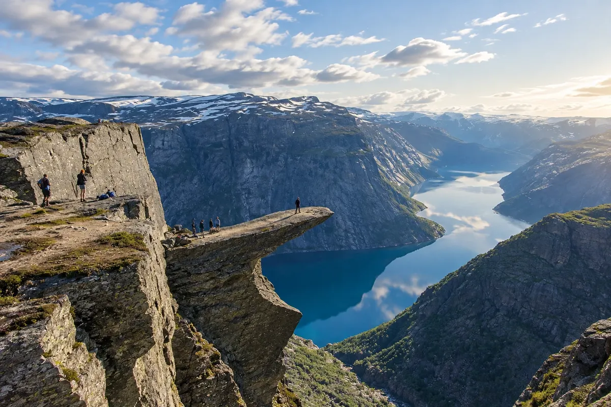
Trolltunga, the Troll’s Tongue, is a slab of rock that juts horizontally from the mountain, at about 1,100 meters elevation and 700 meters above Lake Ringedalsvatnet, northeast of Odda. Its shape comes from a block that detached along a fissure during the last glaciation. A photo of a person sitting on the tip of the tongue with the lake far below made the trail famous worldwide.
The hike is long. From the Skjeggedal parking lot, near Tyssedal, it is about 27 km round trip, with over 1,000 meters of ascent, taking 10 to 12 hours. From the higher Mågelitopp parking lot, which has limited spaces and usually has shuttle buses, it is about 20 km, taking 7 to 9 hours. The path is marked with red markers and distance signs, crosses rock plateaus, lakes and snow sections until early summer, and has emergency shelters along the way.
Kraji na poti: Trolltunga.
Vključuje: Arrange access to the site and transport separately. Guided activities and tickets have their own conditions.
Nasvet: Bring hiking boots, layered clothing, a rain jacket, hat, gloves, a flashlight, water and food for the day. Plan your return time and stick to it. Stay in Odda the night before to depart early.
Najboljši čas za obisk: From mid-June to mid-September, when the trail is usually snow-free
Buarbreen
Odhod: Odda From Odda, follow about 8 km on the narrow Buer road to the parking lot 2 to 3 hours round trip from Buer farm. during the day depending on the route chosen
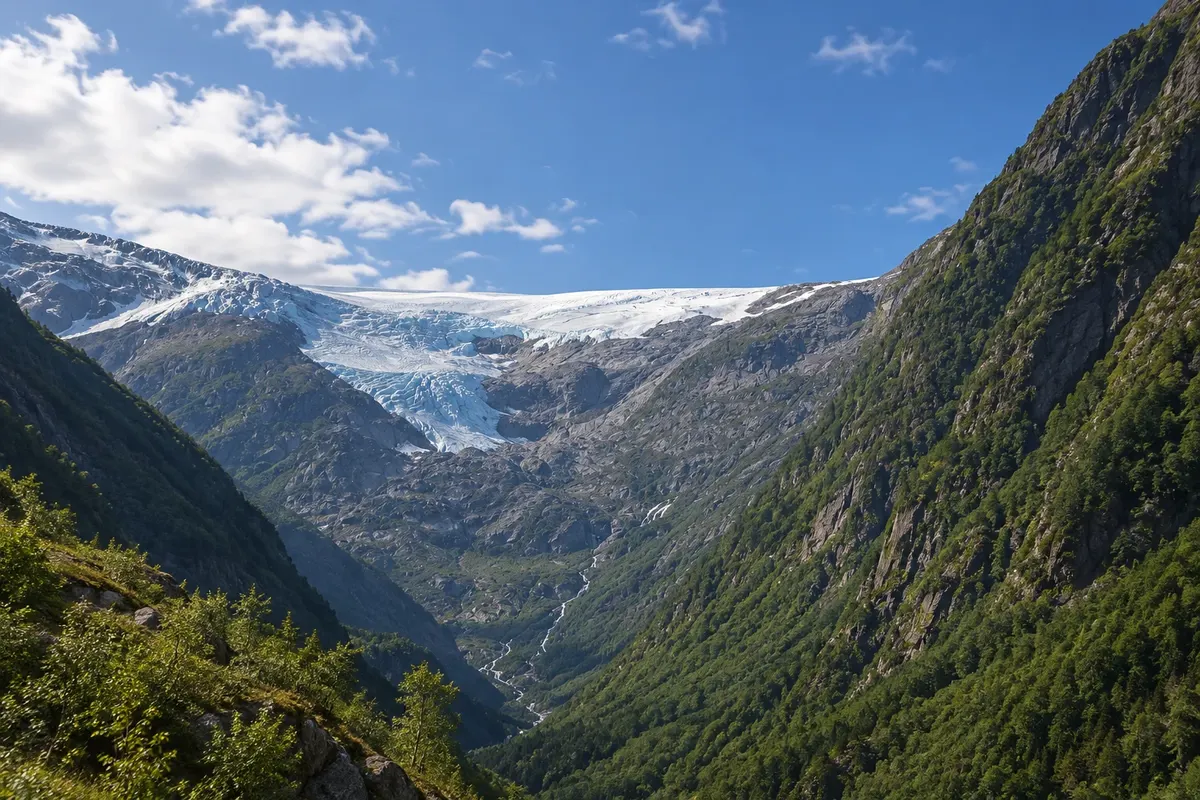
Buarbreen is a tongue of the Folgefonna glacier, the third largest glacier on mainland Norway, which descends into a narrow valley west of Odda. It is one of the easiest ways to see a glacier up close in the area on a half-day hike.
The trail starts at Buer farm, about 8 km from Odda town center, along a narrow road. It is roughly 4 km each way, taking 2 to 3 hours round trip. The path follows the river flowing from the glacier, crosses a suspension bridge and climbs over rocks, with steep sections near the end where fixed ropes provide handholds. At the top, the valley closes before the glacier front, with bluish ice, polished rocks and meltwater waterfalls.
Kraji na poti: Buarbreen.
Vključuje: Arrange access to the site and transport separately. Guided activities and tickets have their own conditions.
Nasvet: Wear hiking shoes with good grip: the end of the trail has smooth rocks and ropes. Do not approach the glacier front; to walk on the ice, hire a guide.
Najboljši čas za obisk: From June to September, when the trail is usually snow-free
Låtefossen
Odhod: Odda It is on Road 13, about 17 km south of Odda, heading toward Røldal 15 to 30 minutes. during the day depending on the route chosen
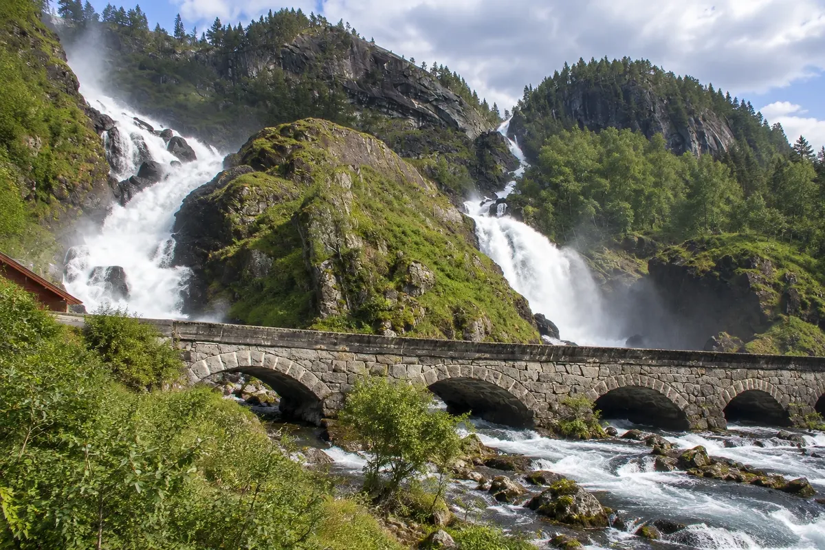
Låtefossen is a twin waterfall in the Grovsdalen valley, south of Odda. Two parallel falls drop about 165 meters down the hillside, coming from Lake Lotevatnet, and join at the bottom, right next to Road 13, which connects Odda to Røldal. The road passes directly over the river on a six-arched stone bridge, and drivers pass through a cloud of spray.
The site has been a classic roadside stop in western Norway since the 19th century, when the route was used by carriage travelers. There is parking beside the road, a small shop and restrooms, and the waterfall can be seen up close, just a few meters from the pavement.
Kraji na poti: Låtefossen.
Vključuje: Arrange access to the site and transport separately. Guided activities and tickets have their own conditions.
Nasvet: Stop at the parking area before the bridge and walk to the edge of the fall. If you are heading south, combine it with Røldal and its stave church.
Najboljši čas za obisk: From May to July, when the thaw usually makes the falls more full-flowing
Norsk vasskraft- og industristadmuseum
Odhod: Odda It is located in Tyssedal, about 6 km from Odda via Road 13 From 1 hour to during the day, including the guided visit. during the day depending on the route chosen
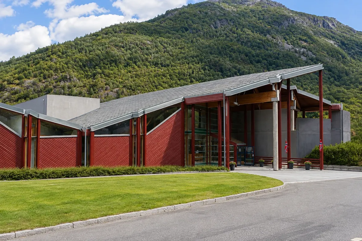
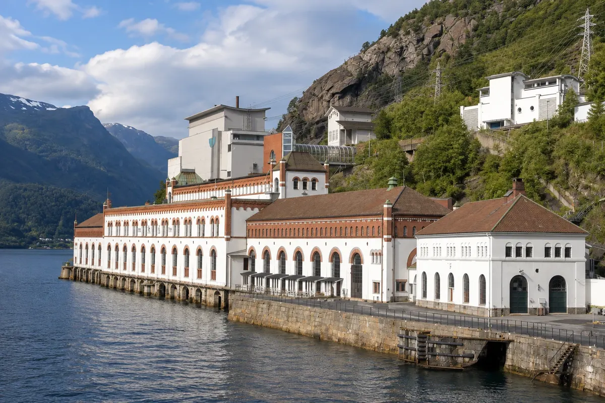
The Norwegian Hydropower and Industrial Museum is in Tyssedal, about 6 km from Odda, in the former Tysso I power plant. The plant was built between 1906 and 1918 to supply power to Odda’s carbide and zinc smelters, and helped transform the area from fishing and farming villages into an industrial centre.
The power plant building is one of Norway’s most well-known industrial structures, with stone façades, tall windows and a machine hall that resembles a cathedral. Inside are the original turbines and generators, with control panels, piping and tools. The guided tour explains how water descends from the mountains through pipes down the slope and drives the machines.
Kraji na poti: Norsk vasskraft- og industristadmuseum.
Vključuje: Arrange access to the site and transport separately. Guided activities and tickets have their own conditions.
Nasvet: Combine it with the route to Trolltunga, which starts from Skjeggedal slightly above. Take the guided tour to enter the machine hall.
Najboljši čas za obisk: From June to August, when the museum usually opens with guided tours
Lofthus
Odhod: Odda It is on Road 13, about 30 km north of Odda and 40 km south of Eidfjord, From 2 hours to half a day, including the cider farms and the church. during the day depending on the route chosen
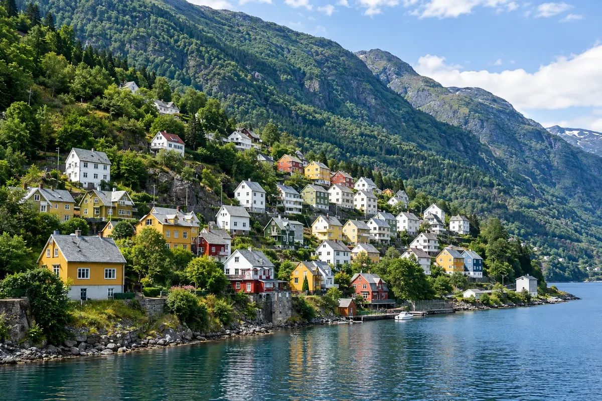
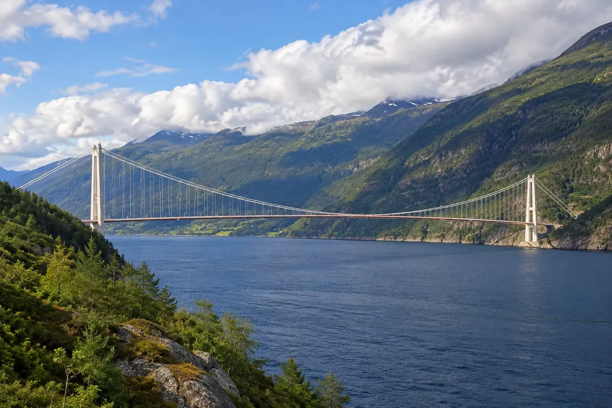
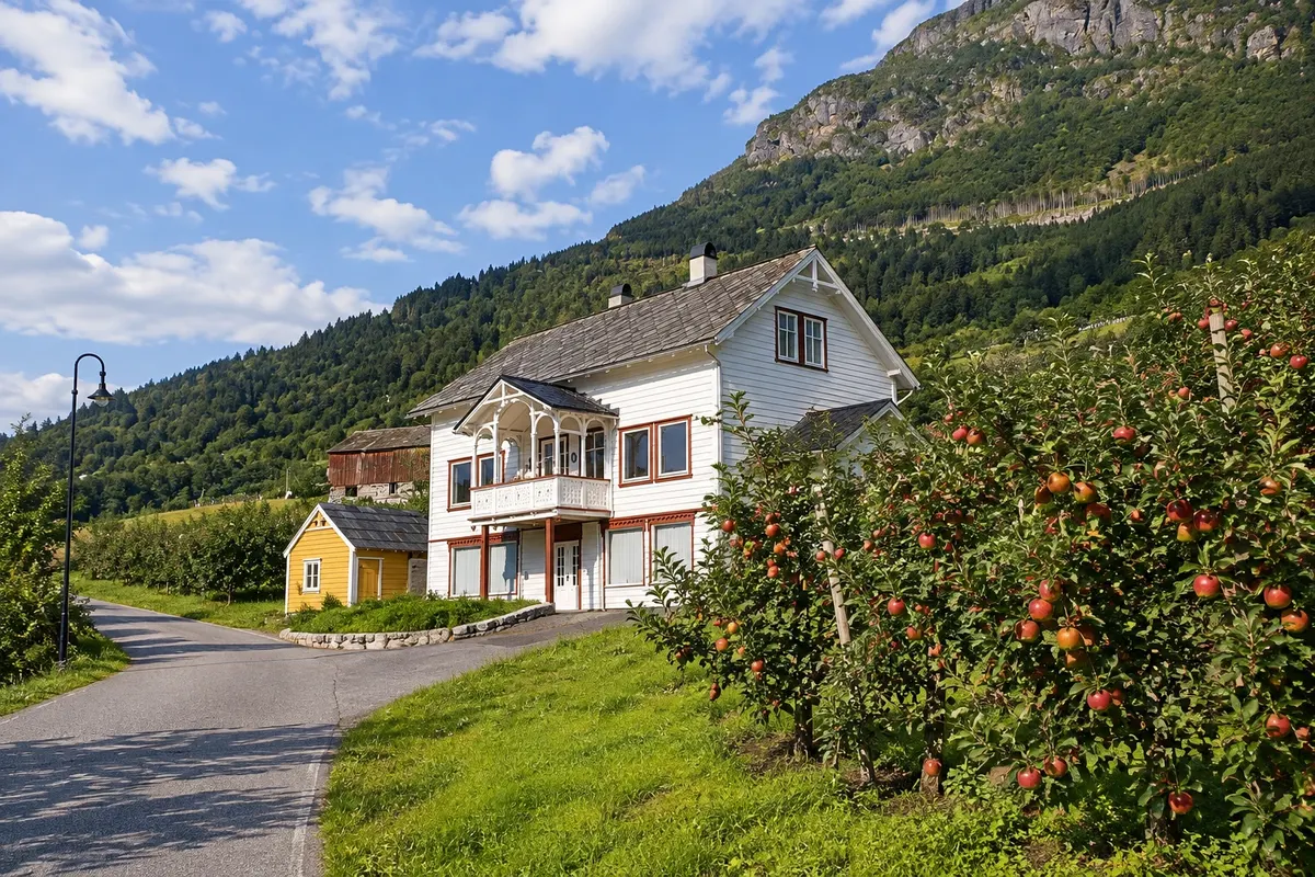
Lofthus is a village on the east shore of the Sørfjord, about 30 km from Odda, with wooden houses, waterfront hotels and slopes covered in orchards. Hardanger is Norway’s main fruit region, and Lofthus and neighboring Ullensvang host orchards of apples, pears, plums and cherries that run down to the fjord with the Folgefonna glacier on the opposite side.
In May the trees typically bloom, covering the slopes in white and pink. From July to September it’s harvest season, and farms sell fruit, juices and Hardanger cider made from local apples with protected origin designation. Several farms have shops and tastings along the cider route that follows the Sørfjord shore.
Kraji na poti: Lofthus.
Vključuje: Arrange access to the site and transport separately. Guided activities and tickets have their own conditions.
Nasvet: Stop at a farm with a cider sign and sample Hardanger cider. Visit Ullensvang Church late in the afternoon and walk along the fjord shore.
Najboljši čas za obisk: In May, when the orchards usually bloom, and from July to September, during the harvest
Vøringsfossen
Odhod: Eidfjord It lies on Road 7, about 18 km east of Eidfjord, climbing the Måbødal valley 1 to 2 hours for the viewpoints on both banks and the stair-bridge. during the day depending on the route chosen
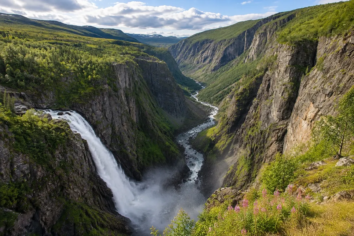
Vøringsfossen is one of Norway’s best-known waterfalls. The Bjoreio river, which flows from the Hardangervidda plateau, drops about 182 meters into a narrow canyon, 163 of them in free fall, down to the bottom of the Måbødalen valley. It lies roughly 18 km from Eidfjord via road 7, which climbs the valley through spiral tunnels.
There are viewpoints on both banks. On the west side, next to the historic Fossli Hotel, platforms offer a frontal view of the fall and the valley below. On the east side, at Fossatromma, a path with platforms and railings follows the canyon edge. Between them, a steel stair-bridge with steps spans the abyss above the waterfall and lets you walk from one side to the other with the fall right beneath you.
Kraji na poti: Vøringsfossen.
Vključuje: Arrange access to the site and transport separately. Guided activities and tickets have their own conditions.
Nasvet: Park on one side, cross the stair-bridge and return to see the drop from both banks. Bring a jacket: it is windy and spray hits the canyon edge.
Najboljši čas za obisk: From June to September, when the waterfall usually has more water and the viewpoints are snow-free


 Brazilija
 Antarktika
 Argentina
 Bolivija
 Čile
 Kolumbija
 Ekvator
 Gvajana
 Francoska Gvajana
 Falklandski otoki (Malvini)
 Paragvaj
 Peru
 Surinam
 Urugvaj
 Venezuela
 Nemčija
 Avstrija
 Belgija
 Hrvaška
 Danska
 Slovaška
 Slovenija
 Španija
 Finska
 Francija
 Grčija
 Nizozemska
 Madžarska
 Irska
 Islandija
 Italija
 Luksemburg
 Poljska
 Portugalska
 Združeno kraljestvo
 Češka
 Švedska
 Švica
 Turčija
 Bermudi
 Kanada
 Združene države Amerike
 Grenlandija
 Mehika
 Sveta Peter in Mihael
 Dominikanska republika
 Japonska
 Južnoafriška republika
 Egipt
 Avstralija
 Fidži
 Nova Zelandija
 Papua Nova Gvineja